이 페이지는 앱이나 개발자의 공식 페이지가 아니며, 정보 제공 및 논평을 목적으로 작성된 독립 편집 간행물입니다. 명시적으로 달리 언급되지 않는 한, 해당 앱이나 개발자는 MWM, Apple, Google Play, 앱 퍼블리셔 또는 앱 개발자와 제휴, 보증, 후원, 승인 또는 공식적으로 연결되어 있지 않으며, 이 페이지의 어떤 내용도 해당 앱이 MWM의 서비스를 사용하여 개발되었음을 의미하지 않습니다. 모든 상표, 로고, 스크린샷 및 기타 콘텐츠는 해당 소유자의 자산입니다.

FarOut: Offline GPS Trail Maps
100% 오프라인에서 작동하는 공식적이고 전문가가 검증한 데이터로 50,000마일 이상의 세계적인 트레일을 탐색하세요. 가장 험난한 지형에서 신뢰성을 요구하는 종주 하이커, 자전거 여행자, 탐험가를 위해 제작되었습니다.
다운로드
515K+사용자 평점
총 평가 수
25K+개발사
카테고리
Navigation지원 언어
4최신 버전
15.0.3크기
182.1 MB출시일
2013년 3월 8일종주 하이커의 여정을 위해 설계됨
단순한 지도를 넘어 — 50,000마일 이상의 야생 지형을 가로지르는 장거리 하이킹, 사이클링, 패들링을 위한 필수 디지털 가이드입니다.
100% 오프라인 탐색
인터넷에서 벗어나세요. 배터리 절약 및 신호 독립성을 유지하면서 완벽하게 작동하는 상세한 지형 지도 및 GPS 추적 기능을 사용하세요.
검증된 중요 웨이포인트
추측은 그만. 공식 트레일 파트너와 검증된 커뮤니티 전문가가 제공하는 수자원, 트레일 폐쇄 및 보급 지점에 대한 신뢰할 수 있는 데이터에 액세스하세요.
다음 스크린샷과 설명은 앱의 공식 스토어 목록에서 직접 가져온 것이며 앱 개발자의 자산입니다.
앱 스토어
스크린샷
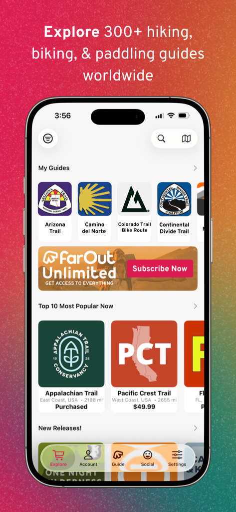
FarOut 모바일 앱 인터페이스로 애팔래치아 트레일 및 퍼시픽 크레스트 트레일과 같은 하이킹 및 자전거 트레일 가이드 라이브러리 표시
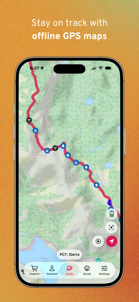
FarOut 앱이 PCT 시에라의 오프라인 지형 트레일 지도를 수자원 및 교차로 웨이포인트와 함께 표시
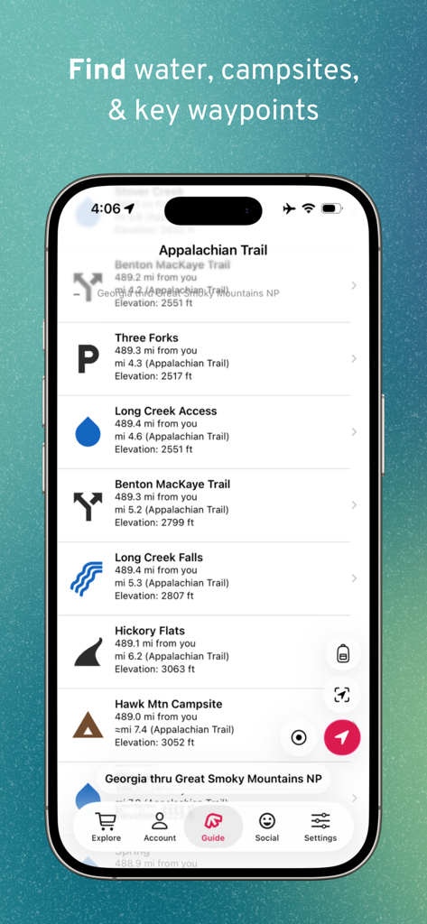
FarOut 앱에서 애팔래치아 트레일의 수자원 및 캠핑장 트레일 웨이포인트를 보여주는 모바일 화면
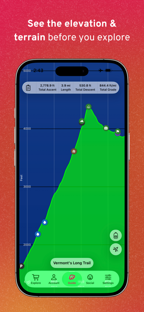
FarOut 앱이 버몬트 롱 트레일의 고도 프로필 및 지형 개요 표시
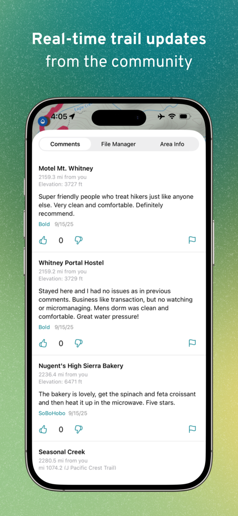
FarOut 앱의 인터페이스로 호스텔 및 빵집과 같은 트레일 웨이포인트에 대한 실시간 커뮤니티 댓글 및 업데이트 표시
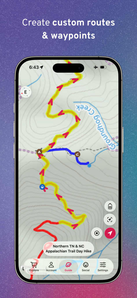
FarOut 앱 화면에 지형 하이킹 지도에 사용자 지정 트레일 경로 및 웨이포인트 표시
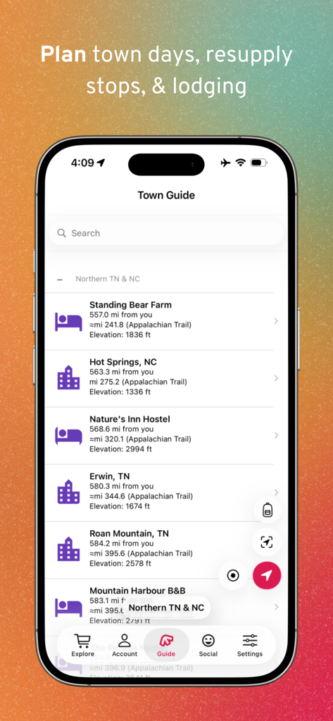
보급 및 숙박 계획을 위한 FarOut 앱 타운 가이드의 스마트폰 디스플레이
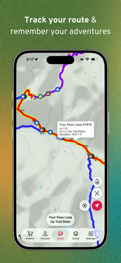
FarOut 앱이 종주 하이킹을 위한 고도 및 웨이포인트가 있는 지형 GPS 트레일 지도 표시
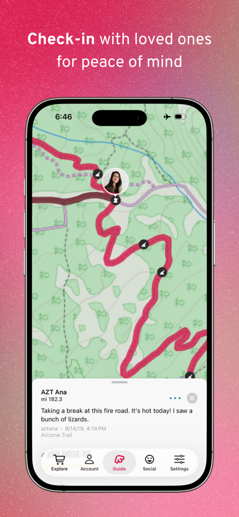
FarOut 모바일 앱 내 지형 트레일 지도에 있는 하이커 확인 게시물
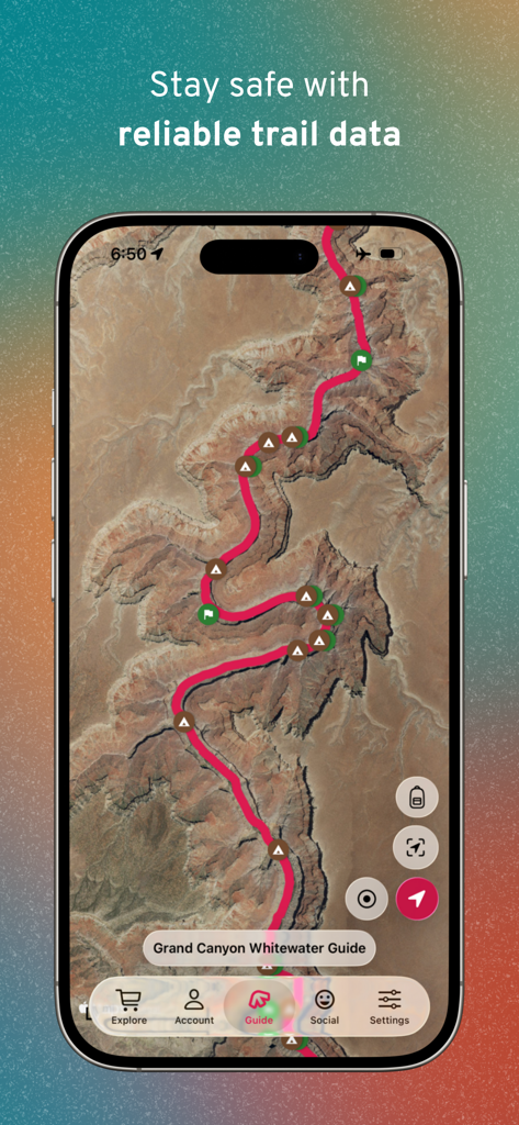
FarOut 트레일 탐색 앱의 그랜드 캐니언 급류 가이드 위성 지도.
설명
Download
비슷한 앱
유사한 기능과 사용자 경험을 가진 앱

AllTrails: Hike, Bike & Run
AllTrails, Inc.

Pedometer++
Cross Forward Consulting, LLC

Organic Maps: Offline Map
Organic Maps OU

Gaia GPS: Mobile Trail Maps
Trailbehind, INC.

Offline hiking maps: Mapy.com
Seznam.cz a.s.

Hiking Map Poland
Mapa Turystyczna sp. z o.o.

MapOut
Valnova GmbH

Norgeskart
Norgeskart AS

GPX viewer - map
Lucas den Otter
이 페이지는 앱이나 개발자의 공식 페이지가 아니며, 정보 제공 및 논평을 목적으로 작성된 독립 편집 간행물입니다. 명시적으로 달리 언급되지 않는 한, 해당 앱이나 개발자는 MWM, Apple, Google Play, 앱 퍼블리셔 또는 앱 개발자와 제휴, 보증, 후원, 승인 또는 공식적으로 연결되어 있지 않으며, 이 페이지의 어떤 내용도 해당 앱이 MWM의 서비스를 사용하여 개발되었음을 의미하지 않습니다. 모든 상표, 로고, 스크린샷 및 기타 콘텐츠는 해당 소유자의 자산입니다.