이 페이지는 앱이나 개발자의 공식 페이지가 아니며, 정보 제공 및 논평을 목적으로 작성된 독립 편집 간행물입니다. 명시적으로 달리 언급되지 않는 한, 해당 앱이나 개발자는 MWM, Apple, Google Play, 앱 퍼블리셔 또는 앱 개발자와 제휴, 보증, 후원, 승인 또는 공식적으로 연결되어 있지 않으며, 이 페이지의 어떤 내용도 해당 앱이 MWM의 서비스를 사용하여 개발되었음을 의미하지 않습니다. 모든 상표, 로고, 스크린샷 및 기타 콘텐츠는 해당 소유자의 자산입니다.

BigBlue Offshore Fishing
물이 없는 곳에서 연료를 태우는 것을 멈추세요. 실시간 SST, 엽록소 스캔, 고해상도 수심 측량으로 경쟁 우위를 확보하세요. 100% 오프라인 기능으로 깊은 바다에서도 사용할 수 있습니다.
다운로드
41K+사용자 평점
총 평가 수
0개발사
카테고리
Weather지원 언어
1최신 버전
3.0.6크기
69.1 MB출시일
2023년 4월 13일잡는 과학
물이 없는 곳에서 연료를 태우는 것을 멈추세요. BigBlue는 전문가 수준의 위성 스캔과 서식지 정보를 주머니에 넣어 다니면서 더 빨리 물고기가 있는 곳을 찾을 수 있도록 합니다.
정밀 위성 스캔
매일 9회의 SST 및 엽록소 업데이트를 통해 대형 게임 물고기가 모이는 온도 경계선과 영양분이 풍부한 가장자리를 정확하게 파악하세요.
신호 없음, 문제 없음
깊은 바다를 위해 제작되었습니다. Wi-Fi에서 고해상도 차트를 캐시하고 셀룰러 서비스 없이도 외해 100마일 이상에서 GPS 정밀도로 완벽하게 탐색하세요.
다음 스크린샷과 설명은 앱의 공식 스토어 목록에서 직접 가져온 것이며 앱 개발자의 자산입니다.
앱 스토어
스크린샷
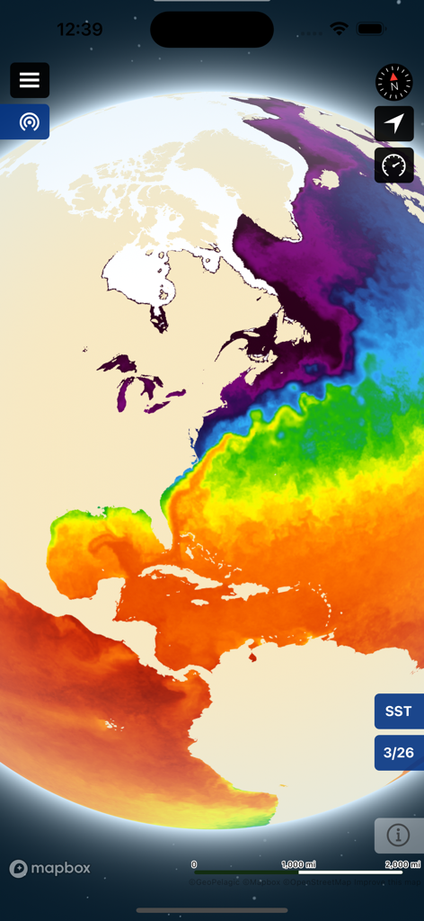
BigBlue Offshore Fishing 앱의 대서양 해수면 온도 열 지도
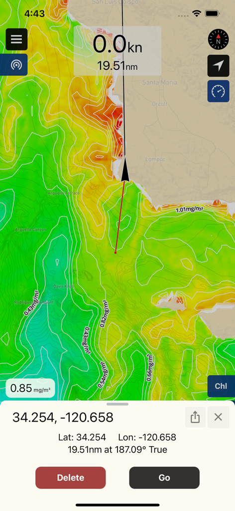
외해 낚시를 위한 엽록소 농도 데이터와 웨이포인트 좌표를 보여주는 BigBlue 앱 탐색 지도
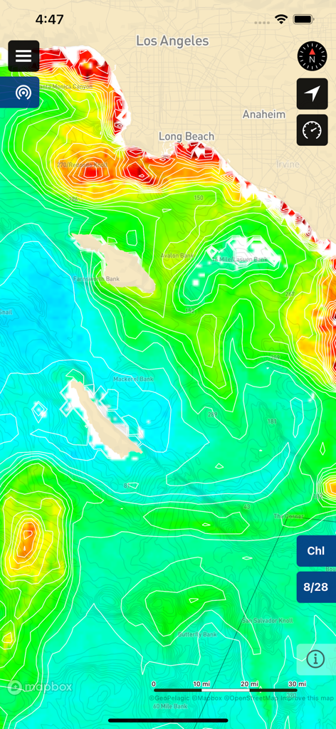
BigBlue 앱에서 로스앤젤레스 해안의 엽록소 농도 차트와 수심 측량 지도 표시
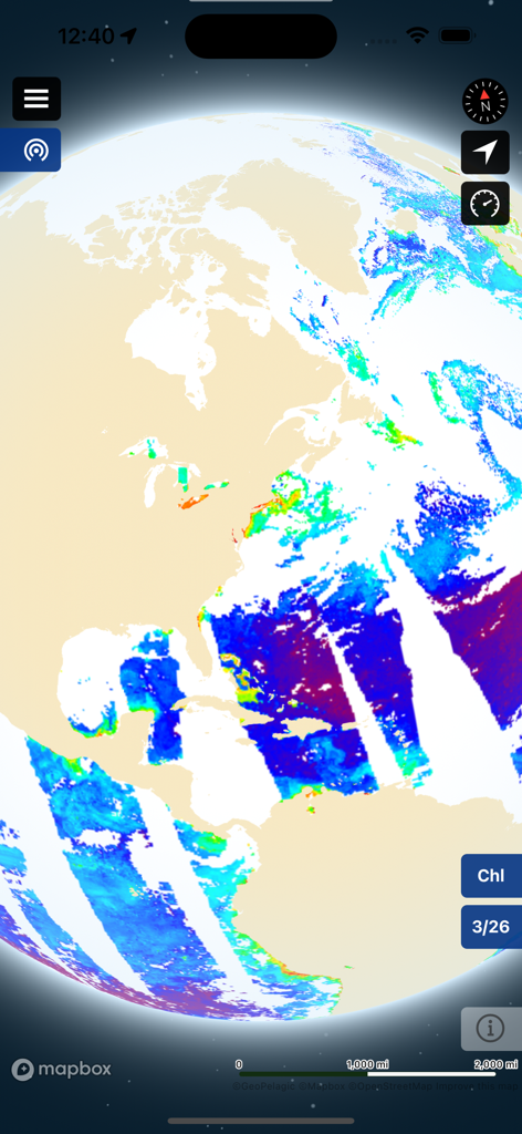
외해 낚시를 위한 해양 조건을 보여주는 BigBlue 앱의 위성 엽록소 지도 오버레이.
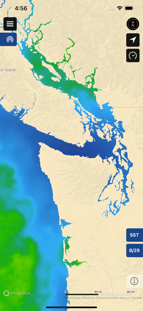
외해 낚시를 위한 해안 지도에 해수면 온도 SST 위성 데이터를 표시하는 BigBlue 앱 인터페이스.
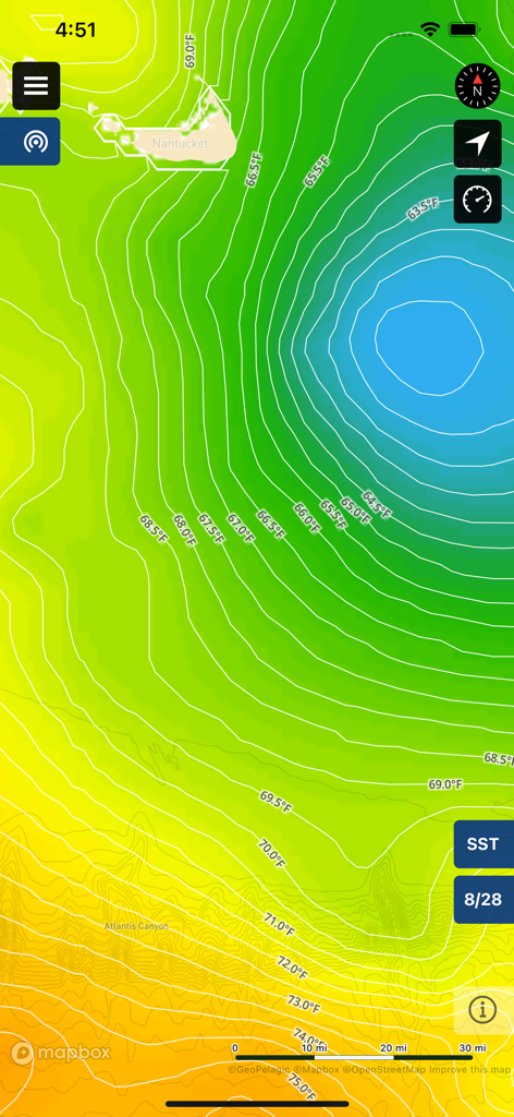
외해 낚시를 위한 화씨 단위의 열수대와 온도 등고선을 보여주는 해수면 온도 지도
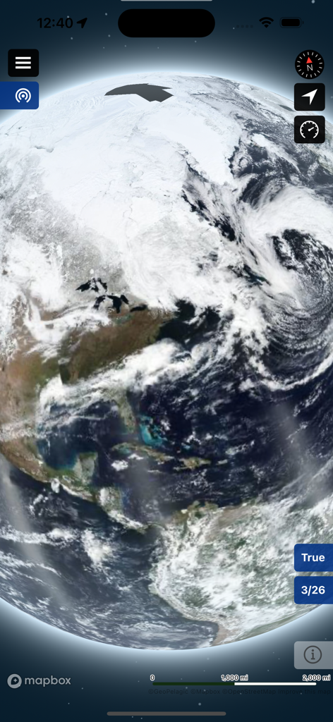
BigBlue 외해 낚시 앱에서 지구의 트루 컬러 위성 이미지.
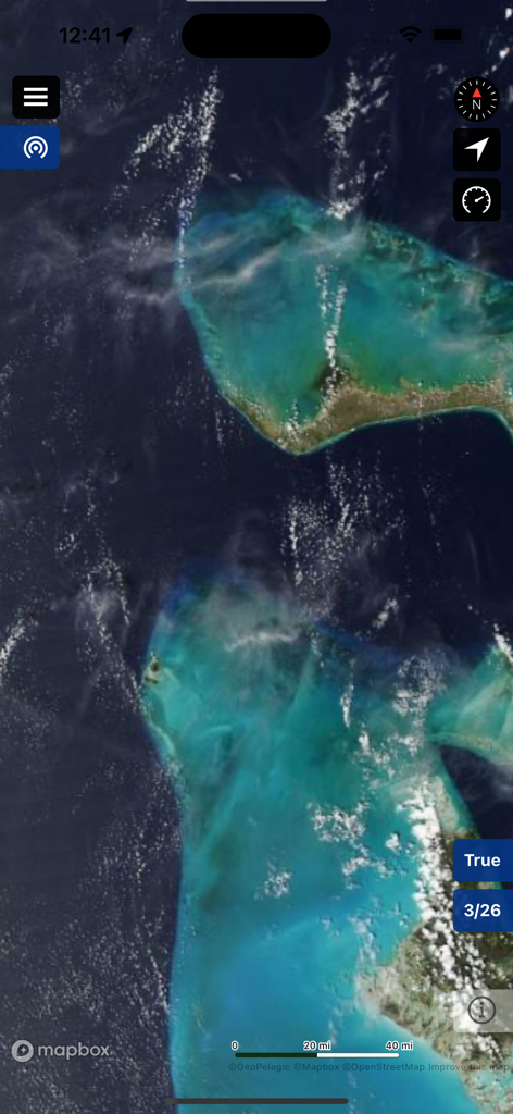
BigBlue Offshore Fishing 앱에서 트루 컬러 해양 이미지를 보여주는 위성 지도 보기.
설명
Download
비슷한 앱
유사한 기능과 사용자 경험을 가진 앱

FishAngler - Fish Finder App
FishAngler, LLC

钓鱼天气预报
Hefei Sasha Technology Co., Ltd.

潮汐表-潮汐天气预报&钓鱼潮汐天气工具助手
荣虎 太

Fishbrain - Fishing App
FishBrain AB

Fishing Points: Map & Forecast
Fishing Points d.o.o.

onX Fish: Midwest Lake Finder
onXmaps, Inc.

Fishbox - Smart Fishing App
MEMS Group, Inc.

釣果記録FishRanker-フィッシュランカー,釣り,分析
SIIG Inc.

Fish Deeper - Fishing App
Deeper UAB
이 페이지는 앱이나 개발자의 공식 페이지가 아니며, 정보 제공 및 논평을 목적으로 작성된 독립 편집 간행물입니다. 명시적으로 달리 언급되지 않는 한, 해당 앱이나 개발자는 MWM, Apple, Google Play, 앱 퍼블리셔 또는 앱 개발자와 제휴, 보증, 후원, 승인 또는 공식적으로 연결되어 있지 않으며, 이 페이지의 어떤 내용도 해당 앱이 MWM의 서비스를 사용하여 개발되었음을 의미하지 않습니다. 모든 상표, 로고, 스크린샷 및 기타 콘텐츠는 해당 소유자의 자산입니다.