이 페이지는 앱이나 개발자의 공식 페이지가 아니며, 정보 제공 및 논평을 목적으로 작성된 독립 편집 간행물입니다. 명시적으로 달리 언급되지 않는 한, 해당 앱이나 개발자는 MWM, Apple, Google Play, 앱 퍼블리셔 또는 앱 개발자와 제휴, 보증, 후원, 승인 또는 공식적으로 연결되어 있지 않으며, 이 페이지의 어떤 내용도 해당 앱이 MWM의 서비스를 사용하여 개발되었음을 의미하지 않습니다. 모든 상표, 로고, 스크린샷 및 기타 콘텐츠는 해당 소유자의 자산입니다.

Compass i16 GeoTag GPS Camera
iPhone을 정밀 기기로 전환하세요. GPS 데이터, MGRS 좌표, 태양 추적 및 실시간 날씨가 내장된 고정밀 사진을 캡처하세요. 오프라인에서도 가능합니다.
다운로드
500사용자 평점
총 평가 수
0개발사
카테고리
Navigation지원 언어
1최신 버전
1.1크기
7.8 MB출시일
2025년 5월 16일전문가급 현장 정보
모든 환경에서 정확성을 요구하는 분들을 위해 설계된 고정밀 내비게이션 및 문서화 도구 모음입니다.
반박의 여지가 없는 현장 기록
전문적인 검증을 위해 GPS 좌표, MGRS 데이터 및 타임스탬프를 사진에 직접 오버레이하고 기록하세요.
정밀 AR 내비게이션
듀얼 모드 나침반과 소실점 가이드를 사용하여 현장에서 완벽한 정렬과 방향을 보장하세요.
다음 스크린샷과 설명은 앱의 공식 스토어 목록에서 직접 가져온 것이며 앱 개발자의 자산입니다.
앱 스토어
스크린샷
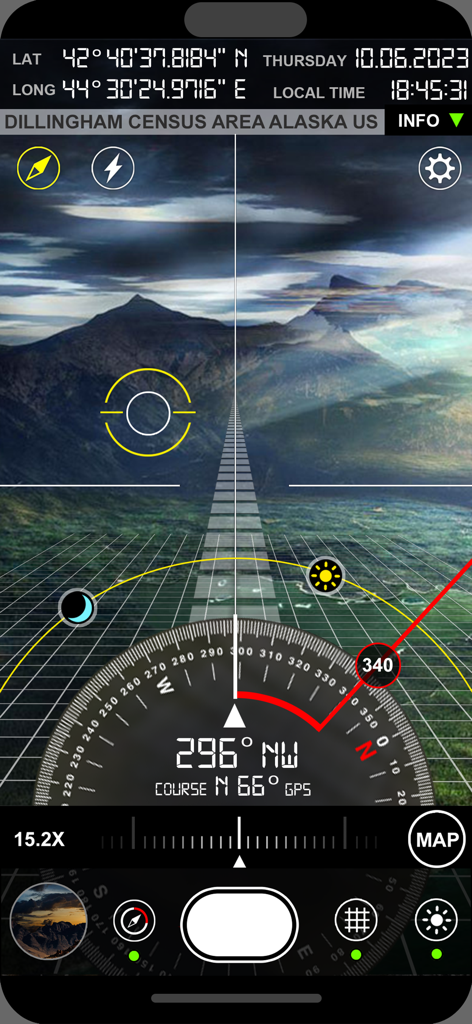
Compass i16 앱의 AR 뷰파인더에 풍경 위에 GPS 좌표와 위치 데이터가 표시됩니다.
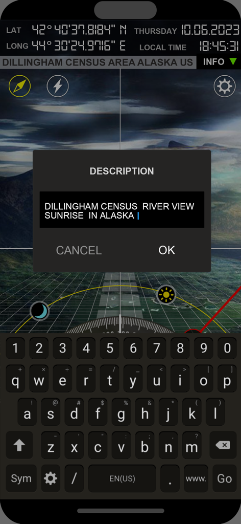
Compass i16 앱 인터페이스에 GPS 좌표와 사진 태그 지정을 위한 사용자 정의 사진 설명 필드가 표시됩니다.
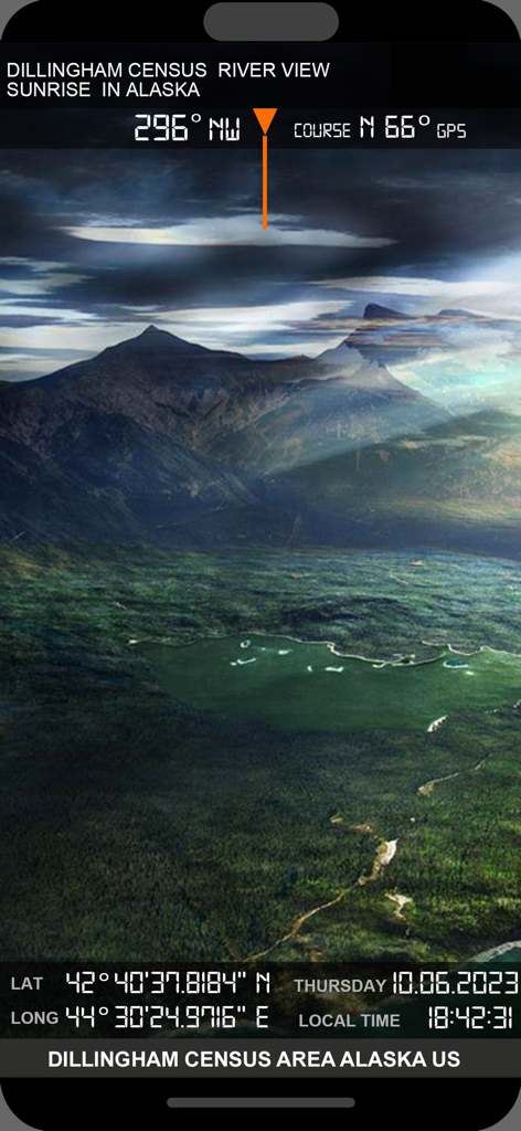
GPS 좌표 및 나침반 방향 오버레이가 있는 알래스카 풍경의 지오태그된 사진
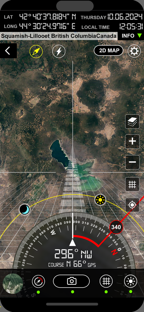
Compass i16 GeoTag GPS 카메라에 위성 지도, 태양 추적기 및 좌표가 표시된 AR 뷰파인더가 표시됩니다.
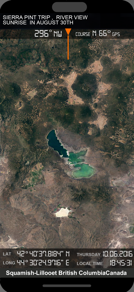
통합 GPS 좌표 및 나침반 데이터가 있는 위성 지도 디스플레이
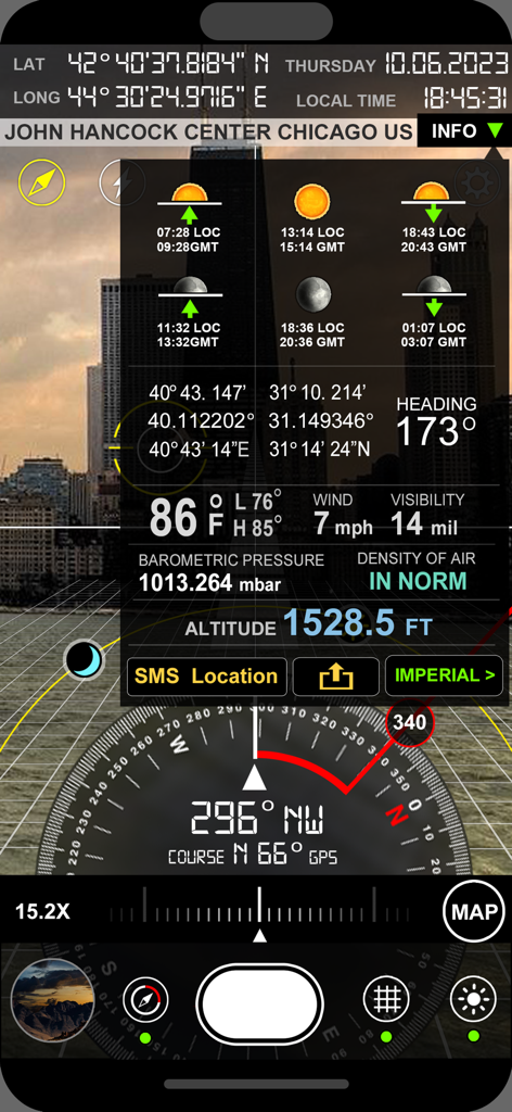
나침반 좌표, 고도 및 날씨 데이터 오버레이가 있는 전문 GPS 카메라 인터페이스
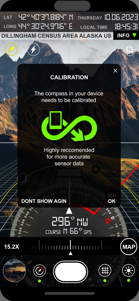
알래스카 산 풍경 위에 좌표가 표시되는 Compass i16 GeoTag GPS 카메라의 보정 화면
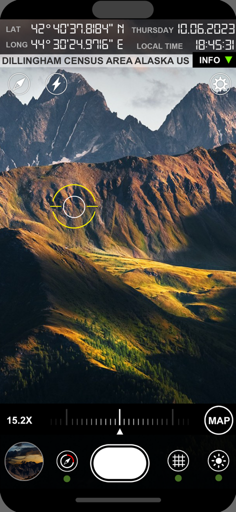
산 위로 좌표 및 위치 데이터가 표시되는 전문 GPS 카메라 인터페이스
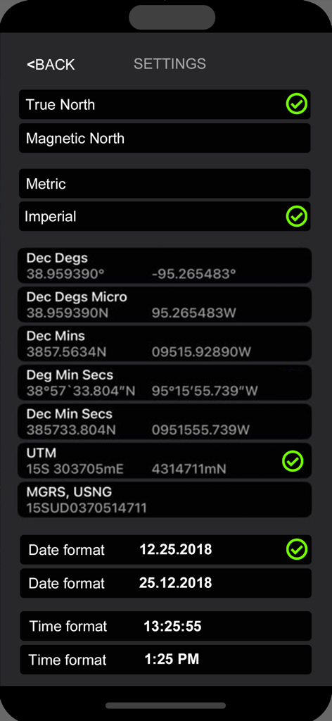
좌표 형식 및 단위 유형 선택을 위한 전문 설정 화면
설명
Download
비슷한 앱
같은 카테고리의 상위 앱

Google Maps
Google LLC

Waze Navigation & Live Traffic
waze

AMap Global
AutoNavi Information Technology Co. Ltd.

百度地图-路线规划,出行必备
Beijing Baidu Netcom Science & Technology Co.,Ltd

Moovit: Bus & Transit Tracker
Moovit App Global LTD

Transit • Subway & Bus Times
9280-0366 Quebec inc.

ParkMobile: Park. Pay. Go.
Parkmobile USA, Inc

腾讯地图-路线规划,导航地铁打车出行
Shenzhen Tencent Computer Systems Company Limited

Île-de-France Mobilités
Ile de France Mobilites
이 페이지는 앱이나 개발자의 공식 페이지가 아니며, 정보 제공 및 논평을 목적으로 작성된 독립 편집 간행물입니다. 명시적으로 달리 언급되지 않는 한, 해당 앱이나 개발자는 MWM, Apple, Google Play, 앱 퍼블리셔 또는 앱 개발자와 제휴, 보증, 후원, 승인 또는 공식적으로 연결되어 있지 않으며, 이 페이지의 어떤 내용도 해당 앱이 MWM의 서비스를 사용하여 개발되었음을 의미하지 않습니다. 모든 상표, 로고, 스크린샷 및 기타 콘텐츠는 해당 소유자의 자산입니다.