이 페이지는 앱이나 개발자의 공식 페이지가 아니며, 정보 제공 및 논평을 목적으로 작성된 독립 편집 간행물입니다. 명시적으로 달리 언급되지 않는 한, 해당 앱이나 개발자는 MWM, Apple, Google Play, 앱 퍼블리셔 또는 앱 개발자와 제휴, 보증, 후원, 승인 또는 공식적으로 연결되어 있지 않으며, 이 페이지의 어떤 내용도 해당 앱이 MWM의 서비스를 사용하여 개발되었음을 의미하지 않습니다. 모든 상표, 로고, 스크린샷 및 기타 콘텐츠는 해당 소유자의 자산입니다.

다운로드
100K+사용자 평점
총 평가 수
300개발사
카테고리
Travel지원 언어
15최신 버전
5.5.0크기
135.2 MB출시일
2024년 10월 15일미지의 길을 위한 설계
정확한 데이터, 오래 지속되는 배터리, 절대적인 개인 정보를 중요하게 생각하는 사람들을 위한 전문가 수준의 GPS 추적기입니다. 광고, 구독 없음 - 트레일을 위한 도구만 제공됩니다.
데이터는 사용자의 것, 장치도 사용자의 것
클라우드 추적은 믿지 않습니다. 위치 기록은 100% 로컬에 유지되어 개인 정보가 침해되거나 제3자에게 판매되지 않도록 합니다.
뛰어난 배터리 효율성
당사의 전문적인 백그라운드 추적 기술은 소모를 최소화하여 보조 배터리 없이 하루 종일 탐험을 기록할 수 있습니다.
다음 스크린샷과 설명은 앱의 공식 스토어 목록에서 직접 가져온 것이며 앱 개발자의 자산입니다.
앱 스토어
스크린샷
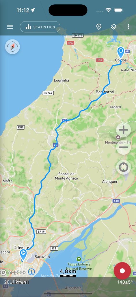
Geo Tracker 앱 화면에 지형도에 기록된 GPS 경로가 표시됨
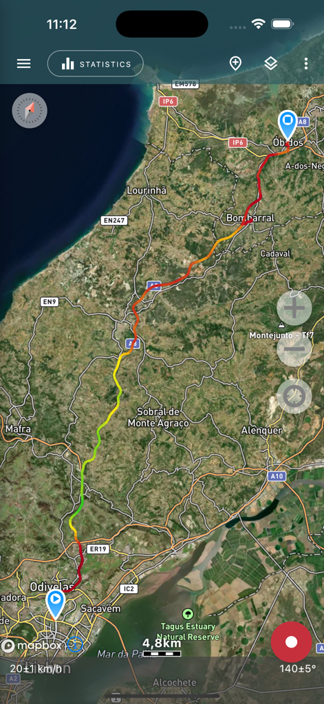
위성 지도에 속도 표시기가 있는 기록된 GPS 트랙이 표시됨
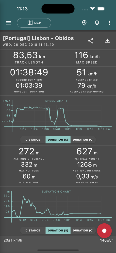
Geo Tracker 앱의 상세 GPS 트립 통계 및 차트
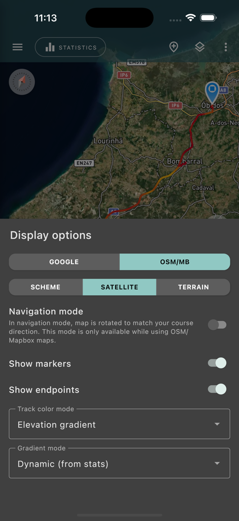
Geo Tracker 앱 인터페이스에 지도 표시 옵션과 기록된 GPS 트랙이 있는 위성 보기 표시
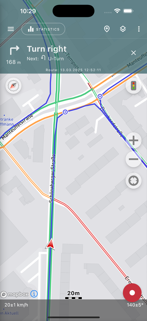
Geo Tracker 앱 내비게이션 화면에 경로, 턴 바이 턴 지침 및 속도 통계가 지도에 표시됨
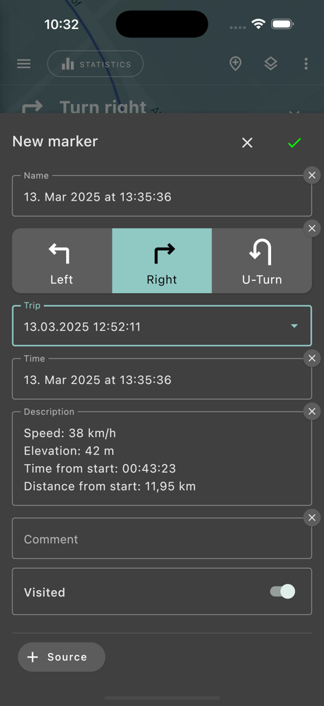
Geo Tracker 앱의 새로운 마커 생성 인터페이스에 트립 통계 및 내비게이션 방향 선택 표시
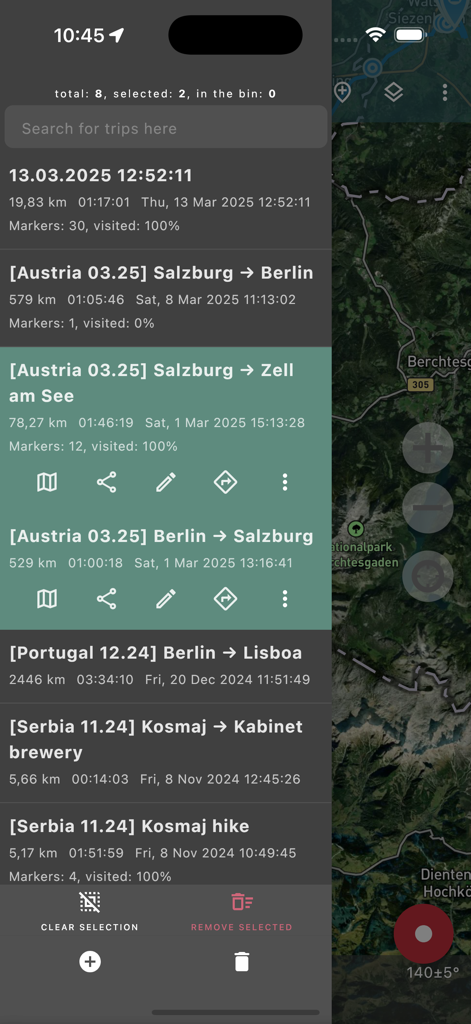
Geo Tracker 앱의 기록된 GPS 트랙 및 여행 통계 목록
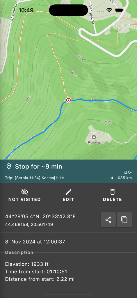
GPS 추적기 앱에 지형도에 하이킹 통계 및 좌표 표시
설명
Download
비슷한 앱
유사한 기능과 사용자 경험을 가진 앱

AllTrails: Hike, Bike & Run
AllTrails, Inc.

Pedometer++
Cross Forward Consulting, LLC

Organic Maps: Offline Map
Organic Maps OU

Gaia GPS: Mobile Trail Maps
Trailbehind, INC.

Offline hiking maps: Mapy.com
Seznam.cz a.s.

Hiking Map Poland
Mapa Turystyczna sp. z o.o.

MapOut
Valnova GmbH

FarOut: Offline GPS Trail Maps
Atlas Guides DE, Inc.

Norgeskart
Norgeskart AS
이 페이지는 앱이나 개발자의 공식 페이지가 아니며, 정보 제공 및 논평을 목적으로 작성된 독립 편집 간행물입니다. 명시적으로 달리 언급되지 않는 한, 해당 앱이나 개발자는 MWM, Apple, Google Play, 앱 퍼블리셔 또는 앱 개발자와 제휴, 보증, 후원, 승인 또는 공식적으로 연결되어 있지 않으며, 이 페이지의 어떤 내용도 해당 앱이 MWM의 서비스를 사용하여 개발되었음을 의미하지 않습니다. 모든 상표, 로고, 스크린샷 및 기타 콘텐츠는 해당 소유자의 자산입니다.