이 페이지는 앱이나 개발자의 공식 페이지가 아니며, 정보 제공 및 논평을 목적으로 작성된 독립 편집 간행물입니다. 명시적으로 달리 언급되지 않는 한, 해당 앱이나 개발자는 MWM, Apple, Google Play, 앱 퍼블리셔 또는 앱 개발자와 제휴, 보증, 후원, 승인 또는 공식적으로 연결되어 있지 않으며, 이 페이지의 어떤 내용도 해당 앱이 MWM의 서비스를 사용하여 개발되었음을 의미하지 않습니다. 모든 상표, 로고, 스크린샷 및 기타 콘텐츠는 해당 소유자의 자산입니다.

Global Mapper Mobile
고정밀 GNSS 지원, 오프라인 지형 표시 및 원활한 워크플로 통합을 통해 엔지니어와 측량사가 사무실과 현장 간의 격차를 해소할 수 있도록 지원합니다.
다운로드
205K+사용자 평점
총 평가 수
0개발사
카테고리
Navigation지원 언어
2최신 버전
3.1.8크기
126.3 MB출시일
2016년 6월 15일현장 GIS 워크플로 최적화
사무실과 현장 사이의 격차를 원활하게 해소하며, 모든 오지 지역에서 고정밀 매핑, 데이터 수집 및 공간 분석을 수행하기 위한 전문가의 선택입니다.
스마트 데이터 수집
현장에서 직접 고품질 데이터의 무결성을 보장하기 위해 사용자 지정 속성 양식 및 지오태깅된 사진과 함께 포인트, 라인 및 폴리곤을 기록하십시오.
신뢰할 수 있는 오프라인 매핑
셀룰러 서비스가 전혀 없는 가장 외진 지역에서도 벡터, 래스터 및 지형 레이어에 액세스하여 어디에서나 완벽한 상황 인식을 보장합니다.
다음 스크린샷과 설명은 앱의 공식 스토어 목록에서 직접 가져온 것이며 앱 개발자의 자산입니다.
앱 스토어
스크린샷
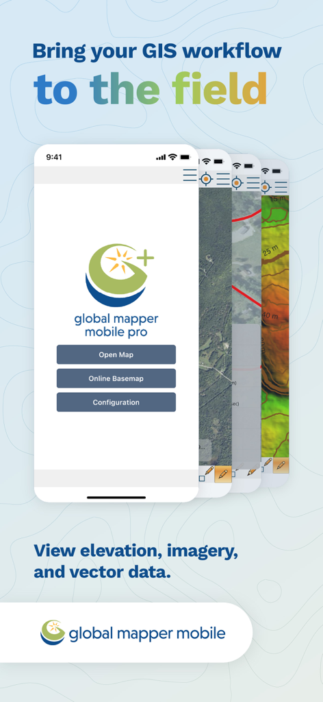
현장 매핑 및 데이터 수집을 위한 GIS 워크플로 기능을 보여주는 Global Mapper Mobile 앱 화면
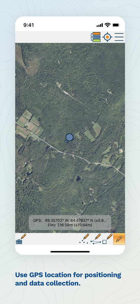
GPS 좌표, 고도 및 현장 데이터 수집 도구를 보여주는 Global Mapper Mobile의 위성 지도 보기
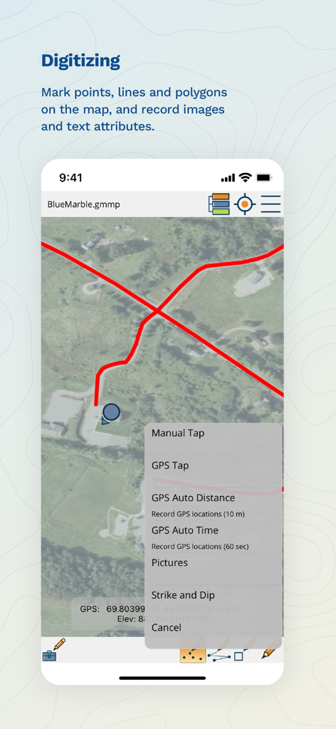
지도에 포인트, 라인 및 폴리곤을 표시하기 위한 GIS 디지털화 도구를 보여주는 Global Mapper Mobile 화면
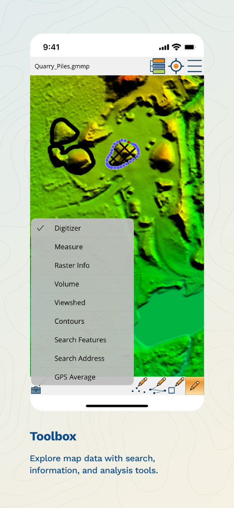
지형 지도 위에 체적, 가시권 및 등고선과 같은 분석 기능이 있는 도구 상자 메뉴를 보여주는 Global Mapper Mobile 앱
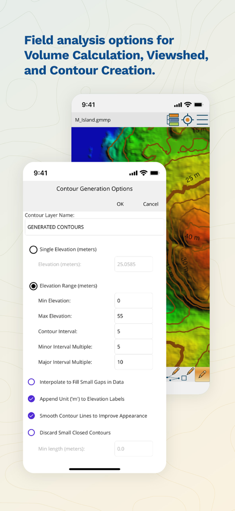
현장 분석을 위한 등고선 생성 옵션을 보여주는 Global Mapper Mobile 인터페이스
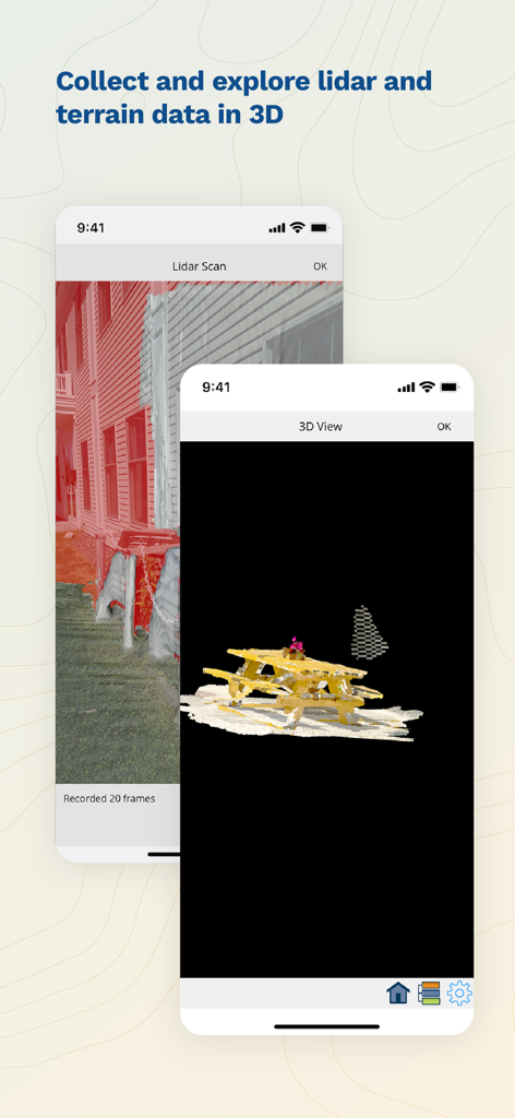
스마트폰에서 라이다 스캔 및 3D 지형 시각화를 보여주는 Global Mapper Mobile 앱 인터페이스
설명
Download
비슷한 앱
유사한 기능과 사용자 경험을 가진 앱

MilGPS
Cascode Labs Pty Ltd

SEAiq Pilot VPP
Sakhalin, LLC

Cartograph Maps 3
Harald Meyer

新知卫星地图-路线规划,高清地图导航
Chongqing Xinzhi Space Technology Co., Ltd.

Coordinates – GPS Converter
Mapnitude Company Limited

Mgrs & Utm Map
Vahid Cataltas

DeepStateMap
Heorhii Karpenko

Map Plus
Miocool Inc.

Compass 55. Map & GPS kit.
Kalimex-Consulting s.r.o.
이 페이지는 앱이나 개발자의 공식 페이지가 아니며, 정보 제공 및 논평을 목적으로 작성된 독립 편집 간행물입니다. 명시적으로 달리 언급되지 않는 한, 해당 앱이나 개발자는 MWM, Apple, Google Play, 앱 퍼블리셔 또는 앱 개발자와 제휴, 보증, 후원, 승인 또는 공식적으로 연결되어 있지 않으며, 이 페이지의 어떤 내용도 해당 앱이 MWM의 서비스를 사용하여 개발되었음을 의미하지 않습니다. 모든 상표, 로고, 스크린샷 및 기타 콘텐츠는 해당 소유자의 자산입니다.