이 페이지는 앱이나 개발자의 공식 페이지가 아니며, 정보 제공 및 논평을 목적으로 작성된 독립 편집 간행물입니다. 명시적으로 달리 언급되지 않는 한, 해당 앱이나 개발자는 MWM, Apple, Google Play, 앱 퍼블리셔 또는 앱 개발자와 제휴, 보증, 후원, 승인 또는 공식적으로 연결되어 있지 않으며, 이 페이지의 어떤 내용도 해당 앱이 MWM의 서비스를 사용하여 개발되었음을 의미하지 않습니다. 모든 상표, 로고, 스크린샷 및 기타 콘텐츠는 해당 소유자의 자산입니다.

GPX Viewer PRO
상세한 오프라인 벡터 지도와 전문가급 데이터 분석으로 자신 있게 탐색하세요. GPX 및 KML 파일을 가져와 즐겨 찾는 트레일을 마스터하고, 셀 서비스가 없는 곳에서도 모든 모험을 상세하게 기록하세요.
다운로드
191K+사용자 평점
총 평가 수
1K+개발사
카테고리
Navigation지원 언어
12최신 버전
1.29.4크기
58.0 MB출시일
2020년 2월 5일모든 아웃도어 임무를 위한 전문가 도구
GPX Viewer PRO는 장치를 국립공원에서 숨겨진 산악 자전거 트레일까지, 미국 야생 탐험의 기술적 요구 사항에 맞춰 설계된 고정밀 탐색 시스템으로 변환합니다.
신뢰할 수 있는 오프라인 벡터 지도
셀 서비스가 전혀 없는 시에라 또는 애팔래치아 산맥의 가장 외딴 지역을 탐색하세요. 신호가 사라져도 작동하는 상세한 전 세계 지도에 액세스하세요.
다용도 GPX 및 KML 지원
포럼 또는 iCloud에서 사용자 지정 경로 파일을 직접 가져옵니다. 숲길을 오버랜딩하든 비밀 경로를 하이킹하든, 데이터는 항상 탐험할 준비가 되어 있습니다.
다음 스크린샷과 설명은 앱의 공식 스토어 목록에서 직접 가져온 것이며 앱 개발자의 자산입니다.
앱 스토어
스크린샷
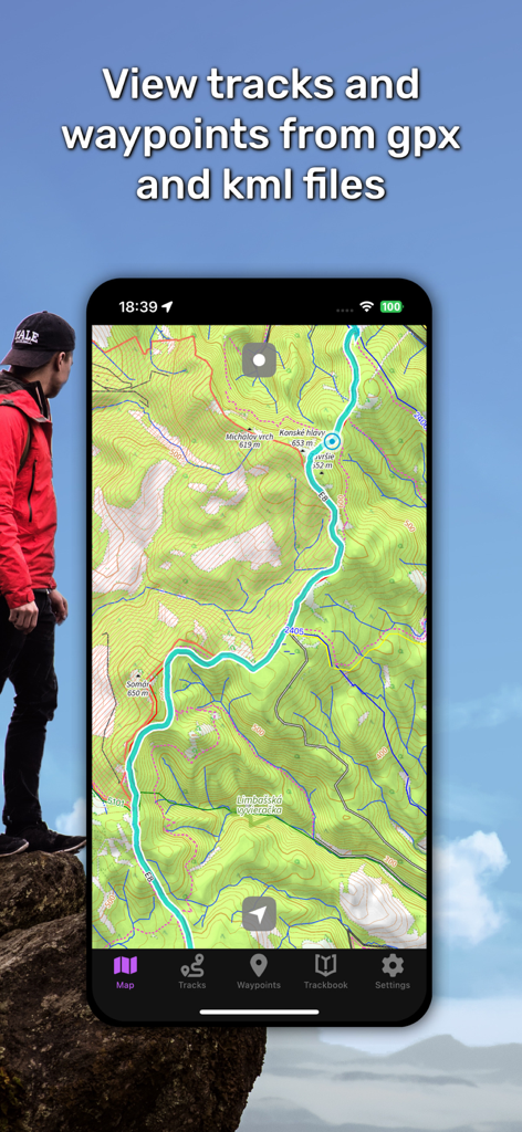
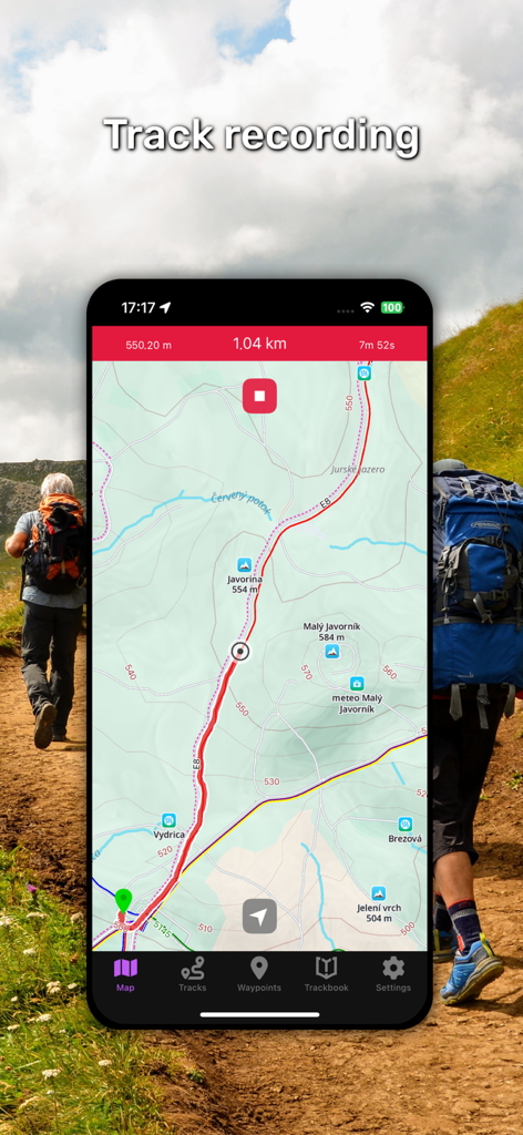
GPX Viewer PRO 앱 내 상세한 지형도에서 청록색 하이킹 트랙을 보여주는 스마트폰 화면.
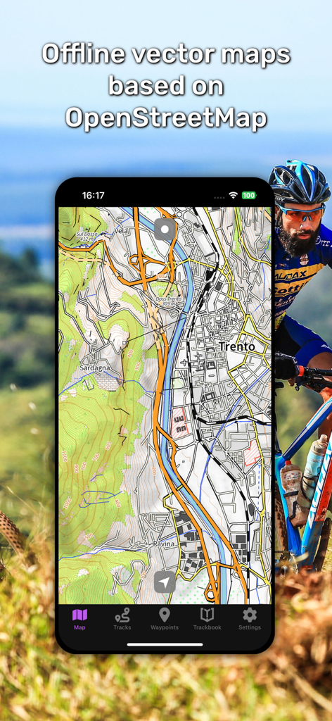
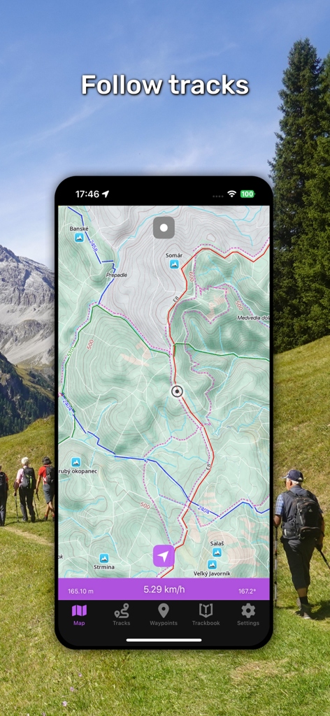
산악자전거를 위한 GPX Viewer PRO의 오프라인 벡터 지도를 보여주는 스마트폰
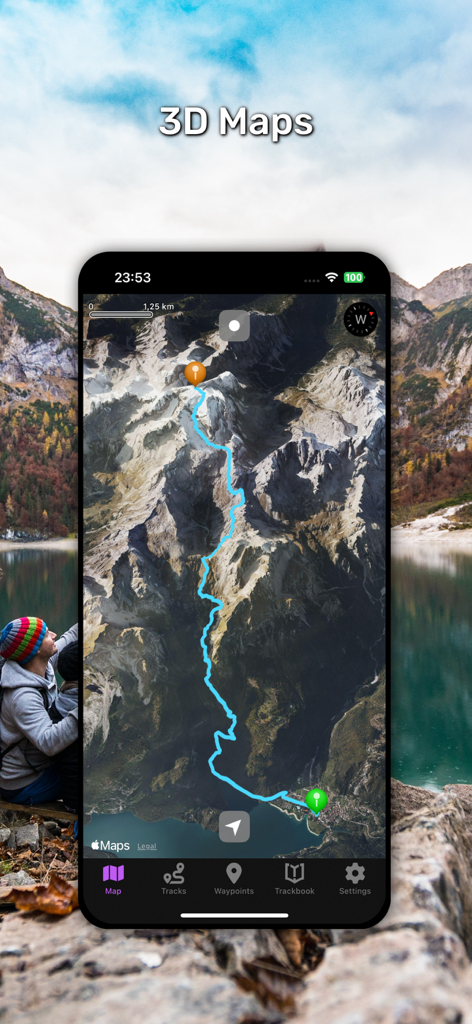
GPX Viewer PRO 앱이 산악 지형을 통과하는 하이킹 트레일이 강조 표시된 3D 지형도를 표시하고 있습니다
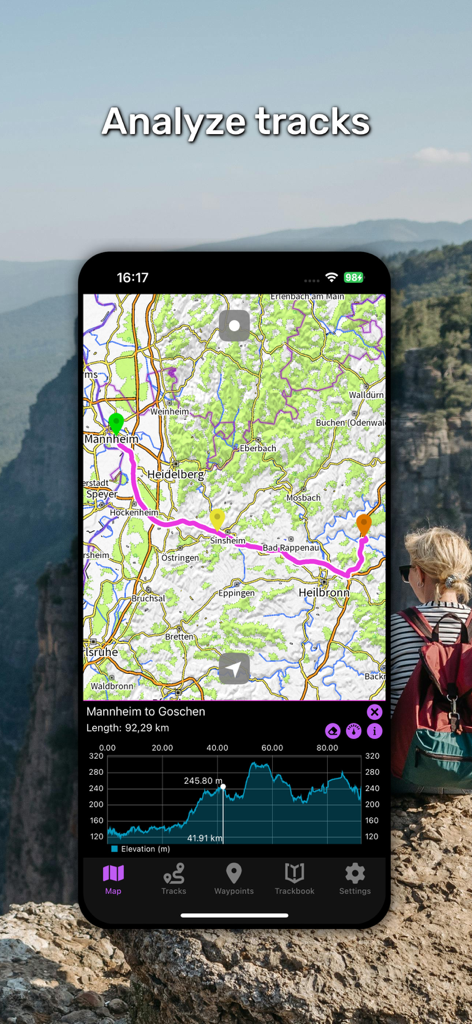
GPX Viewer PRO 앱 인터페이스가 지도 경로와 고도 프로필 차트를 보여줍니다
GPX Viewer PRO 모바일 앱 인터페이스로 지형도에서 하이킹 경로 추적
GPX Viewer PRO 앱 인터페이스가 지형도 하이킹 트랙과 실시간 탐색 데이터를 보여줍니다
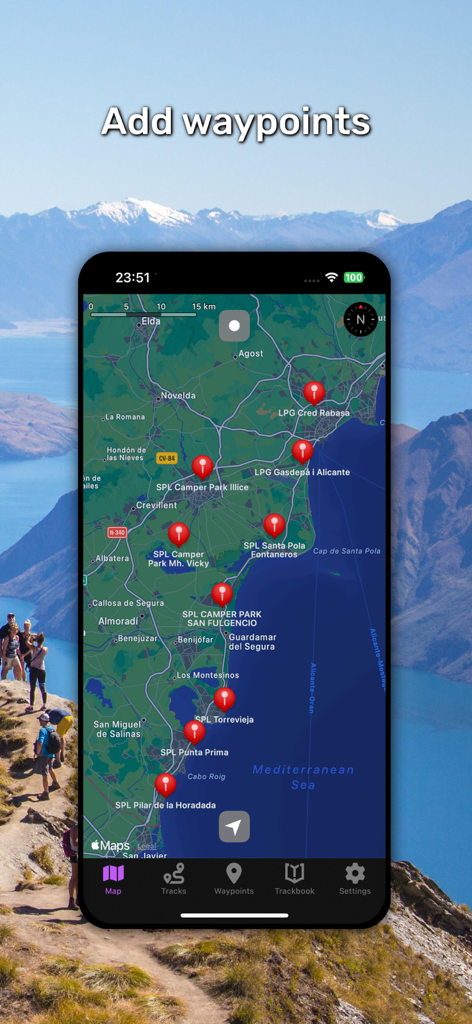
해안 지도에 여러 개의 빨간색 웨이포인트가 있는 GPX Viewer PRO 앱을 보여주는 스마트폰.
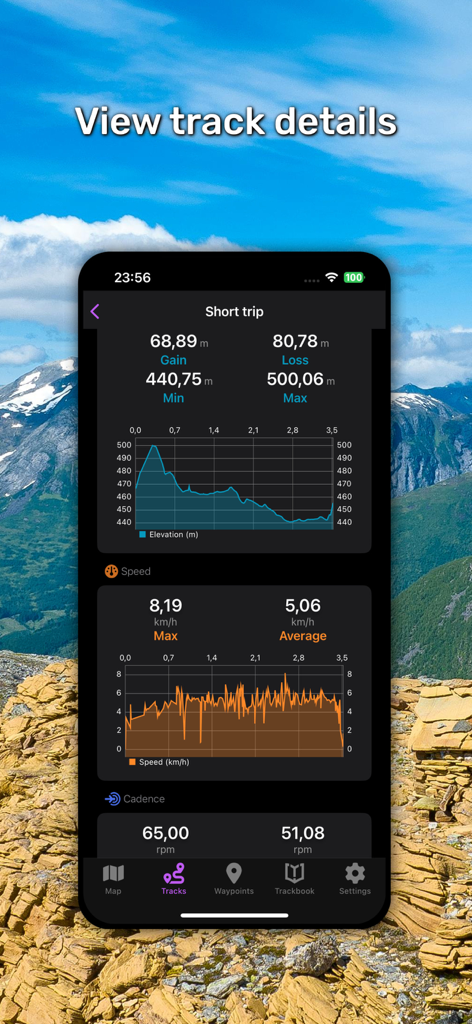
GPX Viewer PRO 앱 인터페이스가 상세한 트랙 통계 및 활동 차트를 표시합니다.
설명
Download
비슷한 앱
유사한 기능과 사용자 경험을 가진 앱

MilGPS
Cascode Labs Pty Ltd

SEAiq Pilot VPP
Sakhalin, LLC

Cartograph Maps 3
Harald Meyer

新知卫星地图-路线规划,高清地图导航
Chongqing Xinzhi Space Technology Co., Ltd.

Coordinates – GPS Converter
Mapnitude Company Limited

Mgrs & Utm Map
Vahid Cataltas

DeepStateMap
Heorhii Karpenko

Map Plus
Miocool Inc.

Compass 55. Map & GPS kit.
Kalimex-Consulting s.r.o.
이 페이지는 앱이나 개발자의 공식 페이지가 아니며, 정보 제공 및 논평을 목적으로 작성된 독립 편집 간행물입니다. 명시적으로 달리 언급되지 않는 한, 해당 앱이나 개발자는 MWM, Apple, Google Play, 앱 퍼블리셔 또는 앱 개발자와 제휴, 보증, 후원, 승인 또는 공식적으로 연결되어 있지 않으며, 이 페이지의 어떤 내용도 해당 앱이 MWM의 서비스를 사용하여 개발되었음을 의미하지 않습니다. 모든 상표, 로고, 스크린샷 및 기타 콘텐츠는 해당 소유자의 자산입니다.