이 페이지는 앱이나 개발자의 공식 페이지가 아니며, 정보 제공 및 논평을 목적으로 작성된 독립 편집 간행물입니다. 명시적으로 달리 언급되지 않는 한, 해당 앱이나 개발자는 MWM, Apple, Google Play, 앱 퍼블리셔 또는 앱 개발자와 제휴, 보증, 후원, 승인 또는 공식적으로 연결되어 있지 않으며, 이 페이지의 어떤 내용도 해당 앱이 MWM의 서비스를 사용하여 개발되었음을 의미하지 않습니다. 모든 상표, 로고, 스크린샷 및 기타 콘텐츠는 해당 소유자의 자산입니다.

Hikingbook: Hike, Bike & Run
정밀한 경로 계획, 3D 지형 미리보기, 실시간 경로 이탈 알림으로 모든 트레일을 정복하세요. Apple Watch 및 Garmin과 원활하게 동기화하여 여러분의 모험을 데이터 기반의 이야기로 바꿔보세요.
다운로드
365K+사용자 평점
총 평가 수
14K+개발사
카테고리
Health & Fitness지원 언어
3최신 버전
18.13.2크기
232.1 MB출시일
2016년 1월 5일아웃도어 경험의 수준을 높이세요
3D 경로 계획부터 실시간 알림을 통한 안전 확보까지, Hikingbook은 야생을 완벽한 자신감으로 탐험할 수 있는 전문적인 도구를 제공합니다.
3D로 경로 시각화
고도 변화를 직관적으로 보여주는 몰입형 3D 지도 미리보기와 플라이오버 비디오로 도착 전에 지형을 파악하세요.
타협 없는 안전
실시간 경로 이탈 음성 알림과 비상 연락처를 위한 자동 위치 공유를 통해 혼자서도 안전하게 탐험하세요.
다음 스크린샷과 설명은 앱의 공식 스토어 목록에서 직접 가져온 것이며 앱 개발자의 자산입니다.
앱 스토어
스크린샷
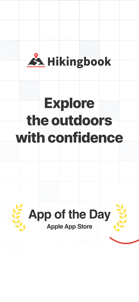
Apple App Store '오늘의 앱' 수상 배지와 '자신감 있게 아웃도어를 탐험하세요'라는 슬로건이 포함된 Hikingbook 앱 프로모션 화면.
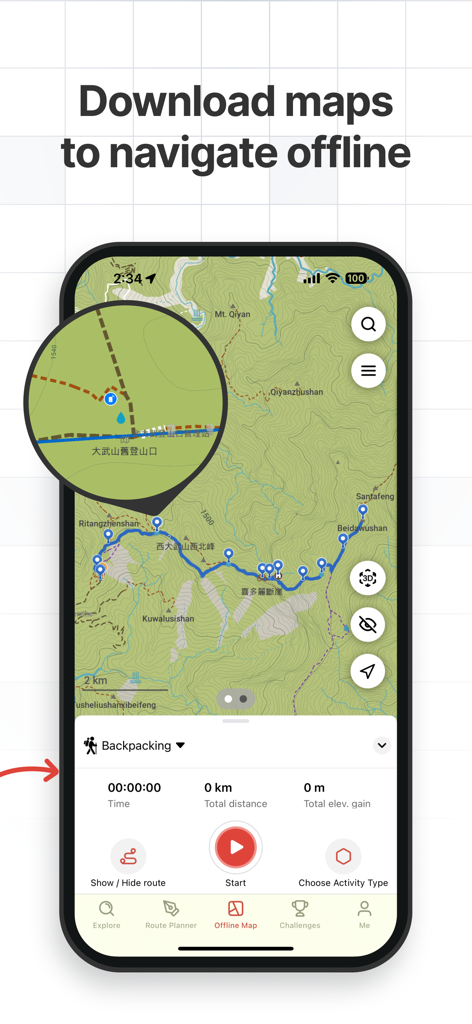
오프라인 내비게이션을 위해 경로가 고정된 지형도를 보여주는 Hikingbook 앱 인터페이스.
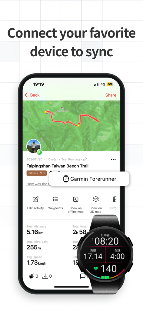
Hikingbook 앱에서 하이킹 데이터를 동기화하는 스마트폰과 Garmin 스마트워치.
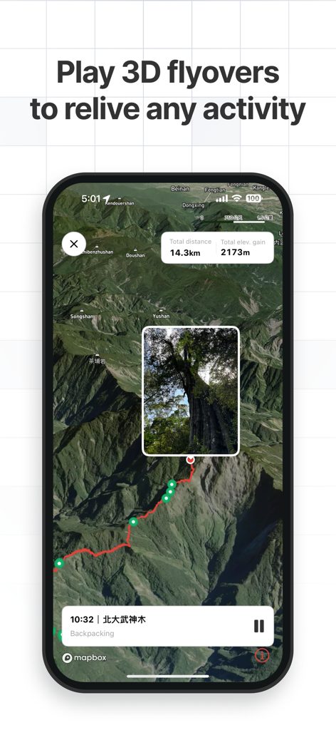
경로 통계 및 사진 마커와 함께 하이킹 트레일의 3D 플라이오버 지도를 보여주는 Hikingbook 앱 인터페이스.
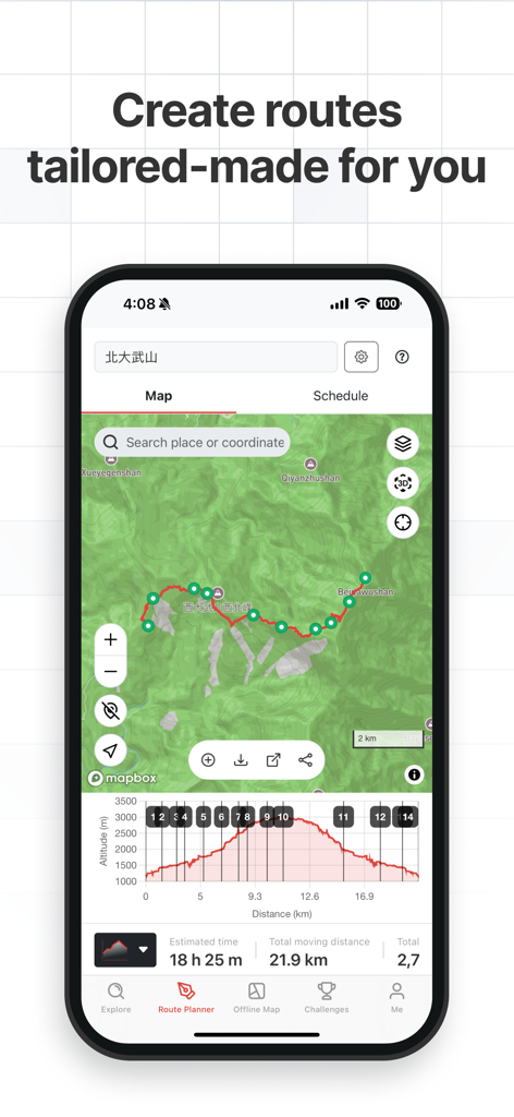
21km 하이킹의 트레일 지도와 고도 프로필을 보여주는 Hikingbook 앱 경로 플래너.
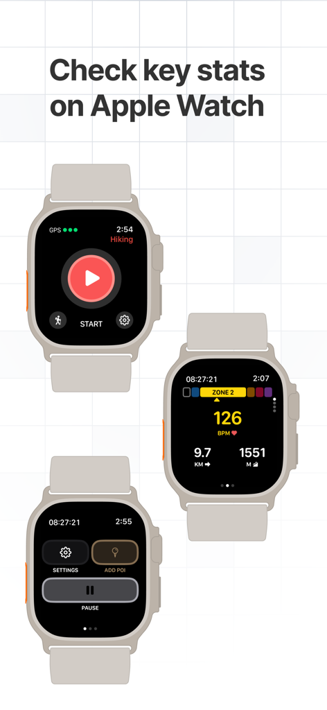
하이킹 통계, 심박수 및 내비게이션 컨트롤을 보여주는 Apple Watch의 Hikingbook 앱 화면.
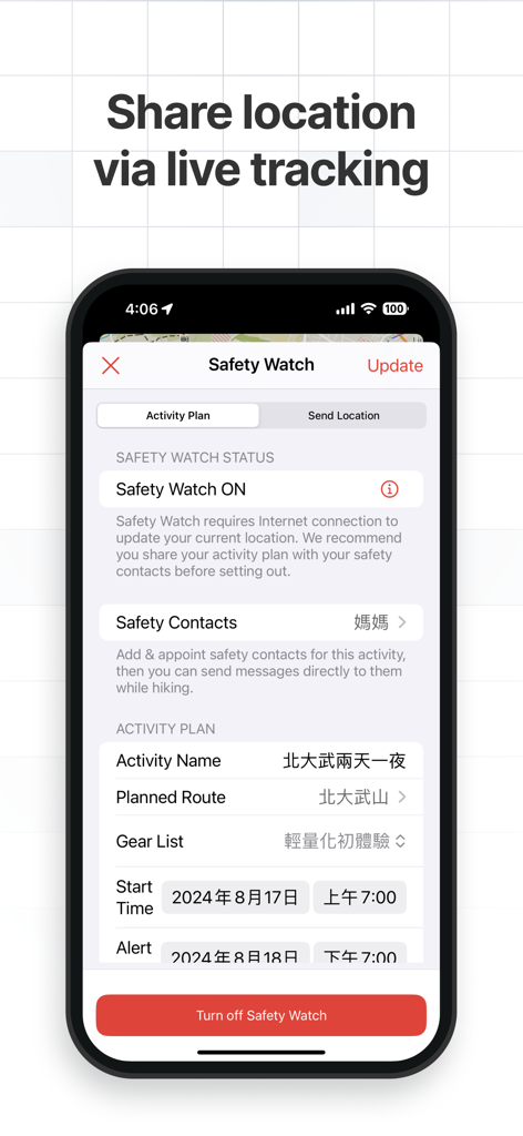
실시간 위치 공유 및 활동 계획을 위한 Safety Watch 기능을 보여주는 Hikingbook 앱 인터페이스.
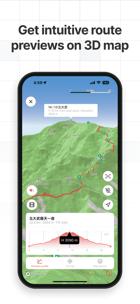
고도 프로필과 함께 직관적인 3D 경로 미리보기를 보여주는 Hikingbook 앱 인터페이스.
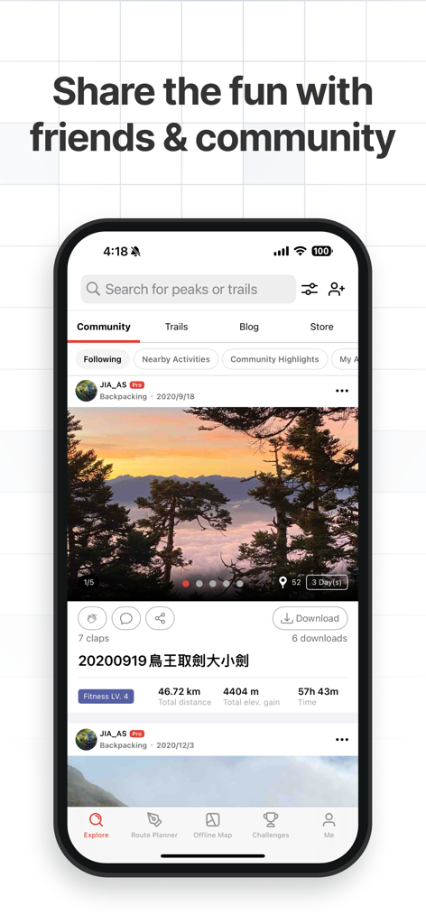
산 사진과 활동 지표가 포함된 커뮤니티 피드의 사용자 게시물을 보여주는 Hikingbook 앱.
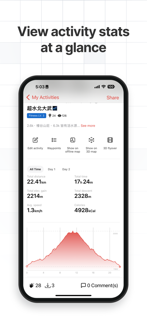
거리 및 고도 프로필을 포함한 하이킹 통계를 표시하는 앱 인터페이스.
설명
Download
비슷한 앱
유사한 기능과 사용자 경험을 가진 앱

AllTrails: Hike, Bike & Run
AllTrails, Inc.

Pedometer++
Cross Forward Consulting, LLC

Organic Maps: Offline Map
Organic Maps OU

Gaia GPS: Mobile Trail Maps
Trailbehind, INC.

Offline hiking maps: Mapy.com
Seznam.cz a.s.

Hiking Map Poland
Mapa Turystyczna sp. z o.o.

MapOut
Valnova GmbH

FarOut: Offline GPS Trail Maps
Atlas Guides DE, Inc.

Norgeskart
Norgeskart AS
이 페이지는 앱이나 개발자의 공식 페이지가 아니며, 정보 제공 및 논평을 목적으로 작성된 독립 편집 간행물입니다. 명시적으로 달리 언급되지 않는 한, 해당 앱이나 개발자는 MWM, Apple, Google Play, 앱 퍼블리셔 또는 앱 개발자와 제휴, 보증, 후원, 승인 또는 공식적으로 연결되어 있지 않으며, 이 페이지의 어떤 내용도 해당 앱이 MWM의 서비스를 사용하여 개발되었음을 의미하지 않습니다. 모든 상표, 로고, 스크린샷 및 기타 콘텐츠는 해당 소유자의 자산입니다.