이 페이지는 앱이나 개발자의 공식 페이지가 아니며, 정보 제공 및 논평을 목적으로 작성된 독립 편집 간행물입니다. 명시적으로 달리 언급되지 않는 한, 해당 앱이나 개발자는 MWM, Apple, Google Play, 앱 퍼블리셔 또는 앱 개발자와 제휴, 보증, 후원, 승인 또는 공식적으로 연결되어 있지 않으며, 이 페이지의 어떤 내용도 해당 앱이 MWM의 서비스를 사용하여 개발되었음을 의미하지 않습니다. 모든 상표, 로고, 스크린샷 및 기타 콘텐츠는 해당 소유자의 자산입니다.

i-Boating:HD Gps Marine Charts
고화질 NOAA 차트, 정밀 낚시를 위한 1피트 수심 측량, 실시간 음성 안내 라우팅으로 자신 있게 항해하세요. 이미 소유하고 있는 기기에서 모든 것을 이용할 수 있습니다.
다운로드
15K+사용자 평점
총 평가 수
200개발사
카테고리
Sports지원 언어
8최신 버전
154.0.0크기
48.6 MB출시일
2017년 3월 20일전문가의 자신감으로 항해하세요
모바일 기기를 전문가급 차트 플로터로 바꿔보세요. 낚시꾼을 위한 고화질 수심 측량부터 크루저를 위한 음성 안내 라우팅까지, 물 위를 숙달하는 데 필요한 정밀도를 얻으십시오.
HD 해상 벡터 차트
1피트 등심 윤곽선이 있는 상세 NOAA 및 USACE 데이터에 액세스하여 낚시 명소를 식별하고 얕은 수역을 완벽하게 안전하게 항해하세요.
음성 안내 해상 GPS
음성 안내 기능이 있는 최초의 해상 앱입니다. 시야에서 눈을 떼지 않고도 경로 표지 및 경로 이탈 경고에 대한 실시간 알림을 받으십시오.
다음 스크린샷과 설명은 앱의 공식 스토어 목록에서 직접 가져온 것이며 앱 개발자의 자산입니다.
앱 스토어
스크린샷
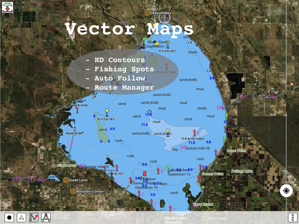
i-Boating 앱의 등심 윤곽선 및 낚시 장소가 포함된 HD 벡터 해상 차트
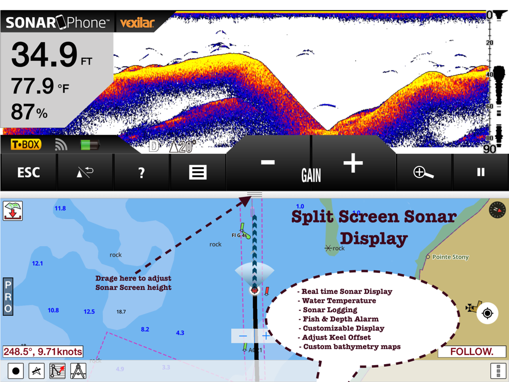
iPad에서 실시간 소나 데이터 및 해도 항해 차트를 표시하는 i-Boating 앱의 분할 화면 보기.
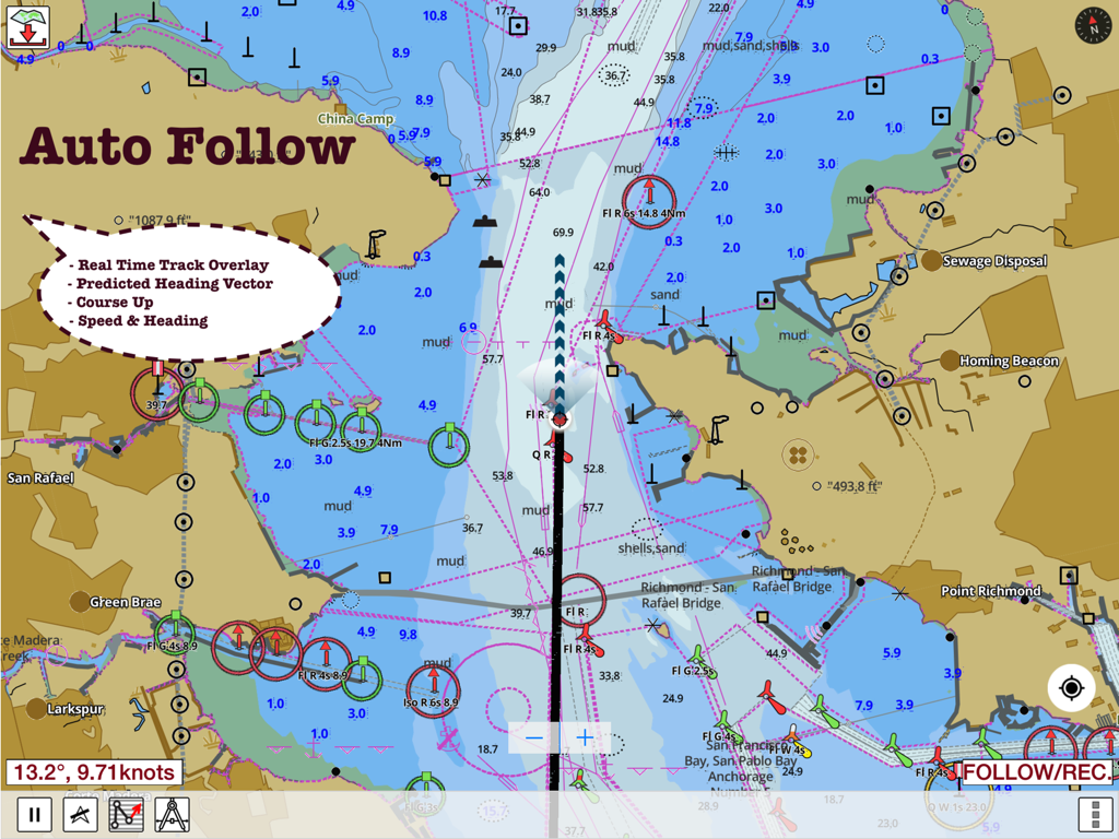
i-Boating 앱 화면이 자동 팔로우 및 실시간 내비게이션 데이터가 포함된 해상 차트를 보여줍니다.
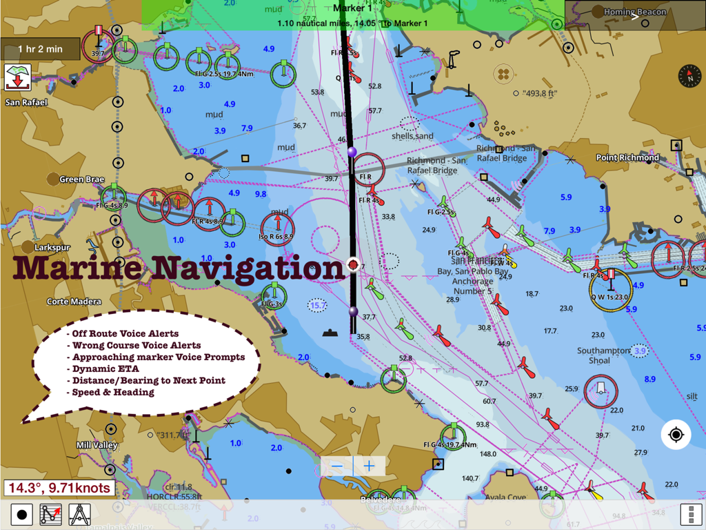
경로 지원 및 해상 내비게이션 음성 경고가 특징인 i-Boating 앱의 상세 해도.
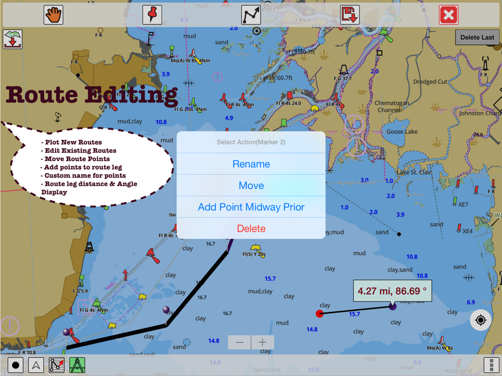
해상 GPS 차트에서 경로 편집 기능 및 거리 측정을 보여주는 i-Boating 앱의 인터페이스
설명
Download
비슷한 앱
유사한 기능과 사용자 경험을 가진 앱

PredictWind — Marine Forecasts
PredictWind Limited

Navily
The Navigation Family

Argo - Boating Navigation
Argo Navigation, LLC

SEAiq Pilot
Sakhalin, LLC

Maptrails
Pasi Salenius

KartenWerft NavGo 2.0
KartenWerft GmbH

MarineTraffic - Ship Tracking
MARINETRAFFIC APPLICATIONS LTD

Wavve Boating: Marine Boat GPS
Wavve Boating Inc

Savvy Navvy Boating Navigation
SAVVY NAVVY LTD
이 페이지는 앱이나 개발자의 공식 페이지가 아니며, 정보 제공 및 논평을 목적으로 작성된 독립 편집 간행물입니다. 명시적으로 달리 언급되지 않는 한, 해당 앱이나 개발자는 MWM, Apple, Google Play, 앱 퍼블리셔 또는 앱 개발자와 제휴, 보증, 후원, 승인 또는 공식적으로 연결되어 있지 않으며, 이 페이지의 어떤 내용도 해당 앱이 MWM의 서비스를 사용하여 개발되었음을 의미하지 않습니다. 모든 상표, 로고, 스크린샷 및 기타 콘텐츠는 해당 소유자의 자산입니다.