이 페이지는 앱이나 개발자의 공식 페이지가 아니며, 정보 제공 및 논평을 목적으로 작성된 독립 편집 간행물입니다. 명시적으로 달리 언급되지 않는 한, 해당 앱이나 개발자는 MWM, Apple, Google Play, 앱 퍼블리셔 또는 앱 개발자와 제휴, 보증, 후원, 승인 또는 공식적으로 연결되어 있지 않으며, 이 페이지의 어떤 내용도 해당 앱이 MWM의 서비스를 사용하여 개발되었음을 의미하지 않습니다. 모든 상표, 로고, 스크린샷 및 기타 콘텐츠는 해당 소유자의 자산입니다.

LandGlide: Find Property Lines
1억 6천만 건 이상의 부동산 소유주 정보, 매매 이력, GIS 지도를 즉시 확인하세요. 부동산 전문가, 측량사, 토지 소유주가 현장에서 전체 정보를 파악하는 데 신뢰받는 모바일 도구입니다.
다운로드
2M+사용자 평점
총 평가 수
55K+개발사
카테고리
Navigation지원 언어
1최신 버전
5.4.1크기
85.0 MB출시일
2014년 4월 6일토지 전문가를 위한 탁월한 정밀도
부동산 중개인, 측량사, 토지 개발업자를 위해 설계된 고급 GPS 매핑 및 심층 부동산 정보를 통해 1억 6천만 건의 필지 기록의 힘을 활용하세요.
즉각적인 경계선 파악
고급 GPS 측량 기술을 사용하여 부동산 경계선을 실시간으로 시각화하여 현장에서 정확히 어디에 있는지 항상 알 수 있도록 합니다.
포괄적인 필지 정보
미국 인구의 99% 이상에 해당하는 소유주 이름, 매매 이력, 세금 평가액, 토지 이용 현황을 포함한 심층 데이터에 액세스합니다.
자주 묻는 질문
에 대해 알아야 할 모든 것 LandGlide: Find Property Lines
LandGlide란 무엇인가요?
LandGlide는 고급 필지 데이터, 부동산 경계 지도, 위성 지도를 제공하는 최고의 부동산 데이터 앱입니다. 부동산 중개인, 측량사, 건물주에게 포괄적인 부동산 정보를 제공합니다.
LandGlide는 무료로 사용할 수 있나요?
아니요, LandGlide는 초기 무료 체험 후에는 무료가 아닙니다. 7일 무료 체험 기간을 제공하며, 그 후에는 월 9.99달러 또는 연 99.99달러의 구독료가 부과됩니다.
LandGlide에서 어떤 부동산 데이터를 사용할 수 있나요?
LandGlide는 판매 이전 내역, 토지 이용, 소유자 정보, 판매 가격, 세금 금액, 면적, 건축 연도 등 광범위한 필지 속성을 제공합니다.
LandGlide는 몇 개의 필지 기록을 다루나요?
LandGlide는 3229개 카운티에 걸쳐 1억 6천만 개의 필지 기록을 다루며, 미국 인구의 99% 이상을 포함하여 전국적으로 포괄적인 부동산 정보를 제공합니다.
LandGlide를 사용하여 부동산 경계를 어떻게 찾을 수 있나요?
LandGlide는 부동산 경계 검색기 역할을 하여 사용자가 지도에서 정확한 부동산 경계를 직접 볼 수 있도록 합니다. 사용자는 부동산 위로 마우스를 가져가면 즉시 세부 정보를 볼 수 있습니다.
LandGlide를 토지 측량에 사용할 수 있나요?
예, LandGlide는 토지 측량 전문가에게 이상적입니다. 정확한 측정 및 GIS 매핑을 위한 현장 면적 측정 도구와 GPS 측량사 기술을 제공합니다.
LandGlide는 과거 부동산 데이터를 제공할 수 있나요?
예, LandGlide는 과거 데이터를 제공합니다. 사용자는 분석에 도움이 되는 판매 이전 내역, 이전 소유자 정보 및 기타 과거 부동산 정보를 이용할 수 있습니다.
LandGlide에서 즐겨찾는 위치와 메모를 저장할 수 있나요?
예, LandGlide를 사용하면 사용자는 즐겨찾는 위치를 저장하고, 메모를 추가하고, 특정 부동산에 대한 사진을 업로드할 수 있습니다. 또한 모든 부동산 데이터를 내보낼 수 있습니다.
다음 스크린샷과 설명은 앱의 공식 스토어 목록에서 직접 가져온 것이며 앱 개발자의 자산입니다.
앱 스토어
스크린샷
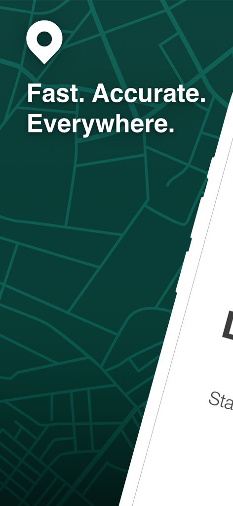
LandGlide 앱 소개 화면, 부동산 경계선 지도 격자와 '빠르고 정확하게 어디에서나'라는 슬로건이 특징입니다.

LandGlide 앱 인터페이스, 스마트폰에 로고와 7일 무료 체험 제안이 표시됩니다.
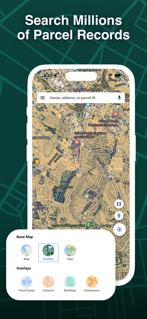
LandGlide 앱 인터페이스, 검색창과 지도 레이어 옵션이 있는 부동산 필지 지도가 표시됩니다.
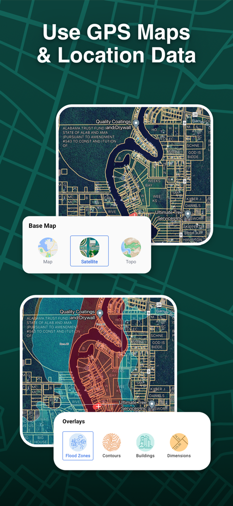
LandGlide 앱 인터페이스, 위성 지도와 부동산 경계선 오버레이, 홍수 구역 및 등고선 데이터 옵션이 표시됩니다.
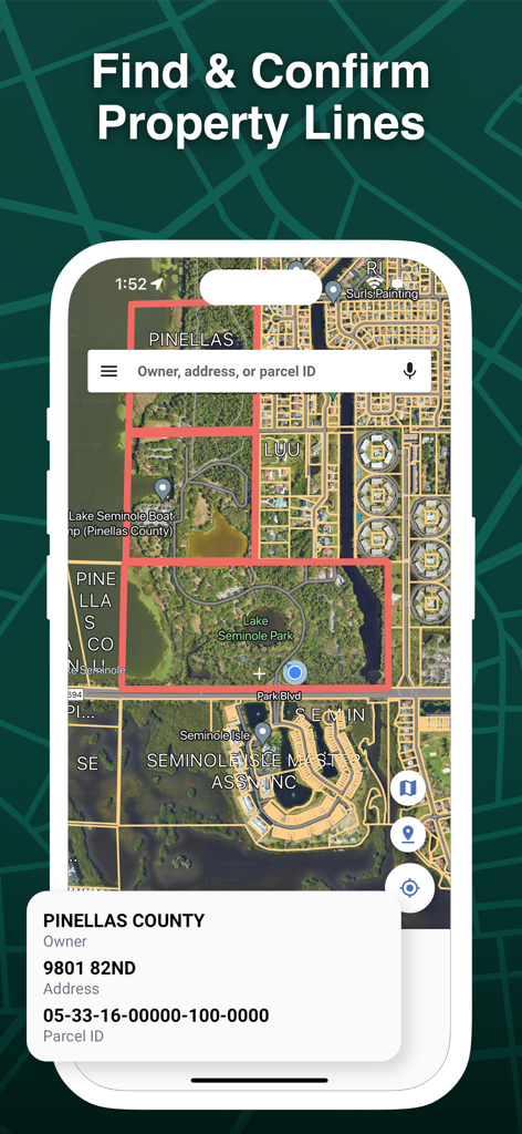
LandGlide 앱 인터페이스, 강조 표시된 경계선과 필지 식별 세부 정보가 있는 위성 부동산 지도가 표시됩니다.
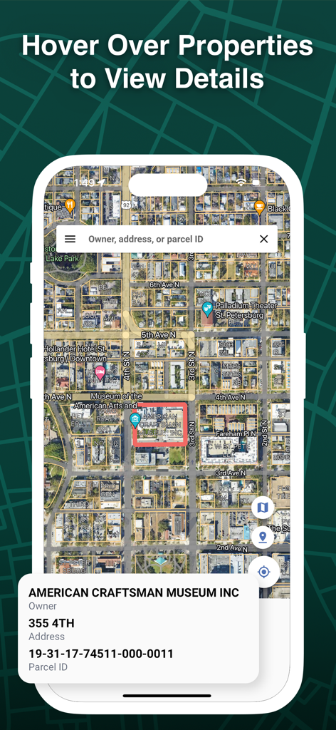
LandGlide 앱 위성 보기, 부동산 경계선과 소유주 정보 팝업이 표시됩니다.
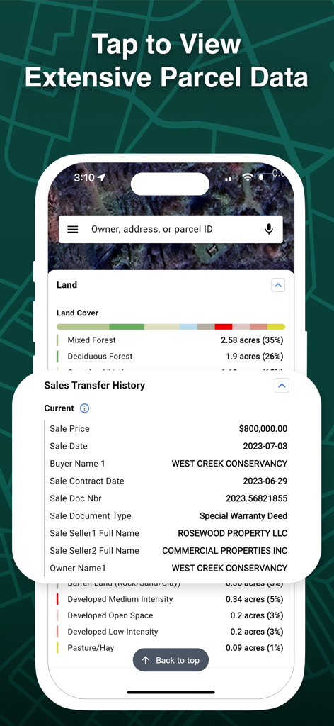
LandGlide 앱 인터페이스 스크린샷, 토지 피복 유형 및 과거 판매 이전 정보를 포함한 광범위한 부동산 필지 데이터가 표시됩니다.
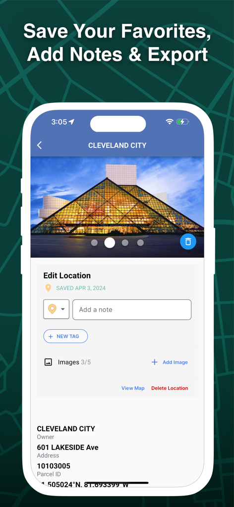
LandGlide 앱 인터페이스, 특정 필지에 대한 부동산 위치 편집, 메모, 태그 및 사진 추가 방법을 보여줍니다. 클리블랜드 시.
설명
Download
비슷한 앱
유사한 기능과 사용자 경험을 가진 앱

Regrid Property App
Loveland Technologies, LLC

DealCheck: Analyze Real Estate
Fortnoff Financial LLC

Reventure App
Reventure App LLC

Land id®
MapRight, LLC

Acres: Land Data & Parcel Maps
AcreMaps, LLC

Tapusor
TUVIMER ARGE FAALIYETLERI VE TEKNOLOJI SISTEMLERITICARET ANONIM SIRKETI

Endeksa: Value & Sell Property
Endeksa Teknoloji Anonim Sirketi

Detector Maps
GOLD DISCOVERY SOLUTIONS PTY LTD

Parceled Land Map
Uri Nemirovsky
이 페이지는 앱이나 개발자의 공식 페이지가 아니며, 정보 제공 및 논평을 목적으로 작성된 독립 편집 간행물입니다. 명시적으로 달리 언급되지 않는 한, 해당 앱이나 개발자는 MWM, Apple, Google Play, 앱 퍼블리셔 또는 앱 개발자와 제휴, 보증, 후원, 승인 또는 공식적으로 연결되어 있지 않으며, 이 페이지의 어떤 내용도 해당 앱이 MWM의 서비스를 사용하여 개발되었음을 의미하지 않습니다. 모든 상표, 로고, 스크린샷 및 기타 콘텐츠는 해당 소유자의 자산입니다.