이 페이지는 앱이나 개발자의 공식 페이지가 아니며, 정보 제공 및 논평을 목적으로 작성된 독립 편집 간행물입니다. 명시적으로 달리 언급되지 않는 한, 해당 앱이나 개발자는 MWM, Apple, Google Play, 앱 퍼블리셔 또는 앱 개발자와 제휴, 보증, 후원, 승인 또는 공식적으로 연결되어 있지 않으며, 이 페이지의 어떤 내용도 해당 앱이 MWM의 서비스를 사용하여 개발되었음을 의미하지 않습니다. 모든 상표, 로고, 스크린샷 및 기타 콘텐츠는 해당 소유자의 자산입니다.

NodeMapp Bike
벨기에, 네덜란드, 프랑스, 독일의 전설적인 노드 네트워크를 마스터하세요. 꿈꾸던 투어를 쉽게 계획하고 오프라인 음성 내비게이션과 함께 90,000km가 넘는 아름다운 경로를 탐험하세요.
다운로드
285K+사용자 평점
총 평가 수
14K+개발사
카테고리
Travel지원 언어
4최신 버전
9.0.15크기
78.5 MB출시일
2016년 5월 24일현지인처럼 유럽을 경험하세요
꼼꼼한 여행자를 위해 설계된 전문 내비게이션 도구로 유럽 중심부의 55,000마일 이상의 프리미엄 자전거 도로를 탐험하세요.
스마트 내비게이션 및 음성 알림
유럽의 노드 시스템을 핸들바 위에서 간단하고 스트레스 없는 길 안내로 바꿔주는 턴 바이 턴 음성 안내를 통해 안심하고 여행하세요.
오프라인 지도 및 로밍 없는 GPS
전체 일정을 미리 다운로드하여 국제 데이터 요금 걱정을 없애고, 가장 외딴 시골 풍경 속에서도 안정적인 GPS 안내를 받으세요.
다음 스크린샷과 설명은 앱의 공식 스토어 목록에서 직접 가져온 것이며 앱 개발자의 자산입니다.
앱 스토어
스크린샷
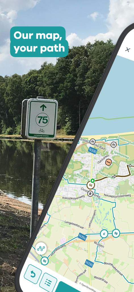
실제 자전거 노드 표지판 옆에 NodeMapp Bike 지도 인터페이스가 표시된 스마트폰.
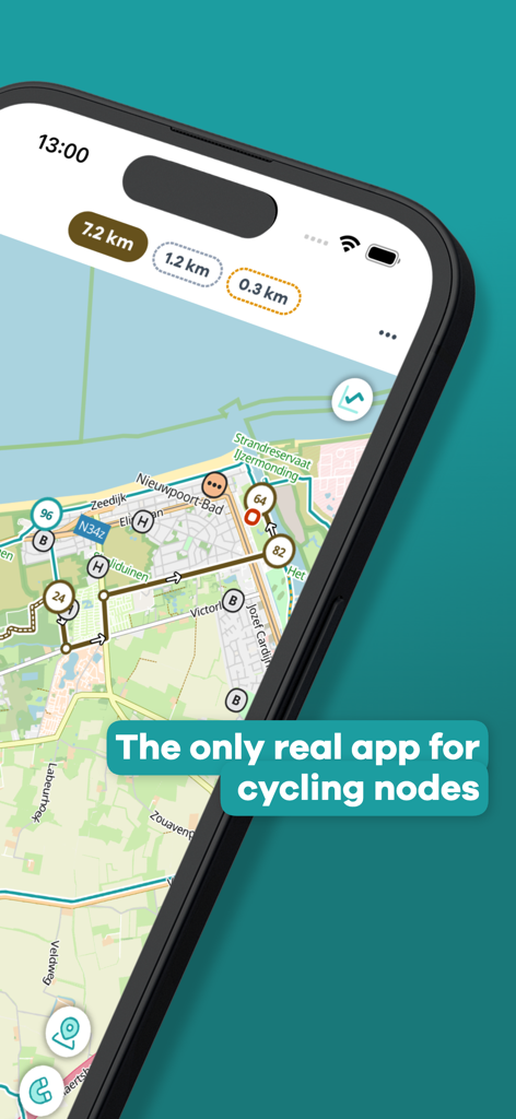
자전거 노드 및 경로 계획 기능이 포함된 NodeMapp Bike 앱 지도가 표시된 iPhone 화면
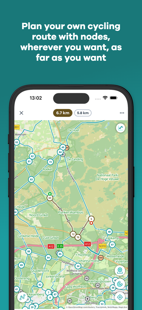
유럽의 번호가 매겨진 노드를 사용한 계획된 자전거 경로를 보여주는 NodeMapp Bike 앱의 지도 인터페이스
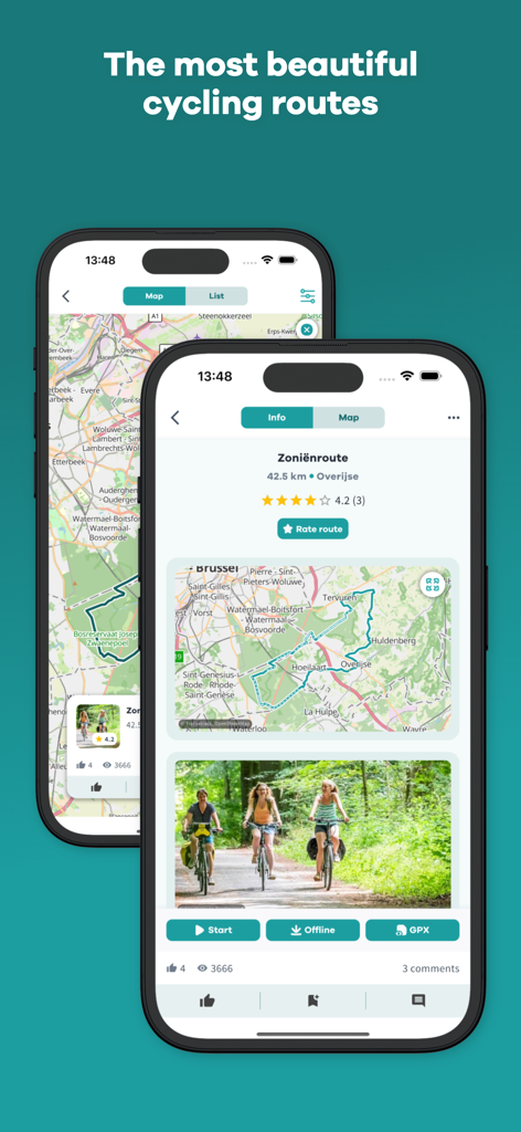
휴대폰에서 자전거 경로 세부 정보와 지도를 보여주는 NodeMapp Bike 앱 인터페이스
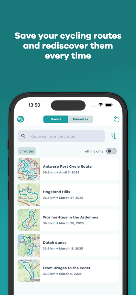
NodeMapp Bike 앱에 저장된 자전거 경로 목록이 표시된 스마트폰 화면.
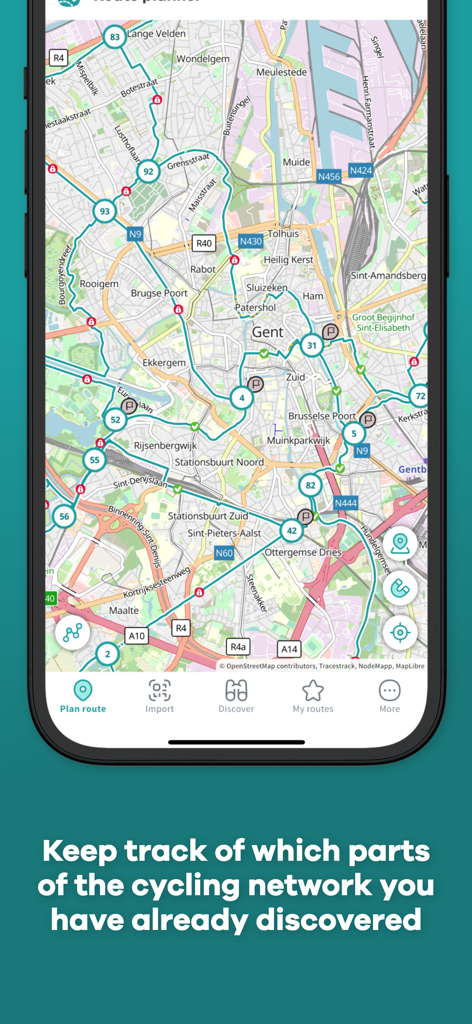
노드가 있는 자전거 경로 지도와 발견된 네트워크 구간 추적에 대한 캡션이 표시된 모바일 앱 화면.
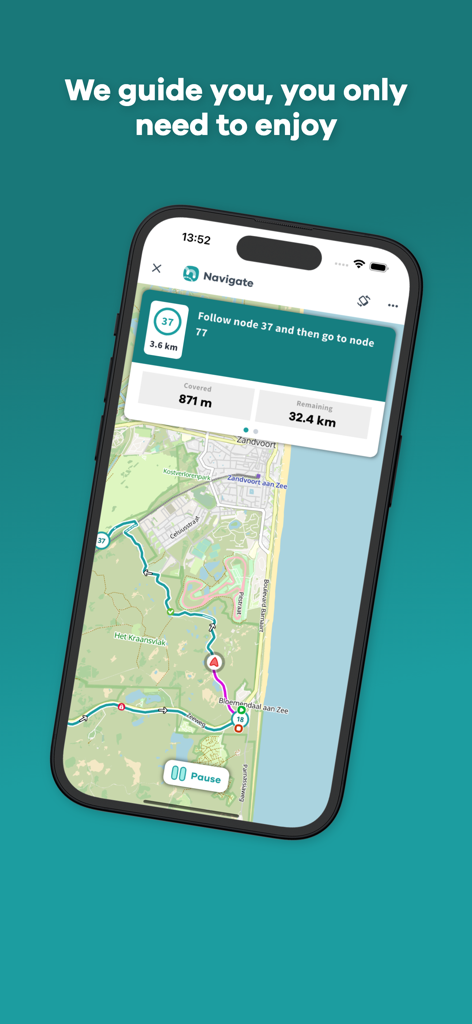
지도의 노드 지점을 통과하는 자전거 경로를 표시하는 NodeMapp Bike 앱 내비게이션 화면
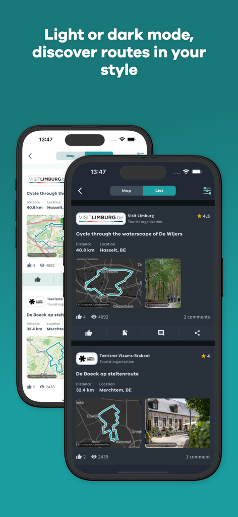
라이트 모드와 다크 모드에서 자전거 경로를 보여주는 NodeMapp Bike 앱 인터페이스
설명
Download
비슷한 앱
유사한 기능과 사용자 경험을 가진 앱

AllTrails: Hike, Bike & Run
AllTrails, Inc.

Pedometer++
Cross Forward Consulting, LLC

Organic Maps: Offline Map
Organic Maps OU

Gaia GPS: Mobile Trail Maps
Trailbehind, INC.

Offline hiking maps: Mapy.com
Seznam.cz a.s.

Hiking Map Poland
Mapa Turystyczna sp. z o.o.

MapOut
Valnova GmbH

FarOut: Offline GPS Trail Maps
Atlas Guides DE, Inc.

Norgeskart
Norgeskart AS
이 페이지는 앱이나 개발자의 공식 페이지가 아니며, 정보 제공 및 논평을 목적으로 작성된 독립 편집 간행물입니다. 명시적으로 달리 언급되지 않는 한, 해당 앱이나 개발자는 MWM, Apple, Google Play, 앱 퍼블리셔 또는 앱 개발자와 제휴, 보증, 후원, 승인 또는 공식적으로 연결되어 있지 않으며, 이 페이지의 어떤 내용도 해당 앱이 MWM의 서비스를 사용하여 개발되었음을 의미하지 않습니다. 모든 상표, 로고, 스크린샷 및 기타 콘텐츠는 해당 소유자의 자산입니다.