이 페이지는 앱이나 개발자의 공식 페이지가 아니며, 정보 제공 및 논평을 목적으로 작성된 독립 편집 간행물입니다. 명시적으로 달리 언급되지 않는 한, 해당 앱이나 개발자는 MWM, Apple, Google Play, 앱 퍼블리셔 또는 앱 개발자와 제휴, 보증, 후원, 승인 또는 공식적으로 연결되어 있지 않으며, 이 페이지의 어떤 내용도 해당 앱이 MWM의 서비스를 사용하여 개발되었음을 의미하지 않습니다. 모든 상표, 로고, 스크린샷 및 기타 콘텐츠는 해당 소유자의 자산입니다.

NodeMapp Hike
해외 탐험가를 위한 필수 동반자. 오프라인 GPS, 음성 안내 및 원활한 Apple Watch 통합을 통해 60,000km에 달하는 아름다운 트레일에서 맞춤형 노드 간 경로를 계획하세요.
다운로드
324K+사용자 평점
총 평가 수
11K+개발사
카테고리
Travel지원 언어
4최신 버전
9.0.15크기
78.5 MB출시일
2016년 5월 31일궁극의 유럽 하이킹 동반자
세련된 해외 여행자를 위해 설계된 도구로 세계에서 가장 아름다운 60,000km 이상의 하이킹 네트워크를 발견하세요.
손쉬운 경로 계획
데스크톱에서 여행을 계획하고 간단한 QR 코드로 iPhone에 동기화하세요. 즉각적인 거리 기반 여정을 위해 'Surprise Me' 도구를 사용해 보세요.
스마트 워치 통합
핸즈프리 하이킹의 자유를 경험하세요. Apple Watch에서 직접 노드별 음성 안내를 따르고 회전 알림을 받으세요.
다음 스크린샷과 설명은 앱의 공식 스토어 목록에서 직접 가져온 것이며 앱 개발자의 자산입니다.
앱 스토어
스크린샷
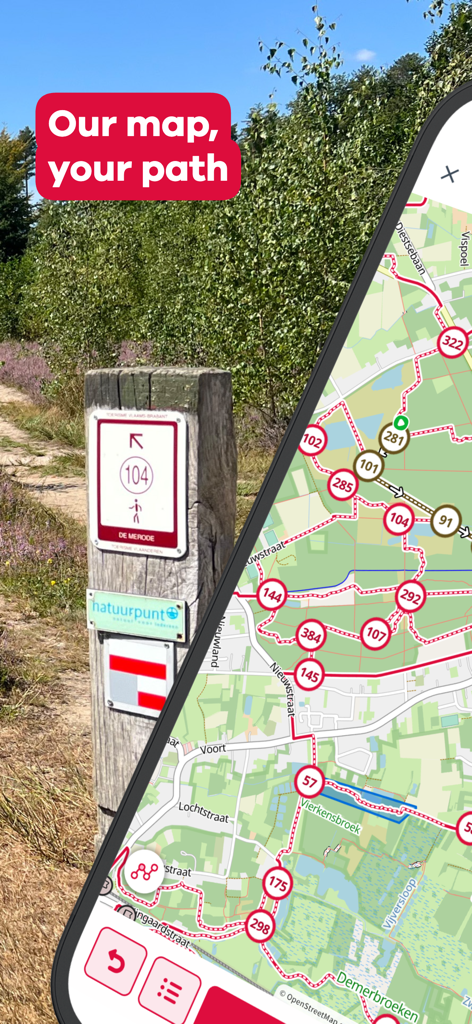
물리적 트레일 마커 기둥 옆에 하이킹 노드 지도를 보여주는 스마트폰 화면
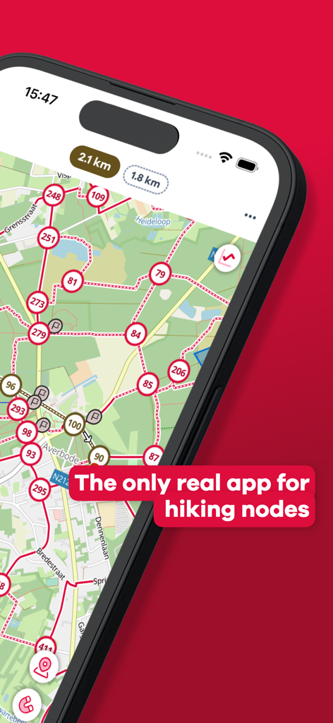
번호가 매겨진 노드와 연결 경로가 있는 상세한 하이킹 네트워크 지도를 보여주는 NodeMapp Hike 앱이 실행된 스마트폰.
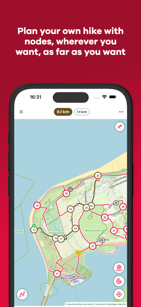
녹색 해안 지역에서 번호가 매겨진 노드와 계획된 경로가 있는 하이킹 지도를 보여주는 모바일 화면

유럽의 특정 하이킹 경로에 대한 상세 정보와 지도를 보여주는 NodeMapp Hike 앱 인터페이스.
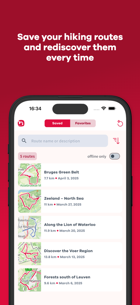
브뤼헤와 제일란트를 포함하여 NodeMapp Hike 앱에 저장된 하이킹 경로 목록을 보여주는 iPhone 화면
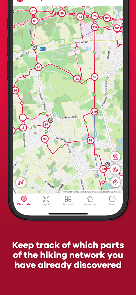
녹색 체크표시로 완료된 하이킹 구간을 보여주는 NodeMapp Hike 앱의 경로 플래너
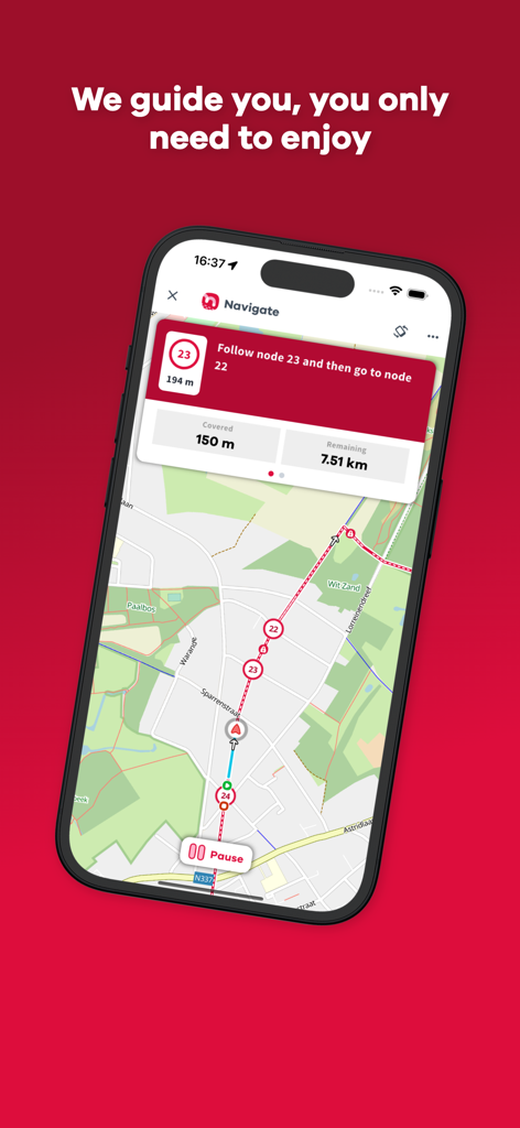
번호가 매겨진 트레일 노드와 도보 방향이 표시된 지도를 보여주는 NodeMapp Hike 앱 네비게이션 인터페이스
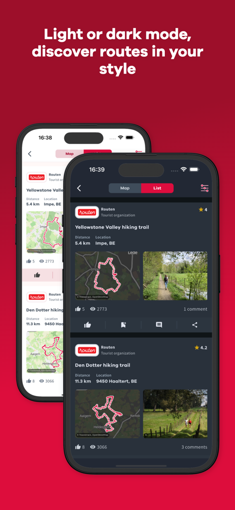
추천 하이킹 경로 목록을 보여주는 라이트 및 다크 모드의 NodeMapp Hike 앱을 표시하는 두 대의 스마트폰
설명
Download
비슷한 앱
유사한 기능과 사용자 경험을 가진 앱

AllTrails: Hike, Bike & Run
AllTrails, Inc.

Pedometer++
Cross Forward Consulting, LLC

Organic Maps: Offline Map
Organic Maps OU

Gaia GPS: Mobile Trail Maps
Trailbehind, INC.

Offline hiking maps: Mapy.com
Seznam.cz a.s.

Hiking Map Poland
Mapa Turystyczna sp. z o.o.

MapOut
Valnova GmbH

FarOut: Offline GPS Trail Maps
Atlas Guides DE, Inc.

Norgeskart
Norgeskart AS
이 페이지는 앱이나 개발자의 공식 페이지가 아니며, 정보 제공 및 논평을 목적으로 작성된 독립 편집 간행물입니다. 명시적으로 달리 언급되지 않는 한, 해당 앱이나 개발자는 MWM, Apple, Google Play, 앱 퍼블리셔 또는 앱 개발자와 제휴, 보증, 후원, 승인 또는 공식적으로 연결되어 있지 않으며, 이 페이지의 어떤 내용도 해당 앱이 MWM의 서비스를 사용하여 개발되었음을 의미하지 않습니다. 모든 상표, 로고, 스크린샷 및 기타 콘텐츠는 해당 소유자의 자산입니다.