이 페이지는 앱이나 개발자의 공식 페이지가 아니며, 정보 제공 및 논평을 목적으로 작성된 독립 편집 간행물입니다. 명시적으로 달리 언급되지 않는 한, 해당 앱이나 개발자는 MWM, Apple, Google Play, 앱 퍼블리셔 또는 앱 개발자와 제휴, 보증, 후원, 승인 또는 공식적으로 연결되어 있지 않으며, 이 페이지의 어떤 내용도 해당 앱이 MWM의 서비스를 사용하여 개발되었음을 의미하지 않습니다. 모든 상표, 로고, 스크린샷 및 기타 콘텐츠는 해당 소유자의 자산입니다.

onWater Fish Maps & Forecast
추측은 그만, 낚시를 시작하세요. 실시간 하천 유량, 정확한 소유지 경계, AI 정보를 이용하여 물가에서 보내는 시간을 최적화하세요.
다운로드
223K+사용자 평점
총 평가 수
2K+개발사
카테고리
Navigation지원 언어
1최신 버전
3.0.2크기
189.1 MB출시일
2021년 7월 5일추측이 아닌 정밀함으로 낚시하세요
데이터 기반 낚시꾼을 위한 궁극의 도구로 실시간 수질, 합법적 접근, AI 기반 통찰력을 통합하여 물가에서 보내는 시간을 최대화하세요.
공공 및 사유 접근 마스터
상세한 소유지 경계를 사용하여 자신 있게 탐색하세요. 다른 사람들이 놓치는 숨겨진 보트 진입로와 공공 낚시 장소를 발견하면서 무단 침입을 피하세요.
실시간 하천 유량 및 온도
물이 넘쳐흐르는 강으로 인해 헛걸음하는 일은 이제 그만. 실시간 수질 및 예보를 추적하여 언제 어디서 낚시가 최적인지 정확히 파악하세요.
다음 스크린샷과 설명은 앱의 공식 스토어 목록에서 직접 가져온 것이며 앱 개발자의 자산입니다.
앱 스토어
스크린샷
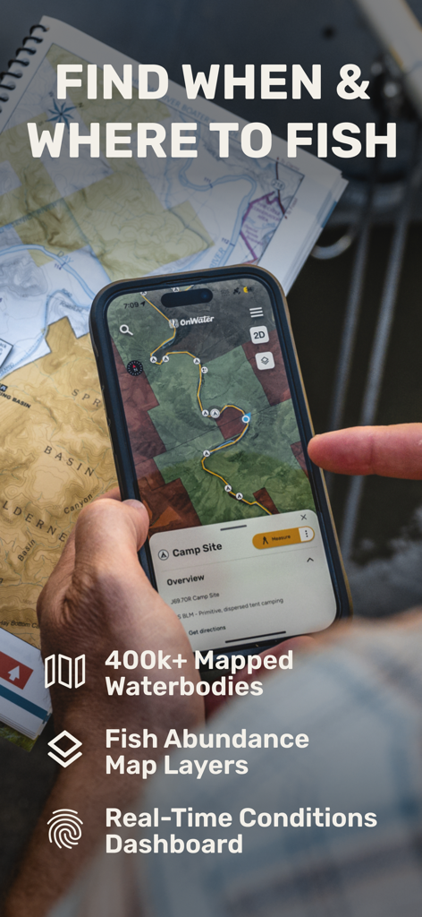
디지털 지도와 실시간 데이터로 낚시 여행 계획에 onWater 앱을 사용하는 사람
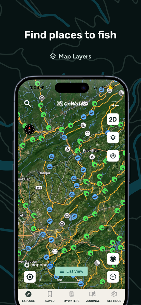
여러 낚시 장소 표시와 지도 레이어 옵션이 있는 위성 지도를 보여주는 onWater 앱 스크린샷
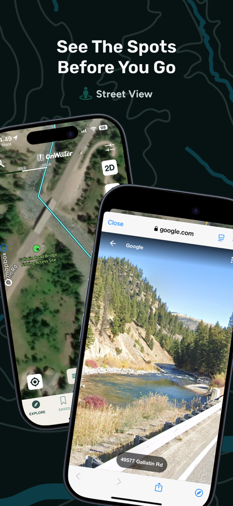
onWater 앱에서 강 낚시 접근 지점의 위성 지도와 거리 보기 표시
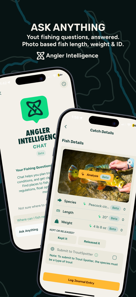
onWater 앱 Angler Intelligence 기능에서 AI 물고기 종 식별 및 낚시 분석 표시
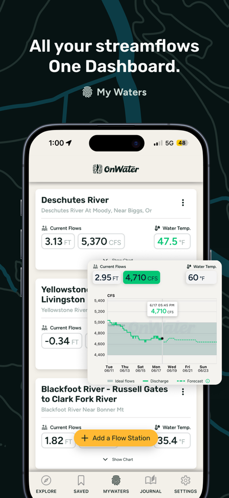
낚시를 위한 강 유량 수준과 수온 데이터를 표시하는 onWater 앱 대시보드
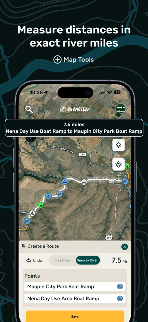
위성 지도에서 보트 진입로 간 거리를 계산하는 onWater 앱의 강 측정 도구 화면
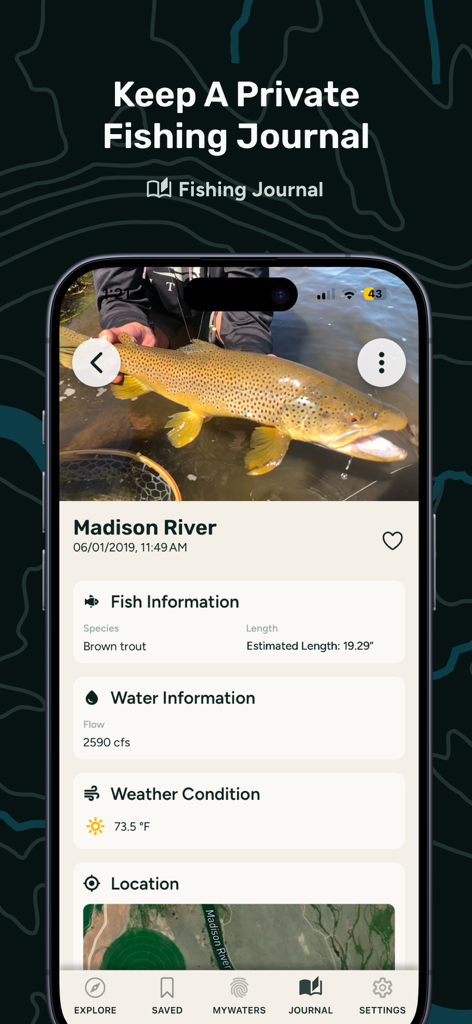
갈색 송어 낚시 기록과 강 유량 및 날씨 데이터가 포함된 onWater 앱의 낚시 일지 항목
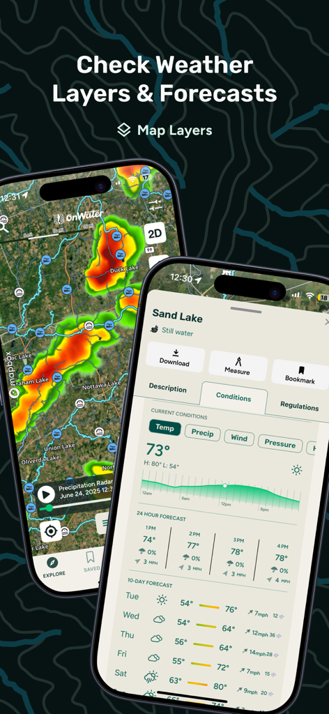
모바일 기기에 표시되는 낚시 날씨 레이더 및 10일 예보
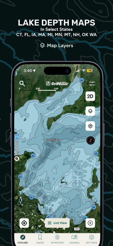
onWater 낚시 앱 인터페이스의 상세한 호수 수심 지도
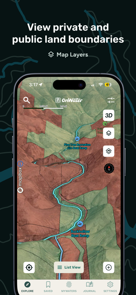
낚시꾼을 위한 공공 및 사유 토지 경계와 보트 진입로를 보여주는 onWater 앱 지도 보기
설명
Download
비슷한 앱
유사한 기능과 사용자 경험을 가진 앱

FishAngler - Fish Finder App
FishAngler, LLC

钓鱼天气预报
Hefei Sasha Technology Co., Ltd.

潮汐表-潮汐天气预报&钓鱼潮汐天气工具助手
荣虎 太

Fishbrain - Fishing App
FishBrain AB

Fishing Points: Map & Forecast
Fishing Points d.o.o.

onX Fish: Midwest Lake Finder
onXmaps, Inc.

Fishbox - Smart Fishing App
MEMS Group, Inc.

釣果記録FishRanker-フィッシュランカー,釣り,分析
SIIG Inc.

Fish Deeper - Fishing App
Deeper UAB
이 페이지는 앱이나 개발자의 공식 페이지가 아니며, 정보 제공 및 논평을 목적으로 작성된 독립 편집 간행물입니다. 명시적으로 달리 언급되지 않는 한, 해당 앱이나 개발자는 MWM, Apple, Google Play, 앱 퍼블리셔 또는 앱 개발자와 제휴, 보증, 후원, 승인 또는 공식적으로 연결되어 있지 않으며, 이 페이지의 어떤 내용도 해당 앱이 MWM의 서비스를 사용하여 개발되었음을 의미하지 않습니다. 모든 상표, 로고, 스크린샷 및 기타 콘텐츠는 해당 소유자의 자산입니다.