이 페이지는 앱이나 개발자의 공식 페이지가 아니며, 정보 제공 및 논평을 목적으로 작성된 독립 편집 간행물입니다. 명시적으로 달리 언급되지 않는 한, 해당 앱이나 개발자는 MWM, Apple, Google Play, 앱 퍼블리셔 또는 앱 개발자와 제휴, 보증, 후원, 승인 또는 공식적으로 연결되어 있지 않으며, 이 페이지의 어떤 내용도 해당 앱이 MWM의 서비스를 사용하여 개발되었음을 의미하지 않습니다. 모든 상표, 로고, 스크린샷 및 기타 콘텐츠는 해당 소유자의 자산입니다.

OpenRunner – Bike, hike, trail
하이커, 사이클리스트 및 트레일 러너를 위한 최정예 경로 계획 도구입니다. 고정밀 매핑, 오프라인 신뢰성 및 실시간 안전 추적 기능을 통해 모든 트레일에서 완벽한 안심과 함께 탐험하세요.
다운로드
496K+사용자 평점
총 평가 수
8K+개발사
카테고리
Health & Fitness지원 언어
4최신 버전
2.9.1크기
89.5 MB출시일
2017년 6월 2일완벽한 모험을 설계하세요
맞춤형 그래블 루프 계획부터 외딴 트레일 탐색까지, 자신감 있게 탐험하는 데 필요한 정밀함과 안전 기능을 활용하세요.
정밀한 경로 설계
특정 성과 목표에 맞춘 실시간 고도 상승 및 거리 지표를 사용하여 모든 활동에 대한 맞춤형 경로를 설계하세요.
신뢰할 수 있는 오프라인 안전
통신 불능 지역 내비게이션을 위해 고해상도 지도를 다운로드하고, LiveTrack을 사용하여 사랑하는 사람들에게 실시간으로 위치를 공유하세요.
다음 스크린샷과 설명은 앱의 공식 스토어 목록에서 직접 가져온 것이며 앱 개발자의 자산입니다.
앱 스토어
스크린샷
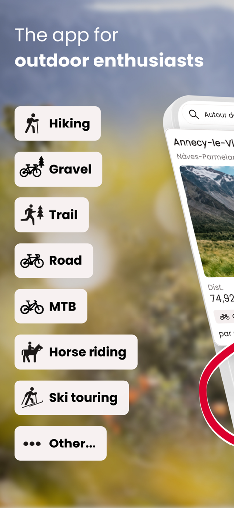
하이킹, 그래블 바이크, 트레일 러닝을 포함한 아웃도어 활동 목록을 보여주는 OpenRunner 앱의 인터페이스
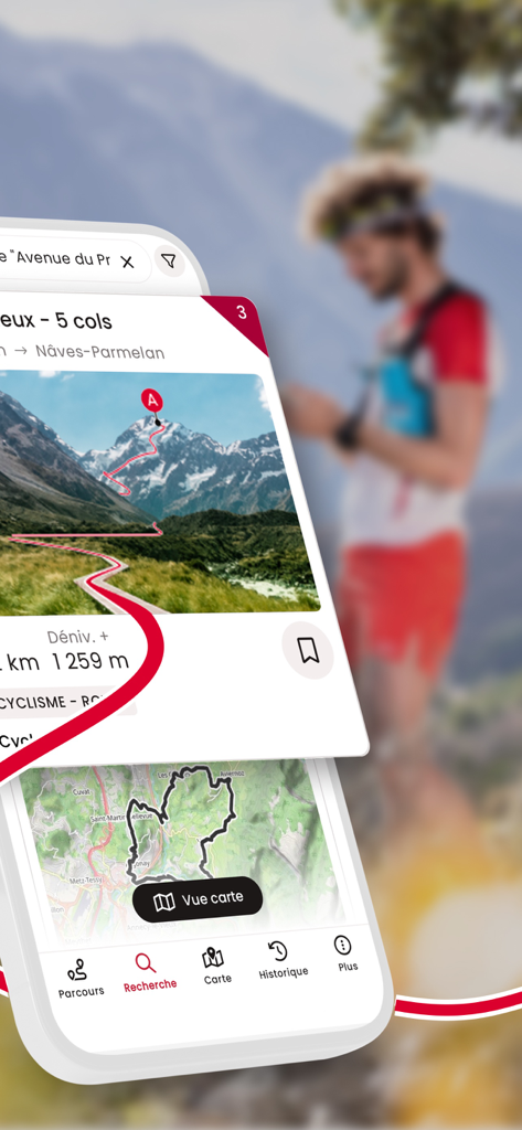
고도 세부 정보 및 지도와 함께 산악 하이킹 경로를 보여주는 OpenRunner 앱 인터페이스
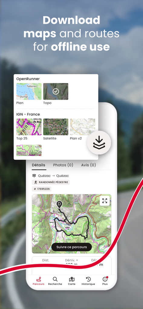
오프라인 사용을 위해 지형도 및 경로를 다운로드하는 옵션을 보여주는 OpenRunner 앱 인터페이스
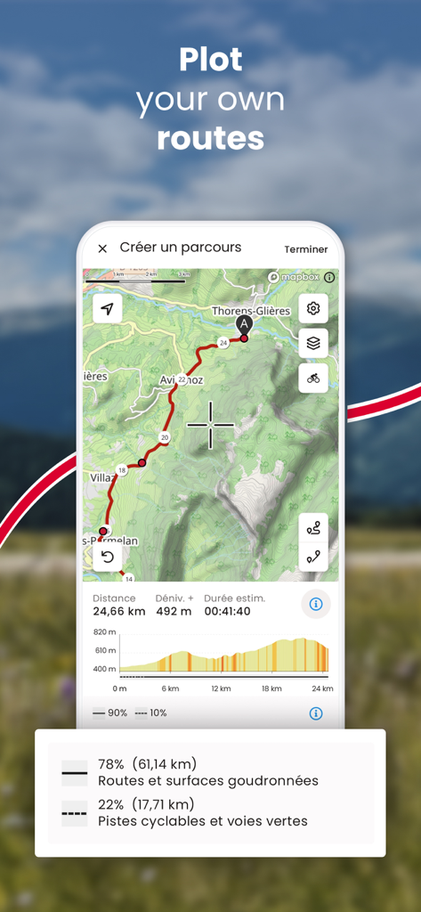
고도 프로필 및 거리 통계와 함께 맞춤형 아웃도어 경로를 계획하기 위한 OpenRunner 앱 인터페이스
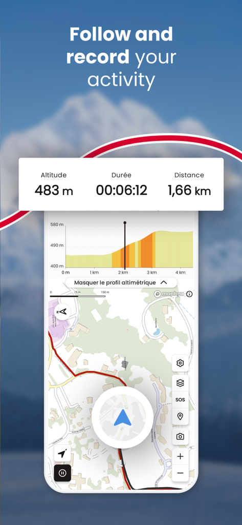
고도, 소요 시간, 거리 및 지도가 포함된 실시간 활동 추적을 보여주는 OpenRunner 앱 화면
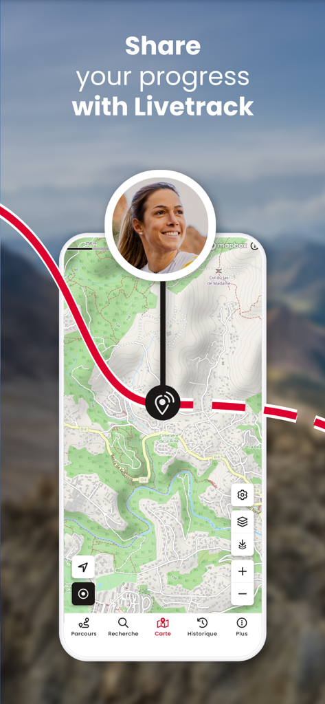
지형도에서 실시간 진행 상황을 공유하는 LiveTrack 기능을 보여주는 OpenRunner 앱 화면
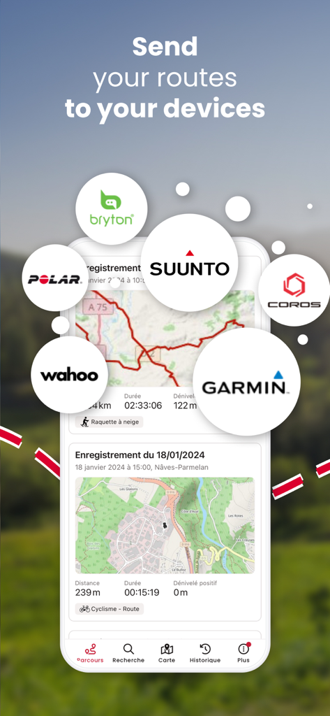
Garmin, Suunto, Wahoo와 같은 GPS 브랜드와의 경로 동기화를 보여주는 OpenRunner 앱 인터페이스
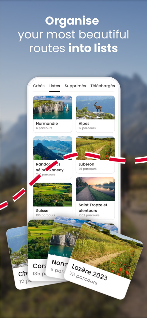
알프스 및 노르망디와 같은 맞춤형 목록으로 정리된 아웃도어 경로를 보여주는 OpenRunner의 모바일 앱 인터페이스
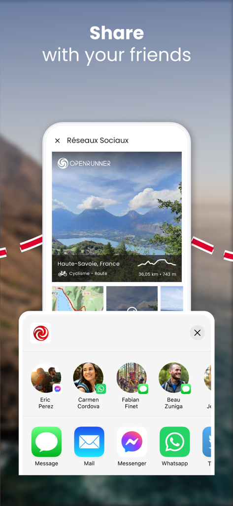
메시징 및 소셜 미디어 아이콘과 함께 사이클링 경로에 대한 OpenRunner 앱 소셜 공유 기능을 보여주는 모바일 화면
설명
Download
비슷한 앱
유사한 기능과 사용자 경험을 가진 앱

AllTrails: Hike, Bike & Run
AllTrails, Inc.

Pedometer++
Cross Forward Consulting, LLC

Organic Maps: Offline Map
Organic Maps OU

Gaia GPS: Mobile Trail Maps
Trailbehind, INC.

Offline hiking maps: Mapy.com
Seznam.cz a.s.

Hiking Map Poland
Mapa Turystyczna sp. z o.o.

MapOut
Valnova GmbH

FarOut: Offline GPS Trail Maps
Atlas Guides DE, Inc.

Norgeskart
Norgeskart AS
이 페이지는 앱이나 개발자의 공식 페이지가 아니며, 정보 제공 및 논평을 목적으로 작성된 독립 편집 간행물입니다. 명시적으로 달리 언급되지 않는 한, 해당 앱이나 개발자는 MWM, Apple, Google Play, 앱 퍼블리셔 또는 앱 개발자와 제휴, 보증, 후원, 승인 또는 공식적으로 연결되어 있지 않으며, 이 페이지의 어떤 내용도 해당 앱이 MWM의 서비스를 사용하여 개발되었음을 의미하지 않습니다. 모든 상표, 로고, 스크린샷 및 기타 콘텐츠는 해당 소유자의 자산입니다.