이 페이지는 앱이나 개발자의 공식 페이지가 아니며, 정보 제공 및 논평을 목적으로 작성된 독립 편집 간행물입니다. 명시적으로 달리 언급되지 않는 한, 해당 앱이나 개발자는 MWM, Apple, Google Play, 앱 퍼블리셔 또는 앱 개발자와 제휴, 보증, 후원, 승인 또는 공식적으로 연결되어 있지 않으며, 이 페이지의 어떤 내용도 해당 앱이 MWM의 서비스를 사용하여 개발되었음을 의미하지 않습니다. 모든 상표, 로고, 스크린샷 및 기타 콘텐츠는 해당 소유자의 자산입니다.

OpenSeaMap
전 세계 무료 해양 데이터, 항만 정보, 날씨 레이어를 이용하세요. 레크리에이션 보팅 커뮤니티를 위해 제작된 강력한 오프라인 지도로 다음 해안 모험을 탐색하세요.
다운로드
222K+사용자 평점
총 평가 수
300개발사
카테고리
Navigation지원 언어
3최신 버전
4.2크기
13.2 MB출시일
2012년 1월 25일구독 없는 스마트한 해도 항해
글로벌 오픈소스 커뮤니티에 참여하여 보조 조타 장치 및 해안 탐사를 위해 설계된 무료 상세 해도를 이용하세요.
완벽한 오프라인 신뢰성
최대 100만 개의 지도 타일을 기기에 캐싱하여 수 마일 떨어진 해상에서 셀룰러 신호가 끊겨도 자신 있게 항해할 수 있습니다.
무료 해양 정보
OpenStreetMap 프로젝트에서 제공하는 날씨 데이터 및 항만 정보가 포함된 전 세계 차트로 비싼 연회비를 절약하세요.
다음 스크린샷과 설명은 앱의 공식 스토어 목록에서 직접 가져온 것이며 앱 개발자의 자산입니다.
앱 스토어
스크린샷
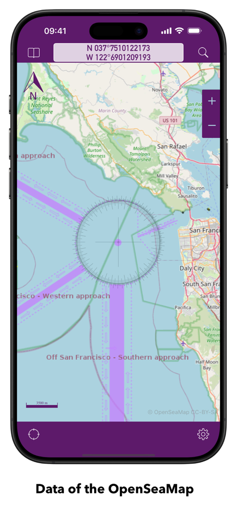
OpenSeaMap 앱이 샌프란시스코 만의 해도에 좌표 및 항해 표시를 표시합니다.
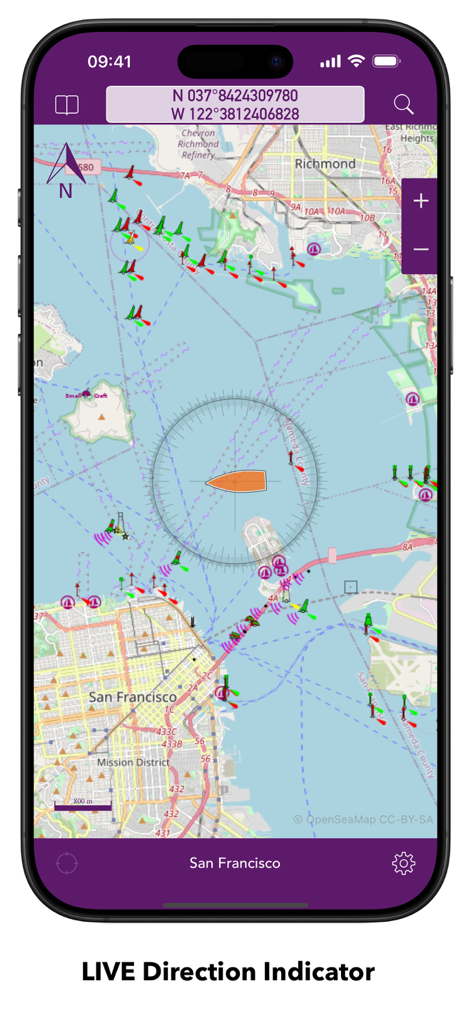
OpenSeaMap 앱이 샌프란시스코의 해도에 실시간 방향 표시기 및 해상 항해 표시를 표시합니다.
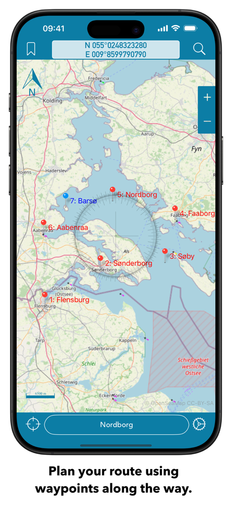
OpenSeaMap 해도 인터페이스가 스마트폰에 여러 웨이포인트 및 나침반 오버레이가 있는 경로 계획을 표시합니다.
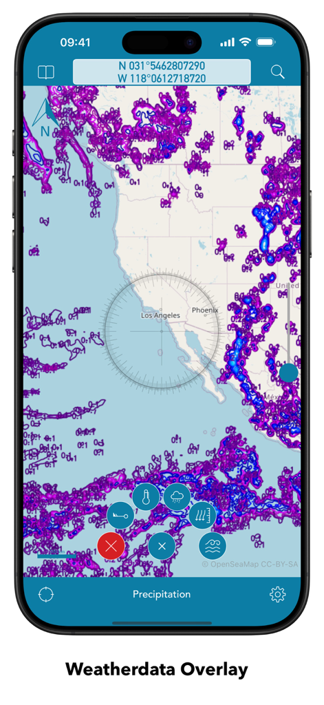
OpenSeaMap 모바일 인터페이스가 해도에 강수량 날씨 데이터 오버레이를 표시합니다.
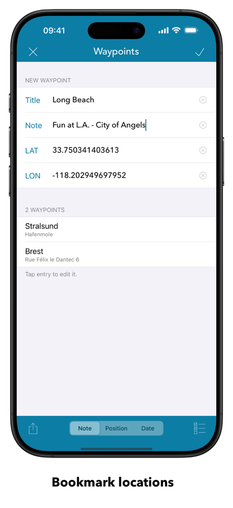
OpenSeaMap 모바일 앱 웨이포인트 화면에 즐겨찾는 해상 위치와 좌표 입력이 표시됩니다.
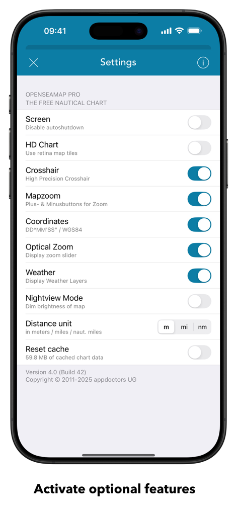
OpenSeaMap 설정 화면에 해도 및 항해 구성 옵션이 표시됩니다.
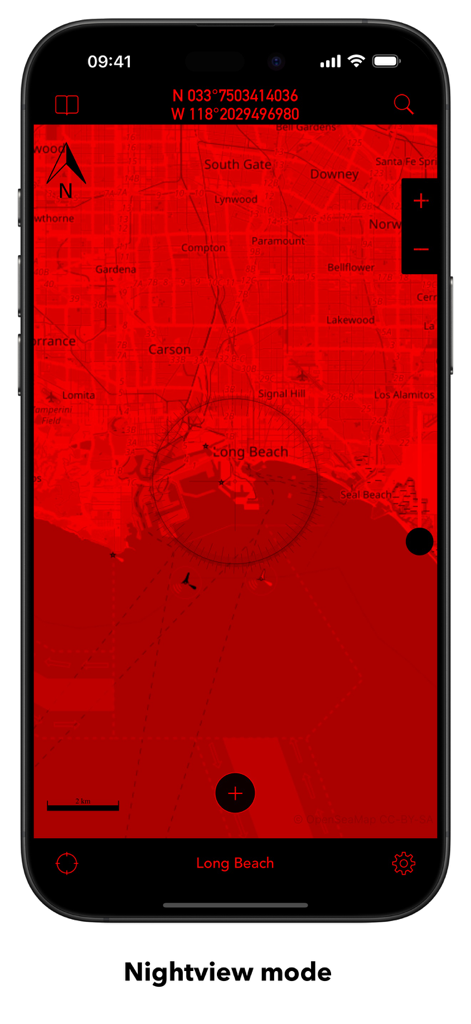
OpenSeaMap 모바일 앱 인터페이스에 롱비치의 빨간색 야간 모드 지도가 표시됩니다.
설명
Download
비슷한 앱
유사한 기능과 사용자 경험을 가진 앱

PredictWind — Marine Forecasts
PredictWind Limited

Navily
The Navigation Family

Argo - Boating Navigation
Argo Navigation, LLC

SEAiq Pilot
Sakhalin, LLC

Maptrails
Pasi Salenius

KartenWerft NavGo 2.0
KartenWerft GmbH

MarineTraffic - Ship Tracking
MARINETRAFFIC APPLICATIONS LTD

Wavve Boating: Marine Boat GPS
Wavve Boating Inc

Savvy Navvy Boating Navigation
SAVVY NAVVY LTD
이 페이지는 앱이나 개발자의 공식 페이지가 아니며, 정보 제공 및 논평을 목적으로 작성된 독립 편집 간행물입니다. 명시적으로 달리 언급되지 않는 한, 해당 앱이나 개발자는 MWM, Apple, Google Play, 앱 퍼블리셔 또는 앱 개발자와 제휴, 보증, 후원, 승인 또는 공식적으로 연결되어 있지 않으며, 이 페이지의 어떤 내용도 해당 앱이 MWM의 서비스를 사용하여 개발되었음을 의미하지 않습니다. 모든 상표, 로고, 스크린샷 및 기타 콘텐츠는 해당 소유자의 자산입니다.