이 페이지는 앱이나 개발자의 공식 페이지가 아니며, 정보 제공 및 논평을 목적으로 작성된 독립 편집 간행물입니다. 명시적으로 달리 언급되지 않는 한, 해당 앱이나 개발자는 MWM, Apple, Google Play, 앱 퍼블리셔 또는 앱 개발자와 제휴, 보증, 후원, 승인 또는 공식적으로 연결되어 있지 않으며, 이 페이지의 어떤 내용도 해당 앱이 MWM의 서비스를 사용하여 개발되었음을 의미하지 않습니다. 모든 상표, 로고, 스크린샷 및 기타 콘텐츠는 해당 소유자의 자산입니다.

Radar Pro
국립 기상청의 원시, 필터링되지 않은 데이터에 직접 액세스하십시오. 스무딩 없음, 타협 없음 - 전술적 진실을 요구하는 파워 유저를 위한 순수하고 고정밀한 레이더입니다.
다운로드
161K+사용자 평점
총 평가 수
400개발사
카테고리
Weather지원 언어
1최신 버전
1.5.1크기
13.3 MB출시일
2011년 3월 4일전술적 날씨 정보
일반 앱의 스무딩된 그래픽을 건너뛰십시오. Radar Pro는 전문가 수준의 정확성을 요구하는 사용자를 위해 NWS에서 직접 원시, 고충실도 NEXRAD 레벨 3 데이터를 제공합니다.
데이터 스무딩 없음
모든 폭풍우 셀의 날것 그대로의 진실을 경험하십시오. 가장 정확한 강수량 밀도와 우박 코어를 볼 수 있도록 데이터를 원본 형식으로 제공합니다.
실시간 모션 루프
폭풍 경로를 즉시 애니메이션화하여 이동을 예측합니다. 고속 루프를 통해 고속도로 및 카운티에 대한 속도와 방향을 정밀하게 추적할 수 있습니다.
다음 스크린샷과 설명은 앱의 공식 스토어 목록에서 직접 가져온 것이며 앱 개발자의 자산입니다.
앱 스토어
스크린샷
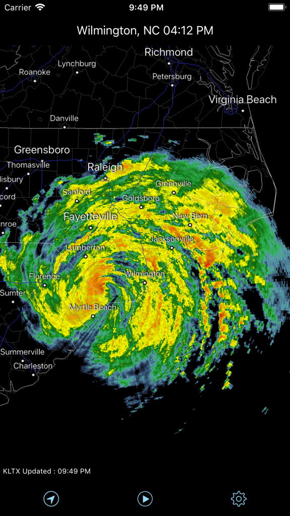
Radar Pro 앱이 노스캐롤라이나 상공의 폭풍 추적과 함께 NEXRAD 레벨 3 날씨 데이터를 보여주고 있음
Radar Pro 앱이 노스캐롤라이나 상공의 NEXRAD 레이더 지도에 상세한 폭풍 시스템을 보여주고 있음
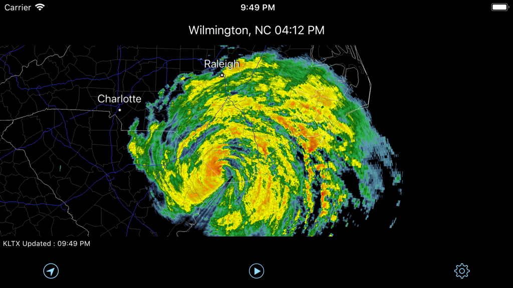
Radar Pro 앱이 노스캐롤라이나와 버지니아 상공의 원시 NEXRAD 레벨 3 강수량 데이터를 표시하고 있음
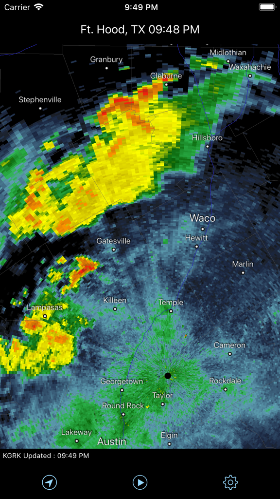
Radar Pro 앱이 중앙 텍사스 상공의 실시간 NEXRAD 날씨 레이더를 표시하고 있음
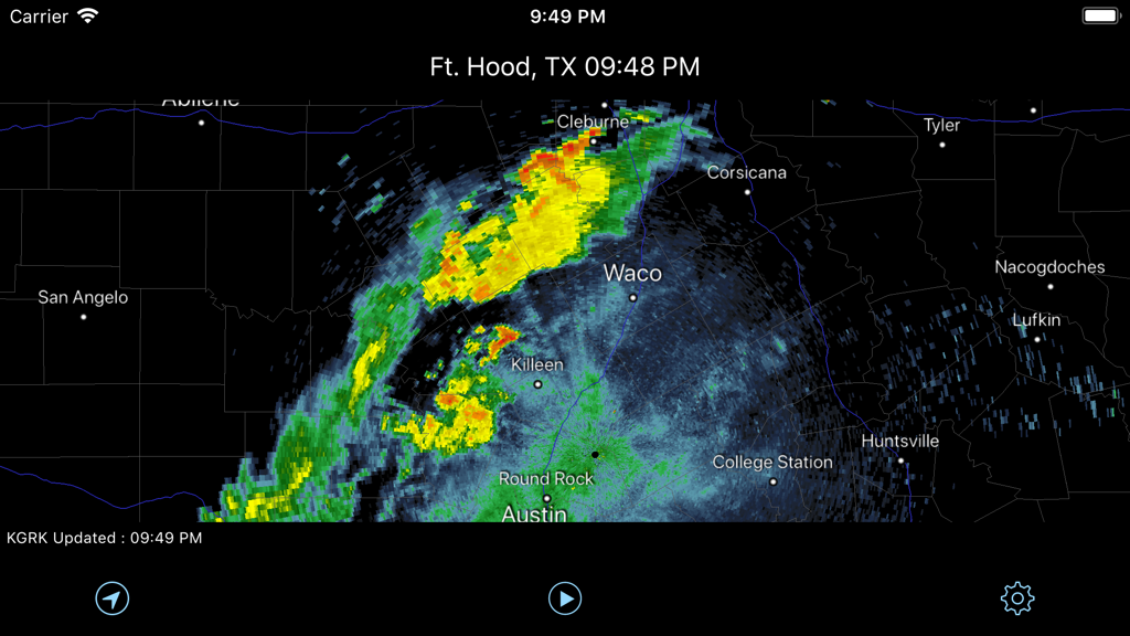
와코와 오스틴 상공의 강수량을 보여주는 중앙 텍사스의 NEXRAD 날씨 레이더 지도
설명
Download
비슷한 앱
유사한 기능과 사용자 경험을 가진 앱

墨迹天气-MojiWeather
Beijing MojiFengyun Technology Co.,Ltd.

Windy.com
Windyty, SE

天气通
Weibo Internet Technology (China) Co.Ltd.

Zoom Earth - Weather Forecast
Neave Interactive Limited

实时天气-40日精准天气实时预报
犇 牛

MyRadar Accurate Weather Radar
Aviation Data Systems, Inc

Ventusky: Weather & Live Radar
Ventusky s.r.o.

FOX Weather: Daily Forecasts
Fox News Network, LLC

2345天气王-天气和空气质量查询小组件
Shanghai 2345 Network Technology Co., Ltd.
이 페이지는 앱이나 개발자의 공식 페이지가 아니며, 정보 제공 및 논평을 목적으로 작성된 독립 편집 간행물입니다. 명시적으로 달리 언급되지 않는 한, 해당 앱이나 개발자는 MWM, Apple, Google Play, 앱 퍼블리셔 또는 앱 개발자와 제휴, 보증, 후원, 승인 또는 공식적으로 연결되어 있지 않으며, 이 페이지의 어떤 내용도 해당 앱이 MWM의 서비스를 사용하여 개발되었음을 의미하지 않습니다. 모든 상표, 로고, 스크린샷 및 기타 콘텐츠는 해당 소유자의 자산입니다.