이 페이지는 앱이나 개발자의 공식 페이지가 아니며, 정보 제공 및 논평을 목적으로 작성된 독립 편집 간행물입니다. 명시적으로 달리 언급되지 않는 한, 해당 앱이나 개발자는 MWM, Apple, Google Play, 앱 퍼블리셔 또는 앱 개발자와 제휴, 보증, 후원, 승인 또는 공식적으로 연결되어 있지 않으며, 이 페이지의 어떤 내용도 해당 앱이 MWM의 서비스를 사용하여 개발되었음을 의미하지 않습니다. 모든 상표, 로고, 스크린샷 및 기타 콘텐츠는 해당 소유자의 자산입니다.

Tactical NAV
현장의 혹독한 요구 사항을 위해 베테랑이 전투에서 제작했습니다. 어떤 환경에서도 자신 있게 작전할 수 있도록 1mm 정확도, MGRS 좌표 및 완전한 오프라인 매핑을 제공합니다.
다운로드
229K+사용자 평점
총 평가 수
600개발사
카테고리
Navigation지원 언어
1최신 버전
5.0.10크기
49.3 MB출시일
2011년 2월 14일임무를 위해 제작, 전투에서 검증
세계에서 가장 혹독한 환경에서 작동하도록 설계된 견고하고 높은 정밀도의 네비게이션 플랫폼으로 군인 및 응급 구조대원에게 힘을 실어줍니다.
전장 정밀도
AN/PSN-13 DAGR과 같은 공식 DoD 하드웨어와 동등한 성능을 제공하는 MGRS, UTM 및 BNG 좌표 시스템으로 1mm 정확도를 달성하십시오.
완전한 오프라인 기능
셀룰러 방출 없이 작동하십시오. 완전히 분리되거나 교전된 환경에서 맵을 다운로드하고 임무를 계획하십시오. 완전한 전술 드로잉 지원.
다음 스크린샷과 설명은 앱의 공식 스토어 목록에서 직접 가져온 것이며 앱 개발자의 자산입니다.
앱 스토어
스크린샷
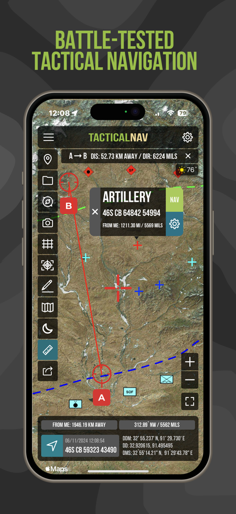
MGRS 좌표와 포병 웨이포인트가 표시된 위성 지도를 보여주는 Tactical NAV 앱 인터페이스
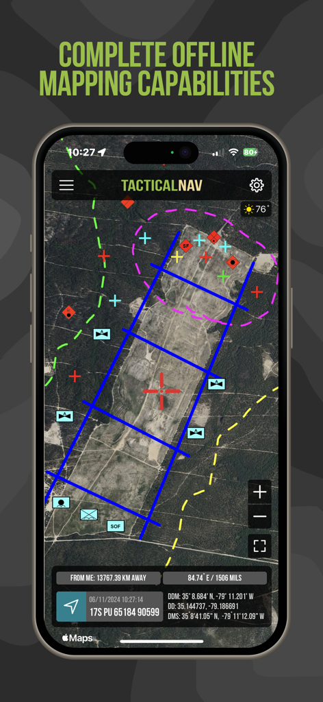
군사 그리드 좌표와 전술 오버레이가 있는 오프라인 위성 매핑을 보여주는 Tactical NAV 앱 인터페이스
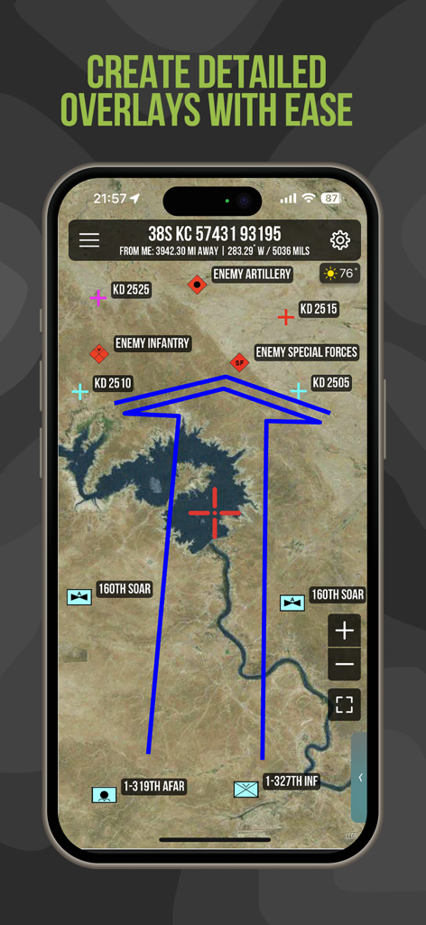
Tactical NAV 앱이 위성 지도에 상세한 군사 오버레이와 부대 위치를 보여줌
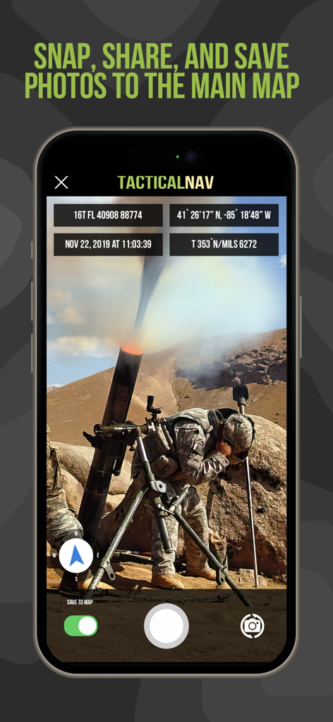
MGRS 좌표와 위치 데이터 오버레이가 있는 군사 작전 사진을 보여주는 Tactical NAV 앱 인터페이스
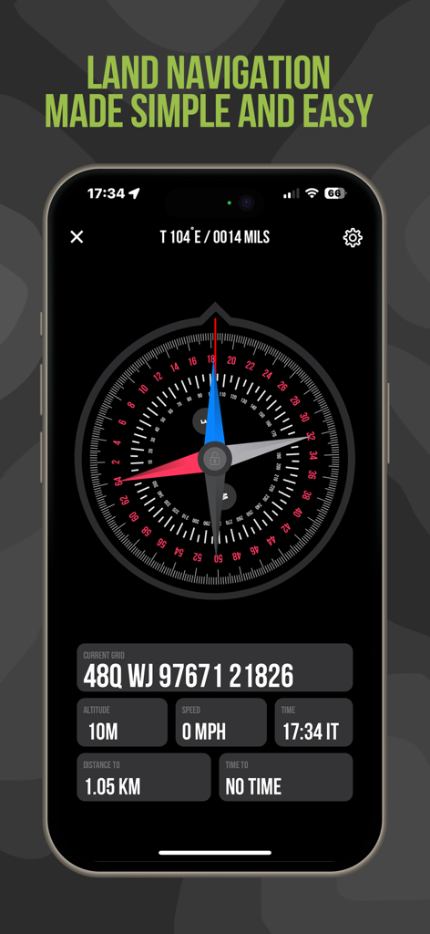
MGRS 좌표와 디지털 나침반이 있는 Tactical NAV 지면 네비게이션 화면
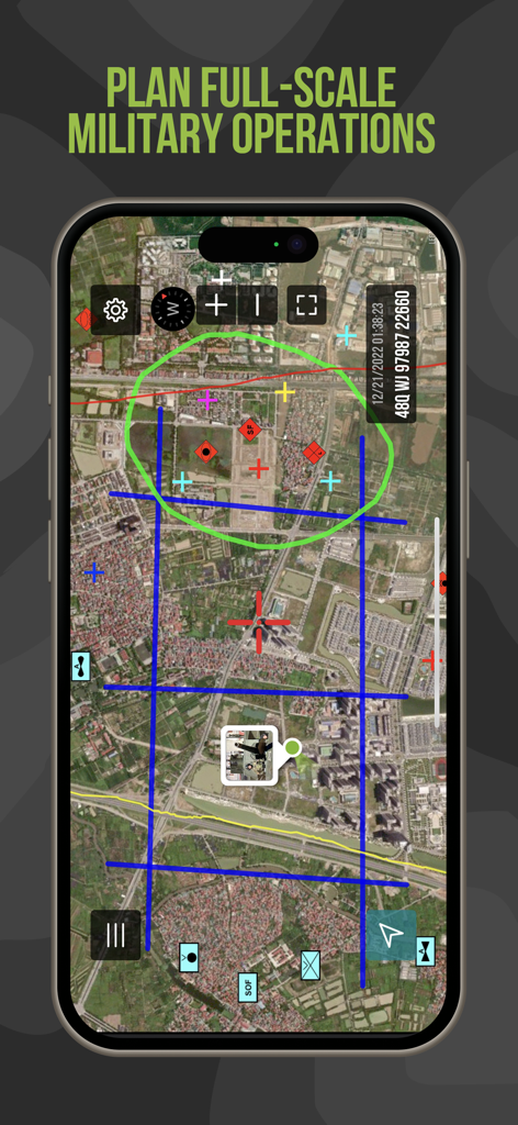
Tactical NAV 앱 인터페이스에 임무 계획 도구와 전술 지도 오버레이가 있음
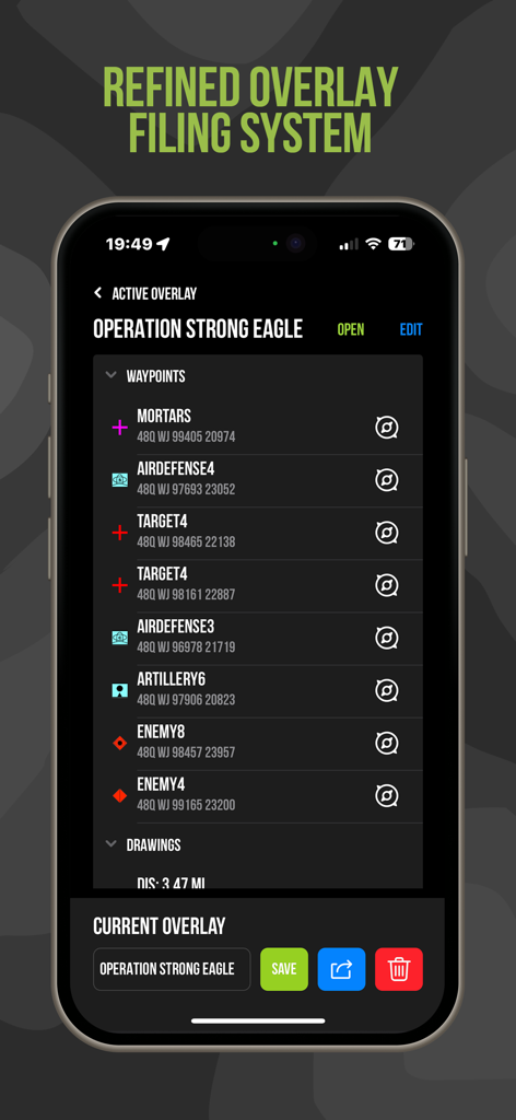
Tactical NAV 앱 인터페이스에 임무 계획을 위한 웨이포인트 관리 및 MGRS 좌표 표시
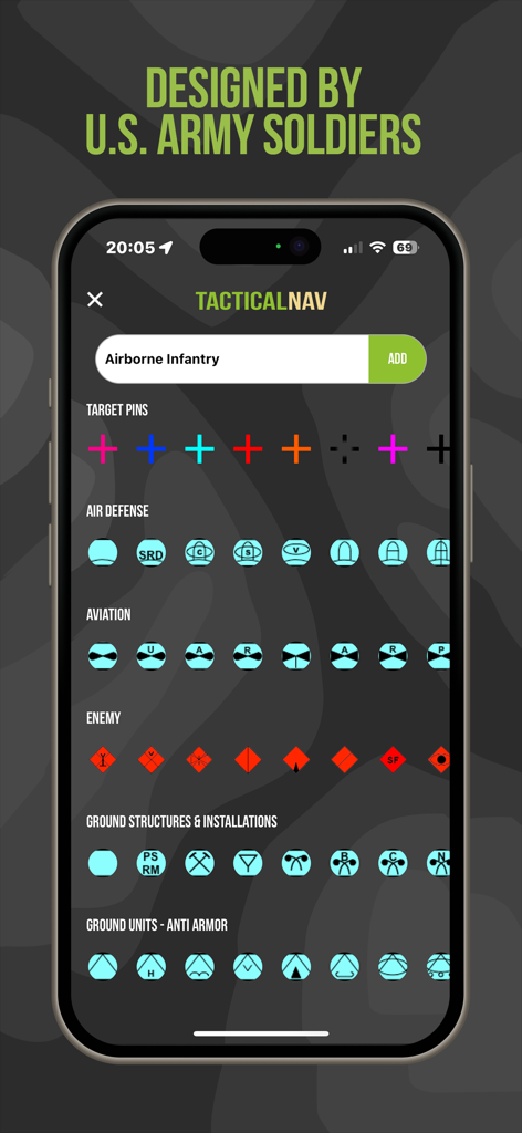
Tactical NAV 앱 화면에 전술 임무 계획을 위한 다양한 군사 기호 및 아이콘 표시

Tactical NAV 앱 화면은 미 육군 전사자 및 재향 군인 자선 단체에 헌정됨

Tactical NAV 앱의 소개 페이지에 베테랑 제작자의 개인 메시지 표시
설명
Download
비슷한 앱
유사한 기능과 사용자 경험을 가진 앱

MilGPS
Cascode Labs Pty Ltd

SEAiq Pilot VPP
Sakhalin, LLC

Cartograph Maps 3
Harald Meyer

新知卫星地图-路线规划,高清地图导航
Chongqing Xinzhi Space Technology Co., Ltd.

Coordinates – GPS Converter
Mapnitude Company Limited

Mgrs & Utm Map
Vahid Cataltas

DeepStateMap
Heorhii Karpenko

Map Plus
Miocool Inc.

Compass 55. Map & GPS kit.
Kalimex-Consulting s.r.o.
이 페이지는 앱이나 개발자의 공식 페이지가 아니며, 정보 제공 및 논평을 목적으로 작성된 독립 편집 간행물입니다. 명시적으로 달리 언급되지 않는 한, 해당 앱이나 개발자는 MWM, Apple, Google Play, 앱 퍼블리셔 또는 앱 개발자와 제휴, 보증, 후원, 승인 또는 공식적으로 연결되어 있지 않으며, 이 페이지의 어떤 내용도 해당 앱이 MWM의 서비스를 사용하여 개발되었음을 의미하지 않습니다. 모든 상표, 로고, 스크린샷 및 기타 콘텐츠는 해당 소유자의 자산입니다.