이 페이지는 앱이나 개발자의 공식 페이지가 아니며, 정보 제공 및 논평을 목적으로 작성된 독립 편집 간행물입니다. 명시적으로 달리 언급되지 않는 한, 해당 앱이나 개발자는 MWM, Apple, Google Play, 앱 퍼블리셔 또는 앱 개발자와 제휴, 보증, 후원, 승인 또는 공식적으로 연결되어 있지 않으며, 이 페이지의 어떤 내용도 해당 앱이 MWM의 서비스를 사용하여 개발되었음을 의미하지 않습니다. 모든 상표, 로고, 스크린샷 및 기타 콘텐츠는 해당 소유자의 자산입니다.

US NOAA Radars 3D Pro
몰입형 3D로 고정밀 NOAA 레이더를 경험하세요. iPhone, Apple Watch 및 Apple TV 간의 원활한 통합과 실시간 데이터로 심각한 폭풍을 추적하십시오.
다운로드
42K+사용자 평점
총 평가 수
0개발사
카테고리
Weather지원 언어
1최신 버전
23.30크기
18.4 MB출시일
2016년 1월 21일3D 정밀도로 하늘을 완벽하게 파악하세요
Apple 생태계 전반에 통합된 전문가 수준의 NOAA 레이더 데이터를 경험하세요. 3D 도시 플라이오버부터 실시간 위성 이미지까지, 대비에 필요한 기상 정보를 확보하십시오.
몰입형 3D 플라이오버
주요 도시 상공의 3차원 기상 패턴을 탐색하여 전례 없는 방식으로 폭풍의 깊이와 움직임을 시각화하세요.
전문가급 NOAA 데이터
투명도 조절 및 실시간 업데이트가 가능한 국립 기상청의 고해상도 레이더 이미지를 직접 확인하세요.
다음 스크린샷과 설명은 앱의 공식 스토어 목록에서 직접 가져온 것이며 앱 개발자의 자산입니다.
앱 스토어
스크린샷
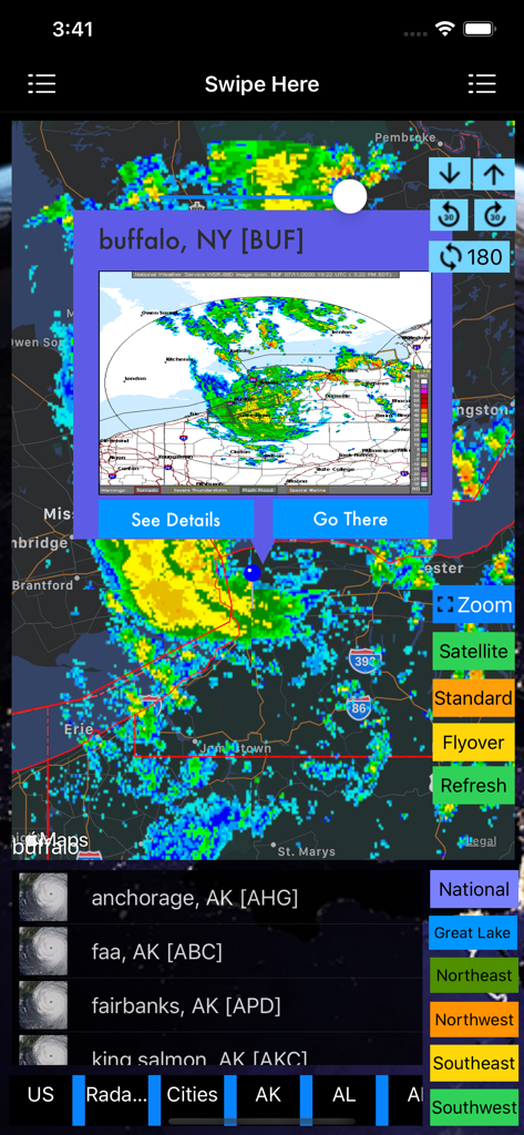
US NOAA Radars 3D Pro 애플리케이션의 뉴욕 버팔로 기상 레이더 지도
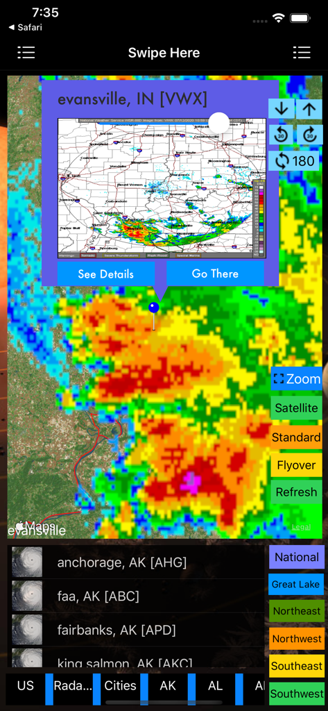
인디애나주 에반스빌의 폭풍 셀을 보여주는 US NOAA Radars 3D Pro 앱의 상세 기상 레이더 지도
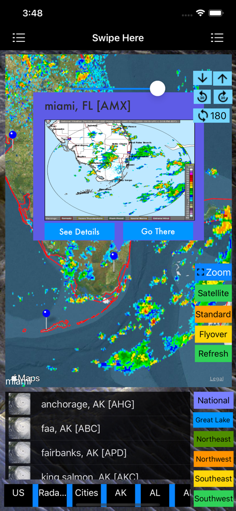
폭풍 추적 오버레이가 포함된 마이애미 기상 레이더 지도를 보여주는 US NOAA Radars 3D Pro 앱
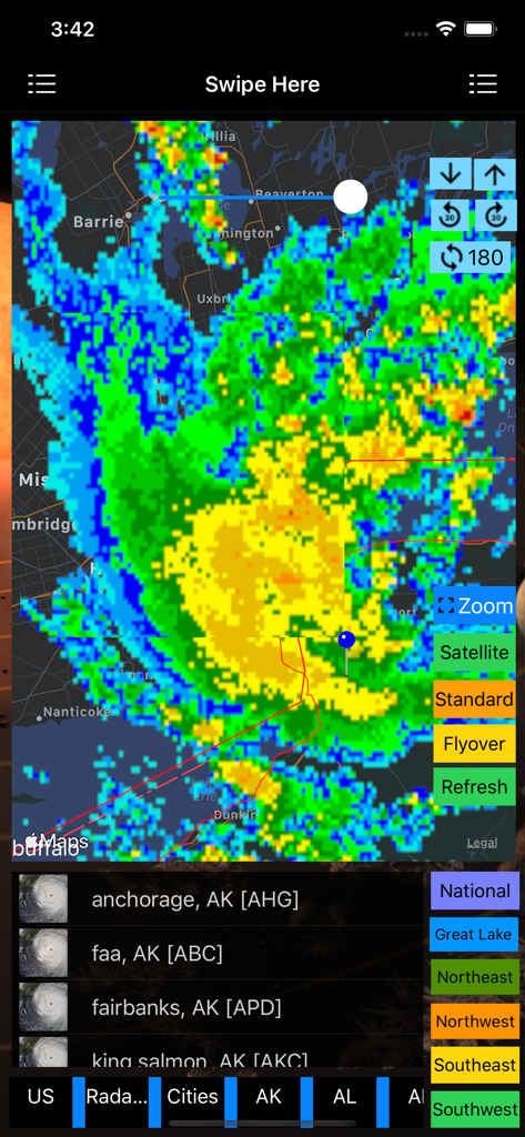
탐색 및 확대/축소 도구와 함께 지도 위에 다채로운 폭풍 레이더 오버레이가 표시된 US NOAA Radars 3D Pro 앱 인터페이스
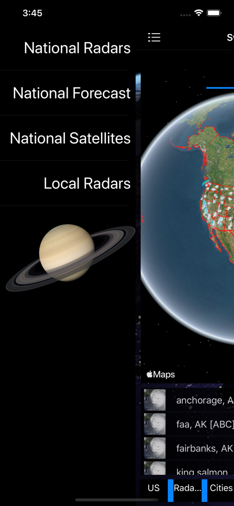
US NOAA Radars 3D Pro 앱의 메인 메뉴 및 3D 지구 시각화.
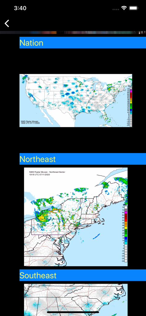
미국 전역 및 지역 NOAA 기상 레이더 지도.
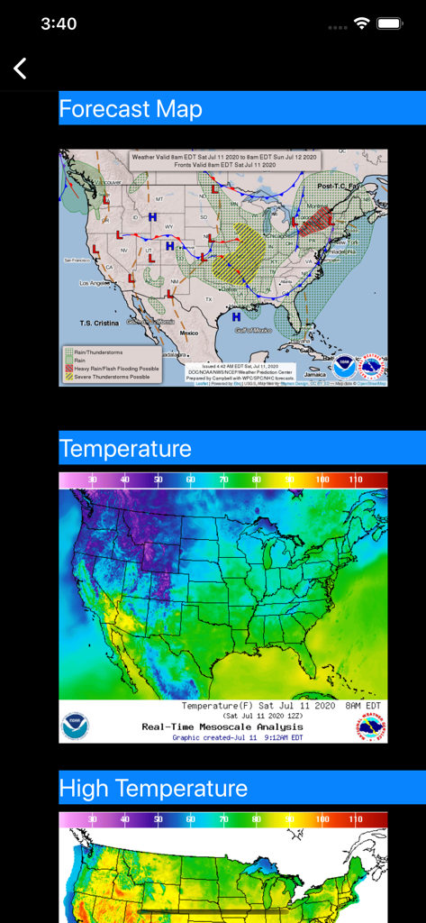
미국 일기 예보 및 온도 레이더 지도
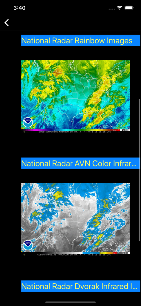
무지개 및 적외선 뷰의 미국 NOAA 위성 레이더 이미지
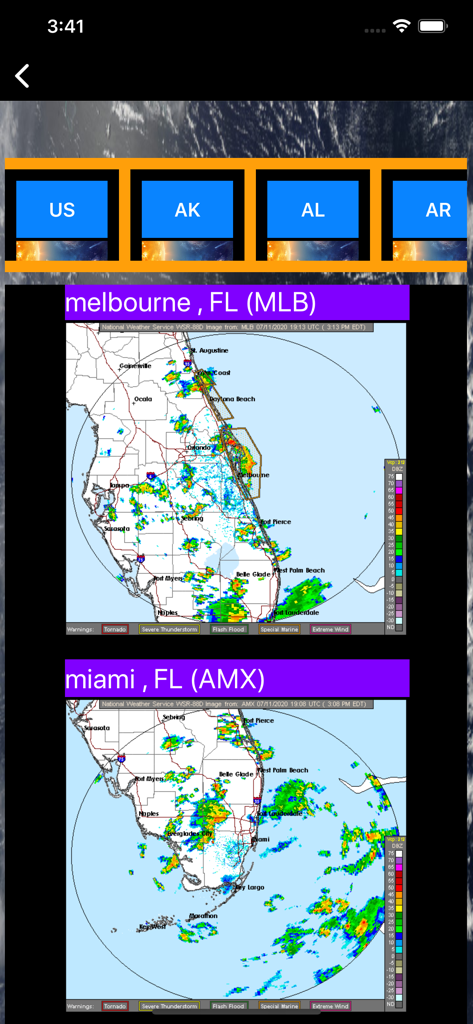
US NOAA Radars 3D Pro 앱 인터페이스의 플로리다주 멜버른 및 마이애미 기상 레이더 지도
설명
Download
비슷한 앱
유사한 기능과 사용자 경험을 가진 앱

墨迹天气-MojiWeather
Beijing MojiFengyun Technology Co.,Ltd.

Windy.com
Windyty, SE

天气通
Weibo Internet Technology (China) Co.Ltd.

Zoom Earth - Weather Forecast
Neave Interactive Limited

实时天气-40日精准天气实时预报
犇 牛

MyRadar Accurate Weather Radar
Aviation Data Systems, Inc

Ventusky: Weather & Live Radar
Ventusky s.r.o.

FOX Weather: Daily Forecasts
Fox News Network, LLC

2345天气王-天气和空气质量查询小组件
Shanghai 2345 Network Technology Co., Ltd.
이 페이지는 앱이나 개발자의 공식 페이지가 아니며, 정보 제공 및 논평을 목적으로 작성된 독립 편집 간행물입니다. 명시적으로 달리 언급되지 않는 한, 해당 앱이나 개발자는 MWM, Apple, Google Play, 앱 퍼블리셔 또는 앱 개발자와 제휴, 보증, 후원, 승인 또는 공식적으로 연결되어 있지 않으며, 이 페이지의 어떤 내용도 해당 앱이 MWM의 서비스를 사용하여 개발되었음을 의미하지 않습니다. 모든 상표, 로고, 스크린샷 및 기타 콘텐츠는 해당 소유자의 자산입니다.