This page is not an official page of the app or its developer, but an independent editorial publication created for informational and commentary purposes. Unless expressly stated otherwise, neither the app nor its developer is affiliated with, endorsed by, sponsored by, authorized by, or otherwise officially connected with MWM, Apple, Google Play, the app publisher, or the app's developer, and nothing on this page implies that the app was developed using MWM's services. Any trademarks, logos, screenshots, and other content remain the property of their respective owners.

3D Mappa - GIS & Topo Analysis
Turn your iPhone or iPad into a powerful geospatial workstation. Visualize contours, slope, and flow patterns in real-time, and export precision data directly to AutoCAD and GIS software while on-site.
Downloads
7K+User Rating
Total Ratings
0Publisher
Category
NavigationLocales
1Latest Version
1.5.0Size
232.3 MBFirst Released
Apr 11, 2024Field-Ready GIS Analysis
Stop waiting for the office. Analyze topography, simulate flow patterns, and export professional-grade data directly from your iPhone or iPad.
On-Site Desktop Power
Perform complex slope, aspect, and flow analysis right where you stand, reducing costly return trips and increasing field efficiency.
Seamless CAD Integration
Export your findings in industry-standard DXF, SHP, and CSV formats to move field data straight into your AutoCAD or ArcGIS project.
The following screenshots and description are sourced directly from the app's official store listing and are the property of the app developer.
App Store
Screenshots
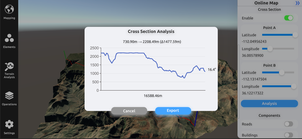
Interface of 3D Mappa showing a cross section analysis graph with elevation profile over a 3D terrain model
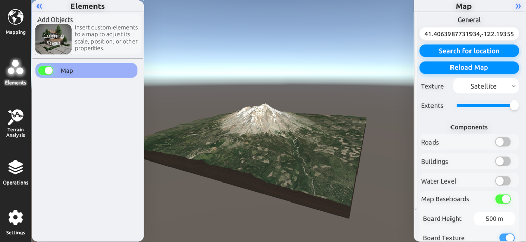
A 3D terrain model of a mountain with satellite imagery and map configuration settings in the 3D Mappa GIS app.
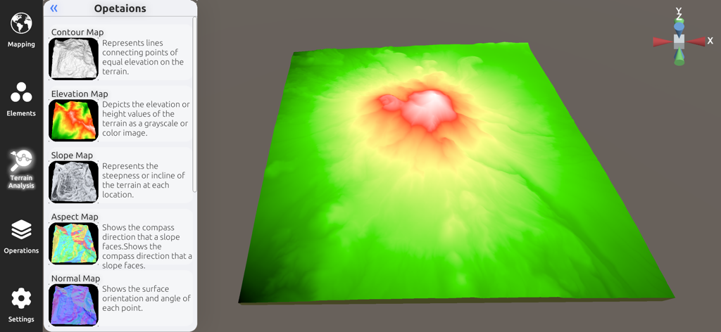
3D elevation model and terrain analysis sidebar in the 3D Mappa app
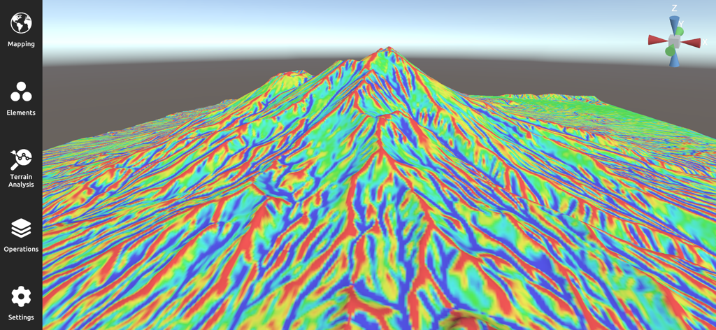
3D terrain visualization showing a multicolored slope map on a mountain landscape in the 3D Mappa app
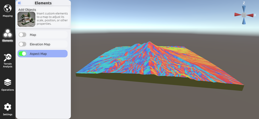
3D Mappa mobile interface displaying a detailed colorful 3D aspect map for terrain analysis.
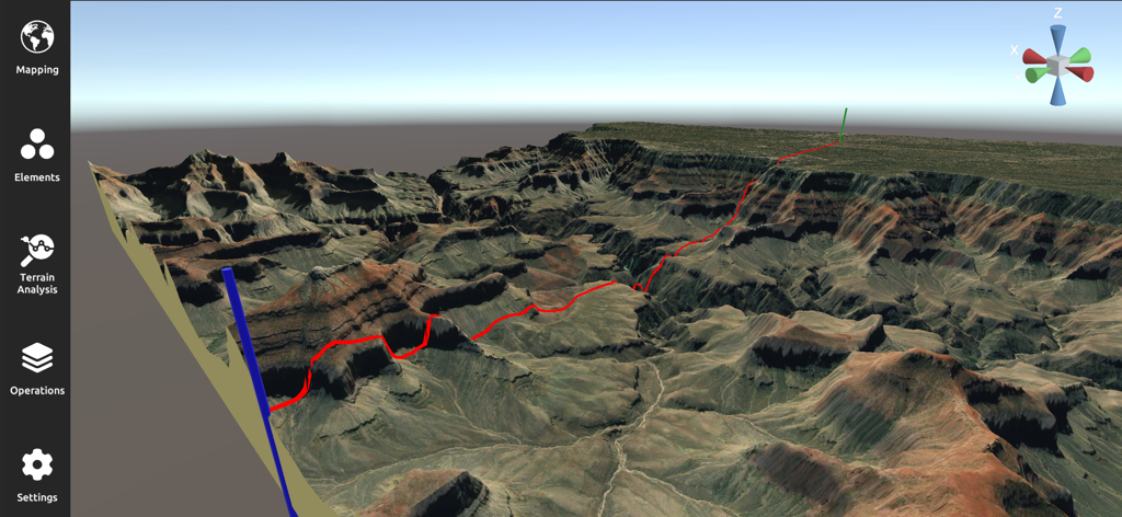
A professional 3D terrain analysis and mapping interface showing a rugged canyon landscape with a red path
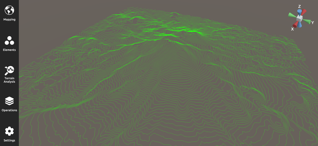
A 3D topographic map with green contour lines for GIS terrain analysis
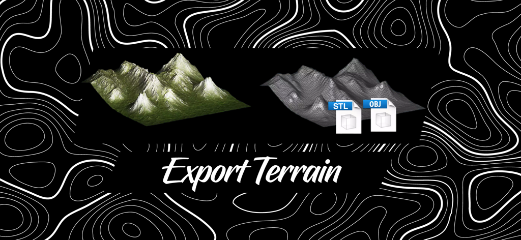
Exporting 3D terrain models in STL and OBJ formats with 3D Mappa.
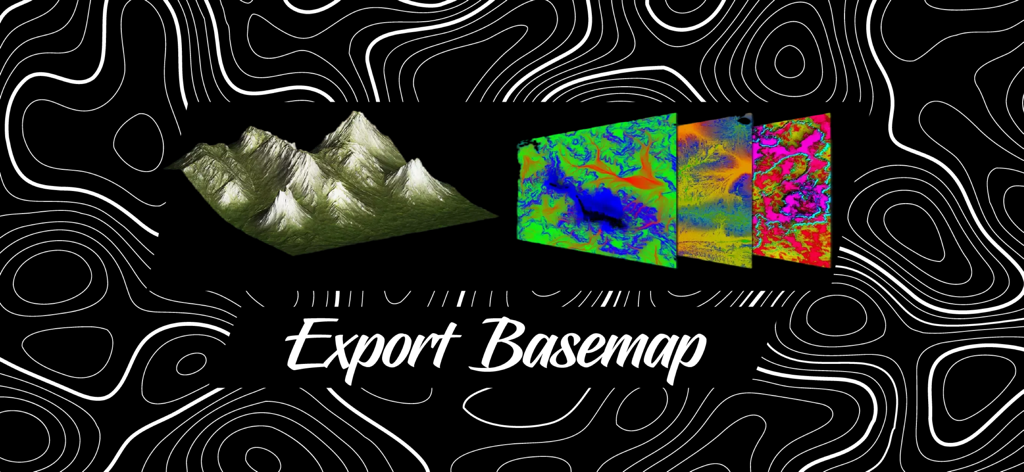
A 3D terrain model and colored topographic basemap layers with text saying Export Basemap
Description
Download
More Like This
Top-ranked apps in the same category

Google Maps
Google LLC

Waze Navigation & Live Traffic
waze

AMap Global
AutoNavi Information Technology Co. Ltd.

百度地图-路线规划,出行必备
Beijing Baidu Netcom Science & Technology Co.,Ltd

Moovit: Bus & Transit Tracker
Moovit App Global LTD

Transit • Subway & Bus Times
9280-0366 Quebec inc.

ParkMobile: Park. Pay. Go.
Parkmobile USA, Inc

腾讯地图-路线规划,导航地铁打车出行
Shenzhen Tencent Computer Systems Company Limited

Île-de-France Mobilités
Ile de France Mobilites
This page is not an official page of the app or its developer, but an independent editorial publication created for informational and commentary purposes. Unless expressly stated otherwise, neither the app nor its developer is affiliated with, endorsed by, sponsored by, authorized by, or otherwise officially connected with MWM, Apple, Google Play, the app publisher, or the app's developer, and nothing on this page implies that the app was developed using MWM's services. Any trademarks, logos, screenshots, and other content remain the property of their respective owners.