This page is not an official page of the app or its developer, but an independent editorial publication created for informational and commentary purposes. Unless expressly stated otherwise, neither the app nor its developer is affiliated with, endorsed by, sponsored by, authorized by, or otherwise officially connected with MWM, Apple, Google Play, the app publisher, or the app's developer, and nothing on this page implies that the app was developed using MWM's services. Any trademarks, logos, screenshots, and other content remain the property of their respective owners.

精图地球-高清,卫星,街景,全球,3D,探索
集成多源高精度影像、历史回溯及 3D 地形渲染。支持 KML/GeoJSON 数据绘制、专业 GPS 轨迹记录与经纬度水印相机,为您提供沉浸式的地理信息专业解决方案。
Downloads
41K+User Rating
Total Ratings
200Publisher
Category
NavigationLocales
1Latest Version
5.0.14Size
136.5 MBFirst Released
Sep 12, 2023Professional Mapping & Global Visualization
Empowering Chinese-speaking professionals and explorers with high-precision 3D terrain, historical satellite imagery, and enterprise-grade GIS tools.
Professional GIS & Surveying Tools
Draw, measure, and export KML or GeoJSON data with ease. Perfect for real estate, construction, and field surveying with a built-in GPS watermark camera for verified records.
High-Definition 3D Terrain
Experience hyper-realistic 3D rendering of global landscapes and cityscapes. Use terrain exaggeration and historical imagery to analyze topographical changes over time.
The following screenshots and description are sourced directly from the app's official store listing and are the property of the app developer.
App Store
Screenshots
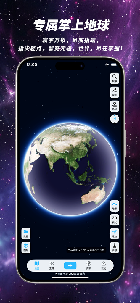
A smartphone screen displaying a high-definition 3D globe within the Kingtop Earth app interface against a celestial background
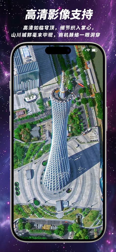
A high-definition satellite view of the Canton Tower in Guangzhou shown within the Kingtop Earth mobile app interface.
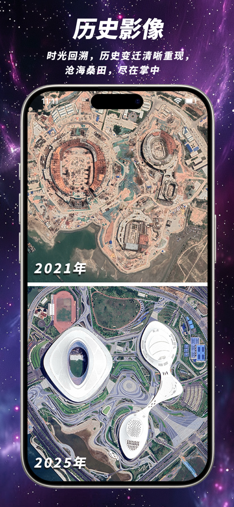
A comparison of satellite imagery from 2021 and 2025 showing the construction and completion of a stadium in the Kingtop Earth app
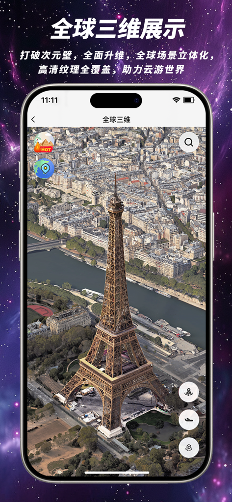
High-definition 3D satellite view of the Eiffel Tower in Paris displayed on the Kingtop Earth app interface.
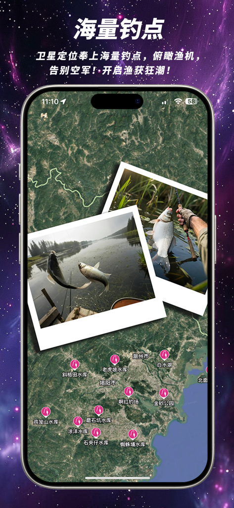
Satellite map view within Kingtop Earth showing various fishing spot markers and photos of successful catches
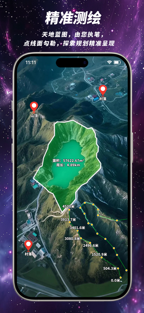
Kingtop Earth app interface showing 3D satellite map with area measurement and distance tracking tools
Description
Download
More Like This
Top-ranked apps in the same category

Google Maps
Google LLC

Waze Navigation & Live Traffic
waze

AMap Global
AutoNavi Information Technology Co. Ltd.

百度地图-路线规划,出行必备
Beijing Baidu Netcom Science & Technology Co.,Ltd

Moovit: Bus & Transit Tracker
Moovit App Global LTD

Transit • Subway & Bus Times
9280-0366 Quebec inc.

ParkMobile: Park. Pay. Go.
Parkmobile USA, Inc

腾讯地图-路线规划,导航地铁打车出行
Shenzhen Tencent Computer Systems Company Limited

Île-de-France Mobilités
Ile de France Mobilites
This page is not an official page of the app or its developer, but an independent editorial publication created for informational and commentary purposes. Unless expressly stated otherwise, neither the app nor its developer is affiliated with, endorsed by, sponsored by, authorized by, or otherwise officially connected with MWM, Apple, Google Play, the app publisher, or the app's developer, and nothing on this page implies that the app was developed using MWM's services. Any trademarks, logos, screenshots, and other content remain the property of their respective owners.