This page is not an official page of the app or its developer, but an independent editorial publication created for informational and commentary purposes. Unless expressly stated otherwise, neither the app nor its developer is affiliated with, endorsed by, sponsored by, authorized by, or otherwise officially connected with MWM, Apple, Google Play, the app publisher, or the app's developer, and nothing on this page implies that the app was developed using MWM's services. Any trademarks, logos, screenshots, and other content remain the property of their respective owners.

Compass: GPS Altimeter & Nav
The all-in-one digital toolkit for tech-enabled explorers. Master the terrain with high-accuracy sensors, offline GPS tracking, and barometric data—designed for peak performance in any environment.
Downloads
0User Rating
Total Ratings
0Publisher
Category
NavigationLocales
3Latest Version
1.0Size
4.7 MBFirst Released
Mar 5, 2026Engineered for Every Adventure
From high-altitude peaks to off-grid trails, get the raw data and precision tools you need to master the outdoors—all in one minimalist, offline-ready interface.
Pro-Grade Orientation
Navigate with a 360° magnetic compass, haptic feedback, and real-time GPS coordinates for total self-reliance even without a cellular signal.
Deep Sensor Intelligence
Monitor barometric pressure, altitude trends, and magnetometer readings. Includes a boiling point calculator for the serious high-altitude camper.
The following screenshots and description are sourced directly from the app's official store listing and are the property of the app developer.
App Store
Screenshots
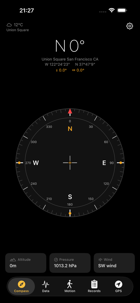
Minimalist compass dashboard showing GPS coordinates, altitude and barometric pressure.
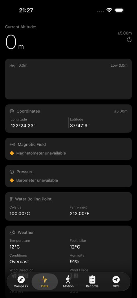
A mobile app interface displaying real-time data including altitude GPS coordinates water boiling point and weather conditions
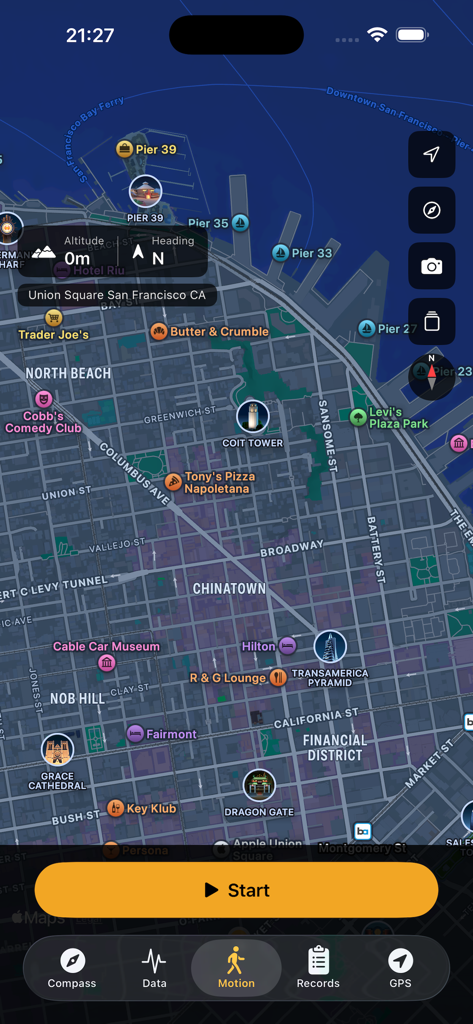
App interface showing a navigation map of San Francisco with altitude and motion tracking features
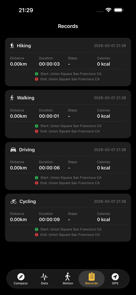
Activity logs screen showing hiking walking driving and cycling records with duration distance and calorie data
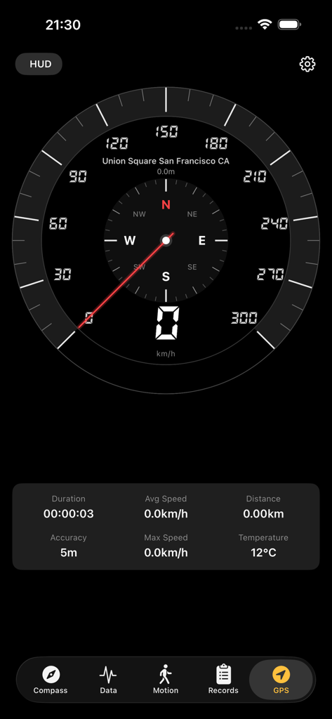
Digital GPS speedometer and navigation screen displaying location and activity stats
Description
Download
More Like This
Top-ranked apps in the same category

Google Maps
Google LLC

AMap Global
AutoNavi Information Technology Co. Ltd.

Waze Navigation & Live Traffic
waze

百度地图-路线规划,出行必备
Beijing Baidu Netcom Science & Technology Co.,Ltd

Moovit: Bus & Transit Tracker
Moovit App Global LTD

腾讯地图-路线规划,导航地铁打车出行
Shenzhen Tencent Computer Systems Company Limited

Transit • Subway & Bus Times
9280-0366 Quebec inc.

ParkMobile: Park. Pay. Go.
Parkmobile USA, Inc

MapXplorer: Map Radar Navigate
GOLDLAB APPLICATIONS YAZILIM VE BILISIM ANONIM SIRKETI
This page is not an official page of the app or its developer, but an independent editorial publication created for informational and commentary purposes. Unless expressly stated otherwise, neither the app nor its developer is affiliated with, endorsed by, sponsored by, authorized by, or otherwise officially connected with MWM, Apple, Google Play, the app publisher, or the app's developer, and nothing on this page implies that the app was developed using MWM's services. Any trademarks, logos, screenshots, and other content remain the property of their respective owners.