This page is not an official page of the app or its developer, but an independent editorial publication created for informational and commentary purposes. Unless expressly stated otherwise, neither the app nor its developer is affiliated with, endorsed by, sponsored by, authorized by, or otherwise officially connected with MWM, Apple, Google Play, the app publisher, or the app's developer, and nothing on this page implies that the app was developed using MWM's services. Any trademarks, logos, screenshots, and other content remain the property of their respective owners.

CoNav
Streamline your bridge operations with high-precision tools for celestial navigation, compass error calculation, and ETA planning. Designed for offline reliability, CoNav puts 18,000 port codes and sophisticated maritime algorithms in the palm of your hand, ensuring safety and efficiency on every watch.
Downloads
129K+User Rating
Total Ratings
200Publisher
Category
NavigationLocales
1Latest Version
2.5.9Size
17.2 MBFirst Released
Mar 24, 2019Essential Bridge Utilities for Professional Mariners
Streamline your maritime operations with a precise, professional-grade toolkit designed for high-seas accuracy and safety.
Celestial & Compass Precision
Execute complex celestial navigation and compass error calculations instantly with sophisticated algorithms for 64 celestial objects.
Global Port & Voyage Intelligence
Plan arrivals with precision using high-accuracy ETA tools and an integrated database of over 18,000 UN LOCODE seaports.
The following screenshots and description are sourced directly from the app's official store listing and are the property of the app developer.
App Store
Screenshots
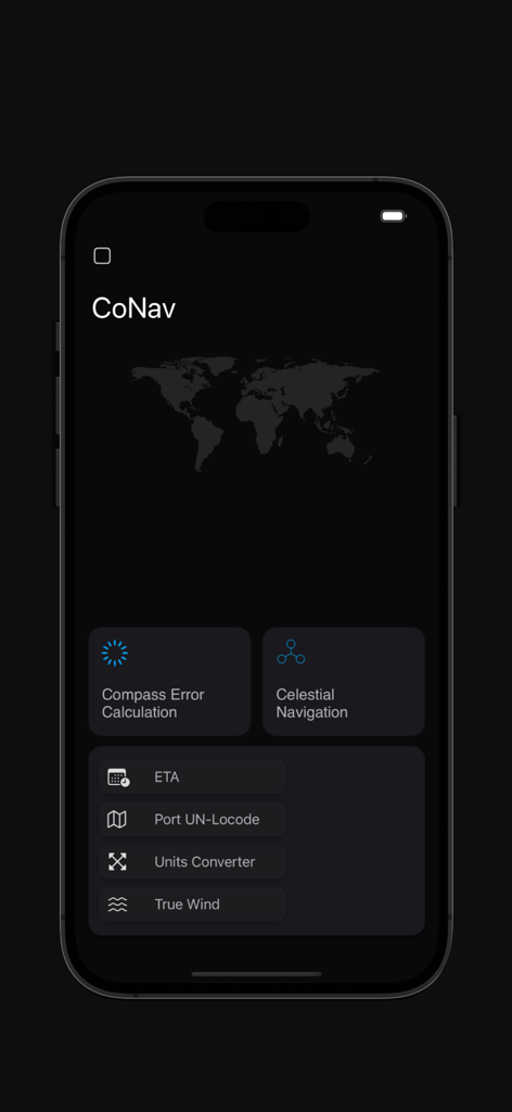
Main dashboard of CoNav maritime navigation app showing professional tools for celestial navigation and compass error calculation
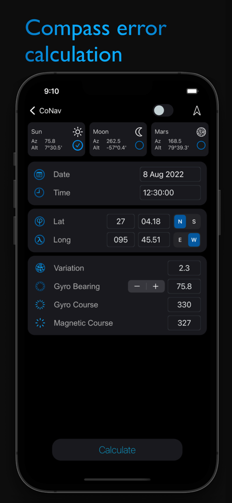
Smartphone screen of CoNav app showing compass error calculation with celestial navigation data
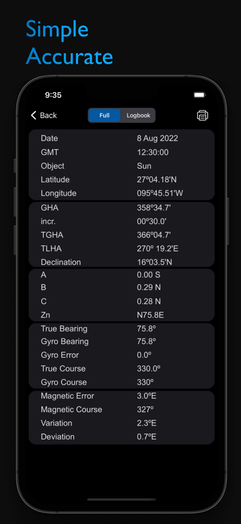
Interface of the CoNav app showing detailed celestial navigation data and compass error calculations for professional mariners.
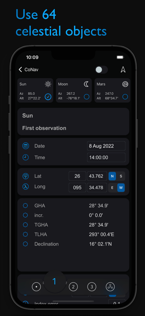
CoNav app interface displaying celestial navigation data for the sun including latitude longitude and declination
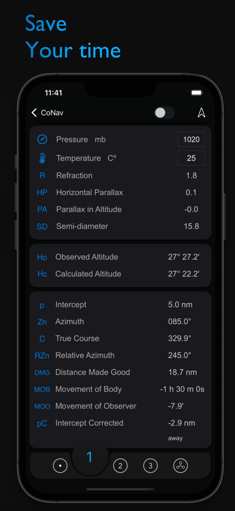
Interface of the CoNav app showing professional celestial navigation and bridge calculation tools for mariners
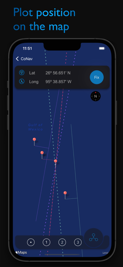
The CoNav app interface displaying a vessel position fix on a nautical map using latitude and longitude coordinates.
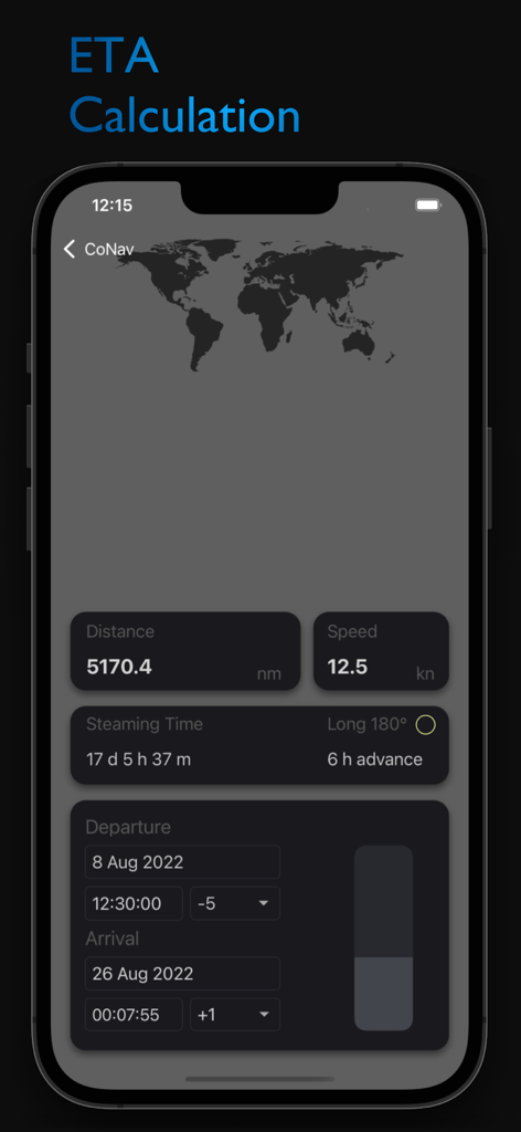
CoNav app screenshot showing ETA calculation for a maritime vessel voyage
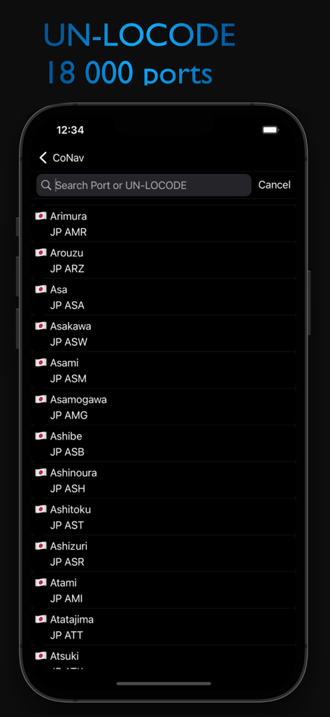
Mobile interface of the CoNav app showing a searchable directory of global seaports and their UN LOCODE identifiers
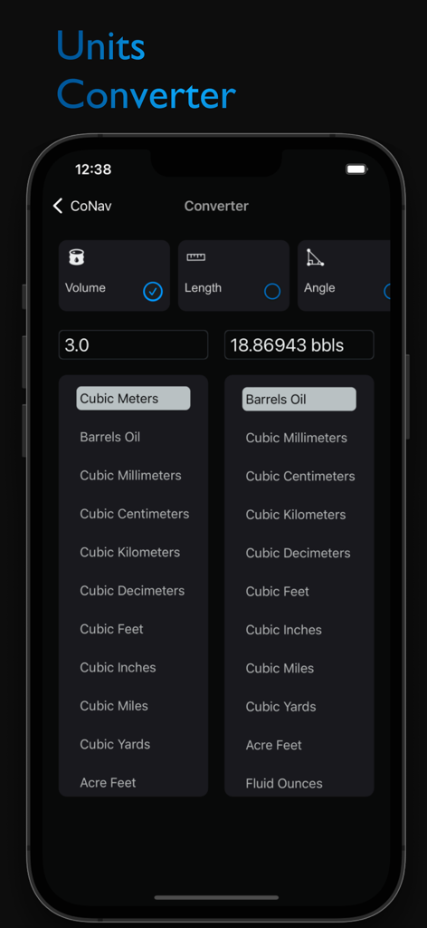
CoNav mobile app unit converter interface displaying volume conversion from cubic meters to barrels of oil
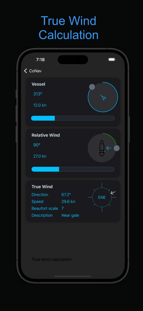
CoNav app screenshot showing maritime true wind calculation with vessel speed and wind direction data
Description
Download
More Like This
Apps with similar features and user experience

CVoyager
Vladyslav Yarmak

iMariner Celestial Navigation
Denis Froschauer

NavimetriX
SOFT4SAIL

HF Weather Fax
Black Cat Systems

PredictWind Offshore Weather
PredictWind Limited

StarPilot
Starpath Corp

iPolar
KND Marine SOCIEDAD LIMITADA

Nautical Calculator Pro
Giacomo Gabriele
This page is not an official page of the app or its developer, but an independent editorial publication created for informational and commentary purposes. Unless expressly stated otherwise, neither the app nor its developer is affiliated with, endorsed by, sponsored by, authorized by, or otherwise officially connected with MWM, Apple, Google Play, the app publisher, or the app's developer, and nothing on this page implies that the app was developed using MWM's services. Any trademarks, logos, screenshots, and other content remain the property of their respective owners.