This page is not an official page of the app or its developer, but an independent editorial publication created for informational and commentary purposes. Unless expressly stated otherwise, neither the app nor its developer is affiliated with, endorsed by, sponsored by, authorized by, or otherwise officially connected with MWM, Apple, Google Play, the app publisher, or the app's developer, and nothing on this page implies that the app was developed using MWM's services. Any trademarks, logos, screenshots, and other content remain the property of their respective owners.

Nautical Calculator Pro
Master every voyage with precision calculations for routes, celestial navigation, and tides—all in one professional-grade app designed for offline reliability in blue-water conditions.
Downloads
144K+User Rating
Total Ratings
0Publisher
Category
NavigationLocales
1Latest Version
12.1.0Size
25.8 MBFirst Released
Mar 28, 2019Professional-Grade Maritime Intelligence
A comprehensive suite of 25+ specialized tools designed for professional mariners and serious offshore sailors who demand mathematical precision and 100% offline reliability.
Advanced Geometric Routing
Solve complex navigation problems using Rhumb Line, Great Circle, and WGS84 algorithms to optimize your long-distance passage planning.
Complete Celestial Suite
Replace bulky manuals with an integrated Nautical Almanac, ABC Tables, and sight reduction tools for professional celestial positioning.
The following screenshots and description are sourced directly from the app's official store listing and are the property of the app developer.
App Store
Screenshots
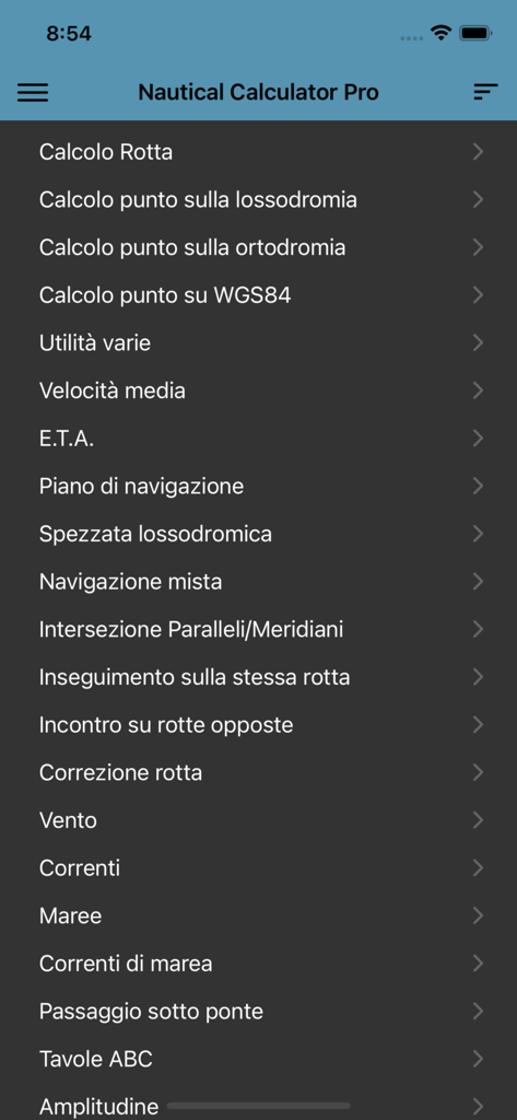
Main menu interface of the Nautical Calculator Pro app listing navigation tools and calculations
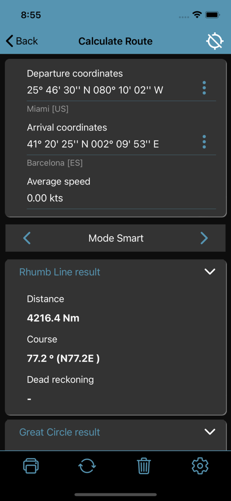
Nautical Calculator Pro interface showing a route calculation from Miami to Barcelona including Rhumb Line distance and course details
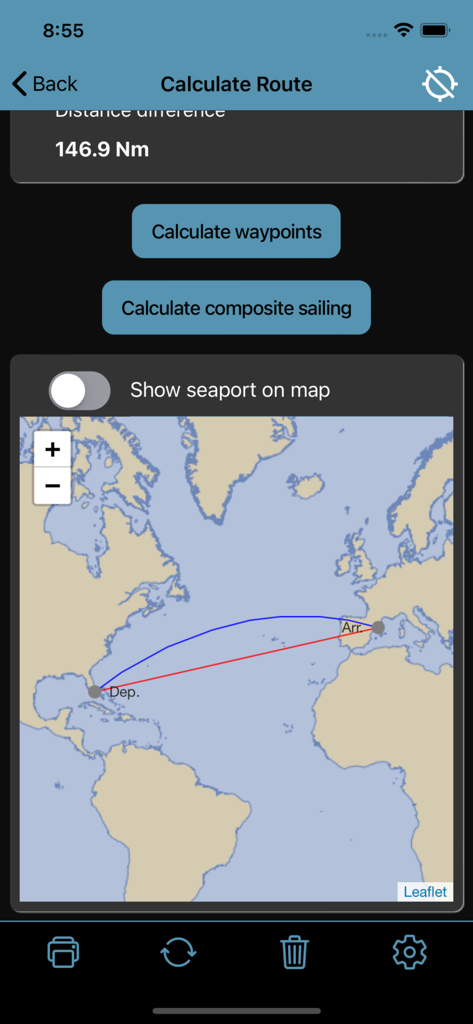
Nautical Calculator Pro route calculation showing Rhumb Line and Great Circle paths on a world map
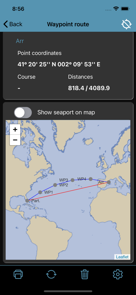
Waypoint route map with coordinate data and trans-Atlantic navigation path in Nautical Calculator Pro
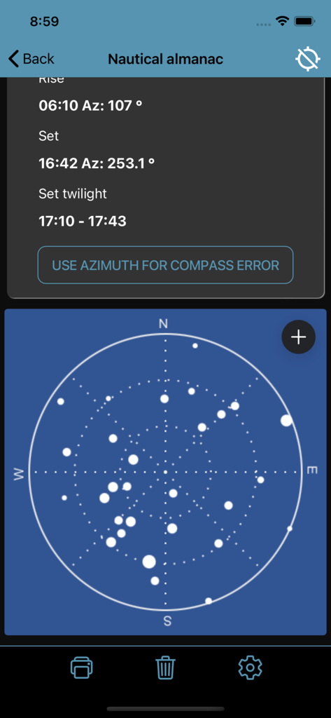
Nautical almanac screen showing sunrise and sunset data with a circular celestial star map
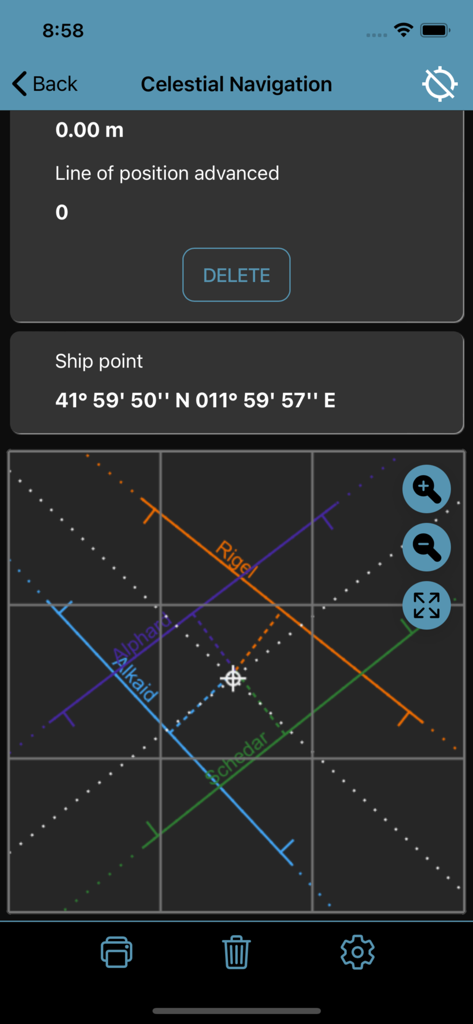
Nautical Calculator Pro Celestial Navigation interface showing lines of position for various stars
Description
Download
More Like This
Apps with similar features and user experience

CVoyager
Vladyslav Yarmak

CoNav
Vladyslav Yarmak

iMariner Celestial Navigation
Denis Froschauer

NavimetriX
SOFT4SAIL

HF Weather Fax
Black Cat Systems

PredictWind Offshore Weather
PredictWind Limited

StarPilot
Starpath Corp

iPolar
KND Marine SOCIEDAD LIMITADA
This page is not an official page of the app or its developer, but an independent editorial publication created for informational and commentary purposes. Unless expressly stated otherwise, neither the app nor its developer is affiliated with, endorsed by, sponsored by, authorized by, or otherwise officially connected with MWM, Apple, Google Play, the app publisher, or the app's developer, and nothing on this page implies that the app was developed using MWM's services. Any trademarks, logos, screenshots, and other content remain the property of their respective owners.