This page is not an official page of the app or its developer, but an independent editorial publication created for informational and commentary purposes. Unless expressly stated otherwise, neither the app nor its developer is affiliated with, endorsed by, sponsored by, authorized by, or otherwise officially connected with MWM, Apple, Google Play, the app publisher, or the app's developer, and nothing on this page implies that the app was developed using MWM's services. Any trademarks, logos, screenshots, and other content remain the property of their respective owners.

PredictWind Offshore Weather
Master the elements with high-resolution weather routing and GRIB downloads optimized for satellite connectivity. Access world-leading models like ECMWF and UKMO to ensure safety and performance on the open ocean.
Downloads
477K+User Rating
Total Ratings
100Publisher
Category
WeatherLocales
1Latest Version
7.5.1Size
157.9 MBFirst Released
Jan 7, 2016Precision Weather Tools for the Serious Mariner
The ultimate offshore toolkit for high-resolution forecasting, weather routing, and safety—engineered to work anywhere on the planet via satellite or cellular data.
Satellite-Optimized Efficiency
Download critical GRIB files and weather routes via Iridium GO!, Globalstar, or Starlink with ultra-compressed files designed for low-bandwidth connections.
Unmatched Model Accuracy
Rely on the world's top-ranking models including ECMWF, SPIRE, and UKMO, plus our exclusive 1km resolution PWG & PWE forecasts for hyper-local precision.
The following screenshots and description are sourced directly from the app's official store listing and are the property of the app developer.
App Store
Screenshots
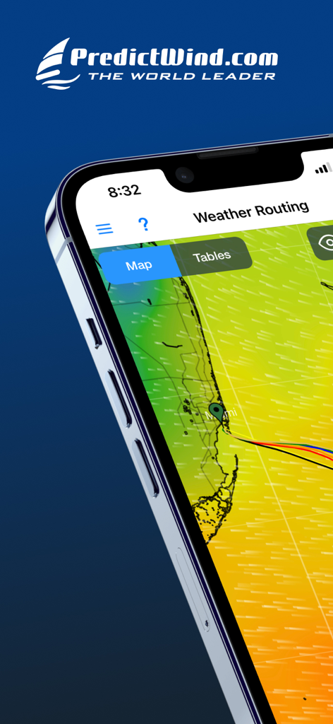
PredictWind Offshore app interface showing a maritime weather routing map with wind data near Miami
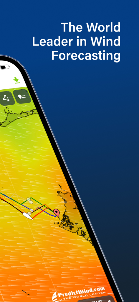
Mobile screen displaying PredictWind offshore wind forecasting and weather routing
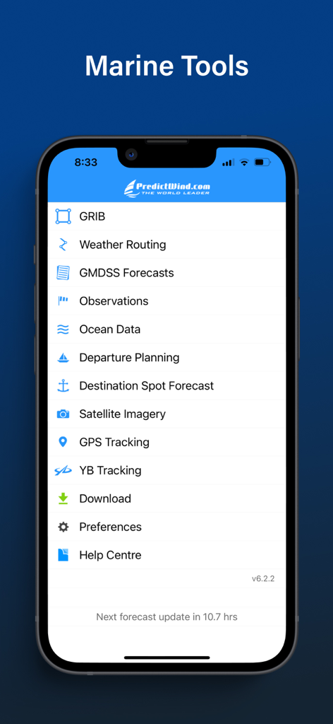
PredictWind Offshore Weather app interface displaying the Marine Tools menu with features like Weather Routing and GRIB files
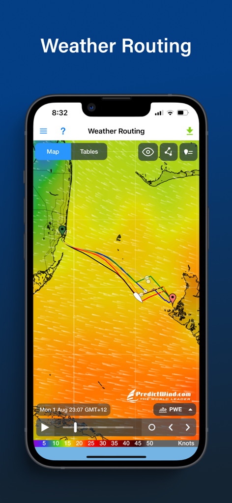
PredictWind Offshore app interface displaying weather routing and wind forecast maps for maritime navigation
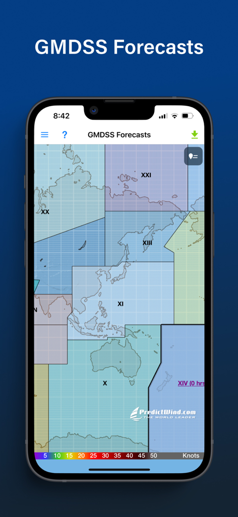
PredictWind Offshore Weather app displaying GMDSS maritime forecast zones on a map
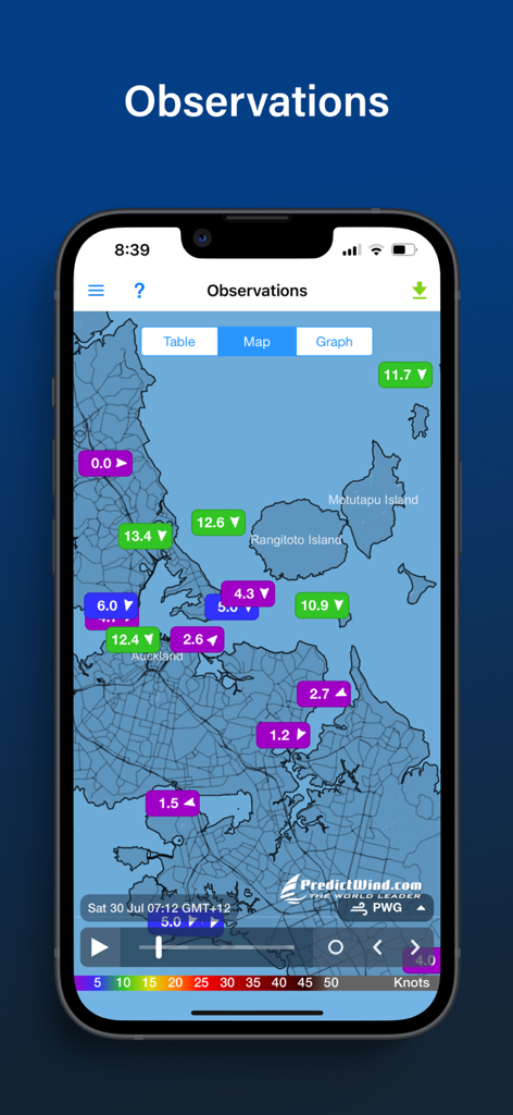
PredictWind app screen displaying live maritime wind observations on a coastal map
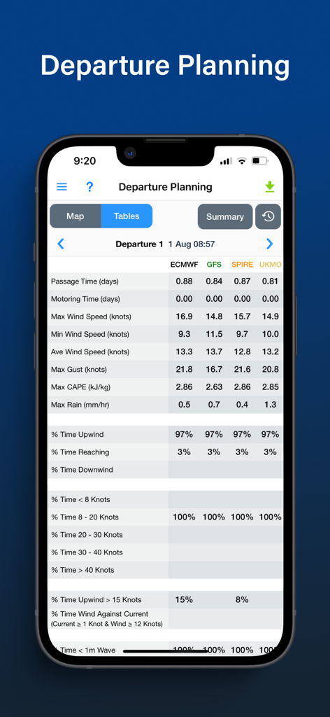
PredictWind Offshore app departure planning table comparing different weather models for maritime passage
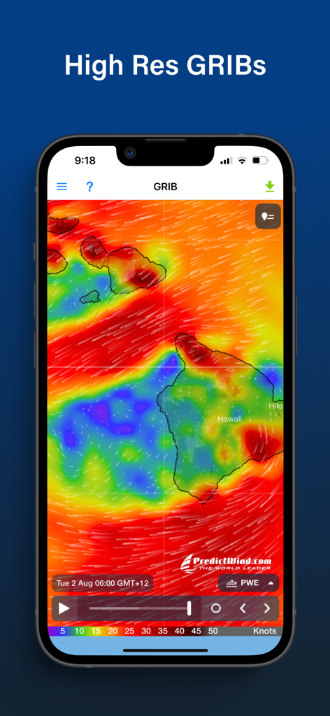
PredictWind Offshore app showing a high resolution GRIB weather map with wind patterns around the Hawaiian Islands.
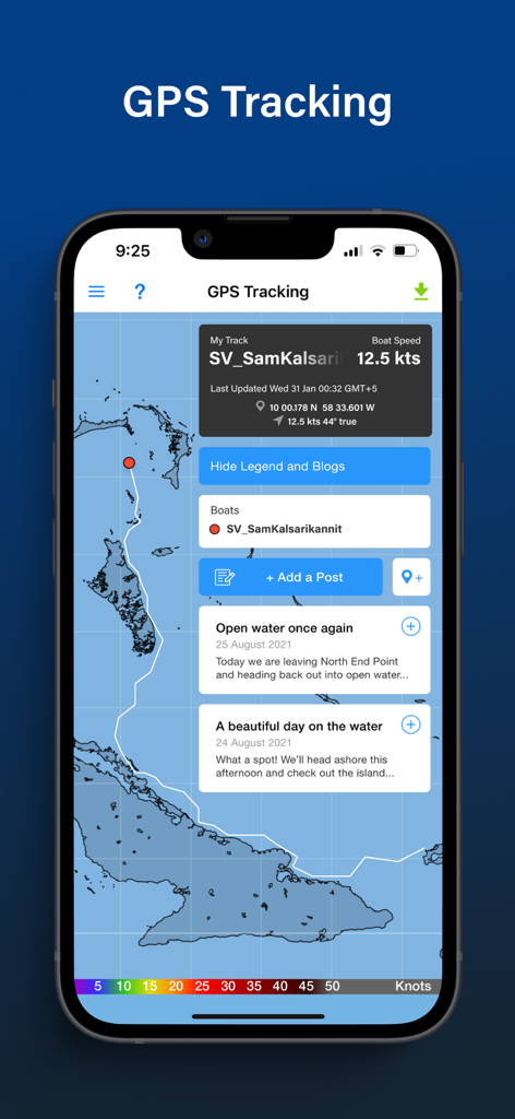
GPS tracking screen in the PredictWind Offshore app showing a vessel's path on a map with speed and blog updates
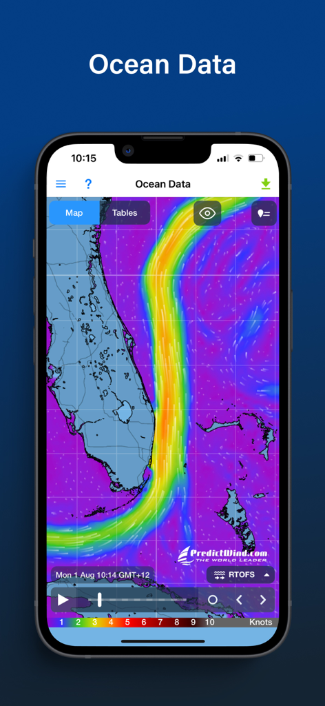
PredictWind Offshore app displaying ocean current data and map for the Florida coast
Description
Download
More Like This
Apps with similar features and user experience


This page is not an official page of the app or its developer, but an independent editorial publication created for informational and commentary purposes. Unless expressly stated otherwise, neither the app nor its developer is affiliated with, endorsed by, sponsored by, authorized by, or otherwise officially connected with MWM, Apple, Google Play, the app publisher, or the app's developer, and nothing on this page implies that the app was developed using MWM's services. Any trademarks, logos, screenshots, and other content remain the property of their respective owners.