This page is not an official page of the app or its developer, but an independent editorial publication created for informational and commentary purposes. Unless expressly stated otherwise, neither the app nor its developer is affiliated with, endorsed by, sponsored by, authorized by, or otherwise officially connected with MWM, Apple, Google Play, the app publisher, or the app's developer, and nothing on this page implies that the app was developed using MWM's services. Any trademarks, logos, screenshots, and other content remain the property of their respective owners.

Coordinate Converter - MyGPSC
Instantly convert between MGRS, UTM, GARS, and more—no internet required. A private, ad-free tool built for military personnel, responders, and backcountry explorers who need accurate data when it matters most.
Downloads
1K+User Rating
Total Ratings
0Publisher
Category
NavigationLocales
1Latest Version
1.0.4Size
0.8 MBFirst Released
Jul 11, 2025Precision Tools for Tactical Navigation
Designed for those who operate where the grid ends. MyGPSC provides high-accuracy, offline-first conversion tools for military, SAR, and backcountry professionals.
100% Offline Reliability
No cell signal? No problem. Convert coordinates anywhere from the deep backcountry to remote mission zones without needing data or Wi-Fi.
Universal Grid Support
Bridge the gap between civilian and military systems. Instantly translate between MGRS, UTM, GARS, and all standard Lat/Long formats.
The following screenshots and description are sourced directly from the app's official store listing and are the property of the app developer.
App Store
Screenshots
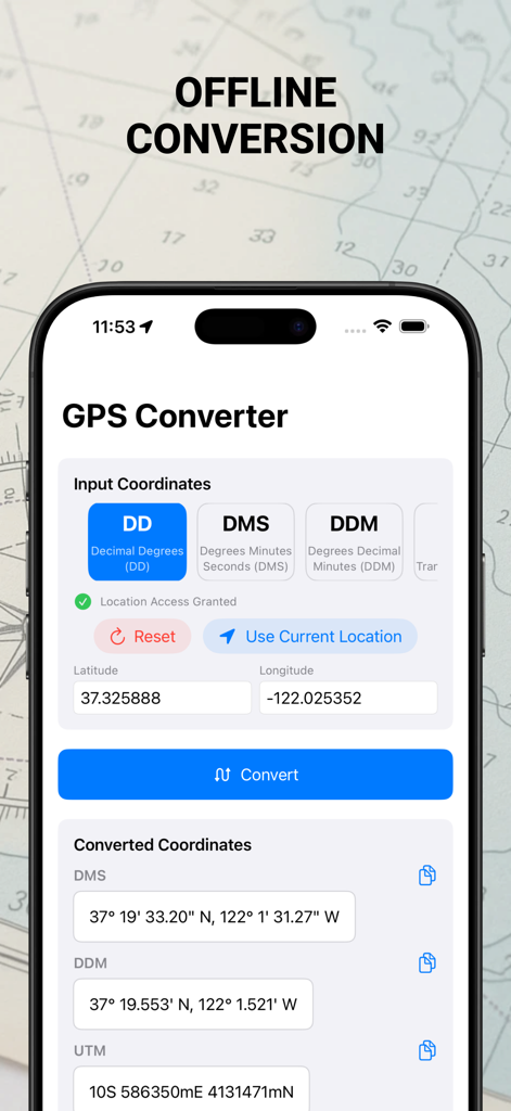
MyGPSC app interface showing offline GPS coordinate conversion between DD DMS and UTM formats
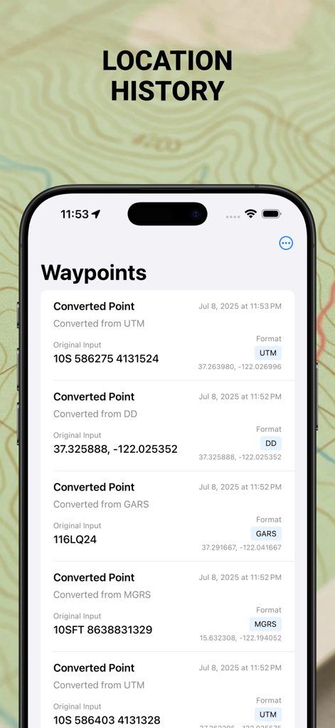
Coordinate Converter app screenshot showing a list of saved waypoints and location history with coordinate formats like UTM, MGRS, and GARS
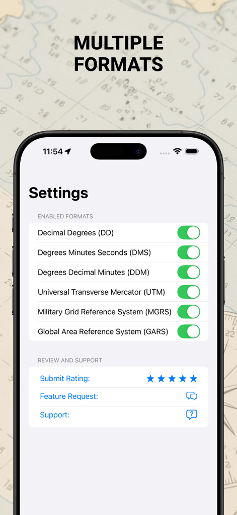
Settings screen of MyGPSC app showing multiple coordinate format toggles including UTM and MGRS.
Description
Download
More Like This
Top-ranked apps in the same category

Google Maps
Google LLC

Waze Navigation & Live Traffic
waze

AMap Global
AutoNavi Information Technology Co. Ltd.

百度地图-路线规划,出行必备
Beijing Baidu Netcom Science & Technology Co.,Ltd

Moovit: Bus & Transit Tracker
Moovit App Global LTD

Transit • Subway & Bus Times
9280-0366 Quebec inc.

ParkMobile: Park. Pay. Go.
Parkmobile USA, Inc

腾讯地图-路线规划,导航地铁打车出行
Shenzhen Tencent Computer Systems Company Limited

Île-de-France Mobilités
Ile de France Mobilites
This page is not an official page of the app or its developer, but an independent editorial publication created for informational and commentary purposes. Unless expressly stated otherwise, neither the app nor its developer is affiliated with, endorsed by, sponsored by, authorized by, or otherwise officially connected with MWM, Apple, Google Play, the app publisher, or the app's developer, and nothing on this page implies that the app was developed using MWM's services. Any trademarks, logos, screenshots, and other content remain the property of their respective owners.