This page is not an official page of the app or its developer, but an independent editorial publication created for informational and commentary purposes. Unless expressly stated otherwise, neither the app nor its developer is affiliated with, endorsed by, sponsored by, authorized by, or otherwise officially connected with MWM, Apple, Google Play, the app publisher, or the app's developer, and nothing on this page implies that the app was developed using MWM's services. Any trademarks, logos, screenshots, and other content remain the property of their respective owners.

Dronelink Flight
Transform your drone into a professional precision tool. Plan complex missions in 3D, automate every flight path, and capture flawless data for mapping, inspections, and cinematography.
Downloads
9K+User Rating
Total Ratings
2K+Publisher
Category
UtilitiesLocales
13Latest Version
5.2.1Size
304.4 MBFirst Released
Sep 18, 2019Precision-Engineered Flight Control
Transform your drone into a professional data collection tool with automated missions, 3D flight previews, and seamless cross-device synchronization designed for demanding workflows.
Automated Mission Planning
Design complex waypoints, orbits, and vertical mapping paths with surgical precision. Dronelink handles the technical flight maneuvers so you can focus on high-quality data capture.
3D Pre-Flight Visualization
Minimize risk by flying a virtual drone in a 3D preview before you take off. Identify obstacles and refine your mission path to ensure a safe and successful execution every time.
The following screenshots and description are sourced directly from the app's official store listing and are the property of the app developer.
App Store
Screenshots
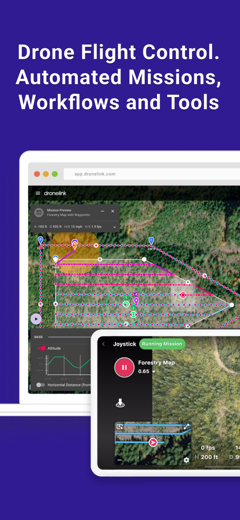
Dronelink Flight app interface showing automated drone mission planning and forestry mapping workflows on web and mobile devices.
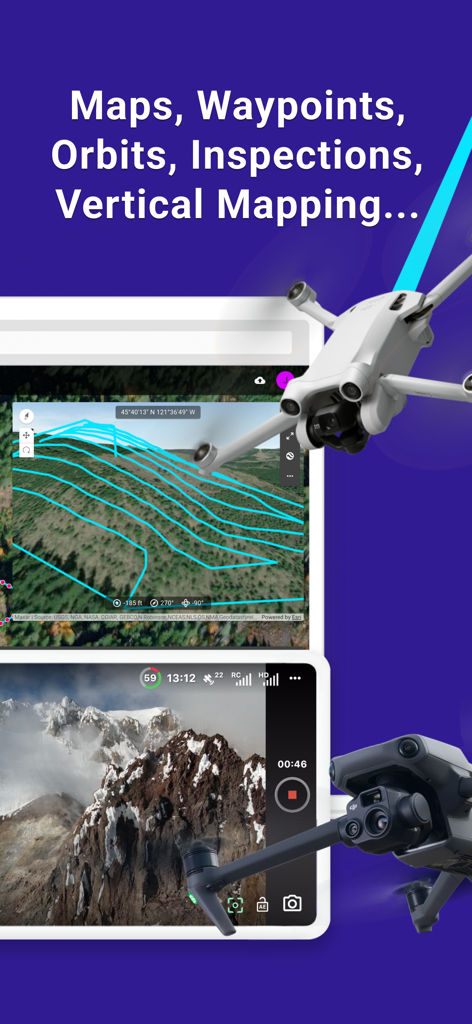
Dronelink Flight app interface showing vertical mapping paths over terrain and a real-time drone camera feed
Dronelink Flight app interface showing a drone inspection mission on a tablet
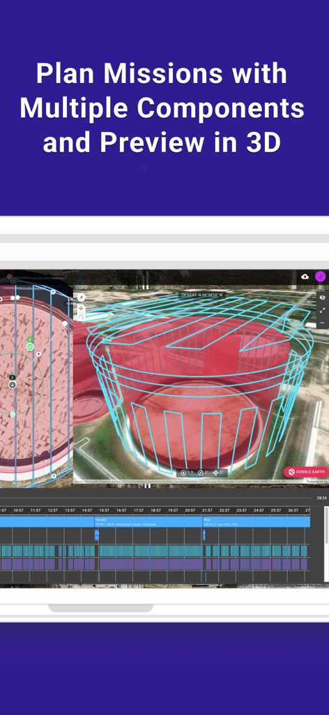
Dronelink Flight app interface showing a 3D preview of a planned drone mission over a structure.
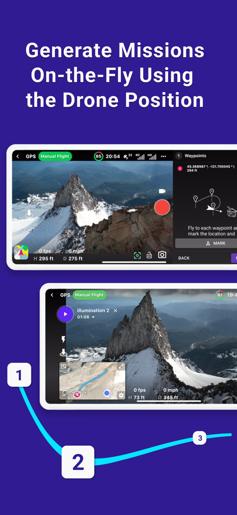
Interface of Dronelink Flight app showing automated drone mission generation using current position and waypoints over a mountain landscape
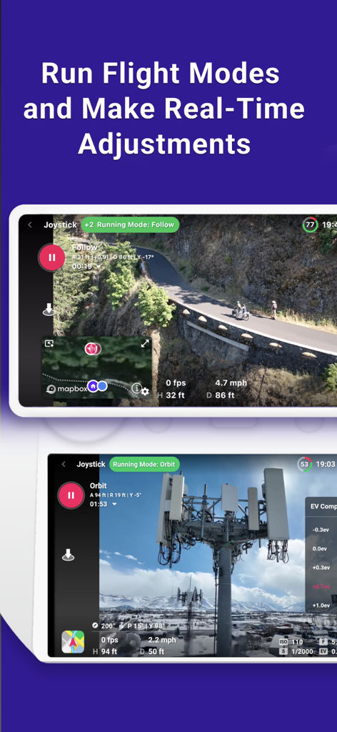
Dronelink app interface showing automated drone flight modes and real-time adjustments.
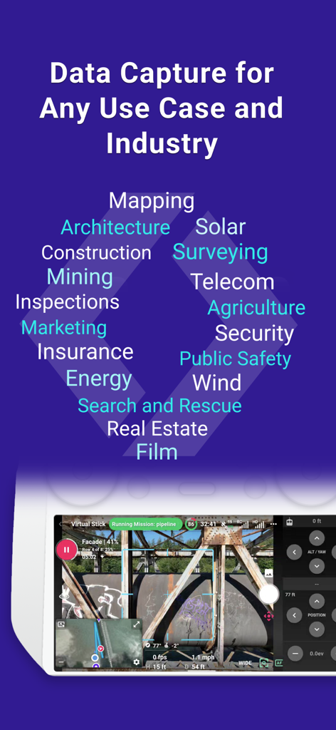
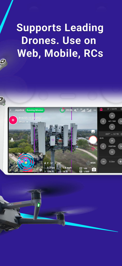
Professional drone flight app interface showing industrial use cases for data capture and a live inspection dashboard.

Dronelink Flight web dashboard showing mission management and flight operation maps for drone pilots
Description
Download
More Like This
Apps with similar features and user experience

Litchi for DJI Drones
VC TECHNOLOGY LTD

Go Fly for DJI Drones
SMART WIDGET LABS COMPANY LIMITED

Rx Drone
Robert Ronash

DJI Fly
SZ DJI TECHNOLOGY CO., LTD

HF UFO
Robert Ronash

FreeFlight Pro.
Parrot

WiFi UAV
文 张

WiFi_CAM
SHENZHEN TZH ELECTRONICS TECHNOLOGY CO., LTD

DJI GO 4
SZ DJI TECHNOLOGY CO., LTD
This page is not an official page of the app or its developer, but an independent editorial publication created for informational and commentary purposes. Unless expressly stated otherwise, neither the app nor its developer is affiliated with, endorsed by, sponsored by, authorized by, or otherwise officially connected with MWM, Apple, Google Play, the app publisher, or the app's developer, and nothing on this page implies that the app was developed using MWM's services. Any trademarks, logos, screenshots, and other content remain the property of their respective owners.