This page is not an official page of the app or its developer, but an independent editorial publication created for informational and commentary purposes. Unless expressly stated otherwise, neither the app nor its developer is affiliated with, endorsed by, sponsored by, authorized by, or otherwise officially connected with MWM, Apple, Google Play, the app publisher, or the app's developer, and nothing on this page implies that the app was developed using MWM's services. Any trademarks, logos, screenshots, and other content remain the property of their respective owners.

Elevation Tracker: Altitude
Get real-time GPS altitude and route visualization designed for the modern adventurer. Track your progress on satellite maps and stay in control with full offline functionality, even in the most remote wilderness.
Downloads
5K+User Rating
Total Ratings
100Publisher
Category
NavigationLocales
5Latest Version
1.5.4Size
9.2 MBFirst Released
Mar 4, 2023Master Every Ascent with Precision
High-accuracy altitude tracking and mapping built for the modern outdoor explorer. Stay informed and safe, even when you are completely off the grid.
Precision GPS Tracking
Harness your device's internal sensors for real-time altitude data that doesn't rely on cellular service, ensuring accuracy on any peak.
100% Offline Reliability
Navigate with confidence in deep backcountry and National Parks. All tracking features work perfectly without an internet connection.
The following screenshots and description are sourced directly from the app's official store listing and are the property of the app developer.
App Store
Screenshots
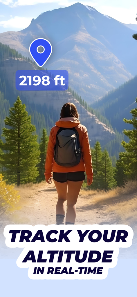
Hiker on a mountain trail showing real-time altitude tracking in feet
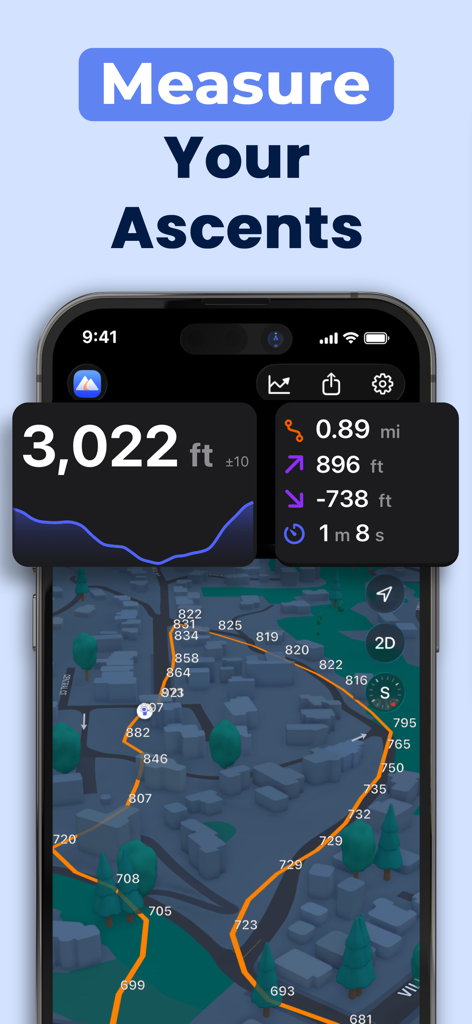
Smartphone displaying the Elevation Tracker app with a 3D map and altitude data overlays
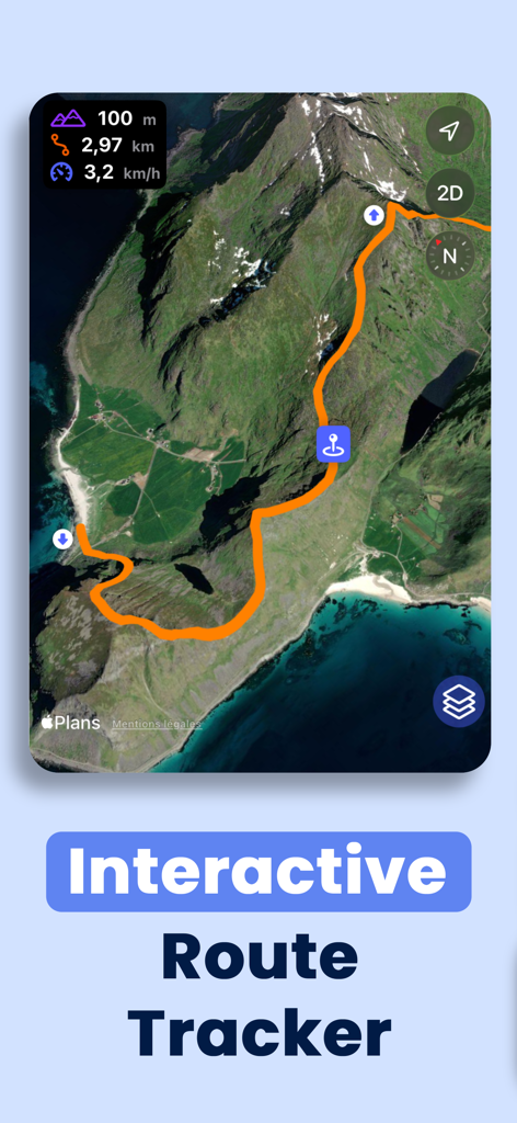
Interactive route tracker showing a hiking path and altitude data on a satellite map
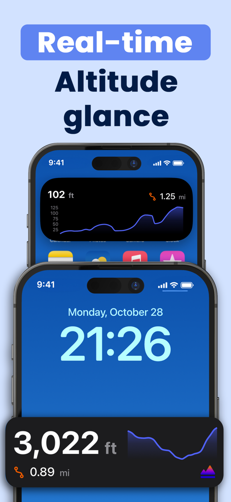
Elevation Tracker app displaying real-time altitude and elevation graphs on iPhone widgets
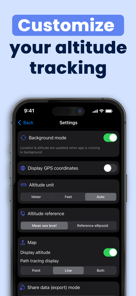
Elevation Tracker app settings screen showing altitude unit and GPS coordinate customization options
Description
Download
More Like This
Top-ranked apps in the same category

Google Maps
Google LLC

Waze Navigation & Live Traffic
waze

AMap Global
AutoNavi Information Technology Co. Ltd.

百度地图-路线规划,出行必备
Beijing Baidu Netcom Science & Technology Co.,Ltd

Moovit: Bus & Transit Tracker
Moovit App Global LTD

Transit • Subway & Bus Times
9280-0366 Quebec inc.

ParkMobile: Park. Pay. Go.
Parkmobile USA, Inc

腾讯地图-路线规划,导航地铁打车出行
Shenzhen Tencent Computer Systems Company Limited

Île-de-France Mobilités
Ile de France Mobilites
This page is not an official page of the app or its developer, but an independent editorial publication created for informational and commentary purposes. Unless expressly stated otherwise, neither the app nor its developer is affiliated with, endorsed by, sponsored by, authorized by, or otherwise officially connected with MWM, Apple, Google Play, the app publisher, or the app's developer, and nothing on this page implies that the app was developed using MWM's services. Any trademarks, logos, screenshots, and other content remain the property of their respective owners.