This page is not an official page of the app or its developer, but an independent editorial publication created for informational and commentary purposes. Unless expressly stated otherwise, neither the app nor its developer is affiliated with, endorsed by, sponsored by, authorized by, or otherwise officially connected with MWM, Apple, Google Play, the app publisher, or the app's developer, and nothing on this page implies that the app was developed using MWM's services. Any trademarks, logos, screenshots, and other content remain the property of their respective owners.

eLiteMap
The ultimate tool for off-grid navigation and spatial data management. Create, edit, and export geo-features with media attachments—no internet, no logins, and zero subscriptions required.
Downloads
0User Rating
Total Ratings
0Publisher
Category
NavigationLocales
5Latest Version
3.1.1Size
87.1 MBFirst Released
Oct 27, 2023Advanced GIS Tools for the Field
Empower your field operations with a robust, offline-first mapping solution. Collect data, record tracks, and manage complex spatial projects without cellular service, accounts, or hidden fees.
True Offline Autonomy
Work seamlessly in remote 'dead zones' with high-performance CMF2 and MBTILES maps. No internet, no logins, and no interruptions to your mission-critical tasks.
Professional Data Collection
Capture points, lines, and polygons with precision. Enhance your field reports with voice notes, photos, and videos attached directly to specific map coordinates.
The following screenshots and description are sourced directly from the app's official store listing and are the property of the app developer.
App Store
Screenshots
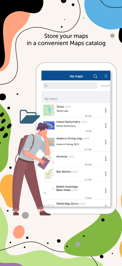
eLiteMap app interface showing a list of stored offline maps in the CMF2 catalog
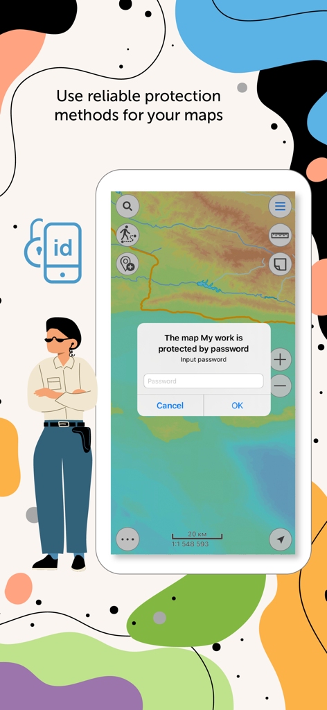
eLiteMap app interface showing a password prompt to protect map data
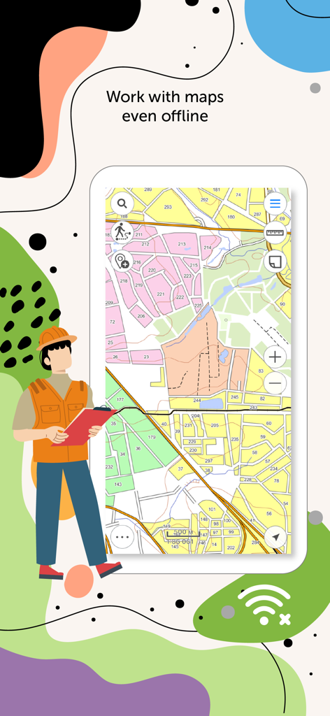
Smartphone screen showing eLiteMap app with interactive offline maps and a field worker illustration
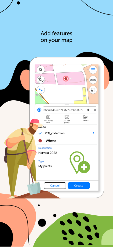
Interface of eLiteMap app showing how to add a map feature with a description and location for agricultural field work
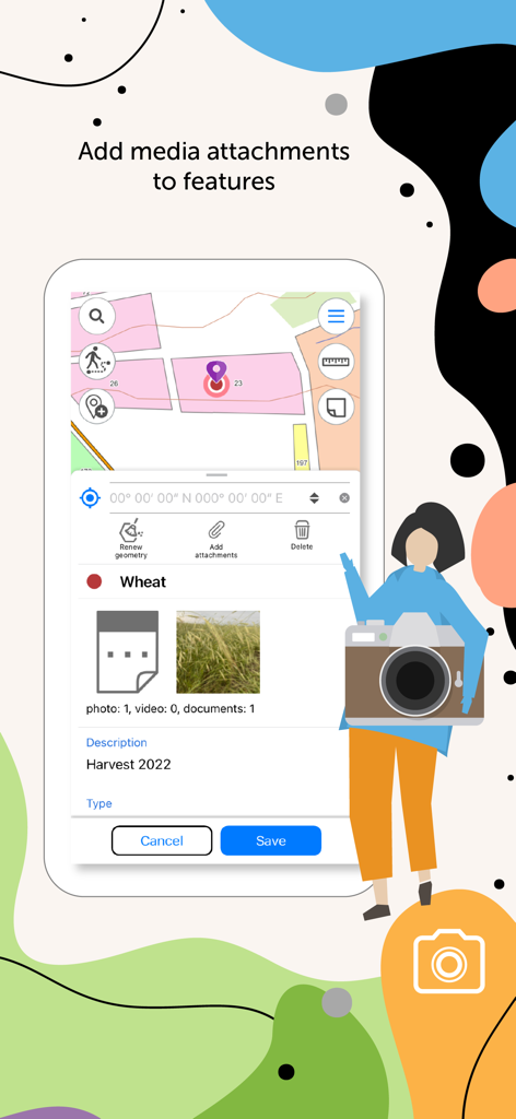
eLiteMap interface for adding photo and video attachments to map features
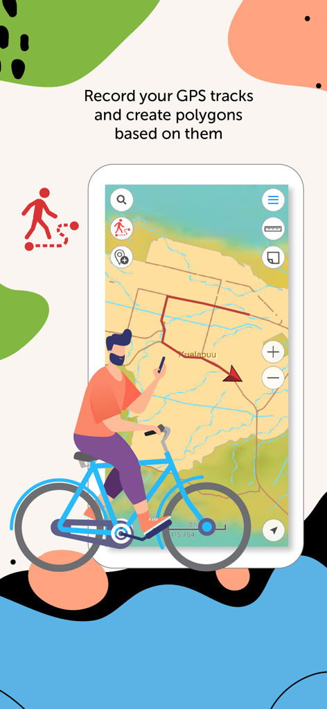
eLiteMap app interface showing GPS track recording and polygon creation on a field map
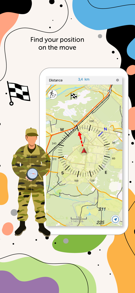
Mobile interface of eLiteMap showing real-time positioning and offline navigation tools for field professionals
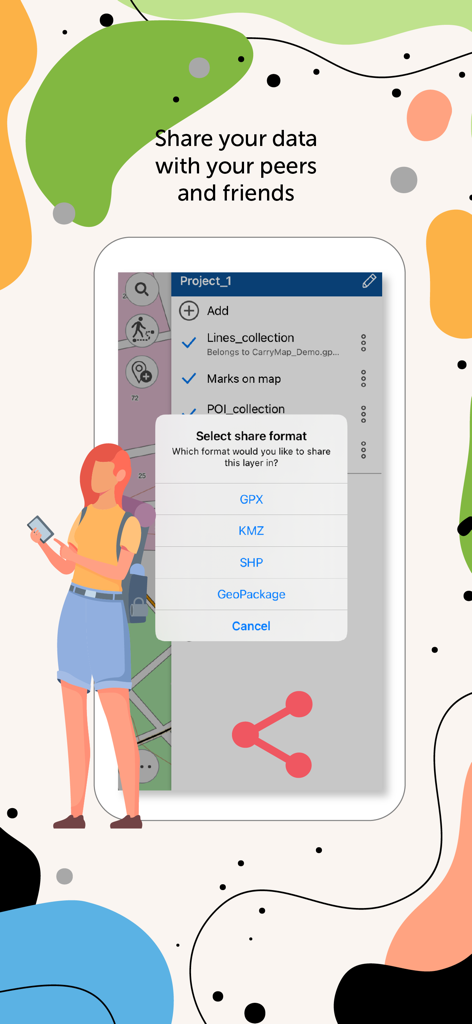
Exporting GIS data from eLiteMap in professional formats including GPX, KMZ, SHP and GeoPackage.
Description
Download
More Like This
Top-ranked apps in the same category

Google Maps
Google LLC

AMap Global
AutoNavi Information Technology Co. Ltd.

Waze Navigation & Live Traffic
waze

百度地图-路线规划,出行必备
Beijing Baidu Netcom Science & Technology Co.,Ltd

Moovit: Bus & Transit Tracker
Moovit App Global LTD

腾讯地图-路线规划,导航地铁打车出行
Shenzhen Tencent Computer Systems Company Limited

ParkMobile: Park. Pay. Go.
Parkmobile USA, Inc

Transit • Subway & Bus Times
9280-0366 Quebec inc.

NAVER Maps, Navigation
NAVER Corp.
This page is not an official page of the app or its developer, but an independent editorial publication created for informational and commentary purposes. Unless expressly stated otherwise, neither the app nor its developer is affiliated with, endorsed by, sponsored by, authorized by, or otherwise officially connected with MWM, Apple, Google Play, the app publisher, or the app's developer, and nothing on this page implies that the app was developed using MWM's services. Any trademarks, logos, screenshots, and other content remain the property of their respective owners.