This page is not an official page of the app or its developer, but an independent editorial publication created for informational and commentary purposes. Unless expressly stated otherwise, neither the app nor its developer is affiliated with, endorsed by, sponsored by, authorized by, or otherwise officially connected with MWM, Apple, Google Play, the app publisher, or the app's developer, and nothing on this page implies that the app was developed using MWM's services. Any trademarks, logos, screenshots, and other content remain the property of their respective owners.

FltPlan Go
Seamlessly sync your flight plans, NavLogs, and geo-referenced charts directly from FltPlan.com. Experience a comprehensive suite of mapping, weather overlays, and avionics integration designed for the safety-conscious pilot.
Downloads
154K+User Rating
Total Ratings
500Publisher
Category
NavigationLocales
2Latest Version
5.0.32Size
180.0 MBFirst Released
Sep 28, 2013Professional Cockpit Intelligence for Serious Pilots
Seamlessly sync your flight plans from FltPlan.com to your iPad. Access essential offline charts, real-time weather, and integrated avionics support to ensure every mission is executed with precision.
Seamless Sync & Offline Access
Create plans on FltPlan.com and sync them instantly. Download NavLogs and charts for reliable, 100% offline use when you're in the air.
Total Situational Awareness
Overlay Geo-referenced approach plates, METARs, and ADS-B traffic on interactive moving maps to stay ahead of the weather and your route.
The following screenshots and description are sourced directly from the app's official store listing and are the property of the app developer.
App Store
Screenshots
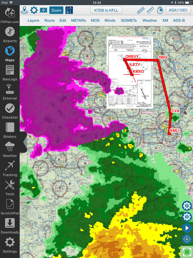
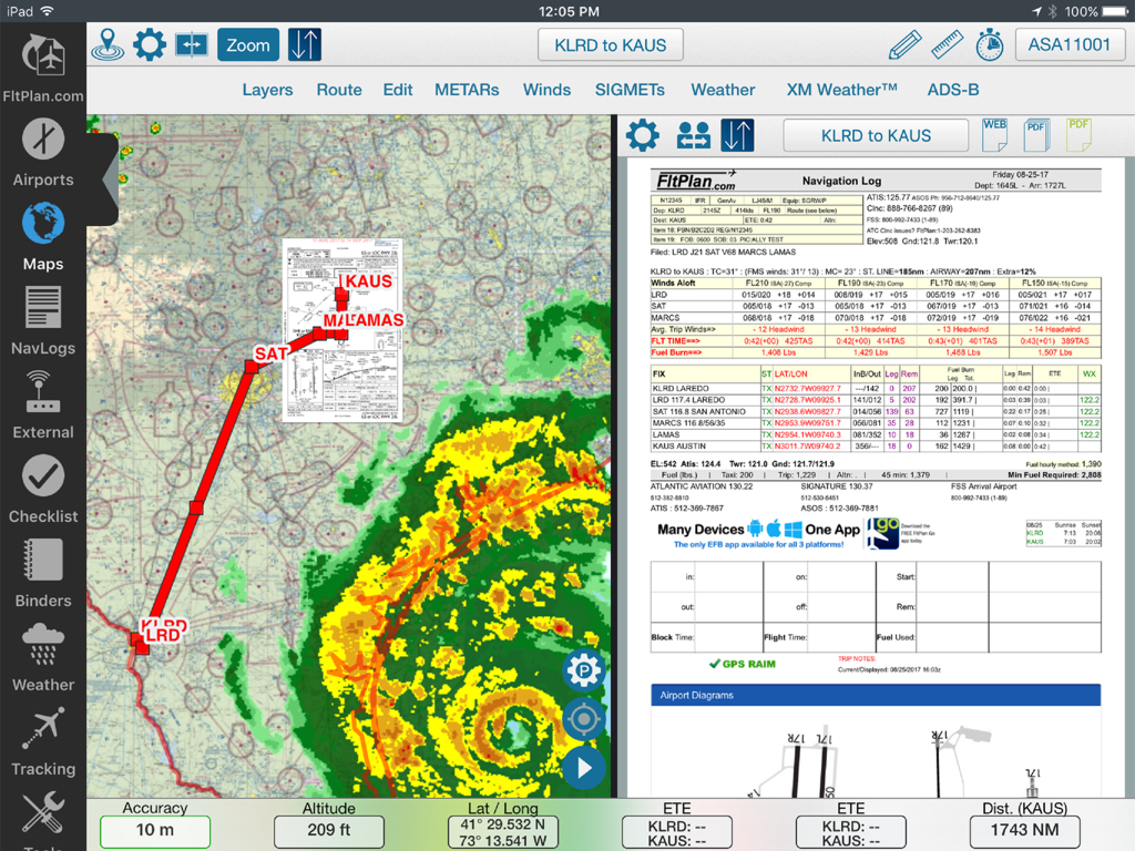
FltPlan Go iPad app interface displaying a moving map with flight route weather radar overlays and an approach plate
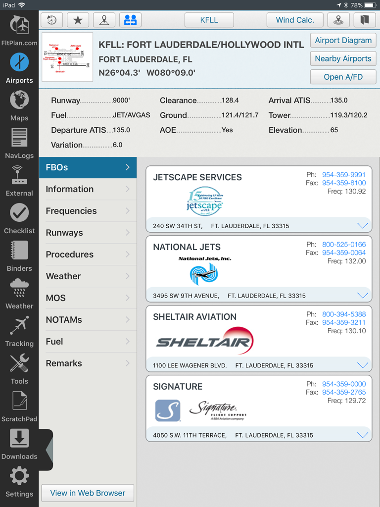
FltPlan Go iPad interface displaying airport details and FBO services for KFLL Fort Lauderdale
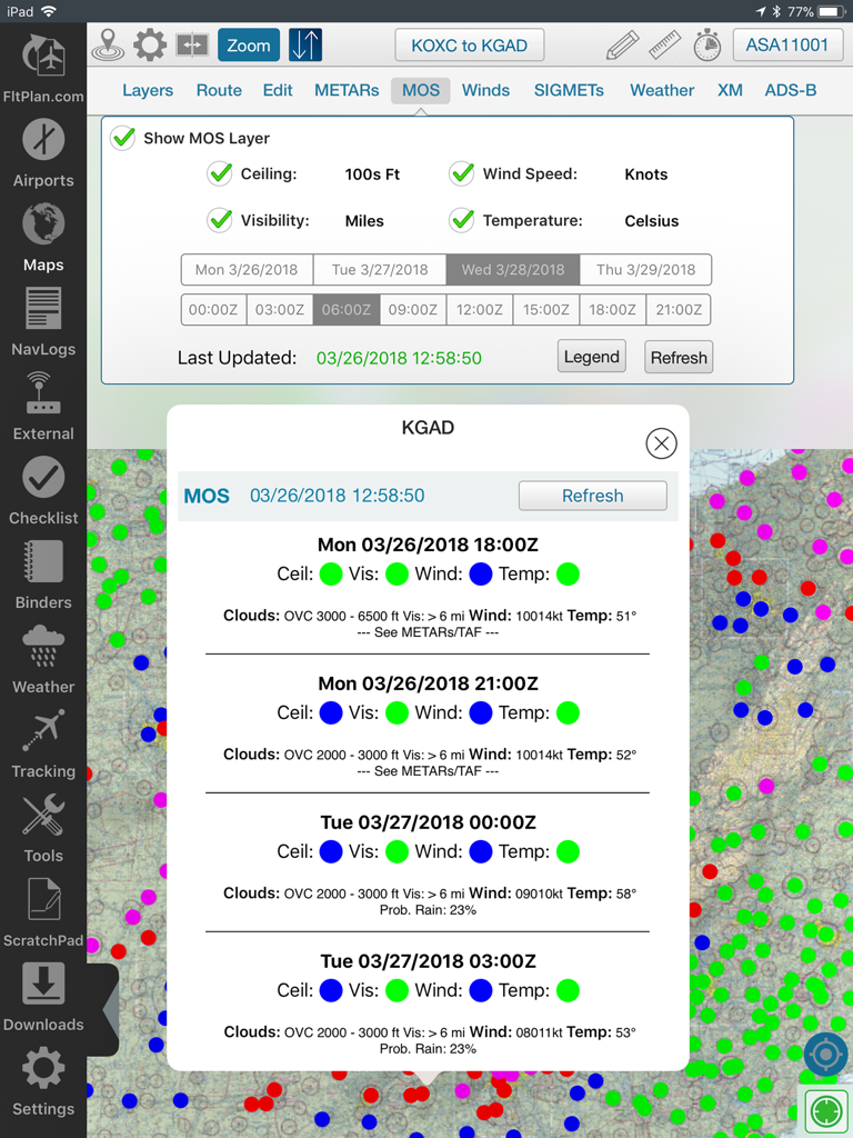
FltPlan Go iPad application displaying MOS weather forecast data on a flight map
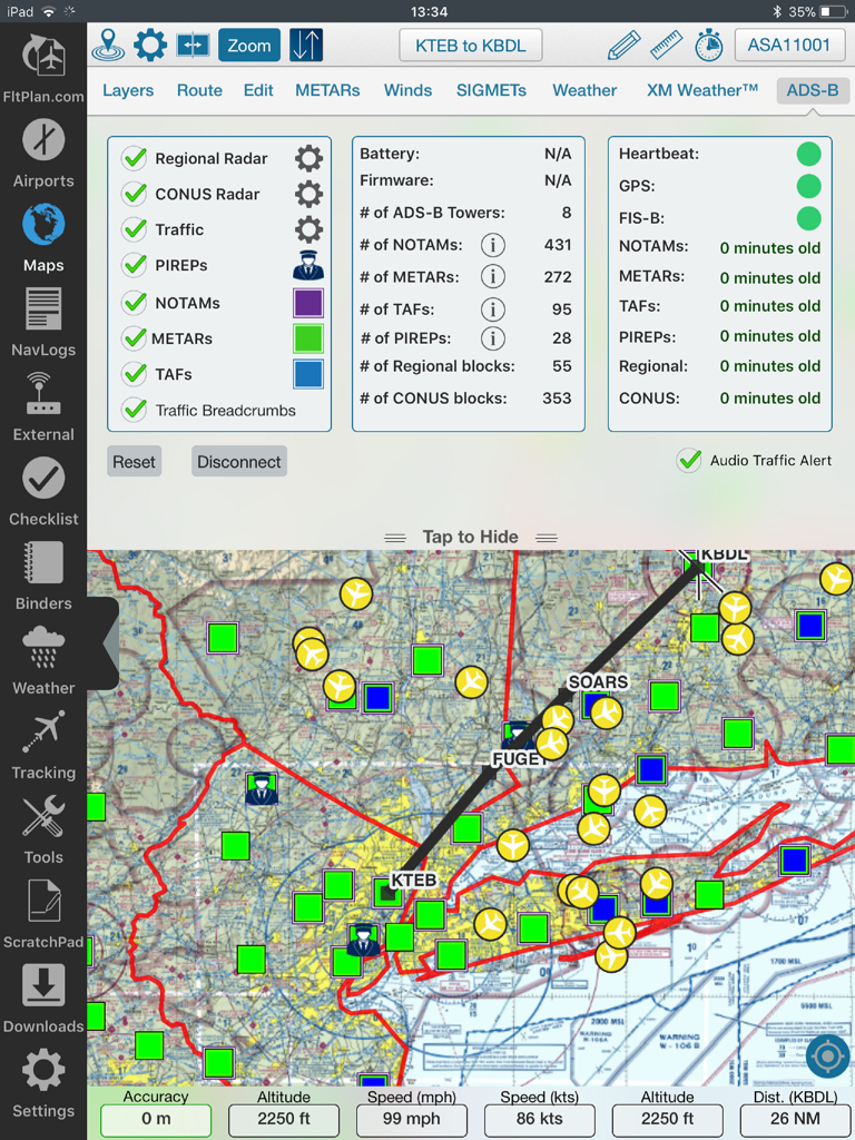
FltPlan Go iPad interface displaying a moving map with flight path, weather overlays, and ADS-B status data.
Split screen view of FltPlan Go on iPad displaying a moving map with weather radar and a navigation log
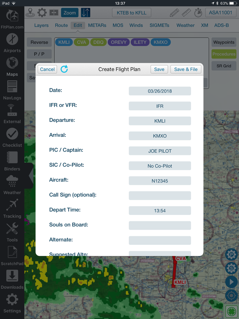
A pilot filling out a flight plan form in the FltPlan Go app over a navigation map with weather overlays.
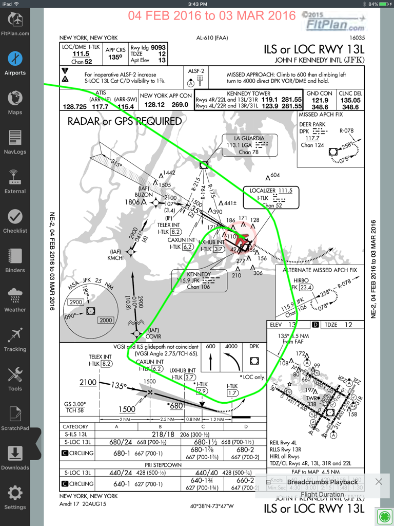
FltPlan Go iPad app displaying a JFK airport ILS approach plate with a green breadcrumb flight path overlay
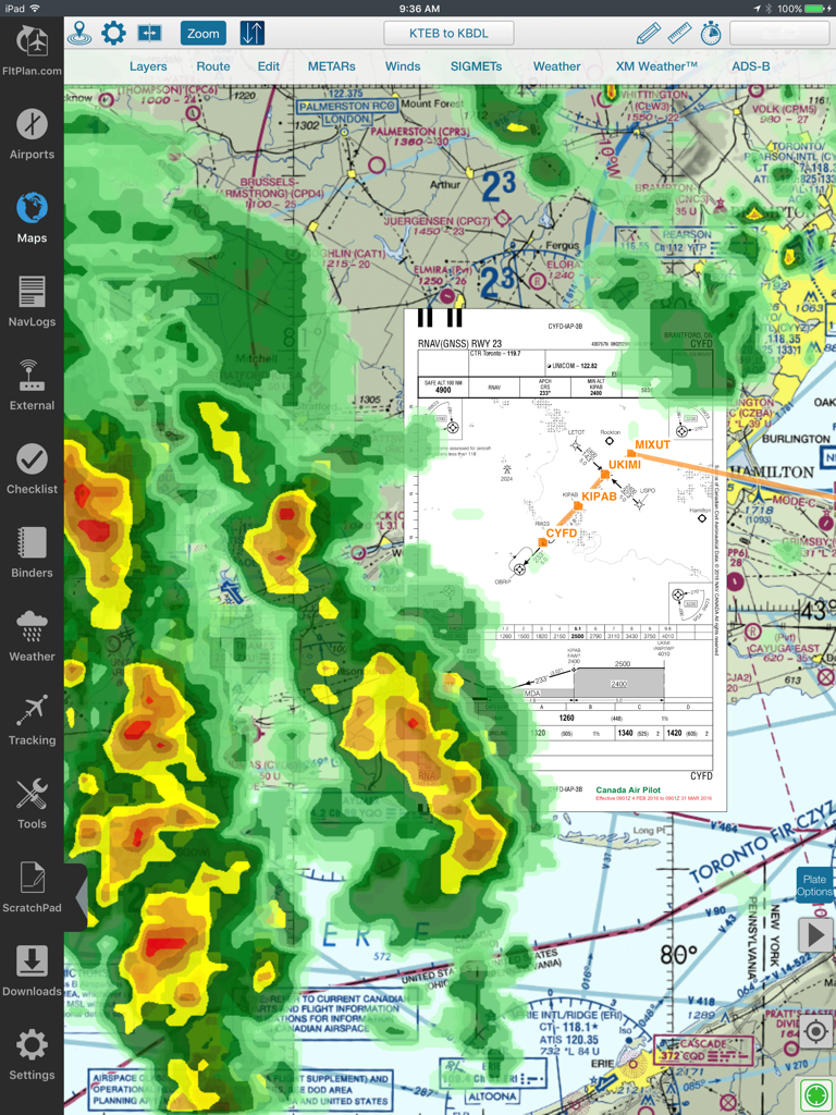
Aviation moving map in FltPlan Go with weather radar and approach plate overlay
Description
Download
More Like This
Top-ranked apps in the same category

Google Maps
Google LLC

Waze Navigation & Live Traffic
waze

AMap Global
AutoNavi Information Technology Co. Ltd.

百度地图-路线规划,出行必备
Beijing Baidu Netcom Science & Technology Co.,Ltd

Moovit: Bus & Transit Tracker
Moovit App Global LTD

Transit • Subway & Bus Times
9280-0366 Quebec inc.

ParkMobile: Park. Pay. Go.
Parkmobile USA, Inc

腾讯地图-路线规划,导航地铁打车出行
Shenzhen Tencent Computer Systems Company Limited

Île-de-France Mobilités
Ile de France Mobilites
This page is not an official page of the app or its developer, but an independent editorial publication created for informational and commentary purposes. Unless expressly stated otherwise, neither the app nor its developer is affiliated with, endorsed by, sponsored by, authorized by, or otherwise officially connected with MWM, Apple, Google Play, the app publisher, or the app's developer, and nothing on this page implies that the app was developed using MWM's services. Any trademarks, logos, screenshots, and other content remain the property of their respective owners.