This page is not an official page of the app or its developer, but an independent editorial publication created for informational and commentary purposes. Unless expressly stated otherwise, neither the app nor its developer is affiliated with, endorsed by, sponsored by, authorized by, or otherwise officially connected with MWM, Apple, Google Play, the app publisher, or the app's developer, and nothing on this page implies that the app was developed using MWM's services. Any trademarks, logos, screenshots, and other content remain the property of their respective owners.

FlyBy E6B
Master your cockpit math with over 70 precision tools designed by a professional airline pilot. From student flight training to commercial operations, get the reliability and features you need to fly safer and smarter.
Downloads
220K+User Rating
Total Ratings
200Publisher
Category
NavigationLocales
1Latest Version
2025.31Size
23.7 MBFirst Released
Jun 21, 2010Professional Precision for Every Phase of Flight
Built by veteran airline pilots, FlyBy E6B delivers 70+ specialized aviation tools designed to eliminate manual math and reduce cognitive load, from flight school exams to complex commercial operations.
Advanced Navigation & VNAV
Go beyond basic math with professional-grade tools for Critical Point, Point of No Return, and precise Vertical Navigation (VNAV) descent profiles.
Real-Time Wind & Airspeed
Instant calculations for True Airspeed (TAS), Ground Speed, and Headwind/Crosswind components to ensure you stay ahead of the aircraft.
The following screenshots and description are sourced directly from the app's official store listing and are the property of the app developer.
App Store
Screenshots
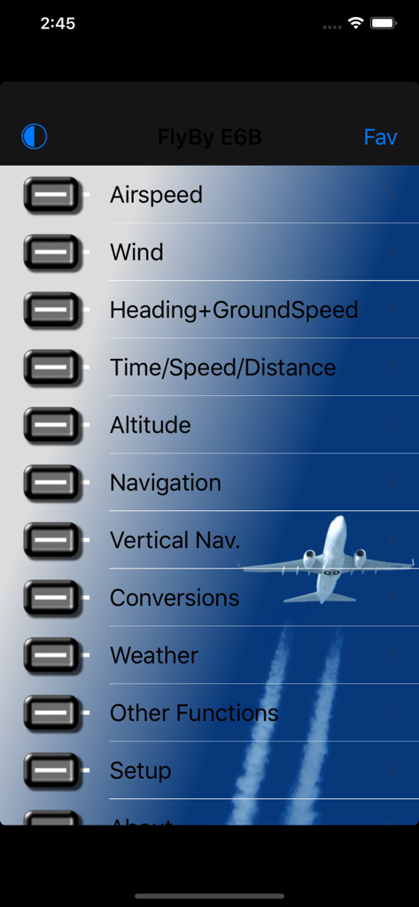
FlyBy E6B main menu interface displaying aviation calculation options
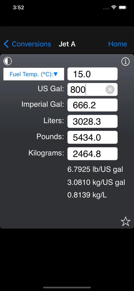
FlyBy E6B app interface showing Jet A fuel volume and weight conversion screen

Aviation passenger weight calculation screen for flight planning in the FlyBy E6B app.
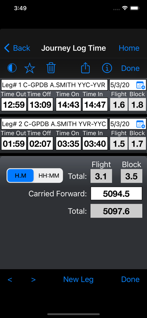
FlyBy E6B app interface showing the journey log time feature with flight and block time calculations for multiple legs
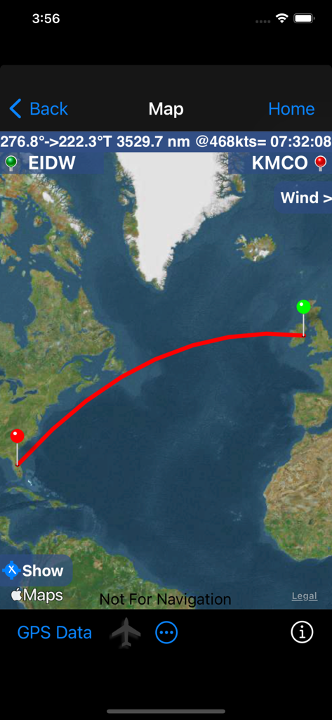
FlyBy E6B app map interface showing a flight route from Dublin to Orlando with distance and time details
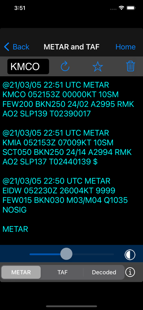
Aviation weather report screen showing METAR and TAF data in FlyBy E6B app
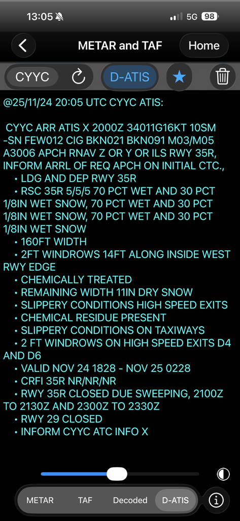
FlyBy E6B app displaying a detailed D-ATIS weather report and runway conditions
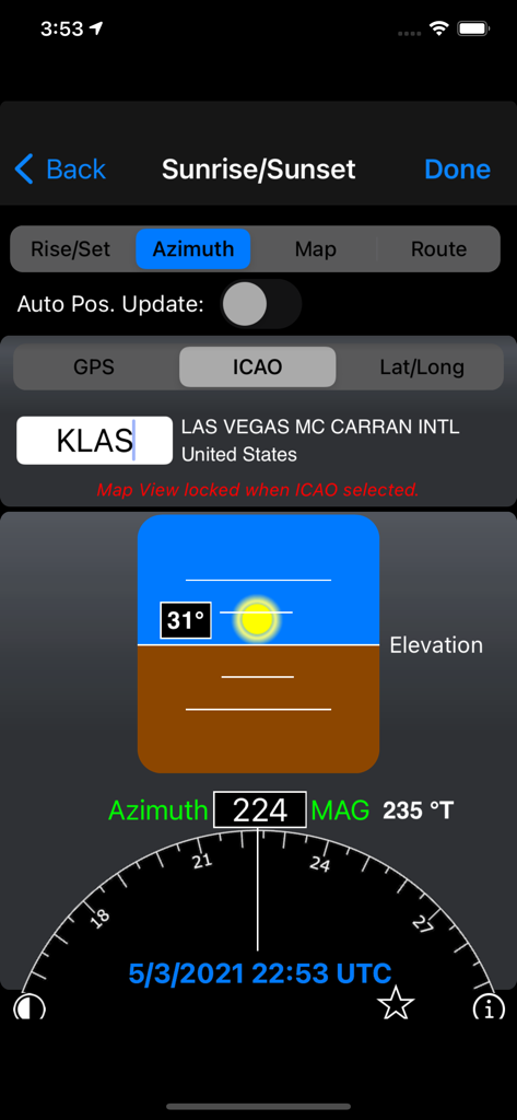
Sunrise and sunset azimuth calculation for Las Vegas airport in FlyBy E6B app
Description
Download
More Like This
Apps with similar features and user experience

BA Financial Calculator
Angel Montana

Astrology Master
ibrahim veli

Sporty's E6B Flight Computer
Sporty's Pilot Shop

BA Financial Calculator (PRO)
Angel Montana

Construction Master Pro Calc
Calculated Industries, Inc.

Construction Master 5 Calc
Calculated Industries, Inc.

Pipe Trades Pro Calc
Calculated Industries, Inc.

Qualifier Plus IIIx/fx
Calculated Industries, Inc.

Resolutioner
Sun Apps, LLC
This page is not an official page of the app or its developer, but an independent editorial publication created for informational and commentary purposes. Unless expressly stated otherwise, neither the app nor its developer is affiliated with, endorsed by, sponsored by, authorized by, or otherwise officially connected with MWM, Apple, Google Play, the app publisher, or the app's developer, and nothing on this page implies that the app was developed using MWM's services. Any trademarks, logos, screenshots, and other content remain the property of their respective owners.