This page is not an official page of the app or its developer, but an independent editorial publication created for informational and commentary purposes. Unless expressly stated otherwise, neither the app nor its developer is affiliated with, endorsed by, sponsored by, authorized by, or otherwise officially connected with MWM, Apple, Google Play, the app publisher, or the app's developer, and nothing on this page implies that the app was developed using MWM's services. Any trademarks, logos, screenshots, and other content remain the property of their respective owners.

GeoBaroud
Built by first responders for wildland fire, SAR, and technical navigation. Experience instant, ultra-precise localization and seamless format conversion with total privacy and zero ads.
Downloads
0User Rating
Total Ratings
0Publisher
Category
NavigationLocales
1Latest Version
2.95Size
319.5 MBFirst Released
Jul 16, 2025Built for Mission-Critical Precision
From wildland firefighting to search and rescue, GeoBaroud turns your device into a professional-grade navigation tool with zero tracking and total reliability.
Seamless Coordinate Conversion
Instantly switch between DD, DMS, and DMD formats to ensure flawless inter-agency communication and reporting on the ground.
Advanced Orientation Data
Calculate distance, azimut, and precise orientation using real-time sensor data, specifically optimized for remote field operations.
The following screenshots and description are sourced directly from the app's official store listing and are the property of the app developer.
App Store
Screenshots
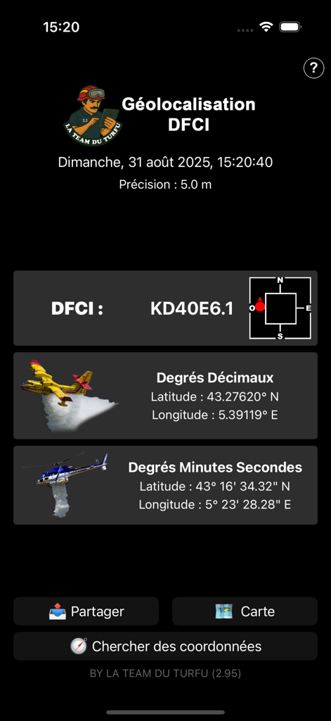
GeoBaroud app interface displaying precise GPS coordinates in DFCI and decimal formats
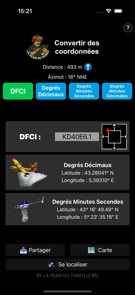
Interface of the GeoBaroud app showing coordinate conversion between DFCI, decimal degrees, and DMS formats with fire service imagery
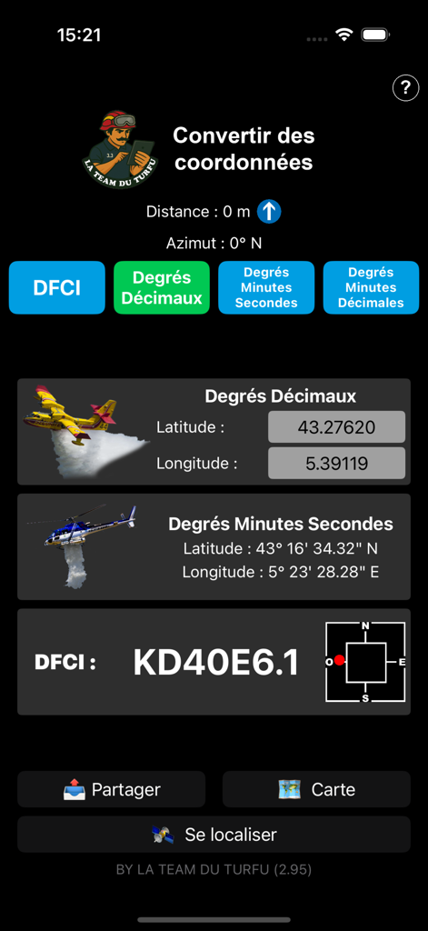
GeoBaroud mobile app interface showing real time GPS coordinate conversion between Decimal Degrees DMS and DFCI formats
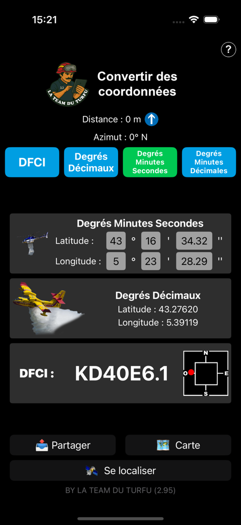
GeoBaroud app interface displaying GPS coordinate conversion in DMS DD and DFCI formats.
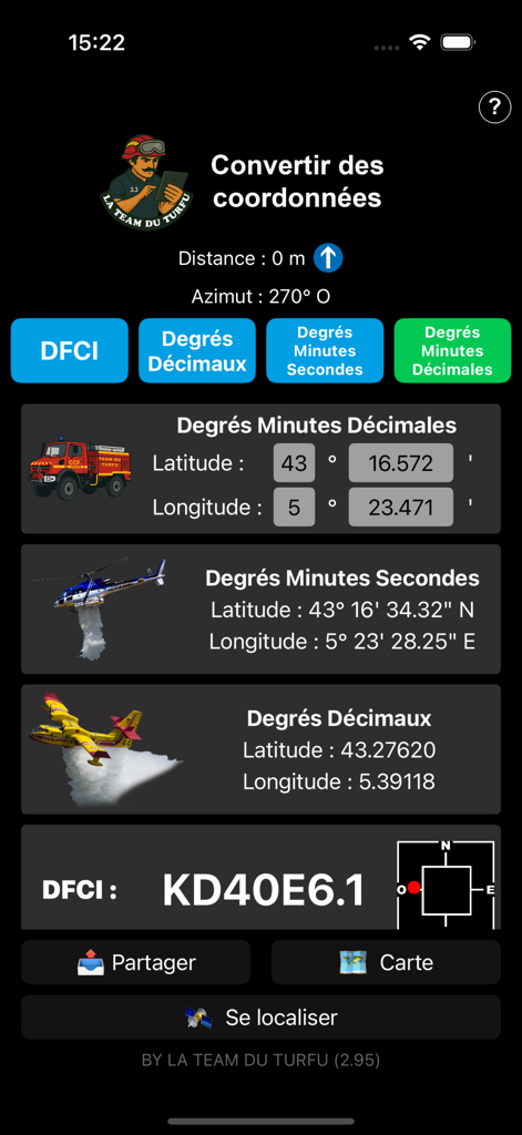
Screenshot of GeoBaroud mobile app showing coordinate conversion tools for firefighters with multiple location formats like DFCI and DMS
Description
Download
More Like This
Top-ranked apps in the same category

Google Maps
Google LLC

AMap Global
AutoNavi Information Technology Co. Ltd.

Waze Navigation & Live Traffic
waze

百度地图-路线规划,出行必备
Beijing Baidu Netcom Science & Technology Co.,Ltd

Moovit: Bus & Transit Tracker
Moovit App Global LTD

腾讯地图-路线规划,导航地铁打车出行
Shenzhen Tencent Computer Systems Company Limited

ParkMobile: Park. Pay. Go.
Parkmobile USA, Inc

Transit • Subway & Bus Times
9280-0366 Quebec inc.

MapXplorer: Map Radar Navigate
GOLDLAB APPLICATIONS YAZILIM VE BILISIM ANONIM SIRKETI
This page is not an official page of the app or its developer, but an independent editorial publication created for informational and commentary purposes. Unless expressly stated otherwise, neither the app nor its developer is affiliated with, endorsed by, sponsored by, authorized by, or otherwise officially connected with MWM, Apple, Google Play, the app publisher, or the app's developer, and nothing on this page implies that the app was developed using MWM's services. Any trademarks, logos, screenshots, and other content remain the property of their respective owners.