This page is not an official page of the app or its developer, but an independent editorial publication created for informational and commentary purposes. Unless expressly stated otherwise, neither the app nor its developer is affiliated with, endorsed by, sponsored by, authorized by, or otherwise officially connected with MWM, Apple, Google Play, the app publisher, or the app's developer, and nothing on this page implies that the app was developed using MWM's services. Any trademarks, logos, screenshots, and other content remain the property of their respective owners.

Geodata Map Viewer
A lightweight, no-bloat utility for professionals and outdoor enthusiasts. View complex metadata, record GPS routes, and organize your spatial data with zero subscriptions or hidden costs.
Downloads
500User Rating
Total Ratings
0Publisher
Category
NavigationLocales
1Latest Version
2.2Size
15.8 MBFirst Released
Nov 21, 2022Professional Precision for Your Geospatial Data
The ultimate ad-free utility for viewing, organizing, and recording GeoJSON, KML, and GPX files with complete privacy and zero cost.
Universal Format Support
Instantly visualize complex GeoJSON, KML, and GPX files. Access deep metadata and search specific locations within your custom map layers.
Live GPS Route Recording
Capture your exact path with real-time tracking and export your data as high-quality GPX files for research or recreational analysis.
Frequently Asked Questions
Everything you need to know about Geodata Map Viewer
Is Geodata Map Viewer a free application?
Yes, Geodata Map Viewer is completely free to download and use. It includes no advertisements or in-app purchases.
What file formats does Geodata Map Viewer support for viewing?
Geodata Map Viewer supports viewing GeoJSON, KML, and GPX file formats. Users can view these files on an interactive map.
Can Geodata Map Viewer display multiple geospatial files simultaneously?
Yes, Geodata Map Viewer allows users to view multiple geospatial files on the map at once. This includes various data types like points or polygons.
Does Geodata Map Viewer support recording GPS routes?
Yes, Geodata Map Viewer records GPS routes using your location. Users can export these recorded routes as GPX files.
Can I get turn-by-turn directions using Geodata Map Viewer?
Yes, Geodata Map Viewer provides turn-by-turn directions to any location by integrating with Apple Maps.
Does Geodata Map Viewer display metadata for geospatial files?
Yes, Geodata Map Viewer displays all file metadata. This includes details like file type, coordinates, area, length, and address information.
How does Geodata Map Viewer help users organize geospatial files?
Geodata Map Viewer allows users to organize their geospatial files into folders. This feature helps manage and categorize different map data.
Can users search for specific features within Geodata Map Viewer files?
Yes, users can search within files by name or address using Geodata Map Viewer. This functionality helps locate specific points or areas of interest on the map.
The following screenshots and description are sourced directly from the app's official store listing and are the property of the app developer.
App Store
Screenshots
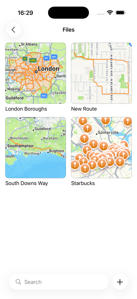
Screenshot of the Geodata Map Viewer app gallery showing various map files like London Boroughs and South Downs Way
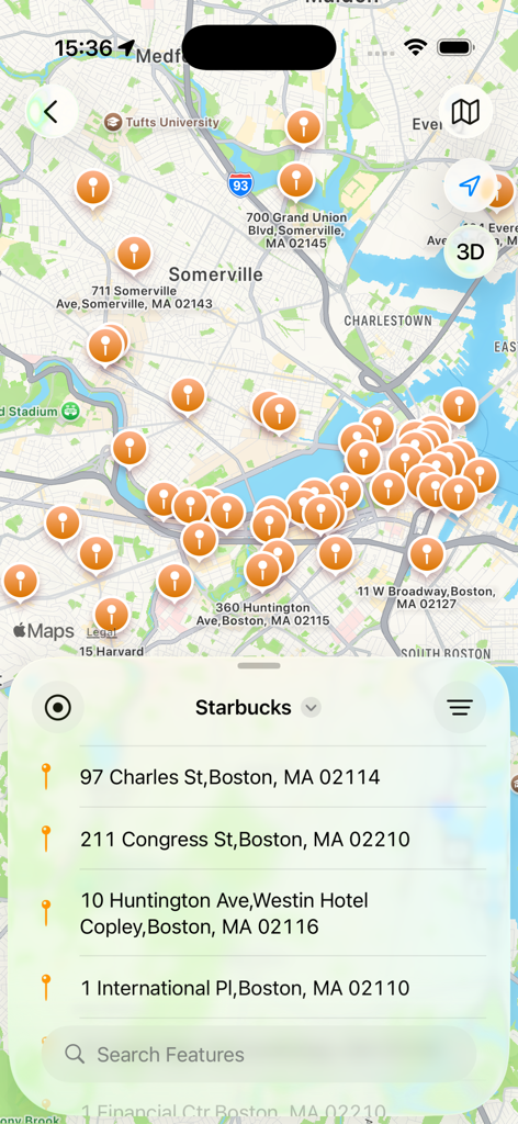
Geodata Map Viewer app interface showing a map of Boston with multiple location markers and a list of Starbucks addresses
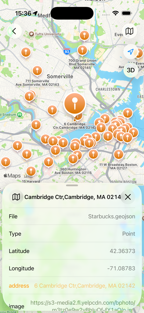
Geodata Map Viewer app showing metadata details for a GeoJSON point on an interactive map
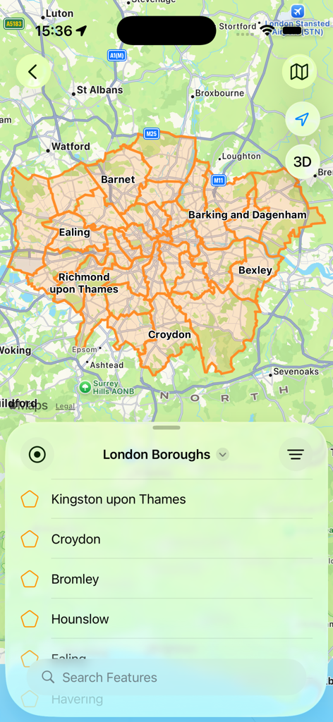
Geodata Map Viewer showing London borough boundaries with a searchable feature list from a GeoJSON file
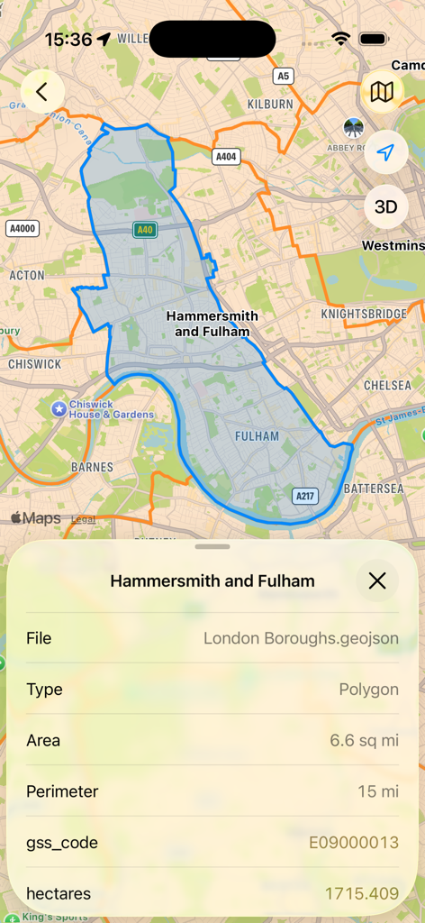
A screenshot of the Geodata Map Viewer app showing a highlighted London borough on a map with its associated GeoJSON metadata like area and perimeter.
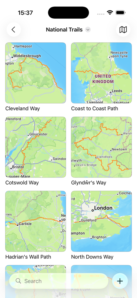
Geodata Map Viewer app screen showing national trails organized in folders with map route previews
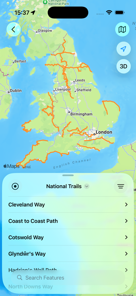
Geodata Map Viewer showing national trails across a map of the United Kingdom
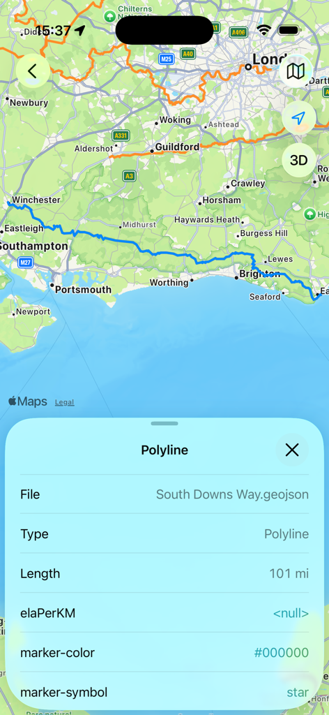
Geodata Map Viewer displaying a 101-mile GeoJSON route on a map with its associated metadata properties
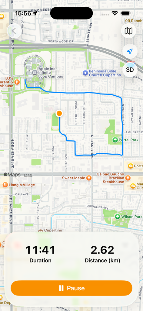
Geodata Map Viewer interface showing a tracked GPS route on a map with duration and distance statistics
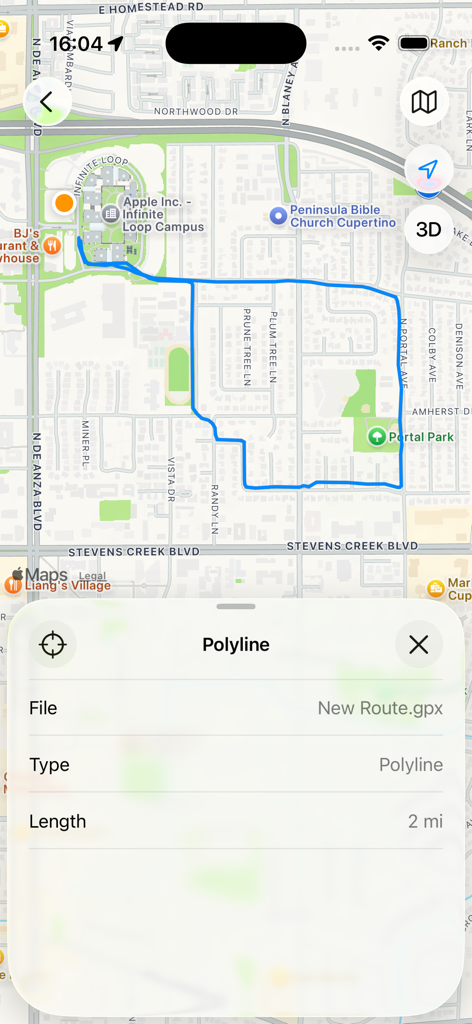
Map view showing a recorded GPX route with polyline metadata details and a total length of two miles
Description
Download
More Like This
Top-ranked apps in the same category

Google Maps
Google LLC

Waze Navigation & Live Traffic
waze

AMap Global
AutoNavi Information Technology Co. Ltd.

百度地图-路线规划,出行必备
Beijing Baidu Netcom Science & Technology Co.,Ltd

Moovit: Bus & Transit Tracker
Moovit App Global LTD

Transit • Subway & Bus Times
9280-0366 Quebec inc.

ParkMobile: Park. Pay. Go.
Parkmobile USA, Inc

腾讯地图-路线规划,导航地铁打车出行
Shenzhen Tencent Computer Systems Company Limited

Île-de-France Mobilités
Ile de France Mobilites
This page is not an official page of the app or its developer, but an independent editorial publication created for informational and commentary purposes. Unless expressly stated otherwise, neither the app nor its developer is affiliated with, endorsed by, sponsored by, authorized by, or otherwise officially connected with MWM, Apple, Google Play, the app publisher, or the app's developer, and nothing on this page implies that the app was developed using MWM's services. Any trademarks, logos, screenshots, and other content remain the property of their respective owners.