This page is not an official page of the app or its developer, but an independent editorial publication created for informational and commentary purposes. Unless expressly stated otherwise, neither the app nor its developer is affiliated with, endorsed by, sponsored by, authorized by, or otherwise officially connected with MWM, Apple, Google Play, the app publisher, or the app's developer, and nothing on this page implies that the app was developed using MWM's services. Any trademarks, logos, screenshots, and other content remain the property of their respective owners.

GlobeViewer PRO
Explore the Earth in unprecedented detail with high-resolution NASA elevation data, 7.5 million place names, and real-time global disaster alerts—all optimized for offline professional use.
Downloads
400User Rating
Total Ratings
0Publisher
Category
EducationLocales
18Latest Version
0.12.0Size
236.4 MBFirst Released
Aug 11, 2022Explore Our World in Unprecedented Detail
GlobeViewer PRO transforms your device into a professional-grade 3D atlas, combining high-resolution NASA topography with real-time global monitoring for the ultimate armchair explorer.
High-Resolution 3D Topography
Experience the Earth's surface and underwater terrain in stunning 3D using precision NASA elevation data and over 22,000 individual high-res tiles.
Live Global Hazard Tracking
Stay ahead of global events with integrated GDACS alerts, visualizing earthquakes, hurricanes, and floods directly on your interactive globe.
The following screenshots and description are sourced directly from the app's official store listing and are the property of the app developer.
App Store
Screenshots
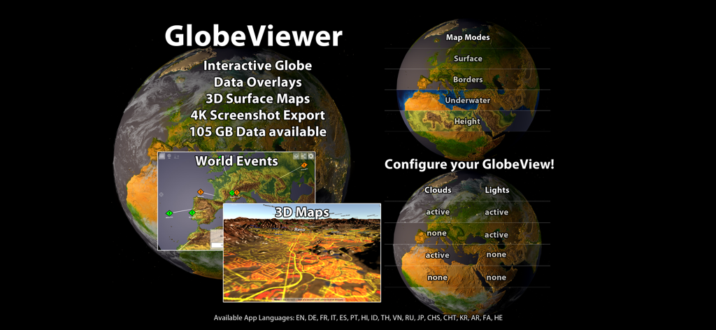
Interface of GlobeViewer PRO displaying 3D interactive globe world event tracking and high-resolution topographical map modes
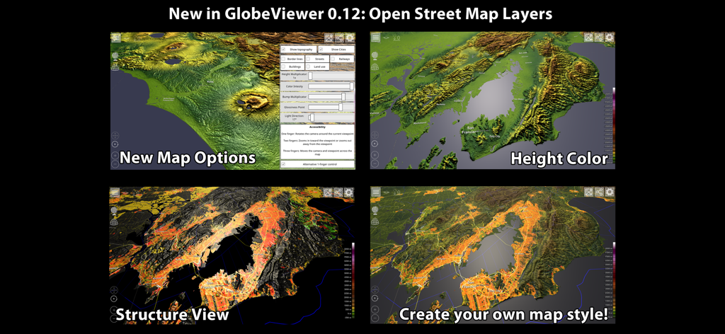
Comparison of 3D topography map styles and Open Street Map layers in GlobeViewer PRO
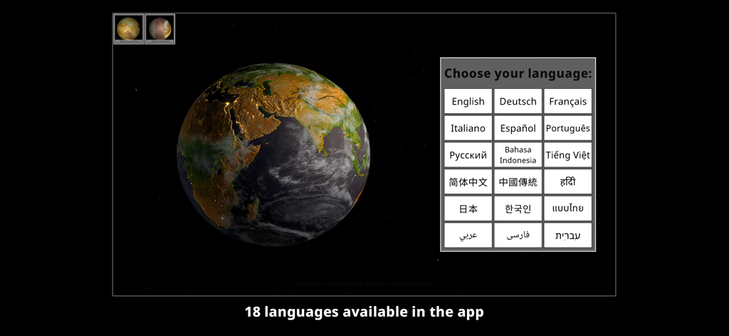
A 3D rendering of the Earth with a language selection menu showing eighteen supported languages.
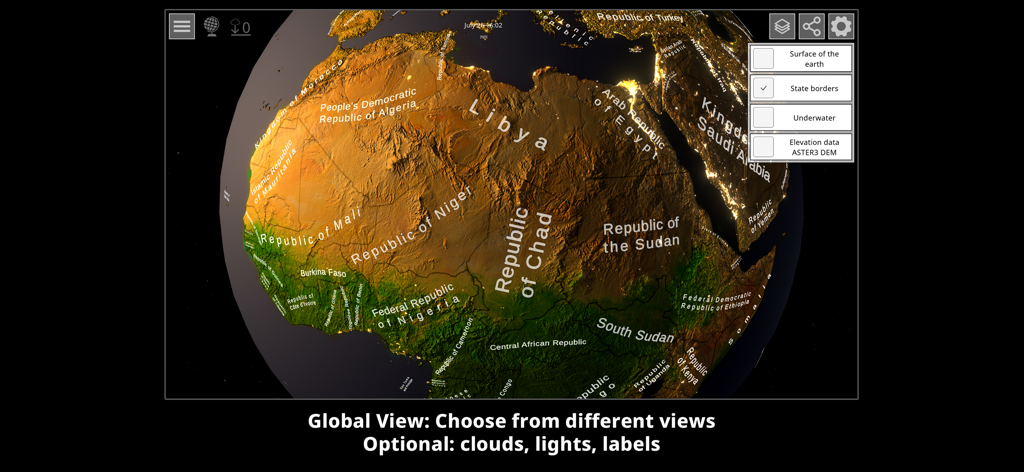
High resolution 3D globe view showing topography and state borders of Africa
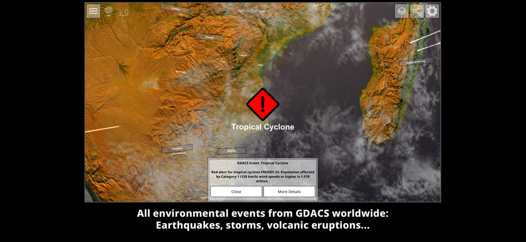
3D topographic map view showing a tropical cyclone warning and GDACS environmental event details
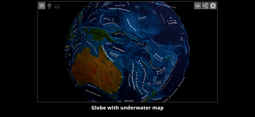
High resolution 3D globe view displaying detailed underwater topography and ocean floor geographical labels near Australia
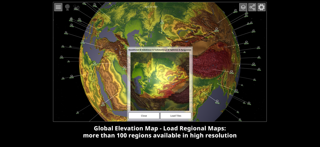
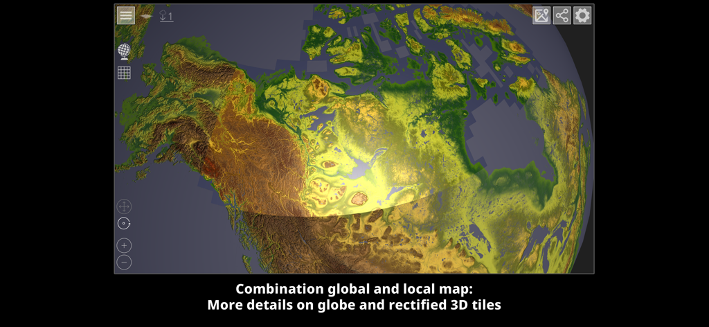
3D topography globe showing high resolution regional elevation maps
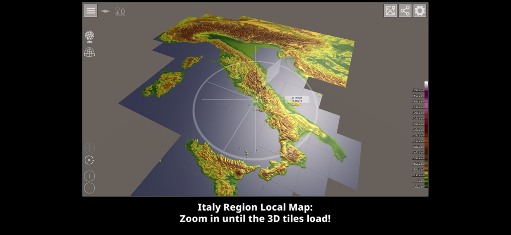
High resolution 3D topographic map of Italy in GlobeViewer PRO
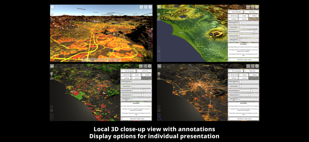
Detailed 3D topographic map views and visualization settings in GlobeViewer PRO
High resolution 3D topography map of North America in GlobeViewer PRO
Description
Download
More Like This
Top-ranked apps in the same category

Duolingo - Language Lessons
Duolingo, Inc

Speak & Learn English: Learna
DEEP FLOW SOFTWARE SERVICES - FZCO

驾考宝典-科一科四驾驶证考试驾考通
Wuhan Jiakaobaodian Information Service Co., Ltd.

Toca Boca World
Toca Boca AB

Google Classroom
Google LLC

作业帮-中小学家长作业检查和辅导工具
Guangzhou Polar Future Culture Technology Co., Ltd

学信网
Student Information Consultation Service Co., Ltd.

Gauth: AI Study Companion
GAUTHTECH PTE. LTD.

ArtWorkout: Learn How to Draw
Aleksandr Ulitin
This page is not an official page of the app or its developer, but an independent editorial publication created for informational and commentary purposes. Unless expressly stated otherwise, neither the app nor its developer is affiliated with, endorsed by, sponsored by, authorized by, or otherwise officially connected with MWM, Apple, Google Play, the app publisher, or the app's developer, and nothing on this page implies that the app was developed using MWM's services. Any trademarks, logos, screenshots, and other content remain the property of their respective owners.