This page is not an official page of the app or its developer, but an independent editorial publication created for informational and commentary purposes. Unless expressly stated otherwise, neither the app nor its developer is affiliated with, endorsed by, sponsored by, authorized by, or otherwise officially connected with MWM, Apple, Google Play, the app publisher, or the app's developer, and nothing on this page implies that the app was developed using MWM's services. Any trademarks, logos, screenshots, and other content remain the property of their respective owners.

GPS Camera: Stamp Photo Map
Instantly add GPS coordinates, timestamps, and live maps to your photos. Whether you are documenting field work or tracking a hike, turn every shot into a data-rich record with precision.
Downloads
0User Rating
Total Ratings
0Publisher
Category
NavigationLocales
11Latest Version
1.0.4Size
59.7 MBFirst Released
Apr 24, 2025Turn Every Photo into a Data-Rich Document
Whether you are documenting a job site or capturing a mountain peak, our app embeds precise GPS coordinates, timestamps, and live maps directly into your images for ultimate proof and organization.
Professional Field Reporting
Generate instant, verifiable documentation for real estate, construction, or insurance claims with unalterable location and time stamps.
Precision Adventure Tagging
Track your journey with altitude, compass directions, and weather data overlays—perfect for hikers, overlanders, and outdoor enthusiasts.
The following screenshots and description are sourced directly from the app's official store listing and are the property of the app developer.
App Store
Screenshots
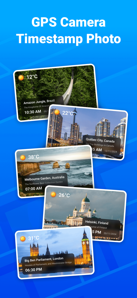
Collage of photos showing GPS location time and weather stamps on various travel destinations
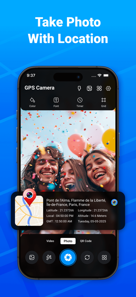
A smartphone interface showing a geotagged photo with map coordinates and timestamp
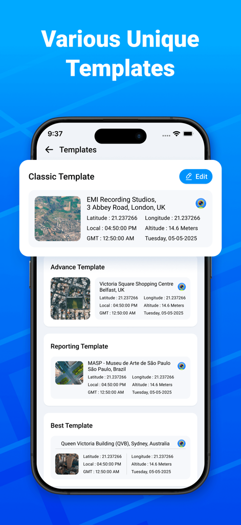
Interface showing various unique templates for geotagging and timestamping photos in the GPS Camera app.
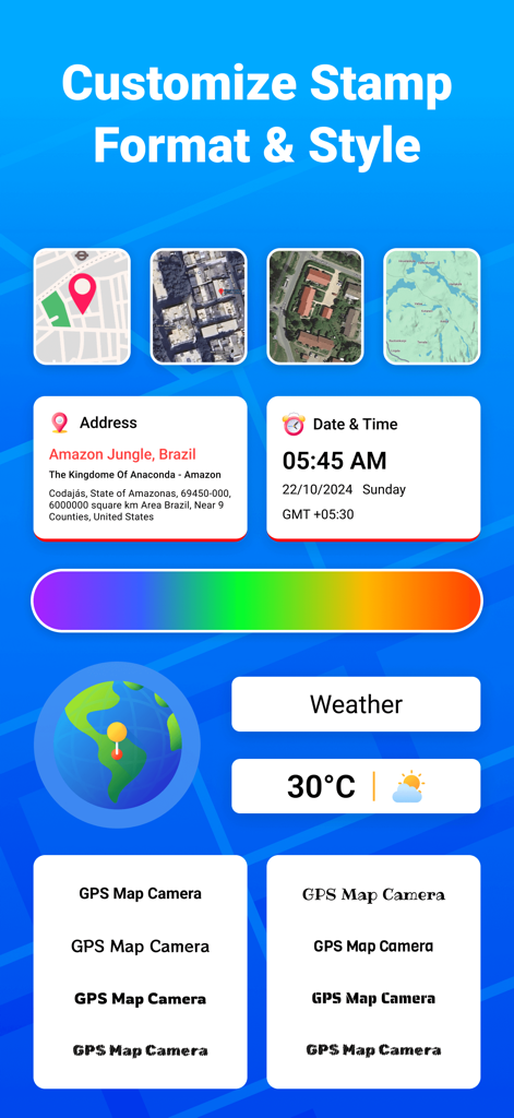
Interface for customizing photo stamp formats including address date time and weather on a map camera app
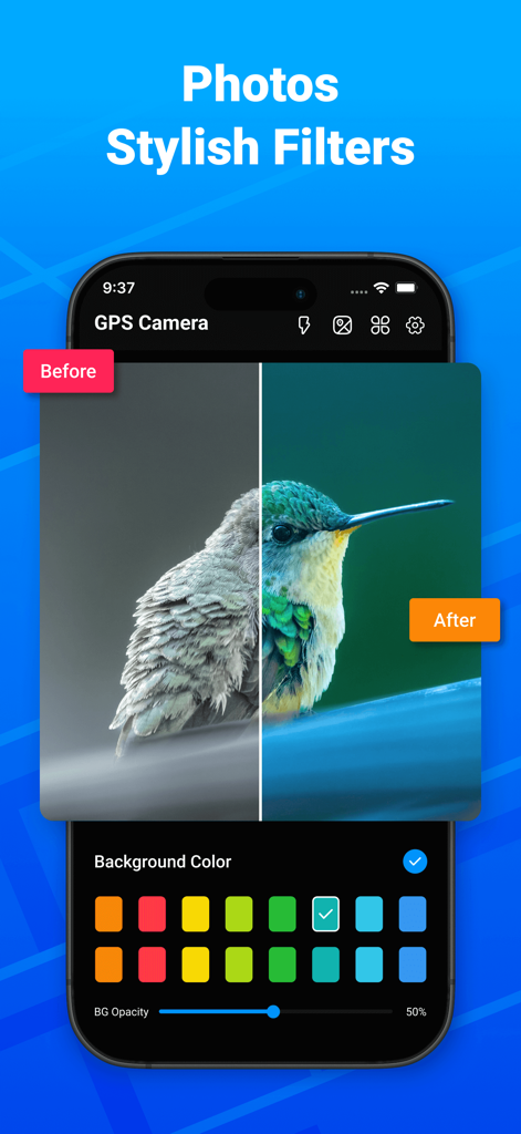
A side-by-side comparison of a hummingbird photo before and after applying stylish filters in the GPS Camera app.
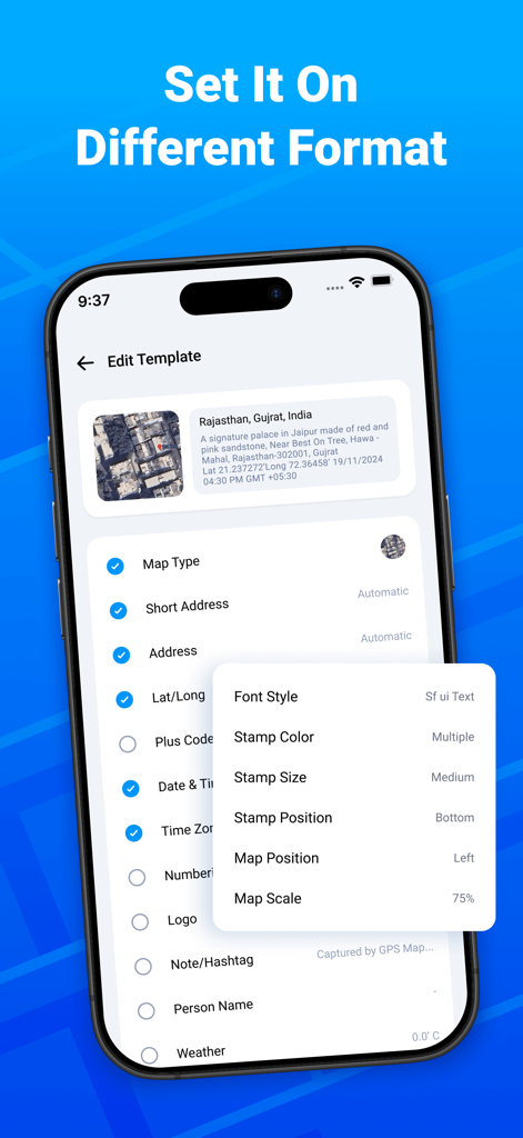
Interface of the GPS Camera app showing the Edit Template screen with options to customize map type address latitude longitude and stamp appearance settings
Description
Download
More Like This
Top-ranked apps in the same category

Google Maps
Google LLC

AMap Global
AutoNavi Information Technology Co. Ltd.

Waze Navigation & Live Traffic
waze

百度地图-路线规划,出行必备
Beijing Baidu Netcom Science & Technology Co.,Ltd

Moovit: Bus & Transit Tracker
Moovit App Global LTD

Transit • Subway & Bus Times
9280-0366 Quebec inc.

MapXplorer: Map Radar Navigate
GOLDLAB APPLICATIONS YAZILIM VE BILISIM ANONIM SIRKETI

ParkMobile: Park. Pay. Go.
Parkmobile USA, Inc

腾讯地图-路线规划,导航地铁打车出行
Shenzhen Tencent Computer Systems Company Limited
This page is not an official page of the app or its developer, but an independent editorial publication created for informational and commentary purposes. Unless expressly stated otherwise, neither the app nor its developer is affiliated with, endorsed by, sponsored by, authorized by, or otherwise officially connected with MWM, Apple, Google Play, the app publisher, or the app's developer, and nothing on this page implies that the app was developed using MWM's services. Any trademarks, logos, screenshots, and other content remain the property of their respective owners.