This page is not an official page of the app or its developer, but an independent editorial publication created for informational and commentary purposes. Unless expressly stated otherwise, neither the app nor its developer is affiliated with, endorsed by, sponsored by, authorized by, or otherwise officially connected with MWM, Apple, Google Play, the app publisher, or the app's developer, and nothing on this page implies that the app was developed using MWM's services. Any trademarks, logos, screenshots, and other content remain the property of their respective owners.

GPS Fields Area Measure App
Accurately measure acreage, plan multi-stop routes, and navigate safely with professional-grade tools designed for landowners, contractors, and outdoor enthusiasts.
Downloads
14K+User Rating
Total Ratings
0Publisher
Category
NavigationLocales
16Latest Version
1.0Size
149.8 MBFirst Released
Dec 10, 2024The Ultimate Digital Toolkit for Land and Road
From calculating acreage for landscaping projects to navigating rural routes with a high-tech HUD, we provide every professional tool you need in one powerful app.
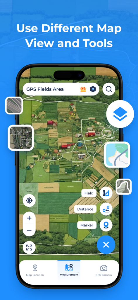
Precise Land & Area Calculation
Easily measure acres, square feet, or perimeters by marking points on the map. Ideal for fencing, farming, and property management.
Geotagged GPS Camera
Document your work with photos that automatically include latitude, longitude, and timestamps for professional record-keeping.
The following screenshots and description are sourced directly from the app's official store listing and are the property of the app developer.
App Store
Screenshots
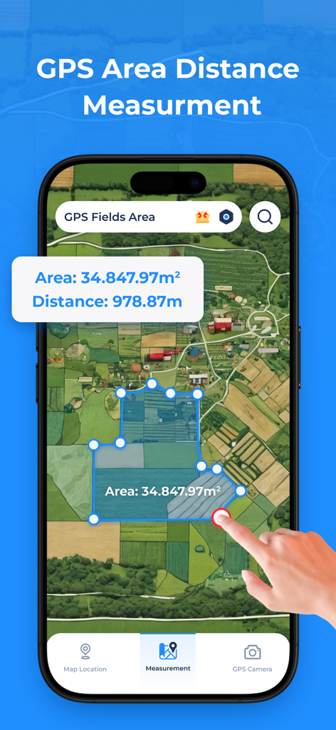
A smartphone app displaying a satellite map with a measured field area and distance calculation.
GPS Fields Area Measure app showing satellite map view and land measurement tools
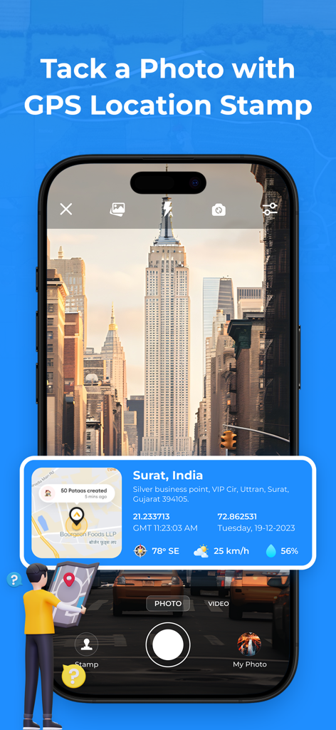
Smartphone screen showing the GPS camera feature with an overlay of location coordinates and a map on a photo.
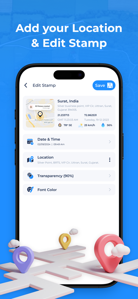
A mobile screen showing options to edit a GPS location stamp including date time and coordinates
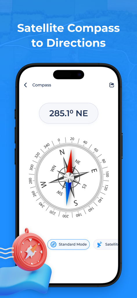
GPS Fields Area Measure app showing a digital compass with directional degrees and satellite mode
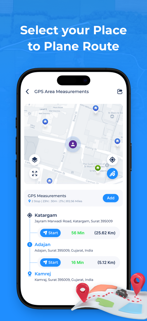
GPS Fields Area Measure App showing a multi stop route planner with map navigation and travel times

List of famous world landmarks like the Great Wall of China and Petra in the GPS navigation app

Interface of the GPS Fields Area Measure app showing the route finder feature with source and destination inputs and search history
Description
Download
More Like This
Top-ranked apps in the same category

Google Maps
Google LLC

Waze Navigation & Live Traffic
waze

AMap Global
AutoNavi Information Technology Co. Ltd.

百度地图-路线规划,出行必备
Beijing Baidu Netcom Science & Technology Co.,Ltd

Moovit: Bus & Transit Tracker
Moovit App Global LTD

Transit • Subway & Bus Times
9280-0366 Quebec inc.

ParkMobile: Park. Pay. Go.
Parkmobile USA, Inc

腾讯地图-路线规划,导航地铁打车出行
Shenzhen Tencent Computer Systems Company Limited

Île-de-France Mobilités
Ile de France Mobilites
This page is not an official page of the app or its developer, but an independent editorial publication created for informational and commentary purposes. Unless expressly stated otherwise, neither the app nor its developer is affiliated with, endorsed by, sponsored by, authorized by, or otherwise officially connected with MWM, Apple, Google Play, the app publisher, or the app's developer, and nothing on this page implies that the app was developed using MWM's services. Any trademarks, logos, screenshots, and other content remain the property of their respective owners.