This page is not an official page of the app or its developer, but an independent editorial publication created for informational and commentary purposes. Unless expressly stated otherwise, neither the app nor its developer is affiliated with, endorsed by, sponsored by, authorized by, or otherwise officially connected with MWM, Apple, Google Play, the app publisher, or the app's developer, and nothing on this page implies that the app was developed using MWM's services. Any trademarks, logos, screenshots, and other content remain the property of their respective owners.

GPS Waypoints Lite
Turn your device into a precision mapping tool. Capture waypoints, create custom survey themes, and export seamless data in KML, CSV, or GPX formats for GIS and field analysis.
Downloads
87K+User Rating
Total Ratings
0Publisher
Category
NavigationLocales
1Latest Version
2.6.4Size
42.0 MBFirst Released
Jul 29, 2021Professional Mapping Made Simple
Transform your mobile device into a high-precision surveying tool. Collect, classify, and export field data with professional-grade accuracy and seamless workflow integration.
Pro-Grade Data Export
Seamlessly move your data to desktop GIS tools or CAD software with support for KML, GPX, CSV, and GeoJSON formats.
Custom Survey Themes
Organize your fieldwork with custom tags and themes to classify points and paths exactly how your professional project requires.
The following screenshots and description are sourced directly from the app's official store listing and are the property of the app developer.
App Store
Screenshots
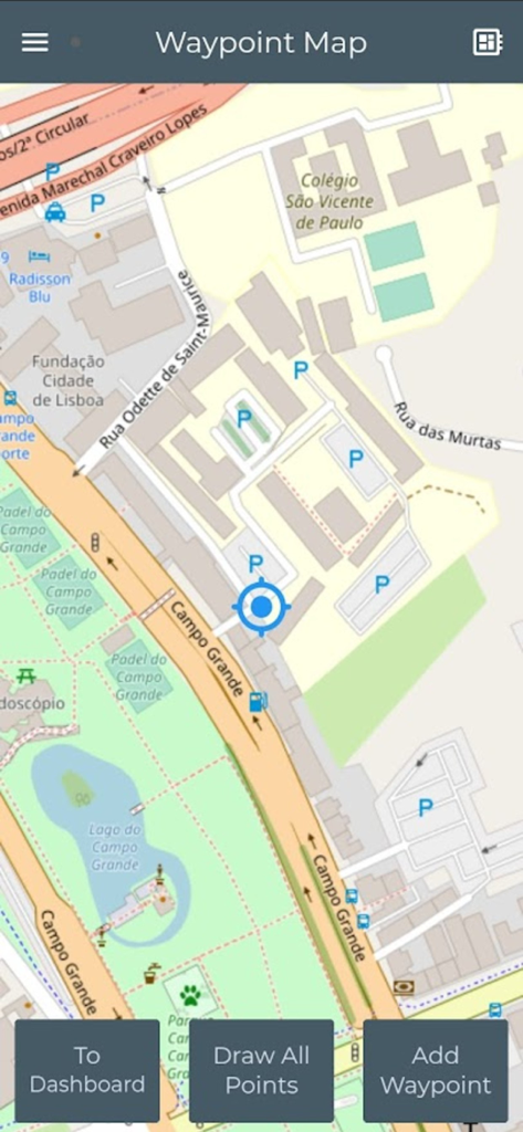
GPS Waypoints Lite map interface showing location markers and surveying tools
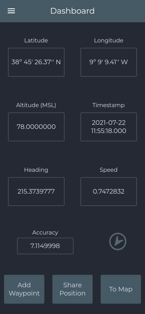
GPS Waypoints Lite dashboard showing real-time coordinate data and surveying options
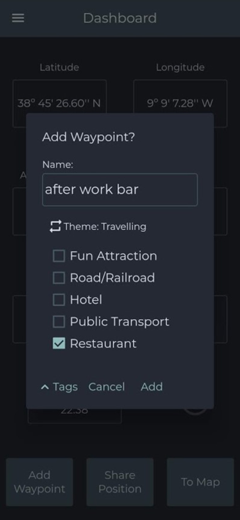
GPS Waypoints Lite app interface showing a popup to add a new waypoint with latitude and longitude coordinates and custom category tags
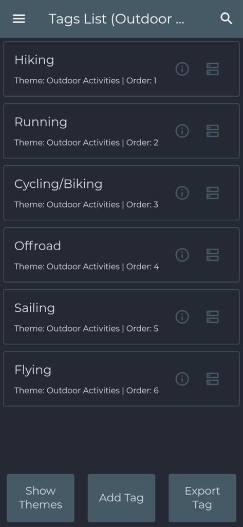
Screen displaying outdoor activity tags for hiking running and cycling in the GPS Waypoints Lite app
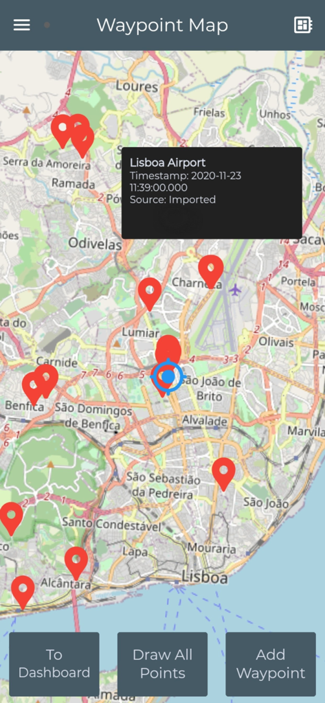
GPS Waypoints Lite map interface showing multiple red waypoint pins across a city map with a detailed info popup for Lisboa Airport.
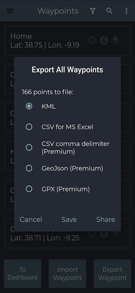
Export dialog in GPS Waypoints Lite showing KML CSV and GPX format options
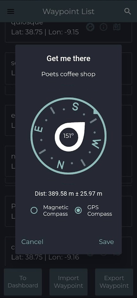
Navigation compass showing distance and accuracy to a saved waypoint
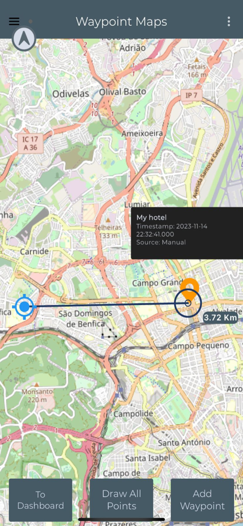
GPS Waypoints Lite map interface showing a waypoint and distance measurement.
Description
Download
More Like This
Top-ranked apps in the same category

Google Maps
Google LLC

Waze Navigation & Live Traffic
waze

AMap Global
AutoNavi Information Technology Co. Ltd.

百度地图-路线规划,出行必备
Beijing Baidu Netcom Science & Technology Co.,Ltd

Moovit: Bus & Transit Tracker
Moovit App Global LTD

Transit • Subway & Bus Times
9280-0366 Quebec inc.

ParkMobile: Park. Pay. Go.
Parkmobile USA, Inc

腾讯地图-路线规划,导航地铁打车出行
Shenzhen Tencent Computer Systems Company Limited

Île-de-France Mobilités
Ile de France Mobilites
This page is not an official page of the app or its developer, but an independent editorial publication created for informational and commentary purposes. Unless expressly stated otherwise, neither the app nor its developer is affiliated with, endorsed by, sponsored by, authorized by, or otherwise officially connected with MWM, Apple, Google Play, the app publisher, or the app's developer, and nothing on this page implies that the app was developed using MWM's services. Any trademarks, logos, screenshots, and other content remain the property of their respective owners.