This page is not an official page of the app or its developer, but an independent editorial publication created for informational and commentary purposes. Unless expressly stated otherwise, neither the app nor its developer is affiliated with, endorsed by, sponsored by, authorized by, or otherwise officially connected with MWM, Apple, Google Play, the app publisher, or the app's developer, and nothing on this page implies that the app was developed using MWM's services. Any trademarks, logos, screenshots, and other content remain the property of their respective owners.

Hawaii Ocean Map
Navigate with 3-meter resolution NOAA bathymetry, offline maps, and integrated fishing zones. No subscriptions—just the most precise depth data for Hawaii’s waters.
Downloads
100+User Rating
Total Ratings
0Publisher
Category
NavigationLocales
1Latest Version
1.3.0Size
14.2 MBFirst Released
Dec 7, 2025Navigate Hawaii's Waters with Confidence
Get professional-grade seafloor mapping, offline reliability, and real-time fishing regulations—all in one high-precision app with no monthly subscriptions.
Pro-Grade Seafloor Detail
Locate hidden reefs, ledges, and channels using 3-meter resolution NOAA data, giving you a professional edge for fishing and diving.
Reliable Offline Navigation
Cell service isn't required. Download high-detail maps to your device and explore the deep ocean without worrying about losing connectivity.
The following screenshots and description are sourced directly from the app's official store listing and are the property of the app developer.
App Store
Screenshots
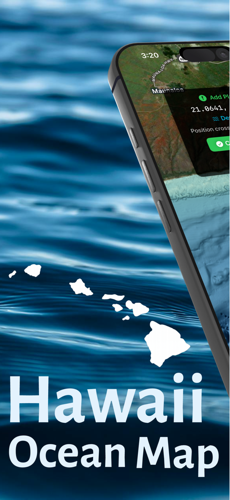
Hawaii Ocean Map app displaying navigation interface and Hawaiian Islands silhouette
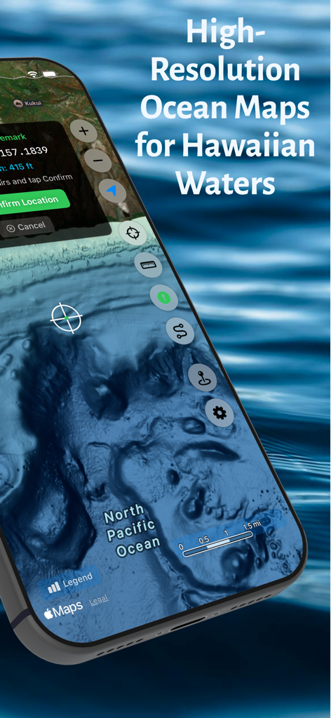
High resolution bathymetry map showing seafloor topography for Hawaiian waters
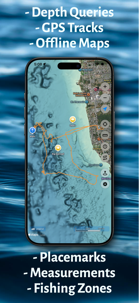
Hawaii Ocean Map app interface showing underwater bathymetry with orange GPS tracks and fishing markers.
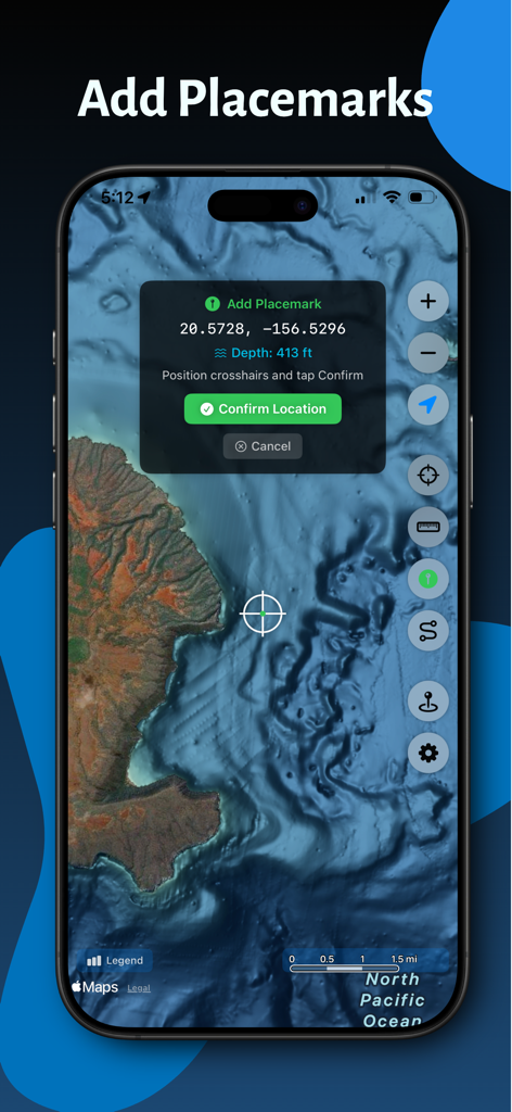
Screenshot of Hawaii Ocean Map app showing the feature to add a custom placemark with coordinates and depth data on a nautical chart
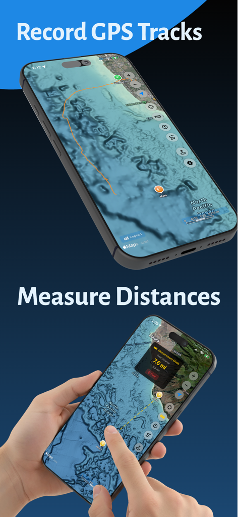
Screenshots of Hawaii Ocean Map app showing GPS track recording and seafloor distance measurement.
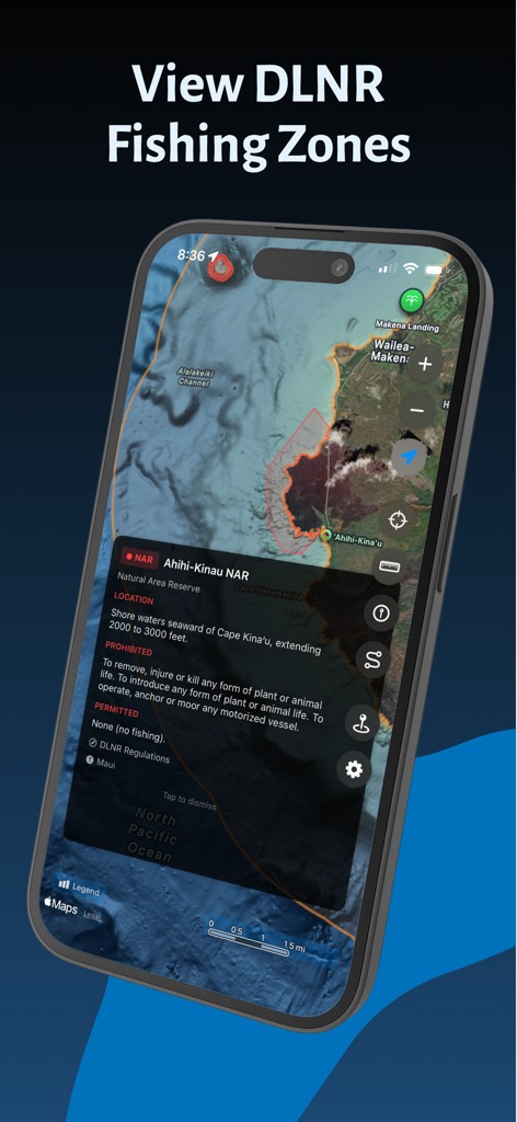
Hawaii Ocean Map app displaying DLNR fishing restriction zones and regulations on a high-resolution marine map.
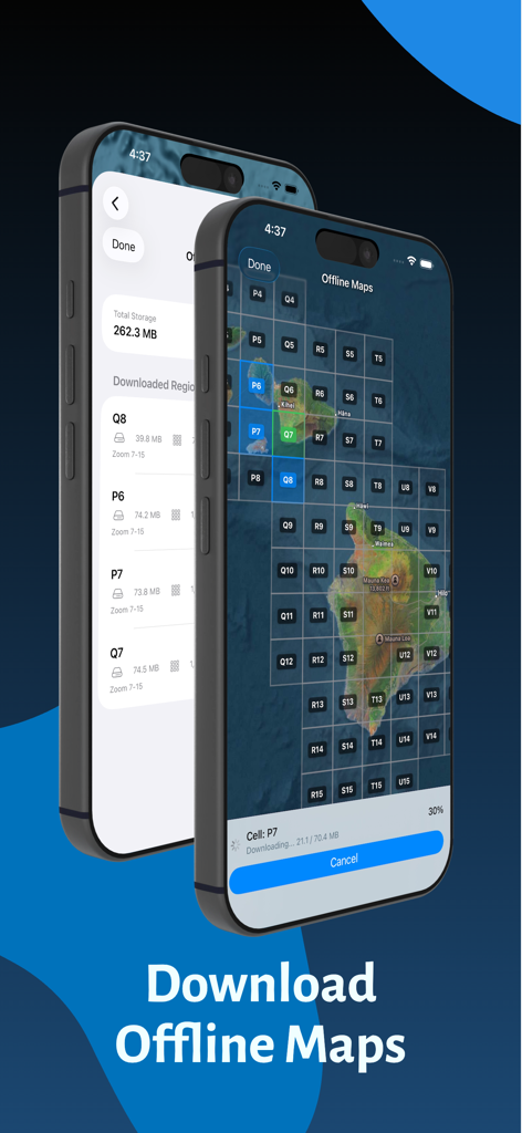
Interface for downloading offline ocean maps of Hawaii
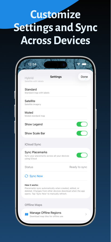
Hawaii Ocean Map app settings and iCloud sync screen
Description
Download
More Like This
Top-ranked apps in the same category

Google Maps
Google LLC

AMap Global
AutoNavi Information Technology Co. Ltd.

Waze Navigation & Live Traffic
waze

百度地图-路线规划,出行必备
Beijing Baidu Netcom Science & Technology Co.,Ltd

Moovit: Bus & Transit Tracker
Moovit App Global LTD

腾讯地图-路线规划,导航地铁打车出行
Shenzhen Tencent Computer Systems Company Limited

Transit • Subway & Bus Times
9280-0366 Quebec inc.

ParkMobile: Park. Pay. Go.
Parkmobile USA, Inc

MapXplorer: Map Radar Navigate
GOLDLAB APPLICATIONS YAZILIM VE BILISIM ANONIM SIRKETI
This page is not an official page of the app or its developer, but an independent editorial publication created for informational and commentary purposes. Unless expressly stated otherwise, neither the app nor its developer is affiliated with, endorsed by, sponsored by, authorized by, or otherwise officially connected with MWM, Apple, Google Play, the app publisher, or the app's developer, and nothing on this page implies that the app was developed using MWM's services. Any trademarks, logos, screenshots, and other content remain the property of their respective owners.