This page is not an official page of the app or its developer, but an independent editorial publication created for informational and commentary purposes. Unless expressly stated otherwise, neither the app nor its developer is affiliated with, endorsed by, sponsored by, authorized by, or otherwise officially connected with MWM, Apple, Google Play, the app publisher, or the app's developer, and nothing on this page implies that the app was developed using MWM's services. Any trademarks, logos, screenshots, and other content remain the property of their respective owners.

i-Boating:HD Gps Marine Charts
Navigate with confidence using high-definition NOAA charts, 1ft bathymetry for precision fishing, and real-time voice-guided routing—all on the device you already own.
Downloads
15K+User Rating
Total Ratings
200Publisher
Category
SportsLocales
8Latest Version
154.0.0Size
48.6 MBFirst Released
Mar 20, 2017Navigate with Professional Confidence
Transform your mobile device into a professional-grade chartplotter. From high-definition bathymetry for anglers to voice-guided routing for cruisers, get the precision you need to master the water.
HD Marine Vector Charts
Access detailed NOAA and USACE data with 1ft depth contours, perfect for identifying fishing honey holes and navigating shallow waters with total safety.
Voice-Guided Marine GPS
The first marine app with voice prompts. Get real-time alerts for route markers and off-course warnings without ever taking your eyes off the horizon.
The following screenshots and description are sourced directly from the app's official store listing and are the property of the app developer.
App Store
Screenshots
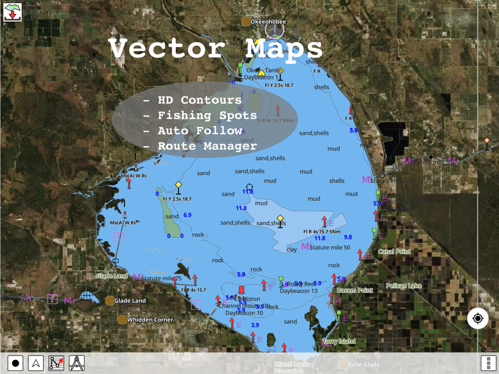
HD vector marine charts with depth contours and fishing spots in the i-Boating app
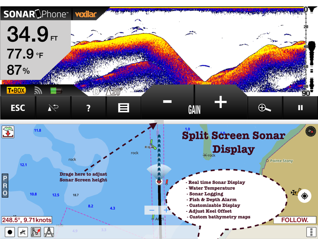
Split screen view of the i-Boating app displaying real-time sonar data and nautical navigation charts on an iPad.
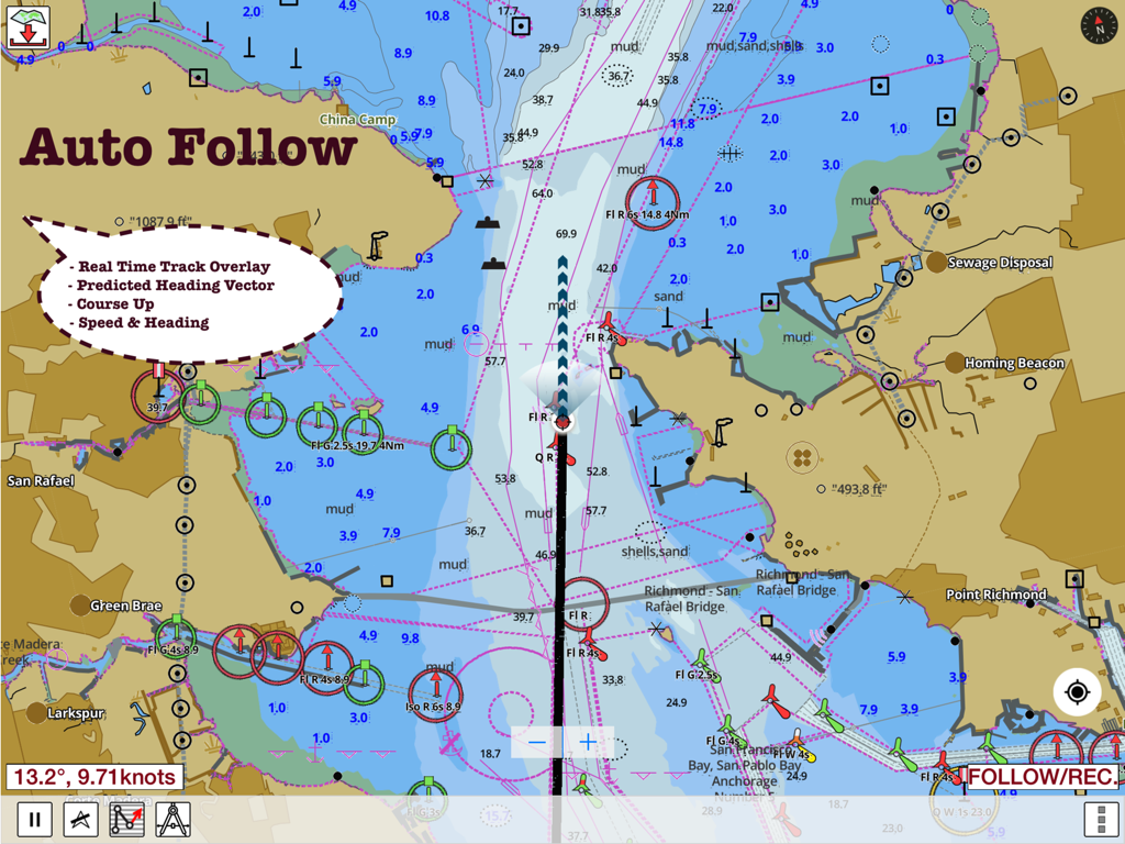
i-Boating app screen showing marine chart with auto-follow and real-time navigation data
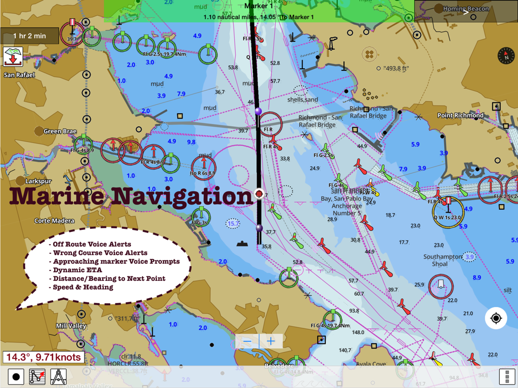
Detailed nautical map in the i-Boating app featuring route assistance and marine navigation voice alerts.
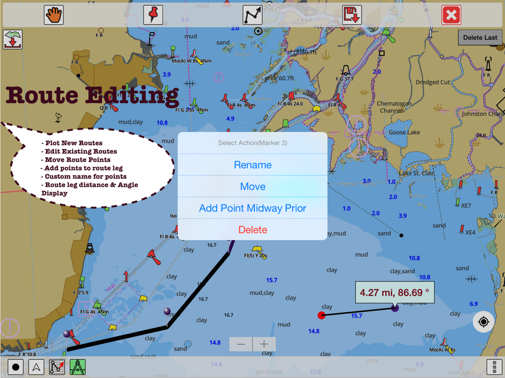
Interface of the i-Boating app showing route editing features and distance measurements on a marine GPS chart
Description
Download
More Like This
Apps with similar features and user experience

PredictWind — Marine Forecasts
PredictWind Limited

Navily
The Navigation Family

Argo - Boating Navigation
Argo Navigation, LLC

SEAiq Pilot
Sakhalin, LLC

Maptrails
Pasi Salenius

KartenWerft NavGo 2.0
KartenWerft GmbH

MarineTraffic - Ship Tracking
MARINETRAFFIC APPLICATIONS LTD

Wavve Boating: Marine Boat GPS
Wavve Boating Inc

Savvy Navvy Boating Navigation
SAVVY NAVVY LTD
This page is not an official page of the app or its developer, but an independent editorial publication created for informational and commentary purposes. Unless expressly stated otherwise, neither the app nor its developer is affiliated with, endorsed by, sponsored by, authorized by, or otherwise officially connected with MWM, Apple, Google Play, the app publisher, or the app's developer, and nothing on this page implies that the app was developed using MWM's services. Any trademarks, logos, screenshots, and other content remain the property of their respective owners.