This page is not an official page of the app or its developer, but an independent editorial publication created for informational and commentary purposes. Unless expressly stated otherwise, neither the app nor its developer is affiliated with, endorsed by, sponsored by, authorized by, or otherwise officially connected with MWM, Apple, Google Play, the app publisher, or the app's developer, and nothing on this page implies that the app was developed using MWM's services. Any trademarks, logos, screenshots, and other content remain the property of their respective owners.

Maptrails
Master the outdoors with offline topographic maps, technical GIS layers, and seamless sync across your iPhone, iPad, Mac, and Apple Watch. All the power you need for hiking, hunting, and exploring—without the subscription fatigue.
Downloads
30K+User Rating
Total Ratings
300Publisher
Category
NavigationLocales
11Latest Version
2025.7.2Size
28.0 MBFirst Released
Aug 2, 2020Advanced Navigation for the Serious Adventurer
Maptrails delivers professional-grade mapping and seamless Apple ecosystem integration for technical hikers, hunters, and navigators—all with no subscriptions.
Seamless Apple Ecosystem Sync
Plan your trek on your Mac or iPad with Apple Pencil support, then navigate with confidence using your iPhone and Apple Watch via instant iCloud sync.
Professional Data & Offline Maps
Import GPX, KML, and Shapefiles for precision planning. Download map tiles for 100% offline reliability even in the deepest backcountry.
The following screenshots and description are sourced directly from the app's official store listing and are the property of the app developer.
App Store
Screenshots
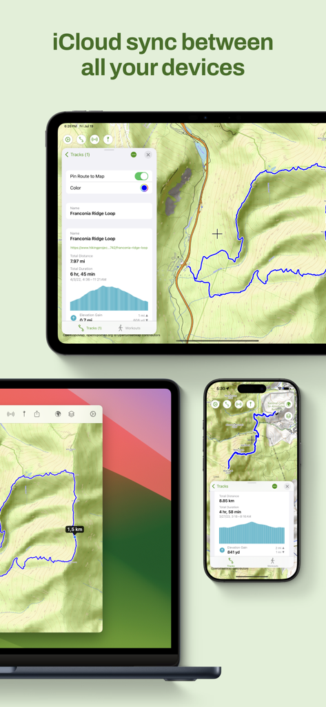
Maptrails app interface on iPad Mac and iPhone showing iCloud synchronization of hiking maps and tracks.
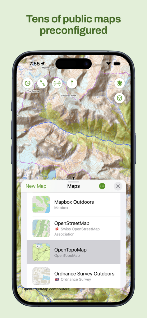
iPhone screenshot of Maptrails app showing a topographic map and a list of preconfigured public maps like OpenTopoMap
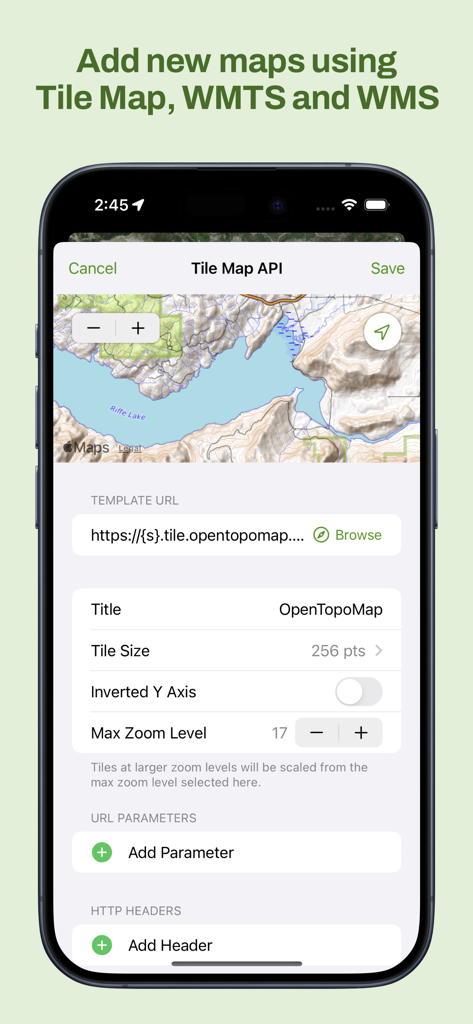
Maptrails app interface for adding custom Tile Map WMTS and WMS layers
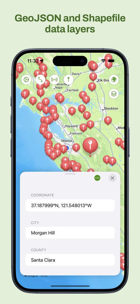
Maptrails app interface showing GeoJSON and Shapefile map layers with location pins and coordinates
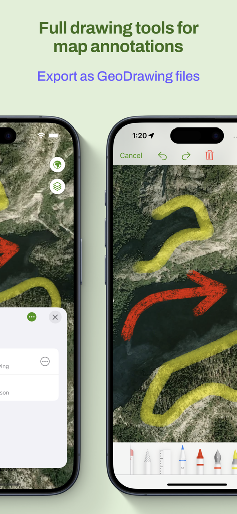
Smartphone screen showing map annotations with various colored drawing tools and export options.
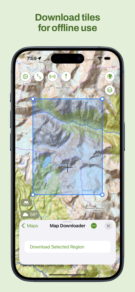
iPhone screenshot showing the Maptrails app interface for selecting and downloading topographic map tiles for offline use
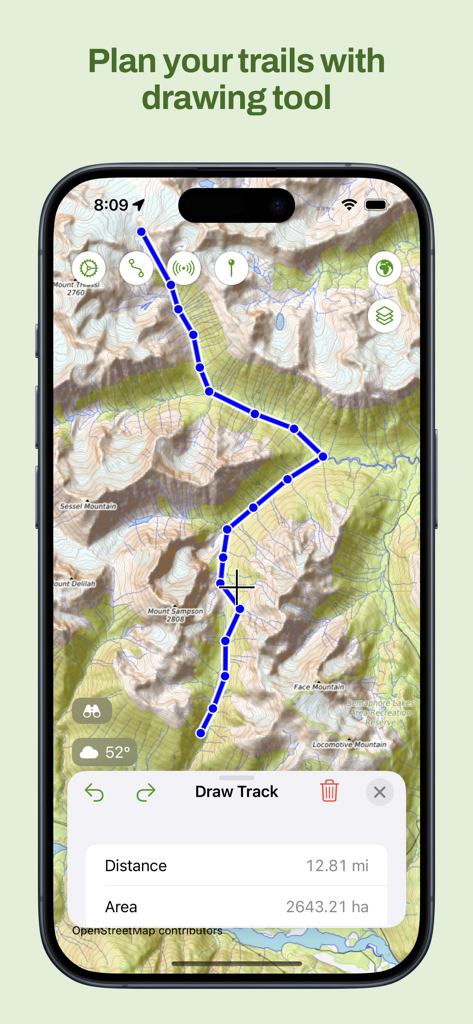
iPhone screen showing the Maptrails app topographic map with a custom hiking path drawn using the track planning tool.
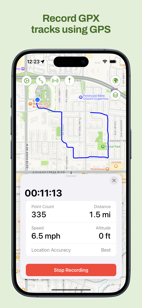
Maptrails iPhone app recording a GPX track on a map with real-time distance and speed data
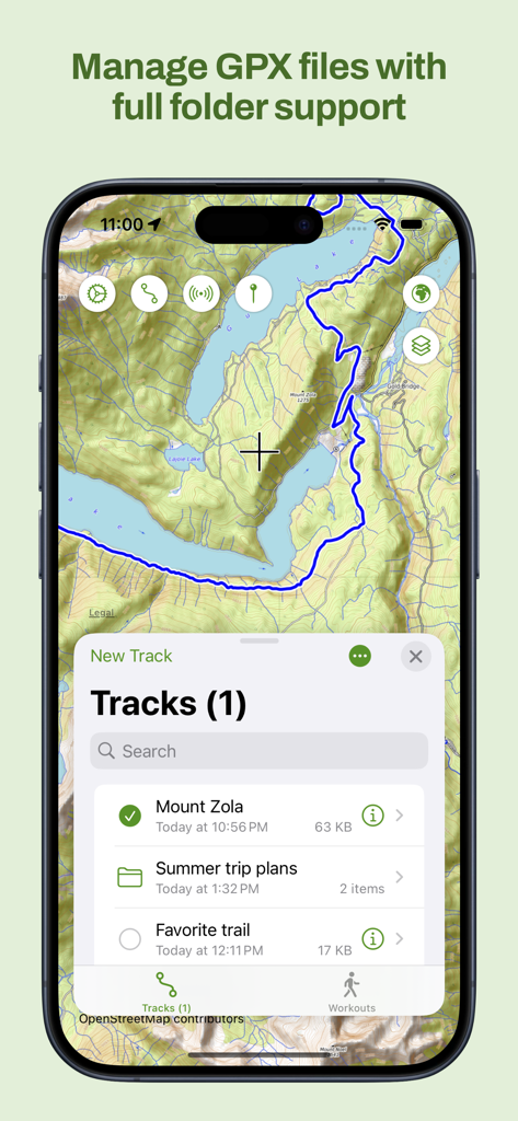
Maptrails app interface showing GPX track management with folder support on a topographic map
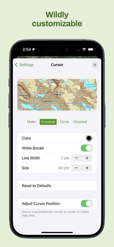
Maptrails app interface showing detailed cursor customization options like color and size over a topographic map
Description
Download
More Like This
Apps with similar features and user experience

PredictWind — Marine Forecasts
PredictWind Limited

Navily
The Navigation Family

Argo - Boating Navigation
Argo Navigation, LLC

SEAiq Pilot
Sakhalin, LLC

KartenWerft NavGo 2.0
KartenWerft GmbH

MarineTraffic - Ship Tracking
MARINETRAFFIC APPLICATIONS LTD

Wavve Boating: Marine Boat GPS
Wavve Boating Inc

Savvy Navvy Boating Navigation
SAVVY NAVVY LTD

Aqua Map Boating
GEC s.r.l.
This page is not an official page of the app or its developer, but an independent editorial publication created for informational and commentary purposes. Unless expressly stated otherwise, neither the app nor its developer is affiliated with, endorsed by, sponsored by, authorized by, or otherwise officially connected with MWM, Apple, Google Play, the app publisher, or the app's developer, and nothing on this page implies that the app was developed using MWM's services. Any trademarks, logos, screenshots, and other content remain the property of their respective owners.