This page is not an official page of the app or its developer, but an independent editorial publication created for informational and commentary purposes. Unless expressly stated otherwise, neither the app nor its developer is affiliated with, endorsed by, sponsored by, authorized by, or otherwise officially connected with MWM, Apple, Google Play, the app publisher, or the app's developer, and nothing on this page implies that the app was developed using MWM's services. Any trademarks, logos, screenshots, and other content remain the property of their respective owners.

iHikeGPS : Classic Topo Maps
Turn your device into a high-performance GPS receiver with detailed USGS and USFS quads. No subscriptions, no ads, and no cell signal required—just professional-grade navigation for the serious explorer.
Downloads
158K+User Rating
Total Ratings
200Publisher
Category
NavigationLocales
1Latest Version
9.6.6Size
12.1 MBFirst Released
Feb 12, 2010Built for the Serious Backcountry Explorer
Navigate with professional-grade USGS topographic quads, advanced track recording, and a privacy-first experience—all for one flat price without subscriptions.
Classic Raster Topo Quads
Access high-resolution USGS and US Forest Service maps that reveal hidden springs, old roads, and terrain details often missing from modern vector maps.
No Subscriptions, Ever
One low price gives you lifetime access. We respect your privacy with no sign-ups, no ads, and no recurring fees to keep your tools working in the field.
The following screenshots and description are sourced directly from the app's official store listing and are the property of the app developer.
App Store
Screenshots
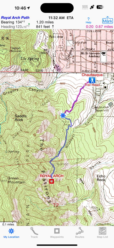
iHikeGPS app screen showing a classic USGS topographic map with a recorded hiking path and navigation data
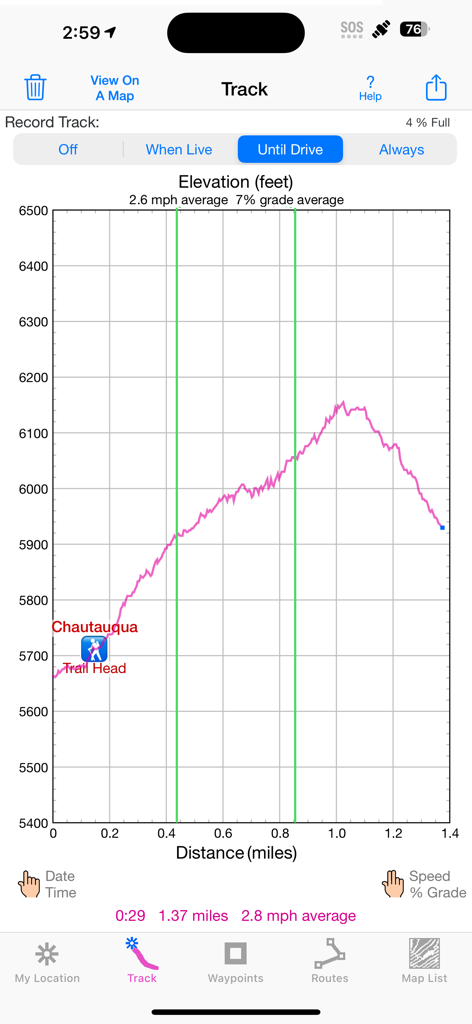
Elevation profile graph of a hiking track showing height in feet and distance in miles
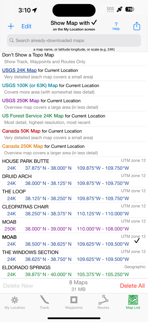
Map list screen in iHikeGPS showing USGS and Canada topo map options and technical coordinates for downloaded maps.
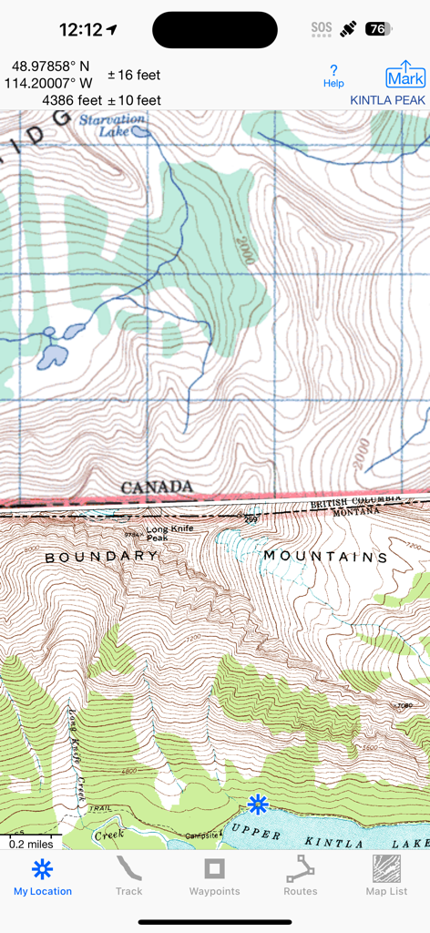
iHikeGPS app interface showing a detailed classic topographic map of the US-Canada border with elevation and GPS coordinates
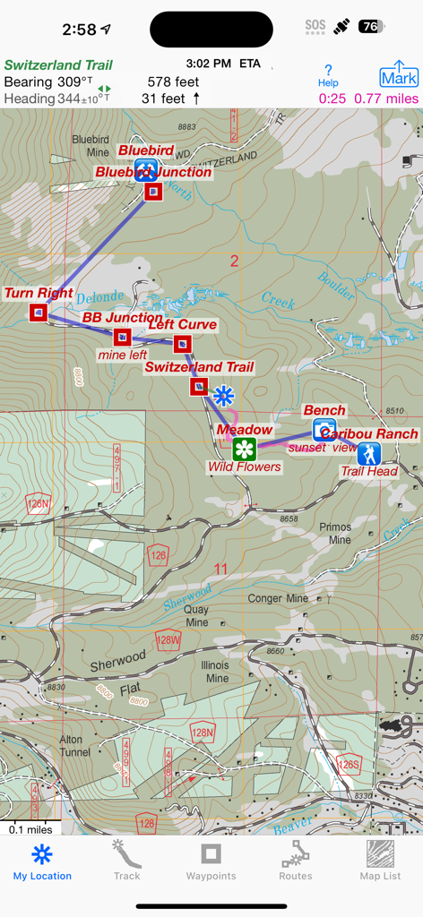
iHikeGPS app interface showing a classic topographic map with a hiking route and waypoints.
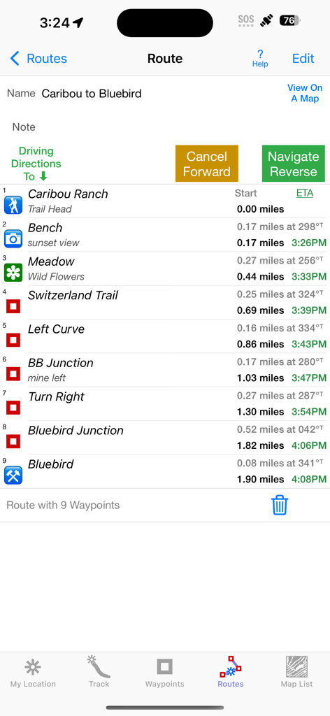
iHikeGPS route screen showing a list of waypoints with distances and estimated times of arrival
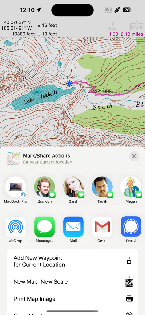
iHikeGPS app interface showing a detailed topo map of Lake Isabelle with sharing and waypoint options.

Detailed hiking route elevation profile showing distance and elevation gain for the Blue Lake trail in iHikeGPS
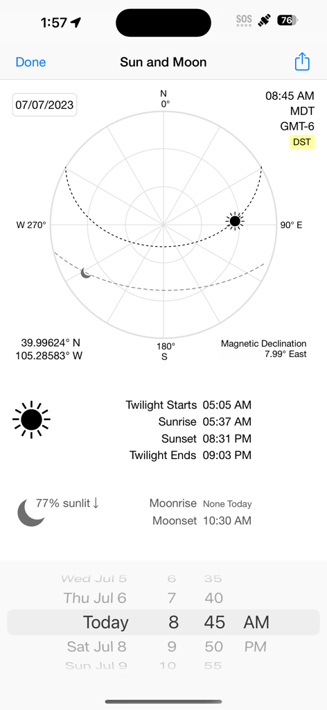
iHikeGPS app screen displaying sun and moon positions, sunrise and sunset times, coordinates, and magnetic declination.
Description
Download
More Like This
Top-ranked apps in the same category

Google Maps
Google LLC

Waze Navigation & Live Traffic
waze

AMap Global
AutoNavi Information Technology Co. Ltd.

百度地图-路线规划,出行必备
Beijing Baidu Netcom Science & Technology Co.,Ltd

Moovit: Bus & Transit Tracker
Moovit App Global LTD

Transit • Subway & Bus Times
9280-0366 Quebec inc.

ParkMobile: Park. Pay. Go.
Parkmobile USA, Inc

腾讯地图-路线规划,导航地铁打车出行
Shenzhen Tencent Computer Systems Company Limited

Île-de-France Mobilités
Ile de France Mobilites
This page is not an official page of the app or its developer, but an independent editorial publication created for informational and commentary purposes. Unless expressly stated otherwise, neither the app nor its developer is affiliated with, endorsed by, sponsored by, authorized by, or otherwise officially connected with MWM, Apple, Google Play, the app publisher, or the app's developer, and nothing on this page implies that the app was developed using MWM's services. Any trademarks, logos, screenshots, and other content remain the property of their respective owners.