This page is not an official page of the app or its developer, but an independent editorial publication created for informational and commentary purposes. Unless expressly stated otherwise, neither the app nor its developer is affiliated with, endorsed by, sponsored by, authorized by, or otherwise officially connected with MWM, Apple, Google Play, the app publisher, or the app's developer, and nothing on this page implies that the app was developed using MWM's services. Any trademarks, logos, screenshots, and other content remain the property of their respective owners.

iHikeGPS NZ : LINZ Topo Maps
The ultimate tool for serious hikers and travelers. Experience high-performance GPS navigation with 100% offline reliability. One price, no subscriptions, no ads—just pure backcountry safety.
Downloads
153K+User Rating
Total Ratings
100Publisher
Category
NavigationLocales
1Latest Version
9.6.6Size
10.6 MBFirst Released
Dec 22, 2011Engineered for the Serious Explorer
Get professional-grade navigation with official LINZ topo maps and advanced GPS features designed for New Zealand's most remote backcountry—all without subscriptions or tracking.
Official Offline Topo Maps
Access high-resolution LINZ 50K maps everywhere. Navigate seamlessly in deep valleys and remote ranges with zero cell signal and no expensive data roaming fees.
Precise Route Intelligence
Stay safe with real-time ETAs, elevation profiles, and off-route alerts. Track your progress with high-performance GPS tools that turn your iPhone into a life-saving device.
The following screenshots and description are sourced directly from the app's official store listing and are the property of the app developer.
App Store
Screenshots
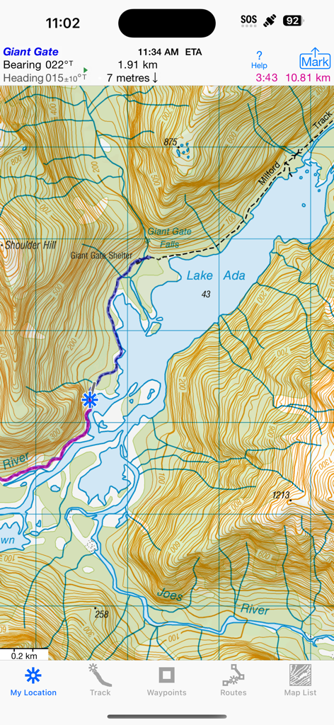
Topographic map display of the Milford Track near Lake Ada in the iHikeGPS NZ app
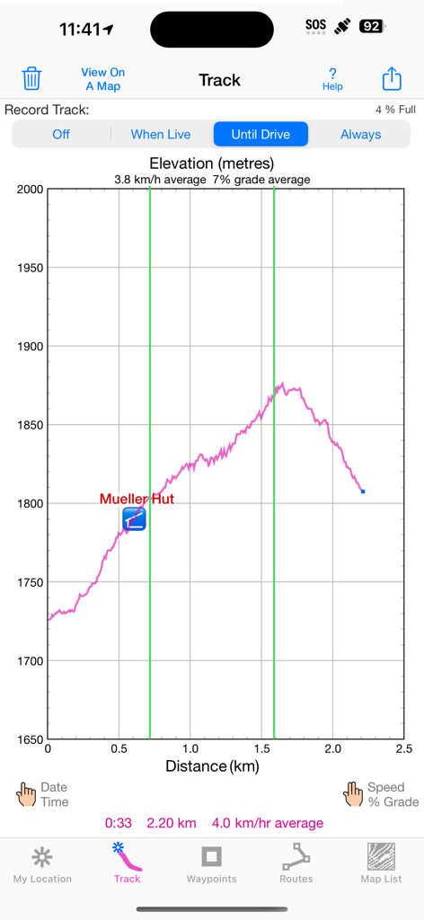
Elevation profile graph showing distance and altitude for a hike to Mueller Hut in the iHikeGPS NZ app.
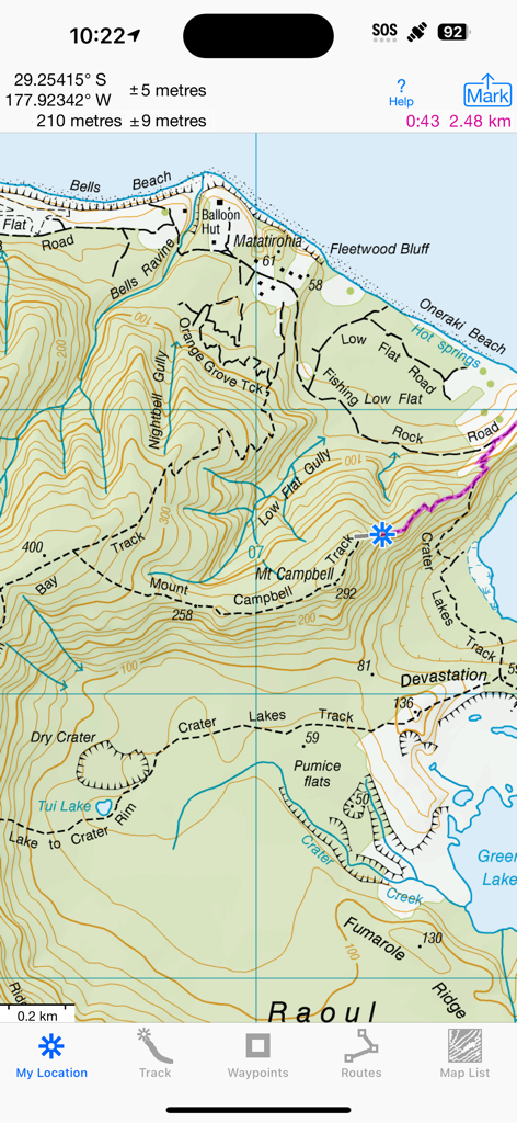
A detailed LINZ topographic map interface in the iHikeGPS NZ app showing hiking trails and GPS coordinates.
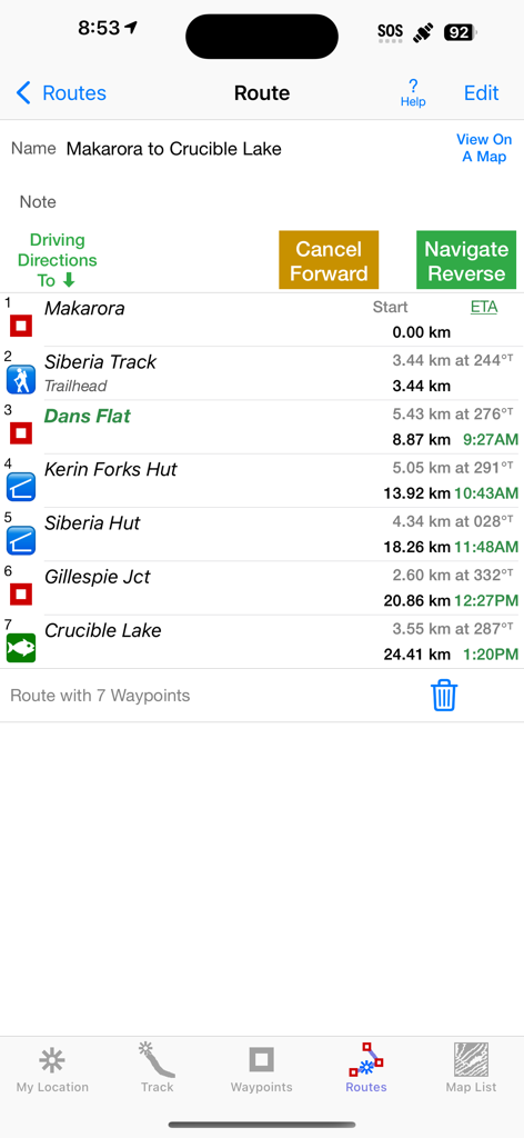
iHikeGPS NZ app route screen showing waypoints and estimated arrival times for a hike from Makarora to Crucible Lake
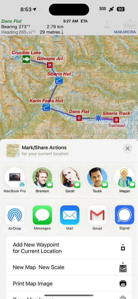
Topographic map of New Zealand in iHikeGPS NZ with the share and mark actions menu open.
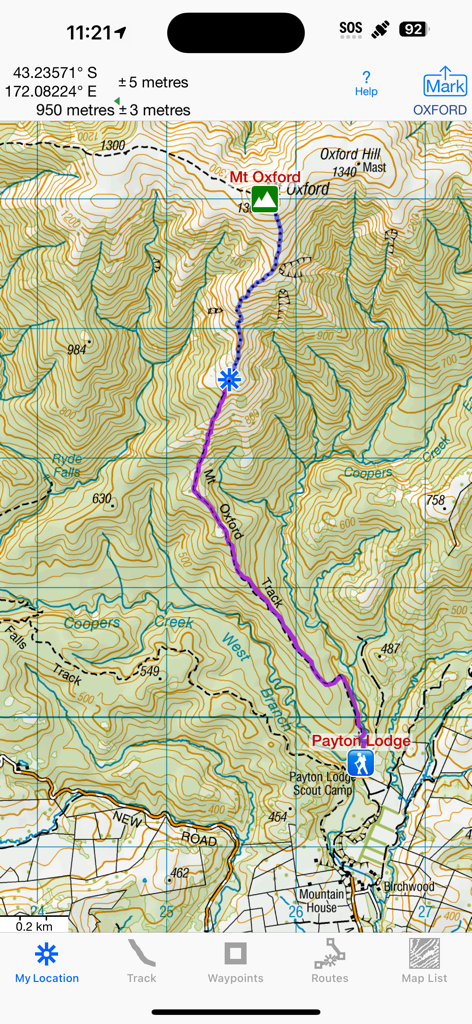
A detailed New Zealand topographic map showing a hiking route near Mt Oxford
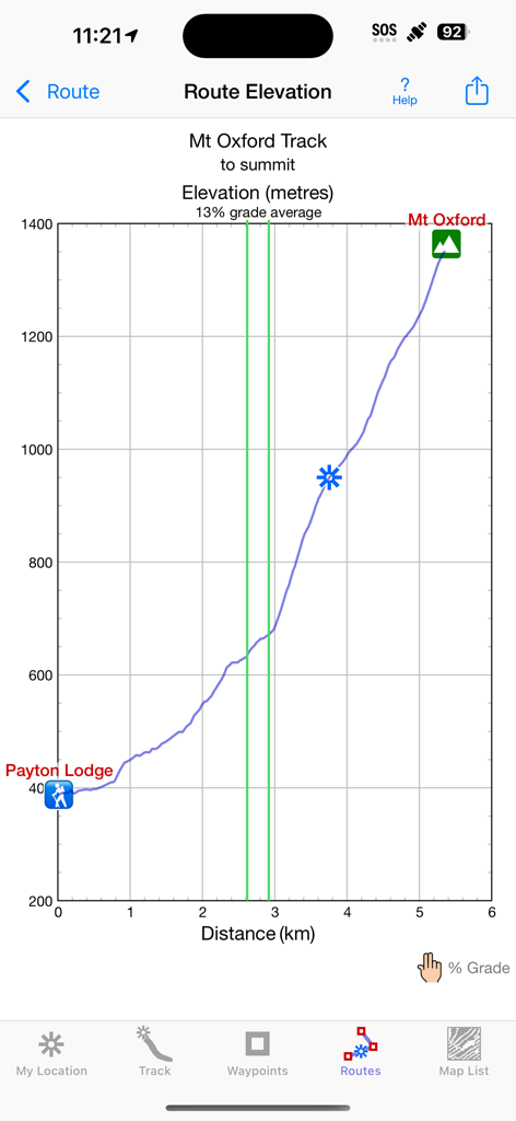
Route elevation profile graph for Mt Oxford Track in the iHikeGPS NZ app
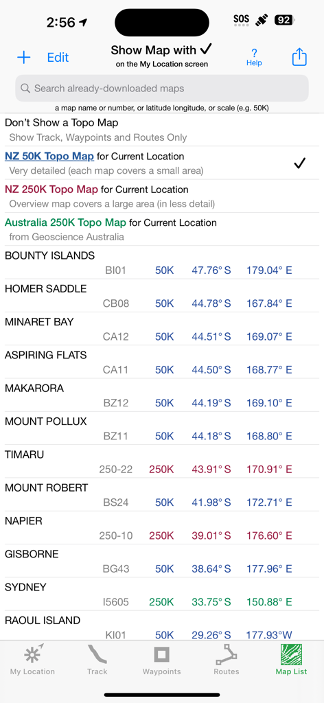
Screen displaying a list of official New Zealand and Australian topographic maps with their scales and coordinates in the iHikeGPS NZ app.
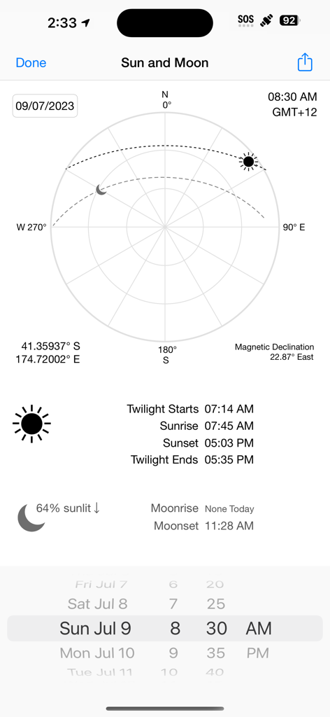
A screenshot of the iHikeGPS NZ app displaying sun and moon positions, rise and set times, and magnetic declination.
Description
Download
More Like This
Top-ranked apps in the same category

Google Maps
Google LLC

Waze Navigation & Live Traffic
waze

AMap Global
AutoNavi Information Technology Co. Ltd.

百度地图-路线规划,出行必备
Beijing Baidu Netcom Science & Technology Co.,Ltd

Moovit: Bus & Transit Tracker
Moovit App Global LTD

Transit • Subway & Bus Times
9280-0366 Quebec inc.

ParkMobile: Park. Pay. Go.
Parkmobile USA, Inc

腾讯地图-路线规划,导航地铁打车出行
Shenzhen Tencent Computer Systems Company Limited

Île-de-France Mobilités
Ile de France Mobilites
This page is not an official page of the app or its developer, but an independent editorial publication created for informational and commentary purposes. Unless expressly stated otherwise, neither the app nor its developer is affiliated with, endorsed by, sponsored by, authorized by, or otherwise officially connected with MWM, Apple, Google Play, the app publisher, or the app's developer, and nothing on this page implies that the app was developed using MWM's services. Any trademarks, logos, screenshots, and other content remain the property of their respective owners.