This page is not an official page of the app or its developer, but an independent editorial publication created for informational and commentary purposes. Unless expressly stated otherwise, neither the app nor its developer is affiliated with, endorsed by, sponsored by, authorized by, or otherwise officially connected with MWM, Apple, Google Play, the app publisher, or the app's developer, and nothing on this page implies that the app was developed using MWM's services. Any trademarks, logos, screenshots, and other content remain the property of their respective owners.

iSailGPS : NOAA USA RNC Charts
Reliable, offline-ready nautical charts for US coastal waters with no subscriptions, no ads, and total privacy. The Practical Sailor "Best Choice" award-winner for coastal cruising and racing.
Downloads
206K+User Rating
Total Ratings
100Publisher
Category
NavigationLocales
1Latest Version
9.6.6Size
10.4 MBFirst Released
Apr 29, 2011Professional Marine Navigation Without the Subscriptions
Transform your device into a high-performance GPS receiver using official NOAA Raster Nautical Charts. Reliable, privacy-focused, and designed for the self-reliant mariner.
Authentic Raster Cartography
Get the unmatched detail of traditional paper charts. Unlike vector maps, our high-resolution RNC charts provide professional cartographic depth and notes that veteran sailors trust.
100% Offline Reliability
Navigate safely without a cell signal. Download and store up to 2,200 charts directly on your device so you are prepared for offshore journeys or emergency situations in any weather.
The following screenshots and description are sourced directly from the app's official store listing and are the property of the app developer.
App Store
Screenshots
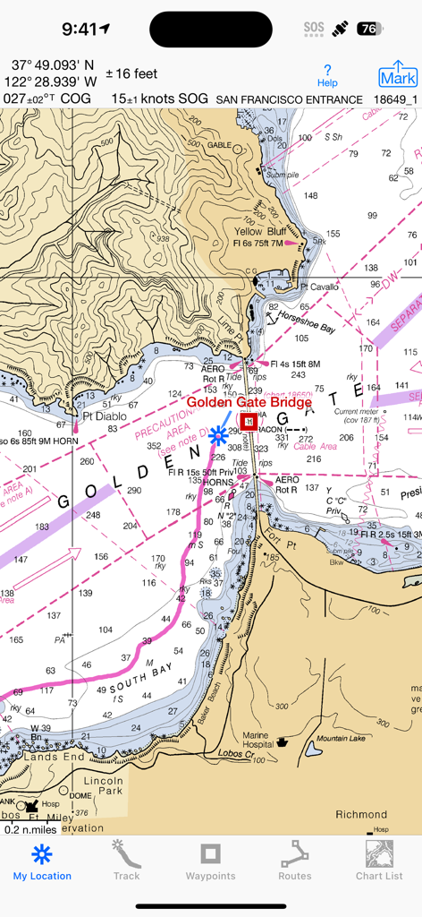
iSailGPS navigation app showing a NOAA raster nautical chart of the San Francisco entrance.
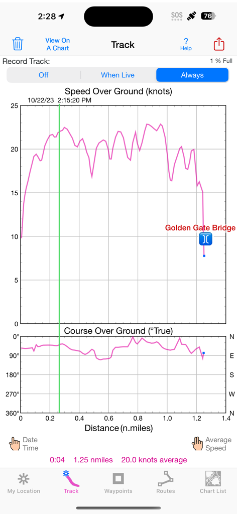
iSailGPS app screenshot showing sailing track data with speed over ground and course over ground graphs near the Golden Gate Bridge.
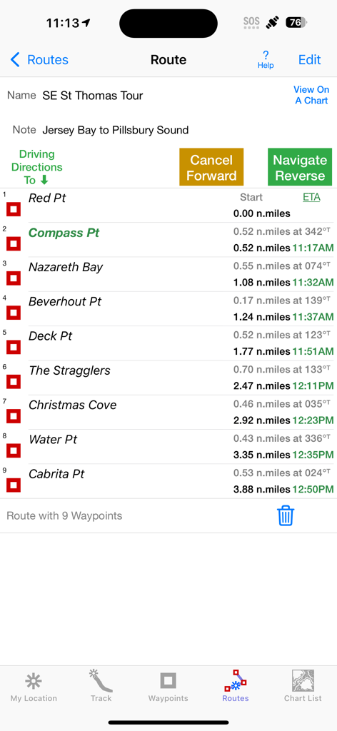
iSailGPS app interface showing a list of navigation waypoints for a sailing route with distance and ETA data
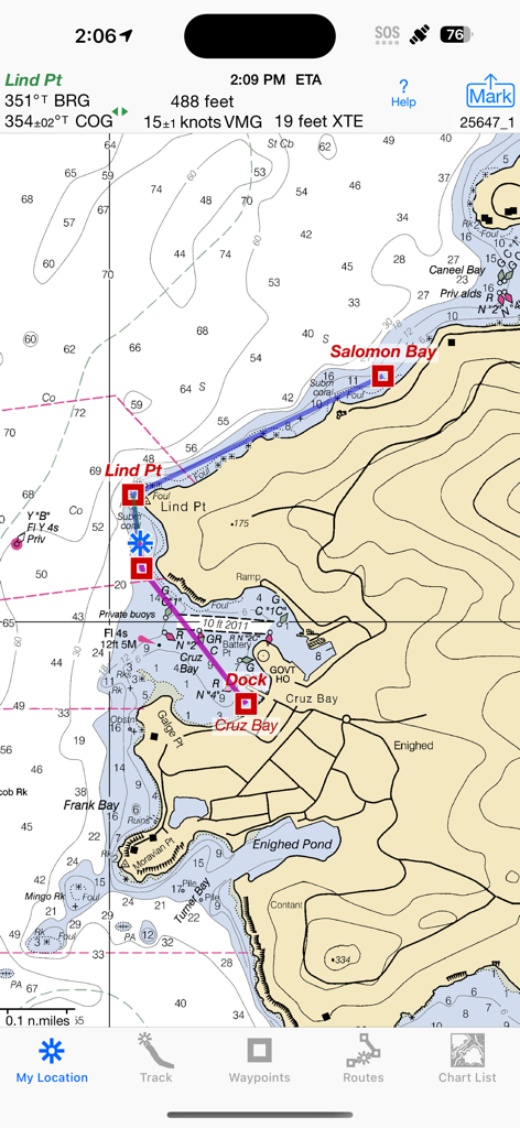
iSailGPS app showing a detailed NOAA raster nautical chart with navigation metrics and route waypoints
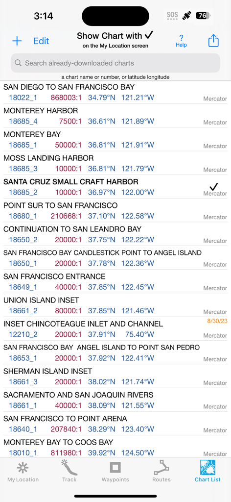
A list of downloaded NOAA nautical charts for California in the iSailGPS app.
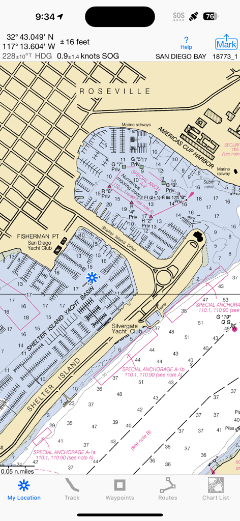
iSailGPS app showing a detailed NOAA raster nautical chart of San Diego Bay

iSailGPS app showing a NOAA raster nautical chart with an open menu for sharing and adding waypoints
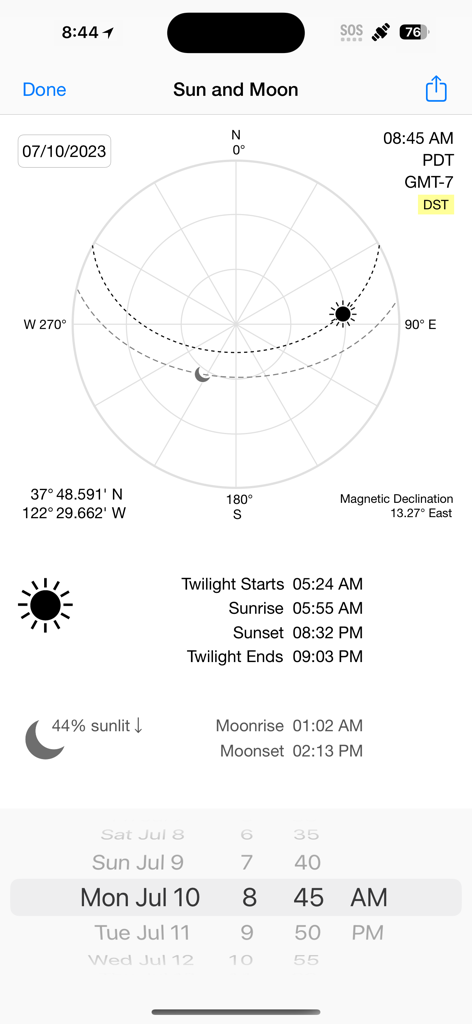
iSailGPS app screen displaying sun and moon positions with sunrise sunset and moon phase data for celestial navigation
Description
Download
More Like This
Top-ranked apps in the same category

Google Maps
Google LLC

Waze Navigation & Live Traffic
waze

AMap Global
AutoNavi Information Technology Co. Ltd.

百度地图-路线规划,出行必备
Beijing Baidu Netcom Science & Technology Co.,Ltd

Moovit: Bus & Transit Tracker
Moovit App Global LTD

Transit • Subway & Bus Times
9280-0366 Quebec inc.

ParkMobile: Park. Pay. Go.
Parkmobile USA, Inc

腾讯地图-路线规划,导航地铁打车出行
Shenzhen Tencent Computer Systems Company Limited

Île-de-France Mobilités
Ile de France Mobilites
This page is not an official page of the app or its developer, but an independent editorial publication created for informational and commentary purposes. Unless expressly stated otherwise, neither the app nor its developer is affiliated with, endorsed by, sponsored by, authorized by, or otherwise officially connected with MWM, Apple, Google Play, the app publisher, or the app's developer, and nothing on this page implies that the app was developed using MWM's services. Any trademarks, logos, screenshots, and other content remain the property of their respective owners.