This page is not an official page of the app or its developer, but an independent editorial publication created for informational and commentary purposes. Unless expressly stated otherwise, neither the app nor its developer is affiliated with, endorsed by, sponsored by, authorized by, or otherwise officially connected with MWM, Apple, Google Play, the app publisher, or the app's developer, and nothing on this page implies that the app was developed using MWM's services. Any trademarks, logos, screenshots, and other content remain the property of their respective owners.

isomaps
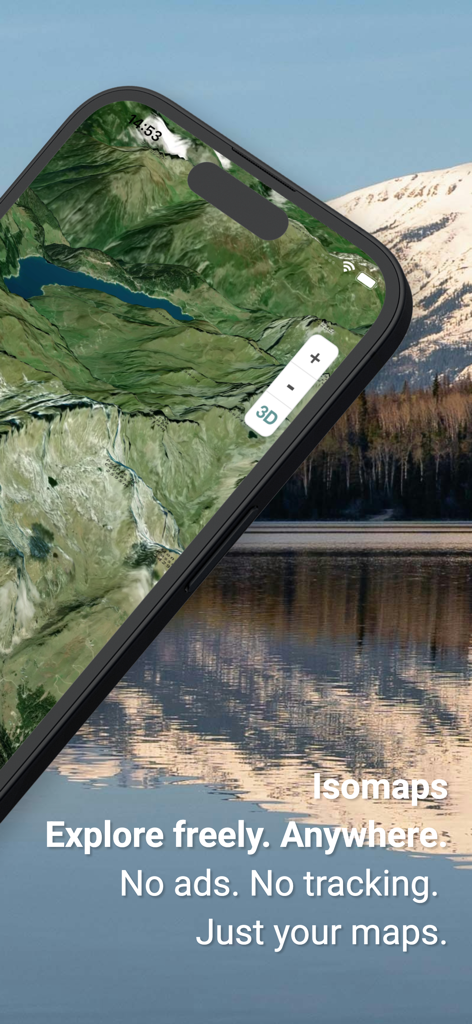
Plan, track, and explore with professional topographic maps and live weather data. A privacy-first experience with zero ads, seamless Garmin sync, and offline reliability for every peak and trail.
Downloads
1K+User Rating
Total Ratings
0Publisher
Category
NavigationLocales
5Latest Version
1.91.26Size
172.3 MBFirst Released
May 28, 2025Built for the Backcountry
Professional-grade navigation and safety tools designed for serious adventurers who demand precision without compromise.
High-Precision Topographic Maps
Access elite layers including SwissTopo, IGN, and slope gradients. Download maps to navigate confidently even in zero-cell zones.
Real-Time Safety & Weather
Stay ahead of the elements with 7-day forecasts, lightning strike tracking, and snow coverage data tailored for rugged terrain.
The following screenshots and description are sourced directly from the app's official store listing and are the property of the app developer.
App Store
Screenshots
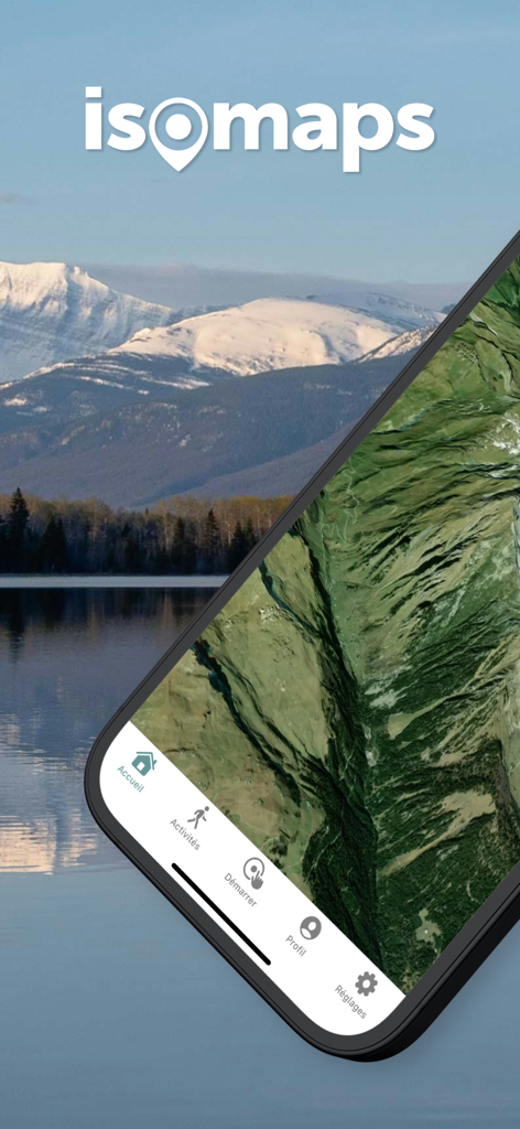
isomaps mobile app displaying a high precision topographic map of a mountain landscape on a smartphone screen
Isomaps app interface displaying a high-precision 3D satellite map for outdoor exploration.
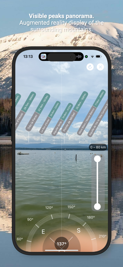
isomaps augmented reality PeakFinder view identifying mountain peaks on a smartphone screen
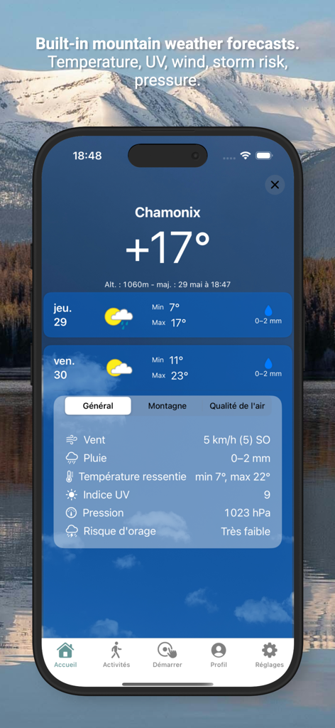
isomaps app display of mountain weather data including temperature and storm risk
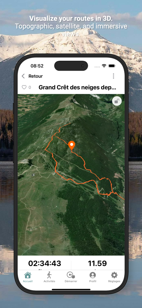
Isomaps app displaying a 3D satellite map with a highlighted hiking trail and activity duration
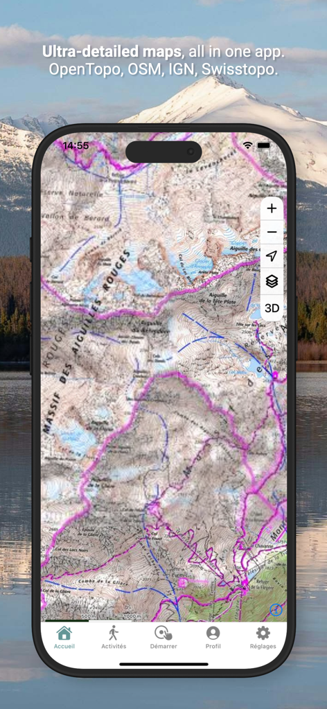
Isomaps mobile app showing a detailed topographic map with hiking trails in the mountains.
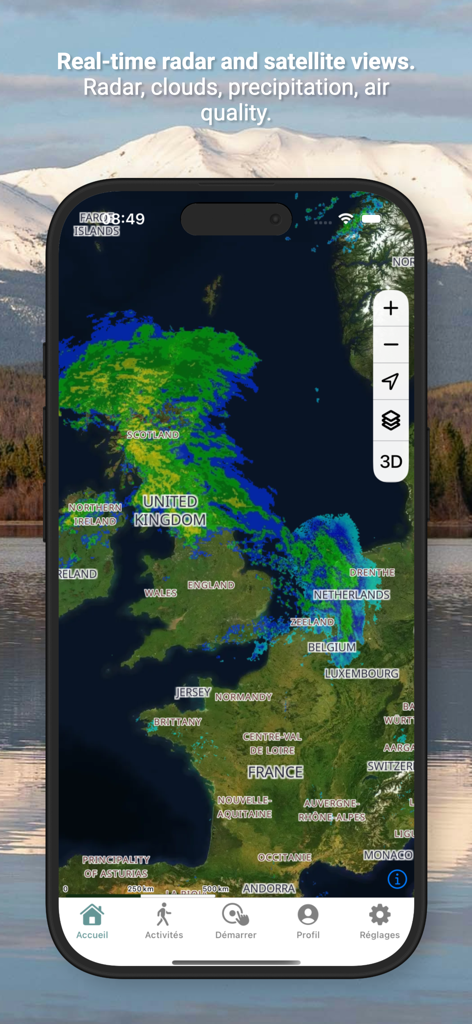
Real time weather radar and satellite map in the isomaps app

Isomaps app displaying real time weather radar and satellite cloud views over Europe
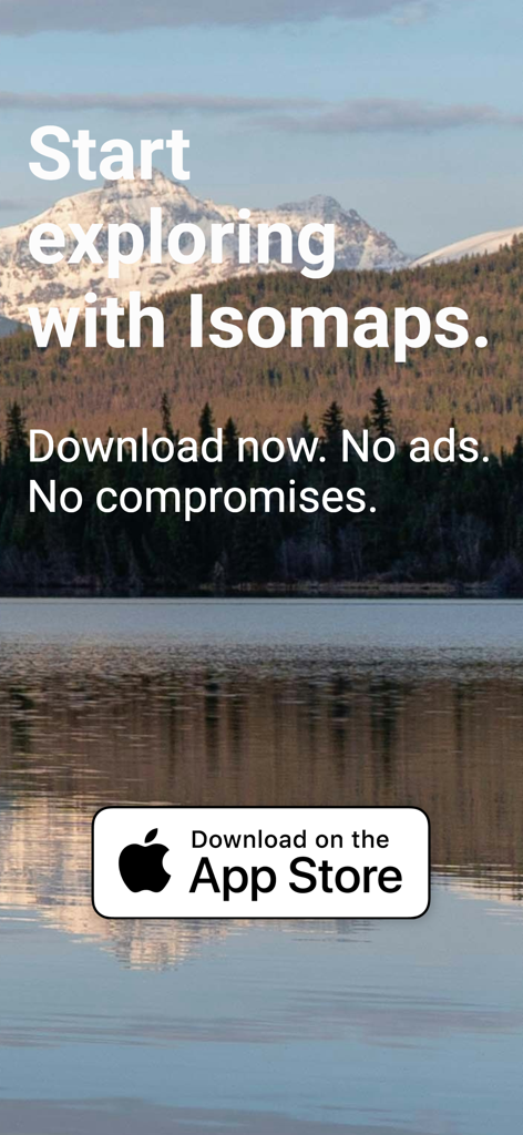
A scenic mountain landscape with a lake reflection featuring text that says Start exploring with Isomaps and a download on the App Store button.
Description
Download
More Like This
Top-ranked apps in the same category

Google Maps
Google LLC

AMap Global
AutoNavi Information Technology Co. Ltd.

Waze Navigation & Live Traffic
waze

百度地图-路线规划,出行必备
Beijing Baidu Netcom Science & Technology Co.,Ltd

Moovit: Bus & Transit Tracker
Moovit App Global LTD

Transit • Subway & Bus Times
9280-0366 Quebec inc.

ParkMobile: Park. Pay. Go.
Parkmobile USA, Inc

腾讯地图-路线规划,导航地铁打车出行
Shenzhen Tencent Computer Systems Company Limited

MapXplorer: Map Radar Navigate
GOLDLAB APPLICATIONS YAZILIM VE BILISIM ANONIM SIRKETI
This page is not an official page of the app or its developer, but an independent editorial publication created for informational and commentary purposes. Unless expressly stated otherwise, neither the app nor its developer is affiliated with, endorsed by, sponsored by, authorized by, or otherwise officially connected with MWM, Apple, Google Play, the app publisher, or the app's developer, and nothing on this page implies that the app was developed using MWM's services. Any trademarks, logos, screenshots, and other content remain the property of their respective owners.