This page is not an official page of the app or its developer, but an independent editorial publication created for informational and commentary purposes. Unless expressly stated otherwise, neither the app nor its developer is affiliated with, endorsed by, sponsored by, authorized by, or otherwise officially connected with MWM, Apple, Google Play, the app publisher, or the app's developer, and nothing on this page implies that the app was developed using MWM's services. Any trademarks, logos, screenshots, and other content remain the property of their respective owners.

Israel Hiking Map
Navigate Israel’s terrain with professional topographic maps, bilingual trail markers, and offline GPS. Perfect for hikers, bikers, and off-roaders seeking safety and discovery in the backcountry.
Downloads
79K+User Rating
Total Ratings
100Publisher
Category
NavigationLocales
1Latest Version
90.20.876Size
35.5 MBFirst Released
Dec 16, 2019Conquer Every Trail in Israel
The pro-grade navigation tool designed for hikers, bikers, and off-roaders seeking an authentic and safe backcountry experience.
Offline Peace of Mind
Navigate with confidence in remote desert dead zones. Access continuously updated maps offline to save battery and stay on track without cellular roaming.
Bilingual Pro-Grade Maps
Toggle between English and Hebrew labels on high-resolution topographic maps. Features specialized layers for single-track biking and 4x4 off-road paths.
The following screenshots and description are sourced directly from the app's official store listing and are the property of the app developer.
App Store
Screenshots
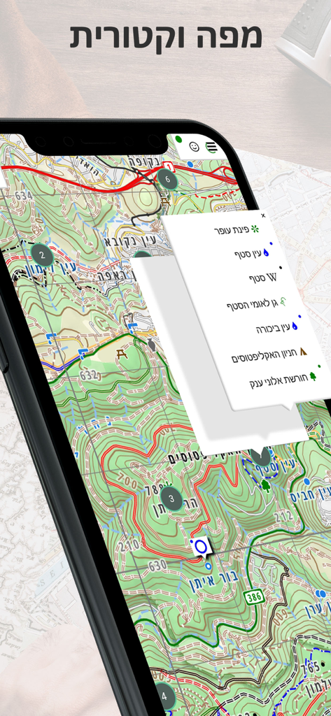
A smartphone showing a detailed topographic vector map of Israel with hiking trails and a list of points of interest.
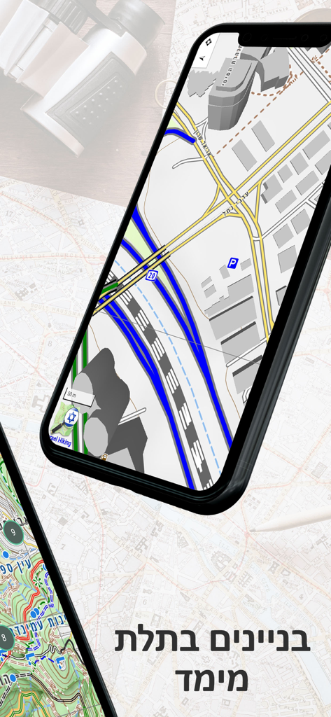
Smartphone screen displaying 3D building models on the Israel Hiking Map navigation app
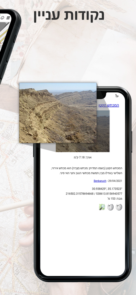
Israel Hiking Map app screenshot showing details for a point of interest with a desert canyon photo and GPS coordinates.
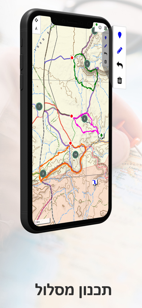
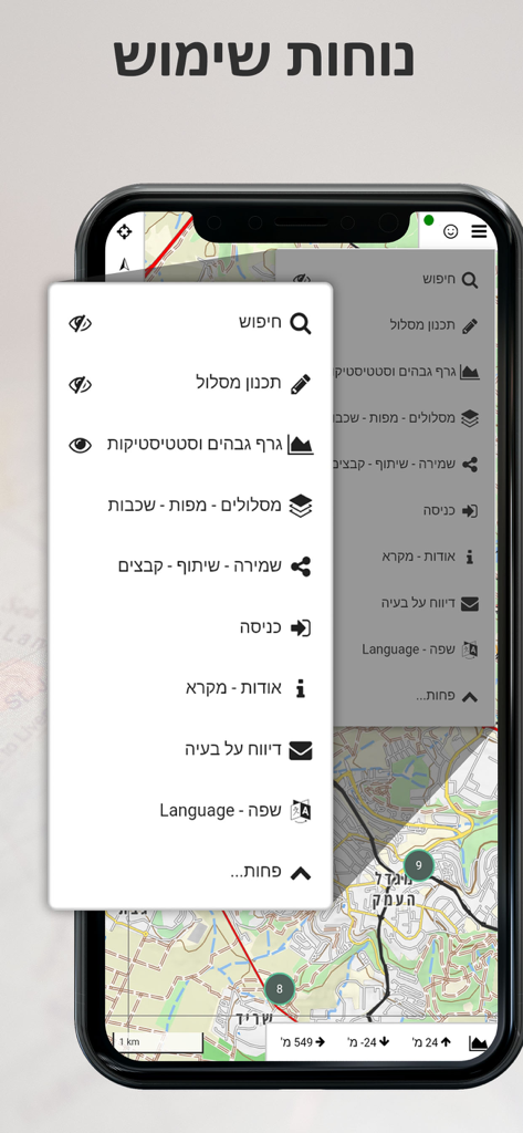
Smartphone showing a topographic map with trail routes and a planning tool in the Israel Hiking Map app.
Israel Hiking Map app displaying a topographic map with trails and dynamic hill shading on a smartphone screen
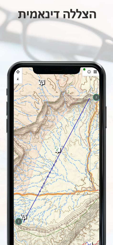
A mobile interface showing a topographic hiking map of Israel with a blue route and an elevation profile graph.
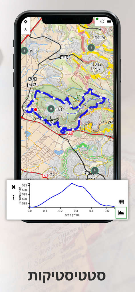
Israel Hiking Map app interface showing a navigation menu with route planning and elevation graph options.
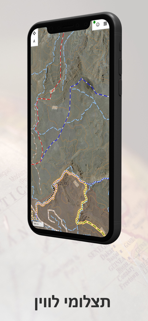
A smartphone displaying a topographic map with hiking trails and contour lines for navigating Israel.
Description
Download
More Like This
Top-ranked apps in the same category

Google Maps
Google LLC

Waze Navigation & Live Traffic
waze

AMap Global
AutoNavi Information Technology Co. Ltd.

百度地图-路线规划,出行必备
Beijing Baidu Netcom Science & Technology Co.,Ltd

Moovit: Bus & Transit Tracker
Moovit App Global LTD

Transit • Subway & Bus Times
9280-0366 Quebec inc.

ParkMobile: Park. Pay. Go.
Parkmobile USA, Inc

腾讯地图-路线规划,导航地铁打车出行
Shenzhen Tencent Computer Systems Company Limited

Île-de-France Mobilités
Ile de France Mobilites
This page is not an official page of the app or its developer, but an independent editorial publication created for informational and commentary purposes. Unless expressly stated otherwise, neither the app nor its developer is affiliated with, endorsed by, sponsored by, authorized by, or otherwise officially connected with MWM, Apple, Google Play, the app publisher, or the app's developer, and nothing on this page implies that the app was developed using MWM's services. Any trademarks, logos, screenshots, and other content remain the property of their respective owners.