This page is not an official page of the app or its developer, but an independent editorial publication created for informational and commentary purposes. Unless expressly stated otherwise, neither the app nor its developer is affiliated with, endorsed by, sponsored by, authorized by, or otherwise officially connected with MWM, Apple, Google Play, the app publisher, or the app's developer, and nothing on this page implies that the app was developed using MWM's services. Any trademarks, logos, screenshots, and other content remain the property of their respective owners.

Just Draw It! Route planner
The fastest way for runners, hikers, and explorers to plan custom routes. Trace your path with your finger and get instant, accurate distance calculations.
Downloads
71K+User Rating
Total Ratings
200Publisher
Category
NavigationLocales
8Latest Version
3.1.1Size
50.4 MBFirst Released
Feb 19, 2020Master Your Miles with a Single Swipe
The ultimate route planner for athletes and explorers who value speed, accuracy, and total control over their journey.
Draw, Don't Click
Map out your entire workout or hike by simply swiping your finger. No more tedious pin-dropping—just natural, fluid planning that follows your intuition.
Smart Path Alignment
Our 'Snap to Roads' technology automatically aligns your drawings to real paths, giving you precise distances for every run, walk, or ride you plan.
The following screenshots and description are sourced directly from the app's official store listing and are the property of the app developer.
App Store
Screenshots
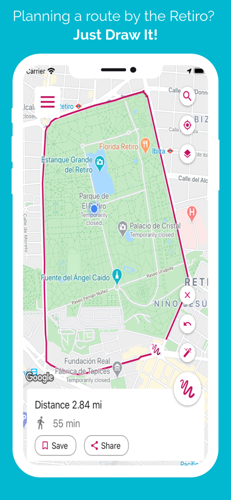
Route planning app interface showing a red path drawn around a park with distance and time statistics.
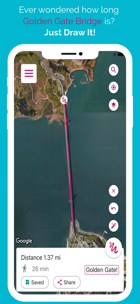
A satellite map view in the Just Draw It app showing a route drawn across the Golden Gate Bridge with a distance of 1.37 miles and a walking time of 26 minutes
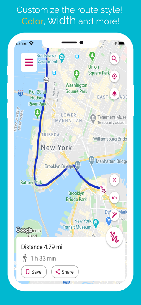
Just Draw It app interface showing a blue route through Lower Manhattan and Brooklyn with a calculated distance of 4.79 miles.
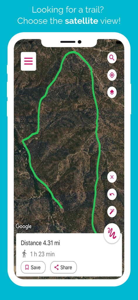
Satellite map view in Just Draw It app showing a drawn hiking route and travel time.
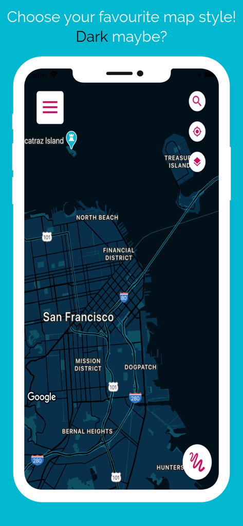
Just Draw It app interface showing a dark mode map of San Francisco for route planning
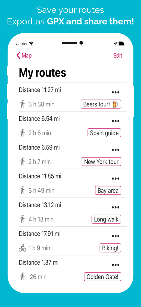
Saved routes list in the Just Draw It app showing distance and time for various activities

Settings screen of the Just Draw It route planner app showing activity types and unit options
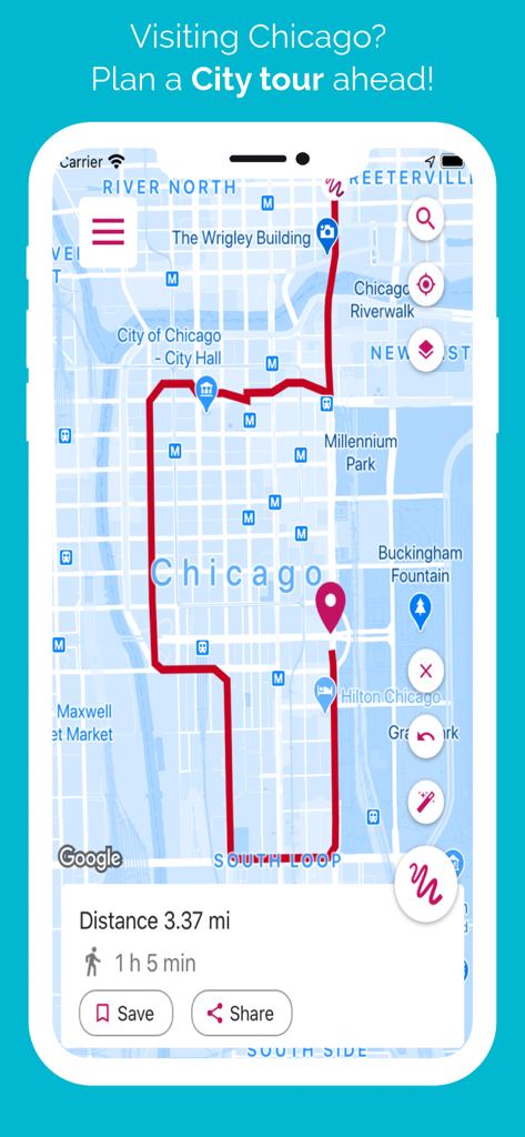
A custom city tour walking route drawn on a Chicago map using the Just Draw It Route planner app.
Description
Download
More Like This
Top-ranked apps in the same category

Google Maps
Google LLC

Waze Navigation & Live Traffic
waze

AMap Global
AutoNavi Information Technology Co. Ltd.

百度地图-路线规划,出行必备
Beijing Baidu Netcom Science & Technology Co.,Ltd

Moovit: Bus & Transit Tracker
Moovit App Global LTD

Transit • Subway & Bus Times
9280-0366 Quebec inc.

ParkMobile: Park. Pay. Go.
Parkmobile USA, Inc

腾讯地图-路线规划,导航地铁打车出行
Shenzhen Tencent Computer Systems Company Limited

Île-de-France Mobilités
Ile de France Mobilites
This page is not an official page of the app or its developer, but an independent editorial publication created for informational and commentary purposes. Unless expressly stated otherwise, neither the app nor its developer is affiliated with, endorsed by, sponsored by, authorized by, or otherwise officially connected with MWM, Apple, Google Play, the app publisher, or the app's developer, and nothing on this page implies that the app was developed using MWM's services. Any trademarks, logos, screenshots, and other content remain the property of their respective owners.