This page is not an official page of the app or its developer, but an independent editorial publication created for informational and commentary purposes. Unless expressly stated otherwise, neither the app nor its developer is affiliated with, endorsed by, sponsored by, authorized by, or otherwise officially connected with MWM, Apple, Google Play, the app publisher, or the app's developer, and nothing on this page implies that the app was developed using MWM's services. Any trademarks, logos, screenshots, and other content remain the property of their respective owners.

LocaToWeb Realtime GPS tracker
Share your live position with loved ones, navigate with topographic maps, and track every stat with ease. No ads, no registration required—just peace of mind while you explore the wild.
Downloads
140K+User Rating
Total Ratings
100Publisher
Category
NavigationLocales
13Latest Version
9.2.2Size
73.4 MBFirst Released
Aug 4, 2012Adventure Safely, Share Freely
Professional-grade GPS tracking and real-time location sharing designed for outdoor enthusiasts who prioritize safety, privacy, and precision.
Real-Time Peace of Mind
Provide your loved ones with a live link to your journey. They can monitor your exact position, speed, and progress on the web, ensuring you're never truly alone in the wild.
Pro-Level Navigation & Data
Go beyond standard maps with topographic views and GPX support. Import waypoints, export routes, and track precise altitude and distance metrics for every excursion.
The following screenshots and description are sourced directly from the app's official store listing and are the property of the app developer.
App Store
Screenshots
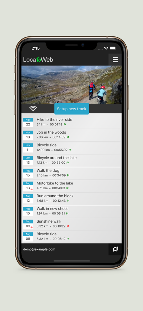
Mobile app interface displaying a list of recorded GPS tracks for hiking, cycling, and motorcycling with distance and duration statistics.
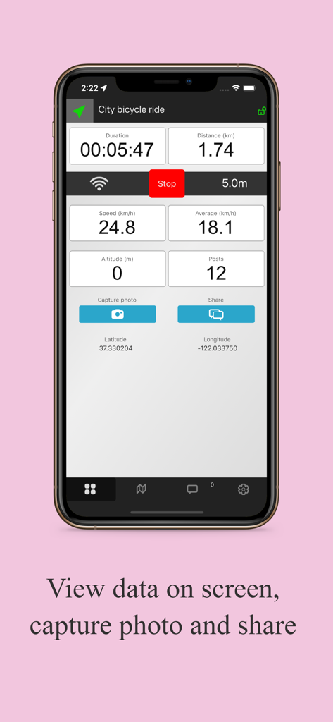
LocaToWeb app screen showing real time tracking data for a bicycle ride including duration and speed
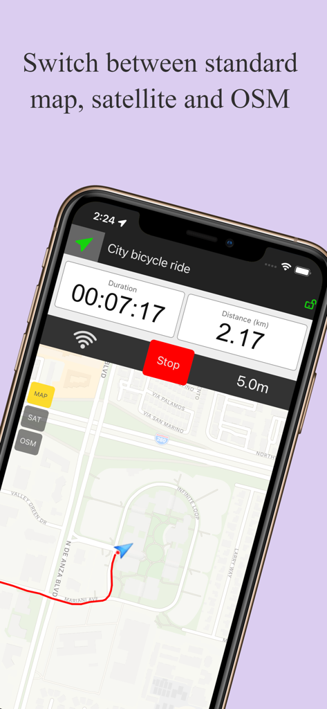
Smartphone displaying LocaToWeb GPS tracker interface with map layers and activity stats
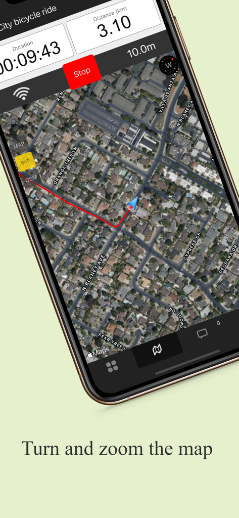
LocaToWeb app interface showing a real-time bicycle ride track on a satellite map with distance and duration statistics.
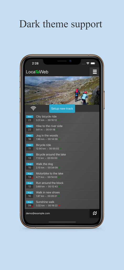
LocaToWeb app interface showing track history list in dark theme mode
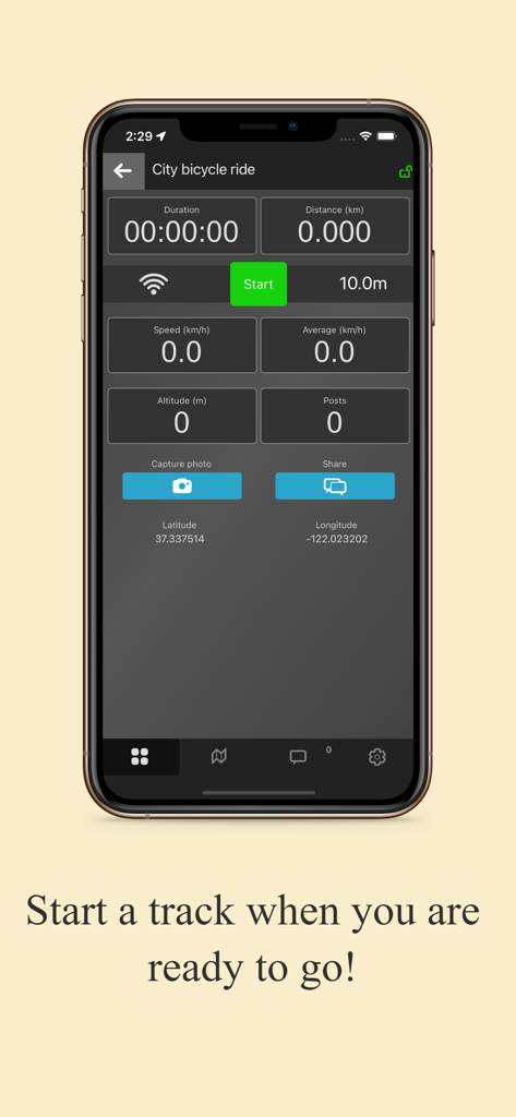
LocaToWeb app start screen showing real-time GPS tracking metrics for a city bicycle ride
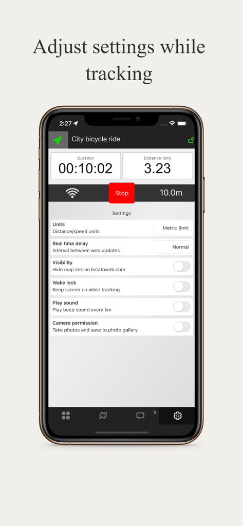
LocaToWeb settings screen for adjusting parameters while tracking a bicycle ride
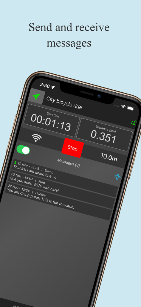
Interface of LocaToWeb app showing real-time messages and trip stats like duration and distance during a bicycle ride.
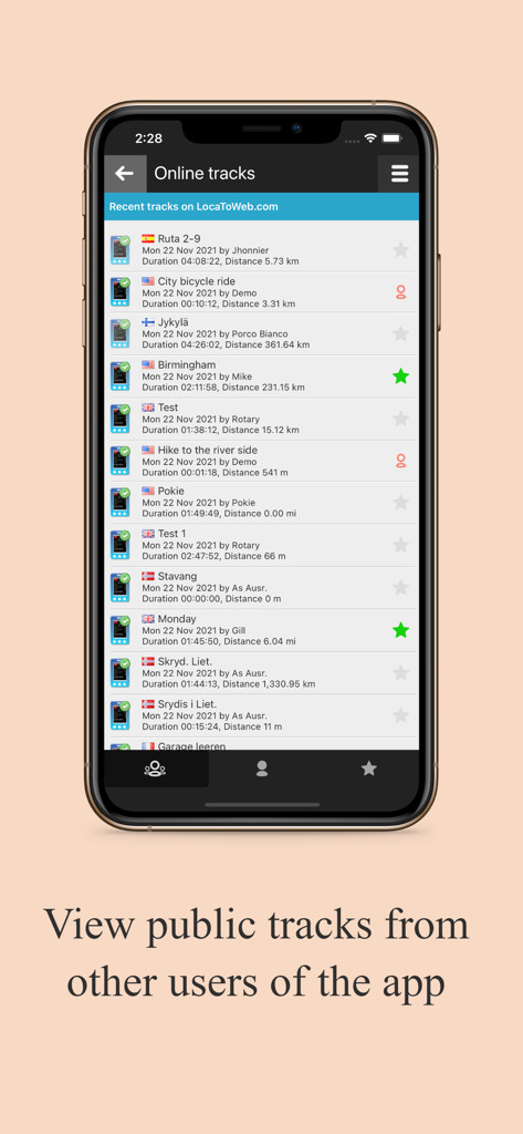
A list of real-time public GPS tracks from various users on the LocaToWeb app showing duration and distance
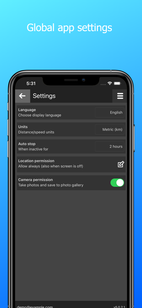
Screenshot of the global app settings screen in the LocaToWeb GPS tracker app showing language, units, and permission options.
Description
Download
More Like This
Top-ranked apps in the same category

Google Maps
Google LLC

Waze Navigation & Live Traffic
waze

AMap Global
AutoNavi Information Technology Co. Ltd.

百度地图-路线规划,出行必备
Beijing Baidu Netcom Science & Technology Co.,Ltd

Moovit: Bus & Transit Tracker
Moovit App Global LTD

Transit • Subway & Bus Times
9280-0366 Quebec inc.

ParkMobile: Park. Pay. Go.
Parkmobile USA, Inc

腾讯地图-路线规划,导航地铁打车出行
Shenzhen Tencent Computer Systems Company Limited

Île-de-France Mobilités
Ile de France Mobilites
This page is not an official page of the app or its developer, but an independent editorial publication created for informational and commentary purposes. Unless expressly stated otherwise, neither the app nor its developer is affiliated with, endorsed by, sponsored by, authorized by, or otherwise officially connected with MWM, Apple, Google Play, the app publisher, or the app's developer, and nothing on this page implies that the app was developed using MWM's services. Any trademarks, logos, screenshots, and other content remain the property of their respective owners.