This page is not an official page of the app or its developer, but an independent editorial publication created for informational and commentary purposes. Unless expressly stated otherwise, neither the app nor its developer is affiliated with, endorsed by, sponsored by, authorized by, or otherwise officially connected with MWM, Apple, Google Play, the app publisher, or the app's developer, and nothing on this page implies that the app was developed using MWM's services. Any trademarks, logos, screenshots, and other content remain the property of their respective owners.

Log GPS
The ultimate offline utility for surveyors, inspectors, and explorers. Capture precise coordinates with one tap, save battery life, and export your data as professional-grade CSV or GPX files.
Downloads
111K+User Rating
Total Ratings
0Publisher
Category
NavigationLocales
1Latest Version
5.2.1Size
2.7 MBFirst Released
Jan 18, 2011Precision Mapping for Field Professionals
Log GPS is the ultimate utility for data-heavy field work, offering robust offline performance and professional-grade export capabilities without draining your battery.
Reliable Offline Logging
Capture precise coordinates in remote rural areas or urban dead zones. Our system requires zero network access for data gathering, ensuring you never miss a point.
Field-Tested Battery Life
Stay productive throughout your entire shift. Log GPS is optimized for maximum efficiency, avoiding the heavy battery drain typical of background-tracking map apps.
The following screenshots and description are sourced directly from the app's official store listing and are the property of the app developer.
App Store
Screenshots
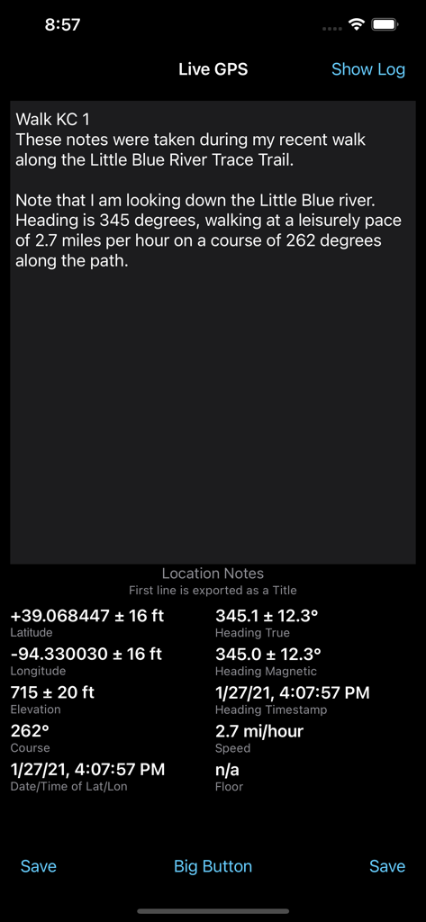
Log GPS app interface showing live coordinates heading speed and location notes
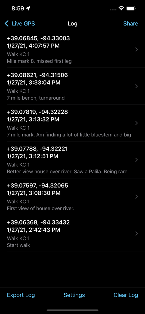
A list of saved GPS coordinates and field notes in the Log GPS app interface.
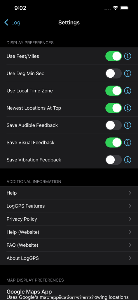
Settings screen of the Log GPS app showing display preferences toggles and additional information menu
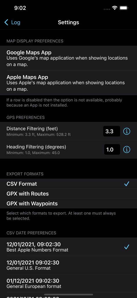
Settings menu of the Log GPS app showing map display preferences, GPS filtering options, and data export format selections.
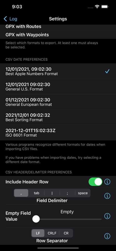
Log GPS app settings screen for configuring CSV export date formats and field delimiters
Description
Download
More Like This
Top-ranked apps in the same category

Google Maps
Google LLC

Waze Navigation & Live Traffic
waze

AMap Global
AutoNavi Information Technology Co. Ltd.

百度地图-路线规划,出行必备
Beijing Baidu Netcom Science & Technology Co.,Ltd

Moovit: Bus & Transit Tracker
Moovit App Global LTD

Transit • Subway & Bus Times
9280-0366 Quebec inc.

ParkMobile: Park. Pay. Go.
Parkmobile USA, Inc

腾讯地图-路线规划,导航地铁打车出行
Shenzhen Tencent Computer Systems Company Limited

Île-de-France Mobilités
Ile de France Mobilites
This page is not an official page of the app or its developer, but an independent editorial publication created for informational and commentary purposes. Unless expressly stated otherwise, neither the app nor its developer is affiliated with, endorsed by, sponsored by, authorized by, or otherwise officially connected with MWM, Apple, Google Play, the app publisher, or the app's developer, and nothing on this page implies that the app was developed using MWM's services. Any trademarks, logos, screenshots, and other content remain the property of their respective owners.