This page is not an official page of the app or its developer, but an independent editorial publication created for informational and commentary purposes. Unless expressly stated otherwise, neither the app nor its developer is affiliated with, endorsed by, sponsored by, authorized by, or otherwise officially connected with MWM, Apple, Google Play, the app publisher, or the app's developer, and nothing on this page implies that the app was developed using MWM's services. Any trademarks, logos, screenshots, and other content remain the property of their respective owners.

MaForêt Cartographie
Navigate your French land with official IGN maps and cadastral data. High-precision GPS tracking that works everywhere, even without a cellular network.
Downloads
22K+User Rating
Total Ratings
100Publisher
Category
NavigationLocales
1Latest Version
3.4.7Size
30.7 MBFirst Released
Jan 29, 2016Professional Stewardship for Your French Woodlands
Bridging the distance between you and your land with the most reliable mapping tools used by foresters and international owners.
Total Offline Autonomy
Never lose sight of your borders, even without a network. Your property data remains fully accessible in the most remote rural locations.
Official Cadastral Accuracy
Visualize precise property limits using official IGN data to secure your borders and manage your forest legacy with legal clarity.
The following screenshots and description are sourced directly from the app's official store listing and are the property of the app developer.
App Store
Screenshots
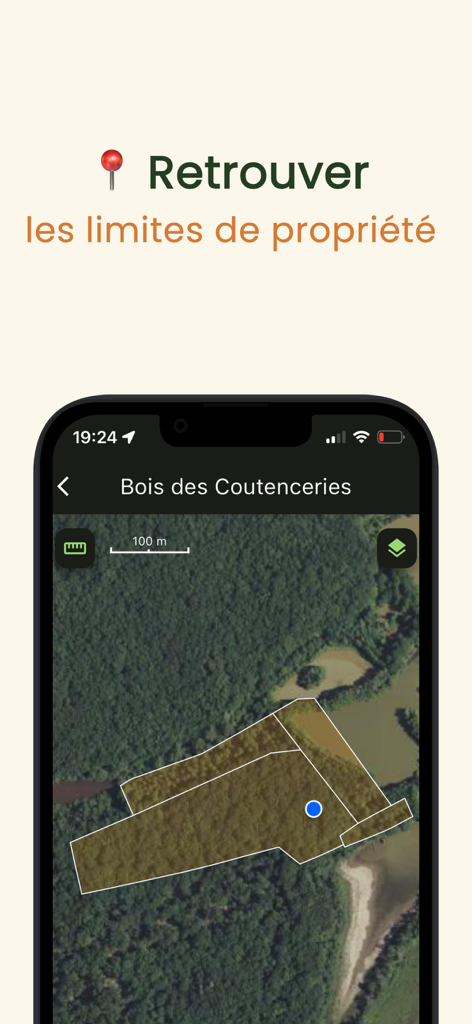
Satellite view of property boundaries and GPS location in the MaForet Cartographie app
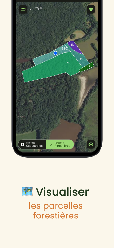
Satellite view of forestry parcels and property boundaries in the MaForet app
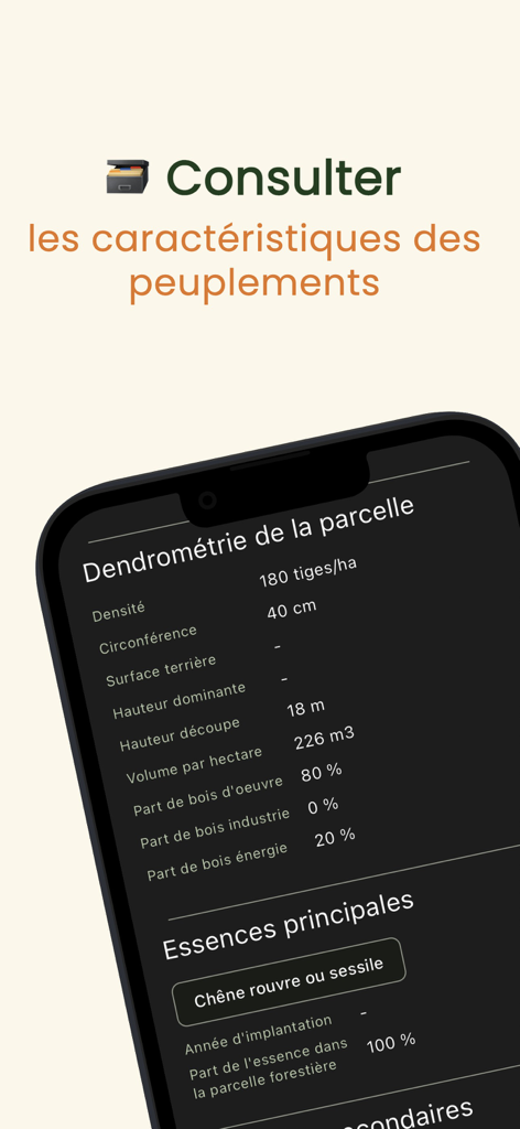
Screenshot of MaForet app showing dendrometry data and tree species for a forest plot.
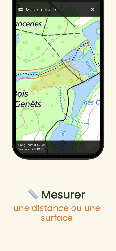
MaForet Cartographie app interface showing distance and surface area measurement on a topographic map
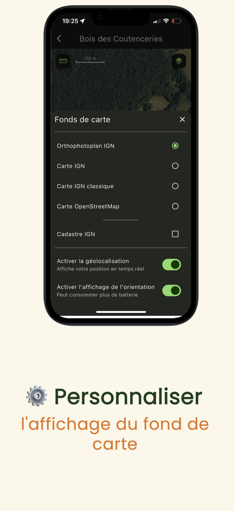
Selection menu for French IGN background maps and GPS settings in MaForêt Cartographie app.
Description
Download
More Like This
Top-ranked apps in the same category

Google Maps
Google LLC

Waze Navigation & Live Traffic
waze

AMap Global
AutoNavi Information Technology Co. Ltd.

百度地图-路线规划,出行必备
Beijing Baidu Netcom Science & Technology Co.,Ltd

Moovit: Bus & Transit Tracker
Moovit App Global LTD

Transit • Subway & Bus Times
9280-0366 Quebec inc.

ParkMobile: Park. Pay. Go.
Parkmobile USA, Inc

腾讯地图-路线规划,导航地铁打车出行
Shenzhen Tencent Computer Systems Company Limited

Île-de-France Mobilités
Ile de France Mobilites
This page is not an official page of the app or its developer, but an independent editorial publication created for informational and commentary purposes. Unless expressly stated otherwise, neither the app nor its developer is affiliated with, endorsed by, sponsored by, authorized by, or otherwise officially connected with MWM, Apple, Google Play, the app publisher, or the app's developer, and nothing on this page implies that the app was developed using MWM's services. Any trademarks, logos, screenshots, and other content remain the property of their respective owners.