This page is not an official page of the app or its developer, but an independent editorial publication created for informational and commentary purposes. Unless expressly stated otherwise, neither the app nor its developer is affiliated with, endorsed by, sponsored by, authorized by, or otherwise officially connected with MWM, Apple, Google Play, the app publisher, or the app's developer, and nothing on this page implies that the app was developed using MWM's services. Any trademarks, logos, screenshots, and other content remain the property of their respective owners.

MapApp NZ North Island
The essential offline topographic companion for hikers and explorers. Access professional-grade LINZ Topo50 maps anywhere on the North Island—no cell service or data required.
Downloads
68K+User Rating
Total Ratings
0Publisher
Category
NavigationLocales
1Latest Version
3.0Size
2.2 GBFirst Released
Dec 14, 2010Navigate the North Island with Confidence
The ultimate tool for self-reliant adventurers. Access high-resolution LINZ Topo50 maps anywhere, from the volcanic peaks of Tongariro to the remote tracks of the Ureweras.
Total Offline Reliability
Zero cell service? No problem. All high-detail map data is stored directly on your device, giving you instant access in the deepest bush without roaming fees.
Pro-Grade Topo Detail
Ditch the simplified maps. Get official LINZ 1:50,000 scale data featuring precise contour lines, hut locations, and river crossings for expert-level navigation.
The following screenshots and description are sourced directly from the app's official store listing and are the property of the app developer.
App Store
Screenshots
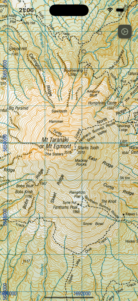
Detailed topographic map of Mount Taranaki in New Zealand showing contour lines and hiking routes on a mobile device.
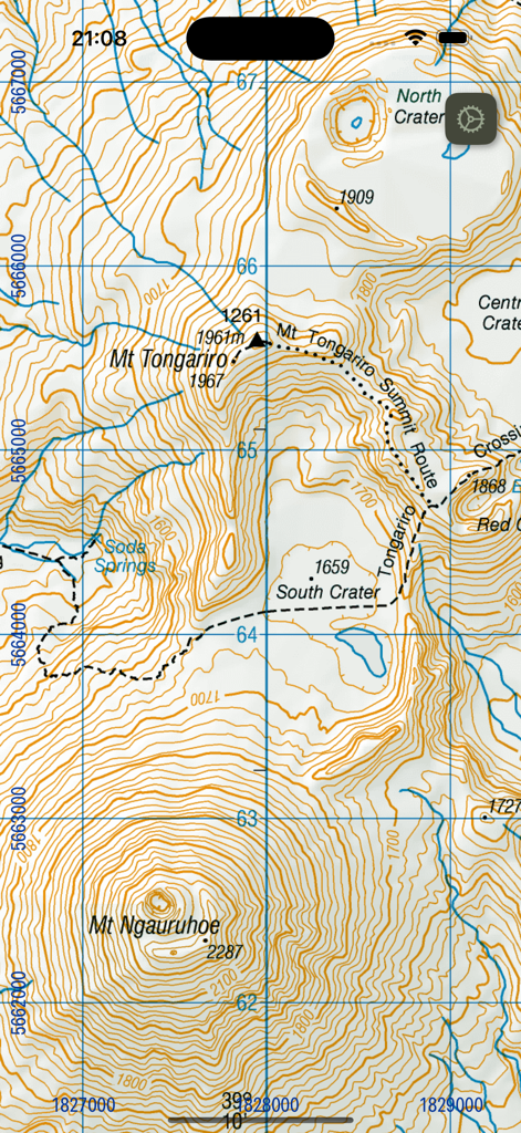
Topographic map showing Mt Tongariro and Mt Ngauruhoe with hiking routes and contour lines
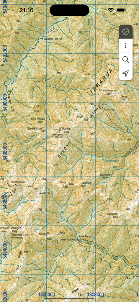
Detailed topographic map of the Tararua Range in New Zealand showing contour lines ridges and hiking huts
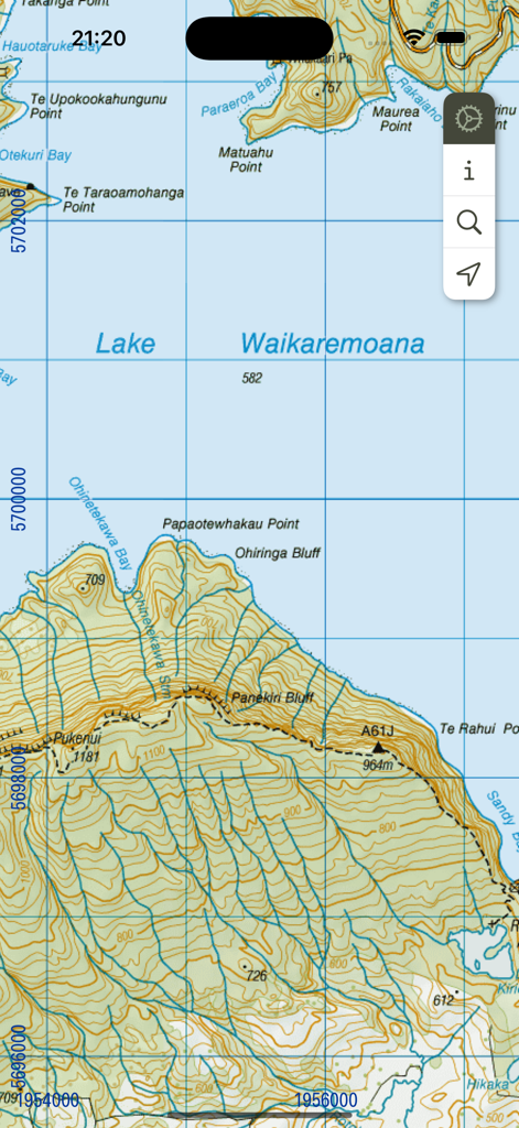
Topographic map view of Lake Waikaremoana in New Zealand North Island showing contour lines and terrain for hiking
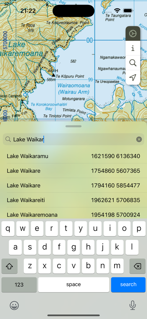
Topographic map of Lake Waikaremoana with a search bar showing place name suggestions
Description
Download
More Like This
Top-ranked apps in the same category

Google Maps
Google LLC

Waze Navigation & Live Traffic
waze

AMap Global
AutoNavi Information Technology Co. Ltd.

百度地图-路线规划,出行必备
Beijing Baidu Netcom Science & Technology Co.,Ltd

Moovit: Bus & Transit Tracker
Moovit App Global LTD

Transit • Subway & Bus Times
9280-0366 Quebec inc.

ParkMobile: Park. Pay. Go.
Parkmobile USA, Inc

腾讯地图-路线规划,导航地铁打车出行
Shenzhen Tencent Computer Systems Company Limited

Île-de-France Mobilités
Ile de France Mobilites
This page is not an official page of the app or its developer, but an independent editorial publication created for informational and commentary purposes. Unless expressly stated otherwise, neither the app nor its developer is affiliated with, endorsed by, sponsored by, authorized by, or otherwise officially connected with MWM, Apple, Google Play, the app publisher, or the app's developer, and nothing on this page implies that the app was developed using MWM's services. Any trademarks, logos, screenshots, and other content remain the property of their respective owners.