This page is not an official page of the app or its developer, but an independent editorial publication created for informational and commentary purposes. Unless expressly stated otherwise, neither the app nor its developer is affiliated with, endorsed by, sponsored by, authorized by, or otherwise officially connected with MWM, Apple, Google Play, the app publisher, or the app's developer, and nothing on this page implies that the app was developed using MWM's services. Any trademarks, logos, screenshots, and other content remain the property of their respective owners.

mKart Marine Navigation
Transform your iPad into a professional-grade 3D navigation suite. Access free NOAA ENCs, real-time AIS traffic, and advanced safety alerts for total confidence on the water.
Downloads
22K+User Rating
Total Ratings
0Publisher
Category
NavigationLocales
1Latest Version
1.8.727Size
85.5 MBFirst Released
Jan 28, 2020Precision Navigation for the Modern Captain
Transform your iPad into a professional-grade 3D chartplotter. mKart combines official NOAA data with cutting-edge visualization for safer, smarter voyages.
Immersive 3D Situational Awareness
Visualize seabed relief and land infrastructure in 3D. Navigate more intuitively with models that match your real-world surroundings.
Automatic Safety & No-Go Zones
Sail with confidence using auto-routing that respects your vessel's draft and highlights dangerous depths in real-time.
The following screenshots and description are sourced directly from the app's official store listing and are the property of the app developer.
App Store
Screenshots
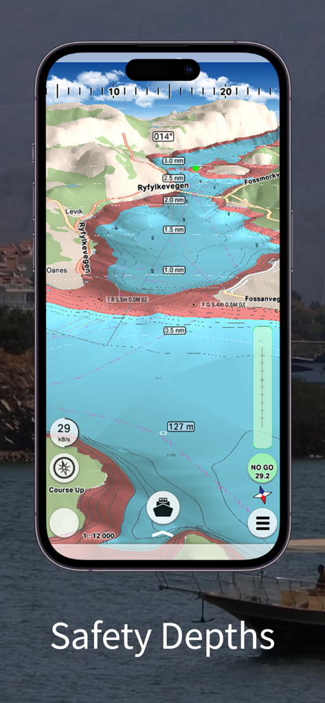
mKart marine navigation app interface showing 3D seabed relief and safety depth zones
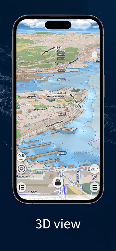
3D visualization of a coastal harbor with buildings and sea floor relief in the mKart Marine Navigation app
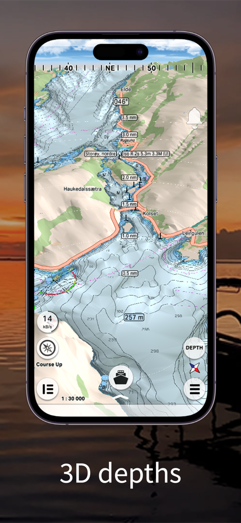
mKart smartphone app displaying a 3D marine chart with bathymetric depth contours and seabed relief
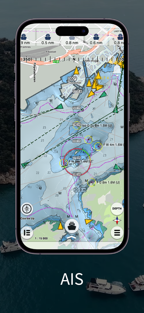
mKart app interface displaying real-time AIS marine traffic and professional nautical charts on a smartphone
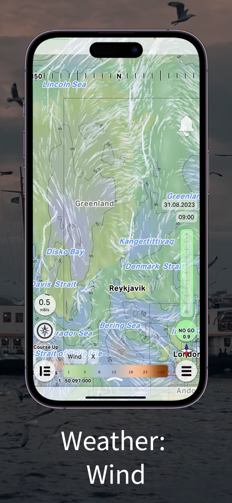
mKart Marine Navigation app interface displaying a wind weather forecast overlay on a global nautical chart
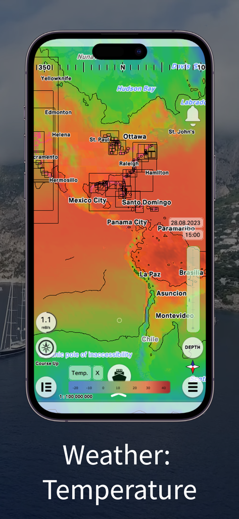
Marine weather temperature heat map overlay on the mKart navigation app showing North and South America.
Description
Download
More Like This
Top-ranked apps in the same category

Google Maps
Google LLC

Waze Navigation & Live Traffic
waze

AMap Global
AutoNavi Information Technology Co. Ltd.

百度地图-路线规划,出行必备
Beijing Baidu Netcom Science & Technology Co.,Ltd

Moovit: Bus & Transit Tracker
Moovit App Global LTD

Transit • Subway & Bus Times
9280-0366 Quebec inc.

ParkMobile: Park. Pay. Go.
Parkmobile USA, Inc

腾讯地图-路线规划,导航地铁打车出行
Shenzhen Tencent Computer Systems Company Limited

Île-de-France Mobilités
Ile de France Mobilites
This page is not an official page of the app or its developer, but an independent editorial publication created for informational and commentary purposes. Unless expressly stated otherwise, neither the app nor its developer is affiliated with, endorsed by, sponsored by, authorized by, or otherwise officially connected with MWM, Apple, Google Play, the app publisher, or the app's developer, and nothing on this page implies that the app was developed using MWM's services. Any trademarks, logos, screenshots, and other content remain the property of their respective owners.