This page is not an official page of the app or its developer, but an independent editorial publication created for informational and commentary purposes. Unless expressly stated otherwise, neither the app nor its developer is affiliated with, endorsed by, sponsored by, authorized by, or otherwise officially connected with MWM, Apple, Google Play, the app publisher, or the app's developer, and nothing on this page implies that the app was developed using MWM's services. Any trademarks, logos, screenshots, and other content remain the property of their respective owners.
Natures GPS.
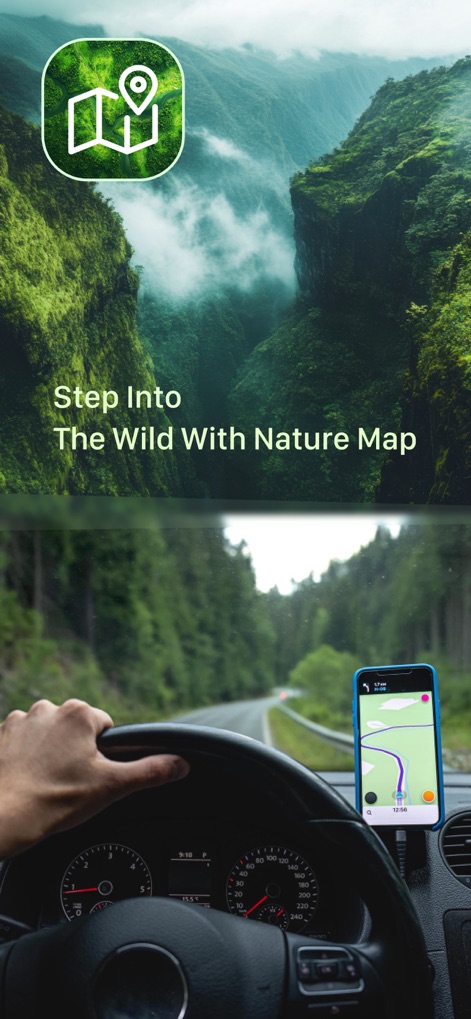
No more guesswork. Natures GPS turns environmental data into actionable intelligence, offering a critical edge in field management.
Downloads
25k+User Rating
Total Ratings
5Publisher
Category
NavigationLocales
1Latest Version
1.1Size
19.0 MBFirst Released
Nov 19, 2025Analyzing core functionalities and their impact on field operations and data management efficiency.
Natures GPS: A Comprehensive Evaluation for Environmental Professionals
Geospatial Mapping
The app provides essential geographical context and robust navigation capabilities, critical for field workers operating in remote locations and for precise site identification.
Collaborative Data Sharing
It allows users to efficiently disseminate information and collaborate seamlessly with team members, ensuring that all stakeholders have access to up-to-date site data.
Interactive Map Annotations
This tool features the ability to add custom notes, markers, and points of interest directly onto maps, enhancing on-site observations and collaborative planning.
Comprehensive Site Management
The app offers comprehensive oversight and administration functionalities for water collection sites, streamlining operational workflows for environmental teams.
Site Tracking & Monitoring
It enables continuous monitoring of changes and historical data for water collection sites, which is crucial for long-term environmental projects and trend analysis.
Detailed Site Profiling
The app ensures thorough and accurate data capture for each site, providing detailed profiles that are essential for in-depth analysis and reporting.
Image Documentation
This tool features visual documentation capabilities, allowing users to attach images to sites for better context, verification, and visual record-keeping.
Maintenance Log & Planning
It facilitates the scheduling and recording of site upkeep, which is vital for maintaining infrastructure and ensuring the longevity of water collection points.
Site Data Recording
The app streamlines the initial data entry process for new water collection sites, making it effortless to record essential information in the field.
Advanced Search & Filtering
This tool provides robust search and filtering options, enabling environmental professionals to quickly retrieve specific site data from extensive datasets.
The following screenshots and description are sourced directly from the app's official store listing and are the property of the app developer.
App Store
Screenshots
This tool guides users to remote locations with an intuitive map display and clear driving directions.
Navigate Nature's Path
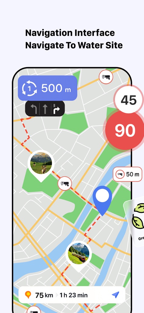
The app offers precise turn-by-turn guidance and real-time speed limit indicators for efficient site access.
Precision Site Navigation
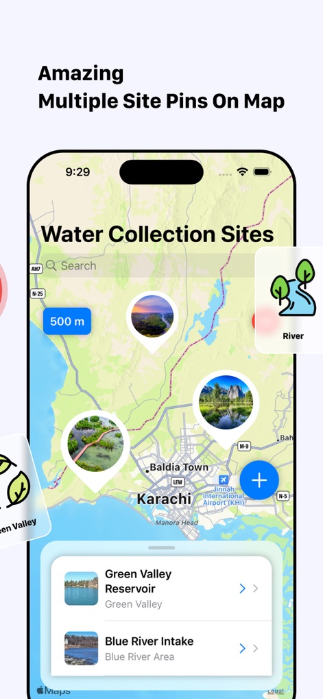
Users can easily view multiple water collection sites on an interactive map and utilize the powerful search function for quick access.
Discover Water Sites
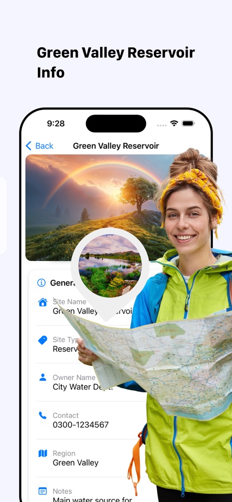
This screen provides a detailed profile of each site, showcasing its general information and an evocative header image.
Comprehensive Site Overview
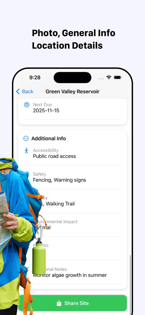
The app streamlines operational management by displaying maintenance schedules and allowing easy sharing of site information.
Manage Site Data
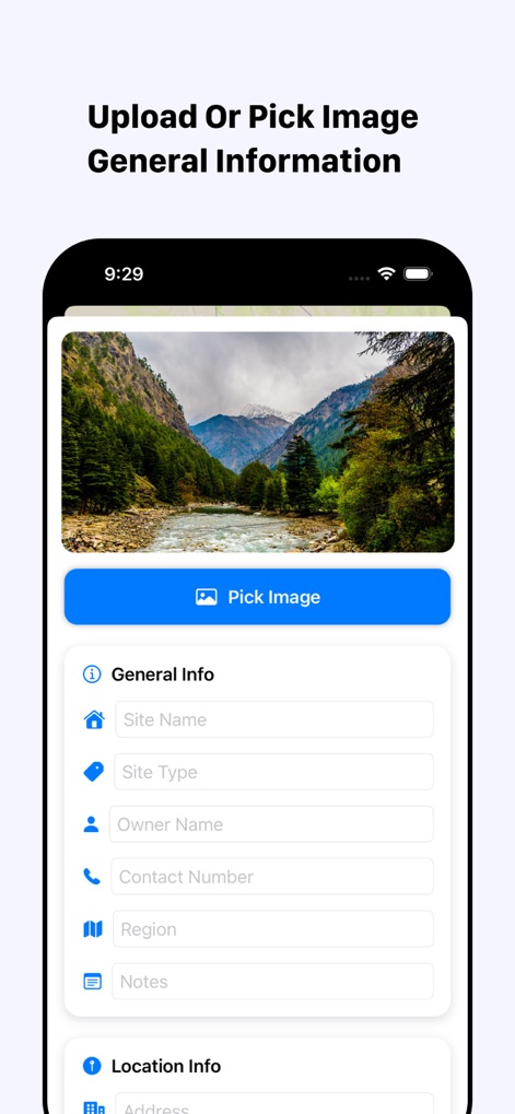
Users can effortlessly create new site profiles by uploading relevant images and inputting essential general information.
New Site Creation
Description
Download
More Like This
Top-ranked apps in the same category

Google Maps
Google LLC

AMap Global
AutoNavi Information Technology Co. Ltd.

Waze Navigation & Live Traffic
waze

百度地图-路线规划,出行必备
Beijing Baidu Netcom Science & Technology Co.,Ltd

Moovit: Bus & Transit Tracker
Moovit App Global LTD

Transit • Subway & Bus Times
9280-0366 Quebec inc.

MapXplorer: Map Radar Navigate
GOLDLAB APPLICATIONS YAZILIM VE BILISIM ANONIM SIRKETI

腾讯地图-路线规划,导航地铁打车出行
Shenzhen Tencent Computer Systems Company Limited

ParkMobile: Park. Pay. Go.
Parkmobile USA, Inc
This page is not an official page of the app or its developer, but an independent editorial publication created for informational and commentary purposes. Unless expressly stated otherwise, neither the app nor its developer is affiliated with, endorsed by, sponsored by, authorized by, or otherwise officially connected with MWM, Apple, Google Play, the app publisher, or the app's developer, and nothing on this page implies that the app was developed using MWM's services. Any trademarks, logos, screenshots, and other content remain the property of their respective owners.